1916 Arch: (
Bridge Hunter)
1937 Arch: (
Bridge Hunter;
Historic Bridges;
Satellite) a widening of the 1916 bridge
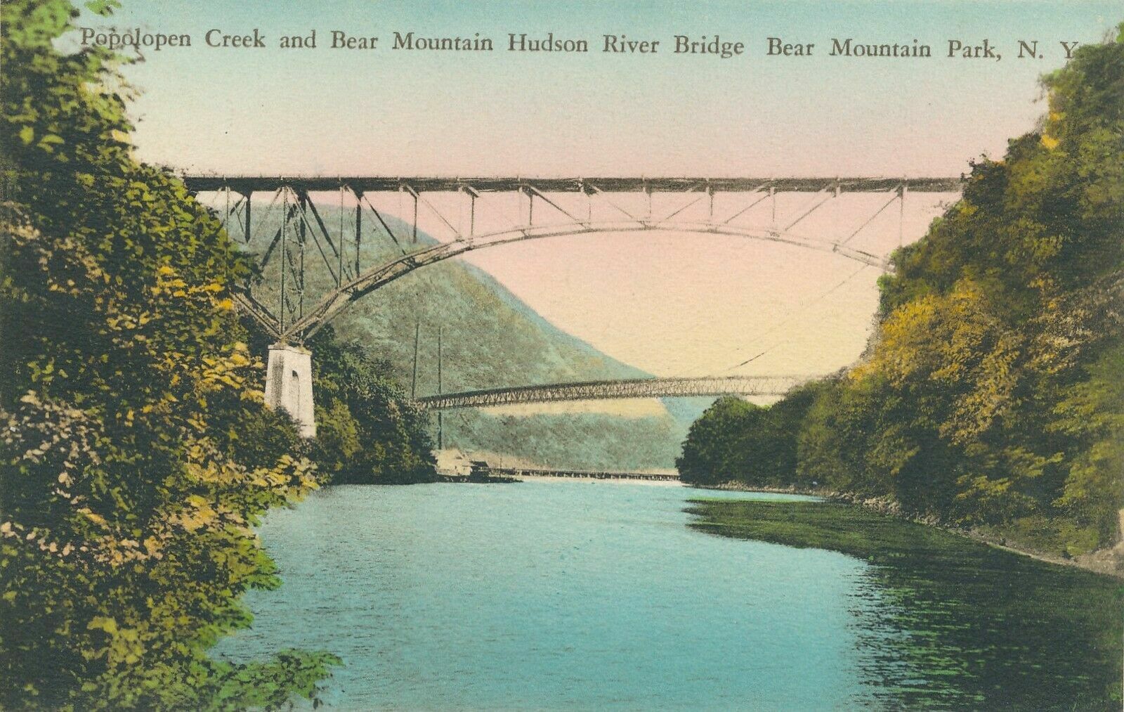
The arch and suspension bridges are over the Popolopen Creek near its mouth with the Hudson River and the railroad bridge is at the mouth.
Thanks to the train, the railroad and arch bridges are obvious. The suspension bridge is the light-blue line just a little above the river.
 |
1 of 4 photos posted by Curtis Tate
Four New Jersey-bound trains from the Bear Mountain Bridge. Look at that color. October 2006.
[The other three photos is the same scene but with different trains]
Dennis DeBruler: I like the view of the three bridges as well. |
 |
River Rail Photo posted
Take A Hike. Looking down from the top on Anthony's Nose in the Town of Cortlandt, New York on Friday, May 8, 2015 gives the "bird's eye view" of CSX 3013 (ES44AC-H) leading an intermodal train over Popolopen Creek in Fort Montgomery, New York. There are four bridges in pic (clockwise) - Popolopen Arch Bridge (Route 9W/road), Poplopen Suspension Bridge (pedestrian), Popolopen Creek Trestle (railroad) and the Bear Mountain Bridge (road). If you want to go for a hike here on a summer weekend, get up early - the limited parking fills up very fast. |
 |
| July 2021 Photo by Geoff Hubbs via BridgeHunter-suspension, License: Released into public domain |
 |
Rick Diliberto posted
Bear Mountain Park |
 |
| July 2021 Photo by Geoff Hubbs via BridgeHunter-1937, License: Released into public domain |
A cloudy sky, but you can see past the trees.
 |
| March 2022 Photo by Josh Schmid via BridgeHunter-1937, License: Creative Commons Attribution-Share-Alike (CC BY-SA) |
This shows the four truss lines.
 |
| March 2022 Photo by Josh Schmid via BridgeHunter-1937, License: Creative Commons Attribution-Share-Alike (CC BY-SA) |
 |
| 1916 photo of the opening via HistoricBridges |
This street view was accessed with a link from BridgeHunter-1937 "
View on Google Maps." I could not get Google Maps to switch to a street view from a trail bridge.
 |
The Hudson Valley in pictures posted
The Bear Mountain Bridge viewed from Fort Montgomery.
[With the railroad and pedestrian bridges in the middle and foreground, respectively.] |
Christopher R Hernandez
posted 11 photos with the comment: Bear Mountain Bridge, Popolopen Creek Bridge (Route 9W) and Popolopen Suspension Footbridge, Highland Falls Hudson River, NY photos 2011-2024""
 |
| 1 |
 |
| 2 |
 |
| 3 |
 |
| 4 |
 |
| 5 |
 |
| 6 |
 |
| 7 |
 |
| 8 |
 |
| 9 |
 |
| 10 |
 |
| 11 |
Christopher R Hernandez
posted five photos with the comment: "Popolopen Creek Bridge, Fort Montgomery, NY originally opened in 1916, widened in 1935 and rehabed in 1992."
 |
| 1 |
 |
| 2 |
 |
| 3 |
 |
| 4 |
 |
| 5 |
 |
1 of 3 photos provided by Mark Lavinski in the comments on Christopher's post
[The photos appear to be of opening day, 1916.] |


No comments:
Post a Comment