The Fort Duquesne Bridge replaced the 1915 Manchester Bridge.
The bridge was started in 1958 and finished in 1963. But that completion date is in parenthesis in the title because it was a bridge to nowhere on the north end! In 1969 some ramps finally connected it to one highway and in 1986 some additional ramps connected it to other highways. [pghbridges] The delays were caused by problems with acquiring the right-of-way. [B&T]


The first of the Three Sisters is the Roberto Clemente (6th Street) Bridge and the next two are the Andy Warhol and Rachel Carson Bridges.


 |
| 20220817 1084, taken from the parking lot for the Duquesne Incline |
 |
| Peter Moreno posted The Fort Duquesne Bridge in Pittsburgh Pennsylvania |
Back when it was the bridge to nowhere.
 |
| Jackson-Township historical preservation posted The North Side of Pittsburgh on January 18, 1964, before its redevelopment as a sports destination. (Photo from http://pgdigs.tumblr.com/) |
A view from the top of the incline. The Fort Duquesne Bridge is the tied-arch bridge on the left.

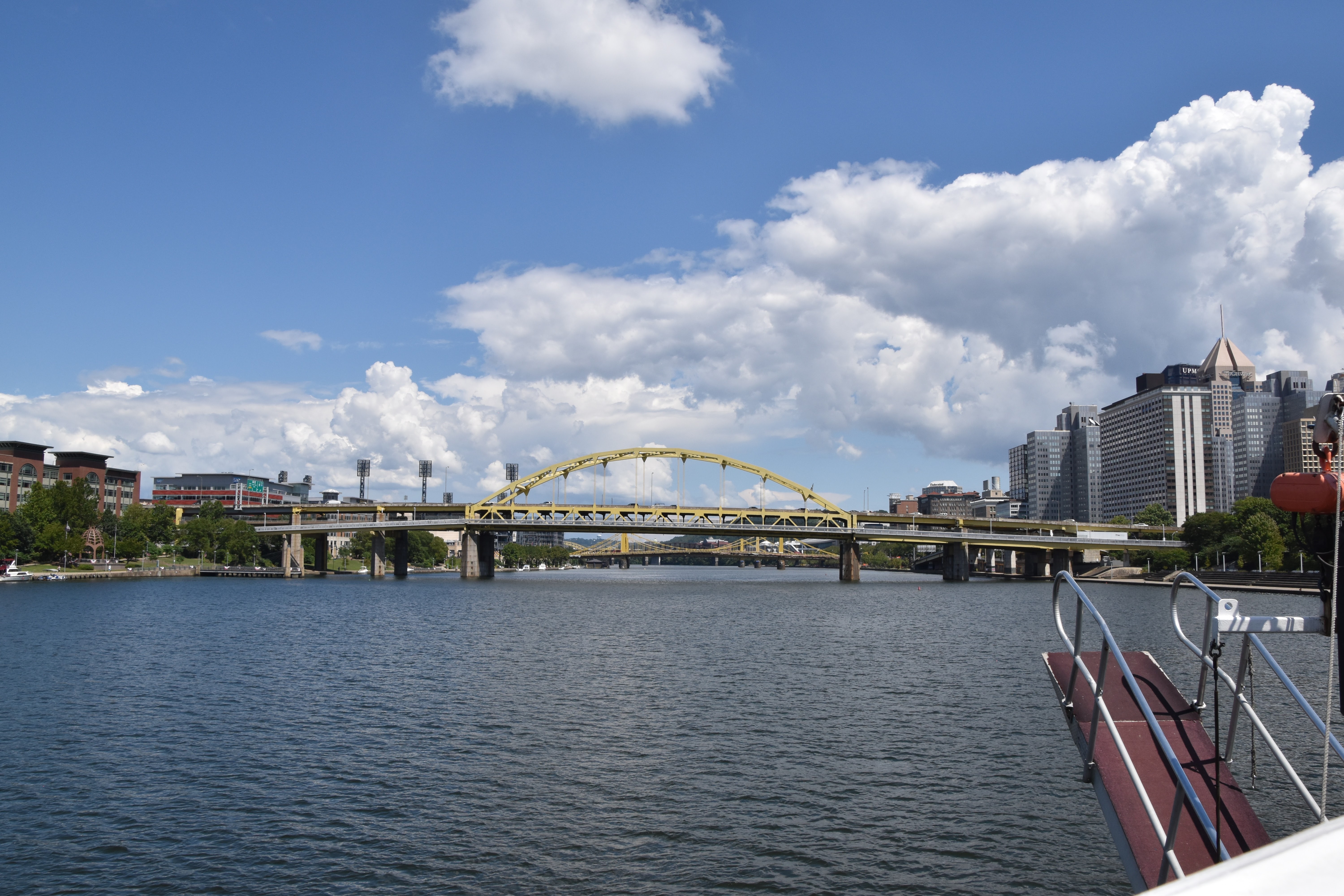


The Fort Duquesne Bridge is the one on the left.

 |
| Bridge & Tunnels posted In a city of bridges, Fort Duquesne Bridge stands out for being -the- Bridge to Nowhere for years. Carrying Interstate 279 over the Allegheny River in Pittsburgh, Pennsylvania, Fort Duquesne Bridge's main span and south approach were completed in 1963 while its northern approaches were not finished until 1969 and 1986 when connections to the East Street Valley Expressway (Interstate 279) and North Shore Expressway (Interstate 279 and PA Route 28) were finished. The crossing was notable for one incident that occurred on December 12, 1964, when a student from the University of Pittsburgh drove his 1959 Chrysler station wagon through the bridge’s wooden barricades, raced off the end of the bridge, and landed upside down. The student was unhurt in the incident. ▶︎ Check out more photos and a history of the Fort Duquesne Bridge at |
Originally, the bridge was constructed with rolled beams that were welded together. But that caused "lamellar tearing" because the structure was too ridged and it didn't absorb temperature and load stresses. So they went back to using bolted splice plate connections. [pghbridges]
 |
| Street View |
 |
| Jackson-Township historical preservation posted The uncompleted Fort Duquesne Bridge cross the Allegheny River in Pittsburgh in 1963 was nicknamed "The Bridge to Nowhere". Construction began on the bridge in 1958 and the bridge wasn't finished and opened for traffic until October 17, 1969. The delay in finishing the bridge was due to not the process of acquiring right of ways for the northern approach ramps. The northwestern ramps were completed in 1969, allowing access to Pennsylvania Route 65. The northeastern ramps were completed in 1986, with the construction of the northern section of Interstate 279 (North Shore Expressway) which runs through Downtown Pittsburgh's Golden Triangle and north towards Interstate 79. The bridge touches down halfway between Heinz Field and PNC Park Baseball Stadium on the City's North Shore. (Photo from William Freker via https://www.facebook.com/groups/132768683480072/) |
No comments:
Post a Comment