 |
| MWRD posted A westward view of the bridge at Burr Oak Avenue (now 127th) over the Cal-Sag Channel in what is now Crestwood, Illinois, on February 14, 1922. MWRD posted A westward view of the bridge at Burr Oak Avenue (now 127th) over the Cal-Sag Channel in what is now Village of Crestwood on February 14, 1922. [Some comments indicate that it is looking eastward. And that the bridge has been closed recently for various construction projects.] Randy Gumkowski: Where is the mountain in the back ground, if this is looking west it would be north ? Mark Kudia: Randy Gumkowski that’s the pile of rocks and dirt from when the canal was dug. It was a cool waterslide in the 80’s, and was eventually leveled about 12 years ago after the waterslides had long since closed. Kevin Cianci: The large pile of debris that you see in the background Could have been when they first dug it deeper But in 1922 I can not see them moving rock and debris that far from the excavation site During the 60s when they widened the canal debris piles were built up on both sides along with a pile of debris on route 83 just to the east of Cicero was piled up Yes it was removed in the 80s and part still remains were the radar ball is If a better photo of the area I would like to see it I am not saying that it is not the area but I would like a little bit better photo or photos |
There were several comments about the "mountain" in the right backgroud on MWRD's second post. This 60' channel was completed in 1922, so that is one of the debris piles.
 |
| Dennis DeBruler commented on Randy's comment As other comments have indicated, I think we are looking eastward. This Google Earth Apr 2002 image shows the debris pile in the lower-right corner. And we can still see a landscar today: https://maps.app.goo.gl/TjiWRAkjfF8KpgN9A. |
On the right side of this image is the "radar ball" mentioned in Kevin's comment above. I find all of that brownland to be disturbing.
 |
| Satellite |
When I used street view to confirm the radar dome, I discovered that there are still a couple of raw debris piles eroding away.
 |
| Street View, Jun 2025 |
It turns out, those piles are because a material handling company was not required to clean up its piles before it abandoned the land. Recent use by a material handling company would also help explain why there are no trees on the land like there is on the north bank of the channel.
 |
| Google Earth, Apr 2002 |
 |
| MWRD posted A view to the west at construction of a bridge at 127th Street over the Cal-Sag Channel between Alsip and Crestwood on August 18, 1916. |
 |
| Dennis DeBruler commented on the MWRD post Except for Blue Island, the Cal-Sag Channel was still in wilderness (swamp) in the late 1920s. 1928 Palos Park and 1929 Blue Island Quads @ 24,000 |
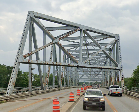
The truss was replaced when the Cal Sag Channel was enlarged in the 1960s.
 |
| Street View, Jun 2023 |
No comments:
Post a Comment