|
| Street View, Apr 2025 |
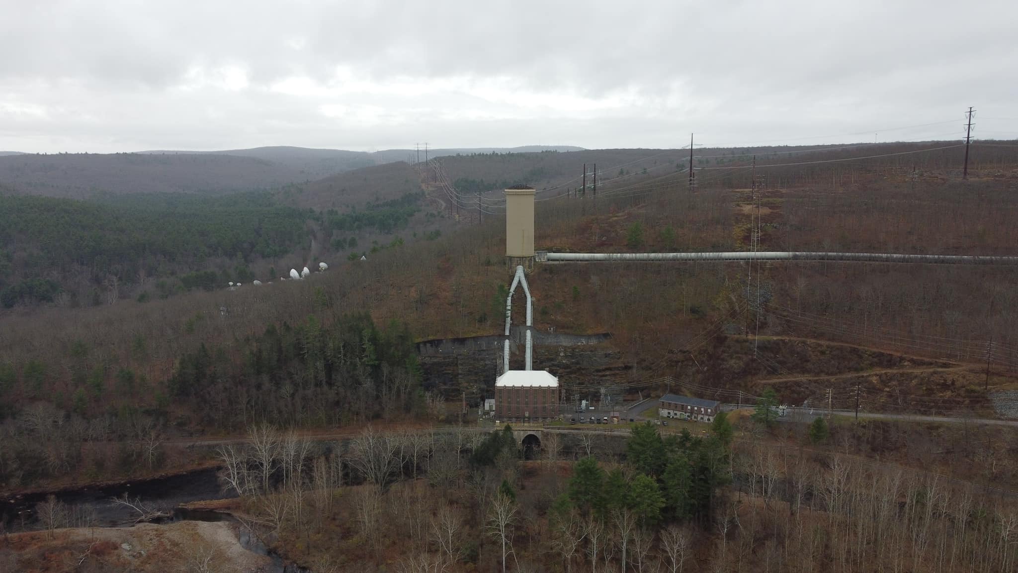
Rust Belt Railroading posted four photos with the comment: "L-100 strolling through Hogback Tunnel heading north into Johnstown. The track speed through there is 10 mph. It is located in Ferndale across from the greenhouse on Eisenhower Boulevard."
Matt Thomas: I remember we would have to fold the mirrors in or we would hit the sides of the tunnel. It’s a tight squeeze.
 |
| 1 |
 |
| 2 |
 |
| 3 |
 |
| 4 |
.jpg) |
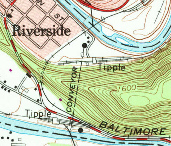
| Metrotrails posted Johnstown Tunnel on the former Cambria and Somerset Branch of the Baltimore and Ohio Railroad south of Johnstown Pennsylvania Steve Lindberg: I thought it might be the coal train out of the current Windber coal mine , but not. It is still an active line though; been there many times with students to examine the local rock layers at a very well exposed hillside cut, and along comes a train. Hsoj Duell: Steve Lindberg this tunnel is on Eisenhower Blvd and a local from Rockwood comes through daily to service Safety Kleen and Pepsi by Dale Oxygen and Gautier and interchange with the C&BL . The coal trains are Norfolk Southern and go up through Elton. Frederick L Leer: It's known as Hogback Tunnel to the railroad. It's deceptively short but you can't see through it due to the sharp curvature of the track. Bob Leverknight: Hogback Tunnel. When EMD's Train of Tomorrow was on it's national tour, it was to be transfered to the PRR off the B&O at Johnstown. However. Hogback had other ideas. The Moon Glow sleeper got hung up inside the tunnel, creating a pretty big gash down it's side. The B&O crews managed to get it out, placed on display, then continued on it's merry way. Later, the UP purchased the dome train set for use as the (unofficial) City of Seattle streamliner. That dent was still there! Fast forward to the late 1980s. CSX had moved dispatch and power assignments to Jacksonville Florida. One fine day, the Johnstown Jet was called in Connellsville, and had an SD-50 as the power. The crew tried to point out to the recently moved from the ACL Road Foreman the timetable specifically stated: "no six axle power west (compass north) of Hollsopple because of clearance restrictions at Krings." The Road Foreman took the throttle. Sure enough, Hogback caught that big SD! Apparently, "told ya" was uttered. Now. Memorial Day, 1957, there was a fantrip from Cumberland to Johnstown featuring EM-1 7600. (If you see photos of this engine sporting a graphite boiler front, it was from that trip and shortly after.) It managed to squeeze through, as did thousands of Bethlehem built TTX 89' flat cars which were delivered across the S&C. The truck center distance is the secret to long stuff making it through. |
 |
| Justin Santichen commented on Metrotrails post Thanks for coming to my home of Johnstown and doing all that you did. Love what you do! |
 |
| Satellite plus Paint |
 |
| 1972 Johnstown @ 24,000 |
The B&O competed aggressively with the Pennsy for the coal and steel business in Western Pennsylvania.
 |
| Rumsey via Dennis DeBruler |
 |
| Digitally Zoomed |