Showing posts with label towerCoal. Show all posts

Friday, April 12, 2024

1883-1953 Penn (17th Street) Incline (Funicular) in Pittsburgh, PA

Bottom: (Satellite, southwest quadrant of 17th and Spring Way, which is close to Penn Ave.)
Top: (Satellite)

I had no idea that there used to  be 24 inclines in Pittsburgh. I only knew about the two that still exist: Duquesne and Monongahela.

𝗥𝗲𝗺𝗲𝗺𝗯𝗲𝗿 𝗪𝗵𝗲𝗻: 𝗣𝗲𝗻𝗻𝘀𝘆𝗹𝘃𝗮𝗻𝗶𝗮 posted
"The Penn (17th Street) Incline descends over Bigelow Boulevard from the Hill District to the Strip District. This massive steel structure was the longest, and strongest, of twenty-four inclines built in Pittsburgh"
CR: Brookline Connection

It used to go up this hill near the right side.
Street View, Aug 2021

OldPittMaps
A view from the Penn Incline
[This source puts the count at 23. Many were built by coal mine companies. Some were built to open up more residential properties on top of the hills.]
A lighter exposure of this photo
Another copy of this photo
"The Penn Incline terminating in the Strip District (background). The Sixteenth Street Bridge is in the far left background. The Penn Incline, also called the 17th Street Incline, began operating in 1883 and handled 20-ton coal freight cars It ceased operation in 1953. Pittsburgh had thirteen inclines servicing both the needs of industry and that of its laborers and commuters of the early twentieth century. The Penn Incline operated between the Hill District and the Strip District neighborhoods of Pittsburgh, and was possibly the largest incline ever built. Samuel Diescher, who immigrated to the United States from Hungary in 1866, designed the majority of heavy incline planes in the United States, including the Penn incline. Diescher introduced a successful pneumatic bumper, which acted as a safety device, during the construction of the Penn Incline. He also served as the designing engineer for operating the Ferris wheel, invented by George Ferris of Pittsburgh, at the 1893 World’s Fair in Chicago."

A different exposure of the top photo.
OldPittMaps
"Penn (17th St) – (1883-1953), height: 330 ft, length: 870 ft"
"The Penn Incline was also known as the 17th St Incline.  Over Bigelow Boulevard to Liberty Avenue, from Ledlie Street to 17th Street – Hill District. It featured 20 ton cars that hauled coal, freight and passengers....There has been recent talk of reopening/rebuilding this incline to use by pedestrians and bicyclists."

1951 Pittsburgh East @ 24,000
 
BrooklineConnection, this webpage is a summary of the inclines in Pittsburgh
"The Penn Incline ferried passengers and freight between the Strip District to Ridgeway Street in the Hill District. It was arguably the longest inclined plane in the world. Built in 1884, it operated until 1953. The large structure to the left of the upper platform was a saloon and entertainment hall called the Penn Incline Resort, which stood for eight years. This resort was built by the Penn Inclined Plane Company to boost business. It enjoyed early popularity, but soon went into decline. The building was destroyed in 1892 by a fire that spread from the incline's boiler house. Note the rickety steps hugging the steep hillside to the left, an alternate path for those short a fare."
Kathy Plays posted
How about these old stairs next to an incline in Pittsburgh PA! Longest incline in the world... see below.
"Note the rickety steps hugging the steep hillside to the left, an alternate path for those short a fare."
"The Penn Incline ferried passengers and freight between the Strip District to Ridgeway Street in the Hill District. It was
arguably the longest inclined plane in the world. Built in 1884, it operated until 1953."

BrooklineConnection
"A view of the Penn Incline in operation, looking down on Pittsburgh's Strip District. Designed by Samuel Deischer, the funicular measured 840 feet in length and rose 330 feet. The structure contained over 750 tons of bridge work with two ten-foot gauge tracks. The incline was originally built to hoist twenty-ton loads of coal to the top of the hill. Although this coal traffic never met expectations passenger and freight traffic took its place and was enough to keep the incline profitable. By the end of World War II business had decreased to only fifty customers a day paying the ten cent fare. With operations cut to only a few hours a day during rush hour, the incline was abandoned by its final owner, the Pittsburgh Railways Company, on November 30, 1953."

BrooklineConnection, this web page has 12 more photos of this incline.
[Note the coaling tower in the background.
This page has a better exposure of this photo.]

Brookline Connection posted
This is the Penn Incline in 1956, shown here during the dismantling of the seventy year old structure.
Also called the 17th Street Incline, the funicular was built in 1884 and designed by Samuel Diescher. The upper station was along Ridgeway Avenue atop the Hill, and the lower platform at 17th Street and Spring Way, between Liberty and Penn Avenue in the Strip District. The ride took the passenger over Bigelow Boulevard, the Pennsylvania RR yard and Liberty Avenue.
Diescher, who immigrated to the United States from Hungary in 1866, designed the majority of heavy incline planes in the United States, including the Penn incline and several others here in Pittsburgh. During the construction of the Penn Incline, Diescher introduced a successful pneumatic bumper, which acted as a safety device.
The massive incline, possibly the largest ever built, measured 840 feet in length and rose 330 feet. The structure contained over 750 tons of bridge work with two ten-foot gauge tracks. The incline was originally built to hoist twenty-ton loads of coal to the top of the hill.
Although this coal traffic never met expectations passenger and freight traffic was enough to keep the incline profitable. By the end of World War II, however, business had decreased to only fifty customers a day paying the ten cent fare.
Operations were cut to only a few hours a day during the morning and evening rush hour, and the incline finally abandoned by the Pittsburgh Railways Company on November 30, 1953.
The Penn Incline was one of twenty-three inclines built here in Pittsburgh and the immediate vicinity. Learn more about all of Pittsburgh's Inclines here ...
James Love: Many don't know Spring Way was to be Pennsylvania Canal.

𝗥𝗲𝗺𝗲𝗺𝗯𝗲𝗿 𝗪𝗵𝗲𝗻: 𝗣𝗲𝗻𝗻𝘀𝘆𝗹𝘃𝗮𝗻𝗶𝗮 posted
Pittsburgh • 1940!
Leslie Passons: H J Heinz standing tall across the river.
[Some comments confirm that this is the Penn incline.]
Larry Wayne: I'm not sure where this was taken from, but that is the Allegheny River with the Heinz plant on the other side. The original Heinz plant was in Sharpsburg. It was floated down the Allegheny to the current location on the North side.

Friday, January 15, 2021

Pennsy 14th and 16th Street Yards

(Satellite, has been rebuilt at least twice after this area was an engine servicing area)

This 1891 map shows that Pennsy (Pittsburgh, Ft. Wayne & Chicago was controlled by Pennsy and later owned by it) had a roundhouse just south of 14th Street before the South Branch was straightened. So I assume that was their 14th Street Yard.
DeBruler, 1891

I learned of this yard from the comment on this post:
Dave Durham posted, cropped, Facebook resolution
#5, Pennsy, 14th St., Chicago, approx 1900-1905.

Note that in the 1891 map above, it shows Stewart Avenue and 14th Street plus some other streets go all the way to the river. This 1891 topo map confirms that there was development east of Canal Street south of Harrison Street. And of course the South Branch had not yet been straightened.
1901 Chicago Quadrangle @ 1:62,500

By 1915 the configuration I'm used to studying had been established. That is Stewart Avenue north of 16th Street was gone. That is, all of the land between Canal Street and the river was used by the railroads --- CB&Q and Pennsy. As part of this rebuilding, Pennsy moved their roundhouse further East and South and evidently changed the name to 16th Street Yard.
pdf copy from 1915 Smoke Abatement Report

While confirming that the railroads removed all development east of Canal Street, I found two more roundhouses. The one on the left was CB&Q, and it appears the one on the right was B&OCT.
pdf copy from 1915 Smoke Abatement Report

By 1915, CB&Q and B&OCT had already built new facilities further West.
pdf copy from 1915 Smoke Abatement Report

Pennsy evidently acquired the former B&OCT property to expand their coach yards and CB&Q converted its old steam servicing facilities to diesel servicing facilities.
1929 Englewood Quadrangle @ 1:24,000

When the river was straightened, Pennsy was forced to move its roundhouse operations down to its 55th Street Yard.


Friday, October 30, 2020

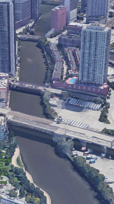
Mystery location of team tracks and coaling tower

<update>
Per the comment, this photo is looking south along the new channel for the South Branch.
</update>

This photo of a dredging operation by the Great Lakes Dredge & Dock Co. (GLDD) caught my eye because of the two gantry cranes and the coaling tower. The gantry cranes indicate there were team tracks on both sides of the river.

GLDD-history-gallery

Given the straightness of the river and the Strauss-trunnion bridge on an angle in the background, my theory was that this photo was taken looking southish along the North Branch from Fullerton Ave.
3D Satellite
However, the tracks indicated in the 1929, 1953 and 1963 topo maps are not consistent with the railyards along the river in the photo.
1929 Chicago Loop Quadrangle @ 1:24,000

And historic aerials are consistent with the topo maps rather than the dredging photo.
1938 Aerial Photo from ILHAP

My second theory was that it was looking along the North Branch down closer to Wolf Point and the coaling tower was part of C&NW's Erie Yard. But that Strauss-trunnion bridge doesn't have the elephant ear counterweights and the trunnion is on the wrong side of the river.
3D Satellite


1938 Aerial Photo from ILHAP

GLDD was the contractor that straightened the South Branch, but the angle of the bridge is wrong for that location.

Was this dredging operation even done in the Chicagoland area? Does Milwaukee, Detroit, Cleveland and/or Buffalo have any Strauss-trunnion bridges? Actually, Buffalo has three of them, but the Buffalo River is too curvy around each of the three bridges to be a location for the photo.


Saturday, March 7, 2020

Skip hoists load blast furnaces and coaling towers

I once saw the question of how was the coal loaded into the tall coaling towers that were used by railroads to fuel steam locomotives. One way they were loaded was with a skip hoist. But even if a tower is still standing, it has probably been stripped of its metal parts so the skip hoist is gone. But skip hoists are still used to load blast furnaces. In fact, loading blast furnaces might have been the application for which skip hoists were invented. Unfortunately, integrated steel mills are so big that there is no way I can get close enough to a blast furnace to get photos of the skip hoist. Fortunately, when Sloss Furnaces in Birmingham, AL, shut down their city furnaces in 1971, they donated them to the city. And enough people realized that they were more valuable than yet another pile of condos or apartments that they are preserved as the Sloss Furnaces National Historic Landmark. During this year's trip from Florida to Illinois, I visited that site. It rained on and off, so the photos won't win any contests, but they do provide some information.

(Update: please see a comment for details as to how these operated.)

In this overview image we can see that each blast furnace has inclines on its side. Those inclines are skip hoists and in the left one we can see that a hoist has two skip cars. As one goes down, the other goes up so that they counterbalance each other. Since the cars meet at the halfway point, we can see that the incline extends quite a bit below the ground.
Street View
This view of the other skip hoist lets us see its two skip cars. It also shows that quite a bit of the incline is hidden underground.
3D Satellite
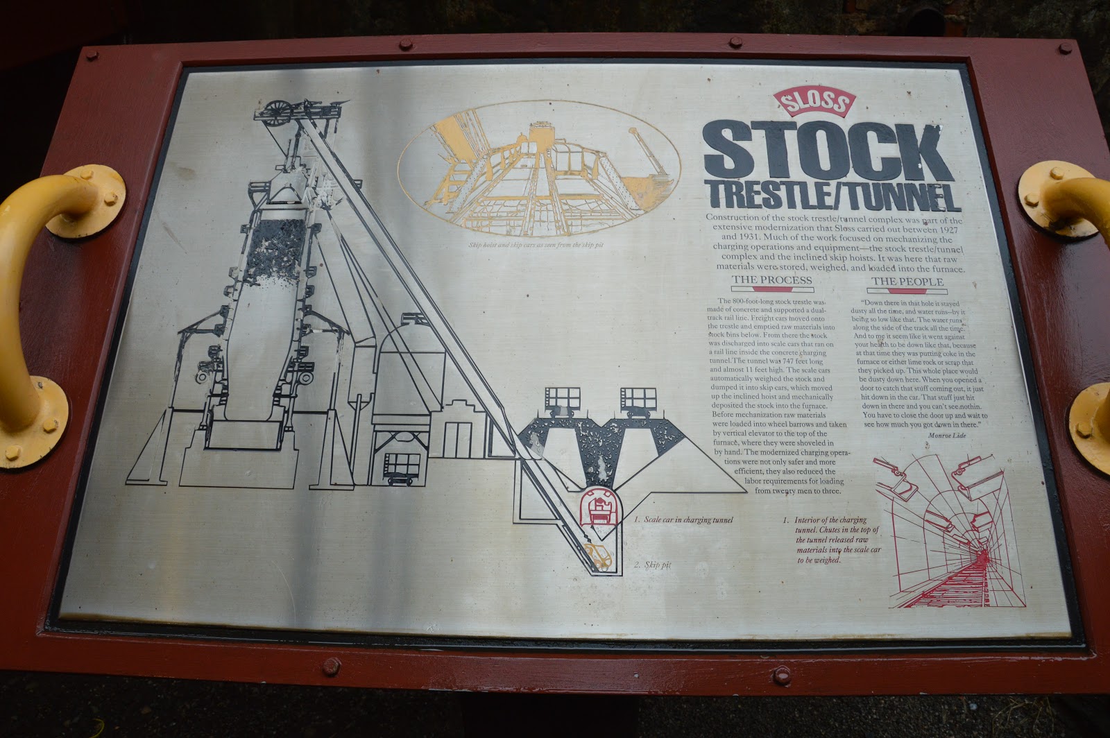
The Street View image above shows that there was a rail trestle that went across the bottom of the skip hoists. There were two tracks on that trestle. Under the tracks are storage bins. And under those bins is the charging tunnel. Here is their sign that illustrates this construction.
20200218 1107
And here I zoom in on the text and crank up the contrast so that it is readable.
Installation of the double bell hoppers at the top of the furnace was part of the upgrade. Before that, gases came pouring out of the top. Much of the gas was carbon monoxide. Sometimes one of the workers shoveling stuff from a wheel barrow would die and fall into the furnace!

This is the path to the stock tunnel. Note the sign I reproduced above.

Along the way, there was a room with at least three pumps powered by at least a couple generations of electric motors.
Now we are beside the hoist looking down into the pit.
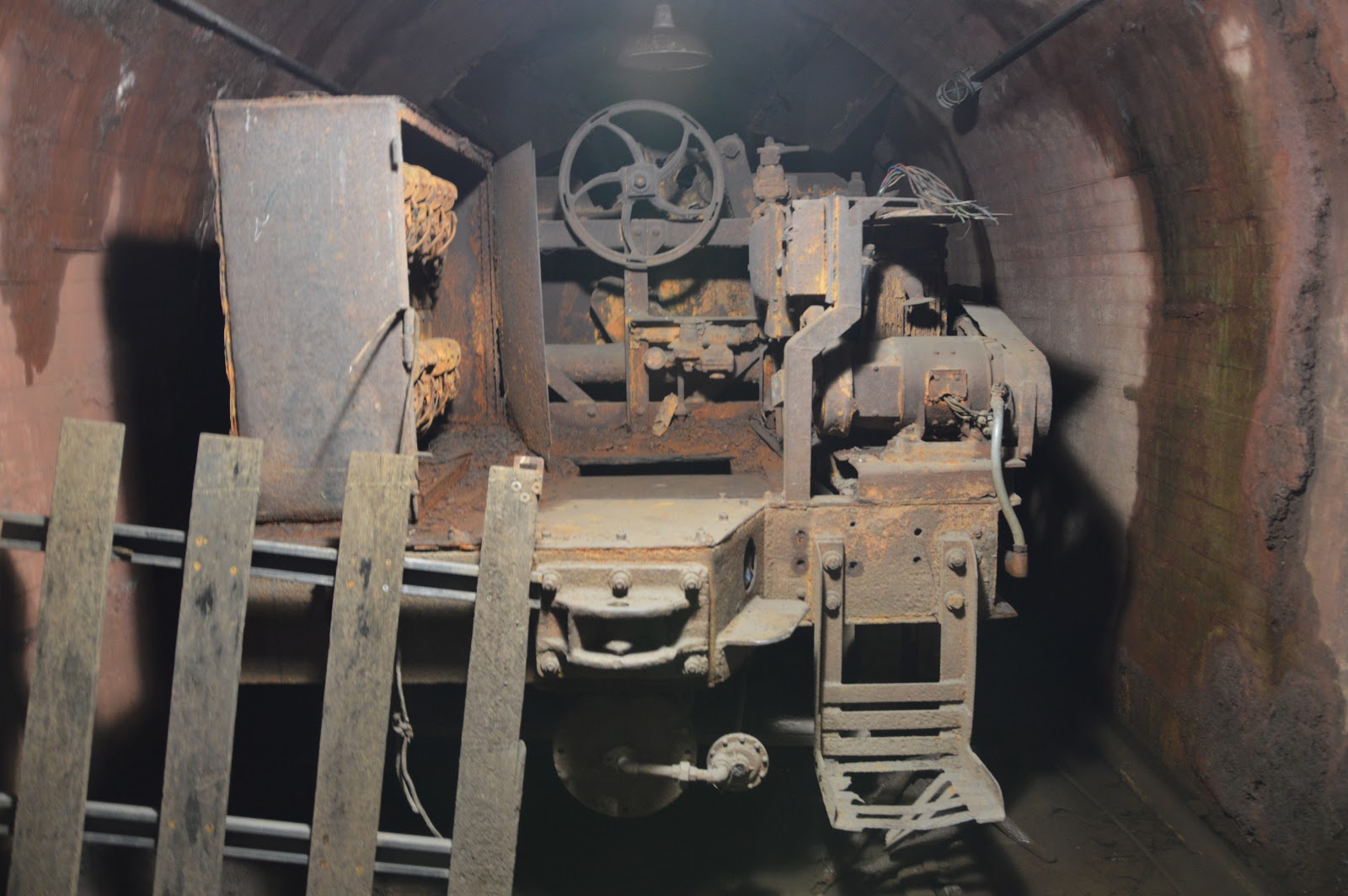
After going down several stairs, we are in the tunnel. Our view toward the other blast furnace is blocked by the scale car and a lack of lighting.
But in the other direction we can see what is left of the tunnel. Note the handrails on the bridge over the skip hoist.
Now I'm standing on that bridge looking at the two tracks for the skip cars and a couple of ladders. I presume the ladders are permanently installed to make maintenance easier. Note there is a higher level bridge.
As discussed earlier, the incline goes far under ground. That length under ground positions a hoist car to be under this bridge when the car is at the end of its tracks.  During operations, I assume that this bridge wasn't here. Specifically, there was just the tracks that went over the hole. That would allow the load in the scale car to dump freely between the tracks into the hoist car waiting below. The bridge above this one would have been the one that workers used to cross to the other side.

I went up to the higher bridge and got this view of the skip cars on their tracks.

Remember when I said there were periods of rain that day? I took this photo while in the tunnel. I don't remember hearing the pumps we saw running. Maybe the city now has storm sewers below this level and this water can go down a drain.
Here are a couple of photos I took as I left the skip hoist area.


Later in the tour I took a walkway over to the trestle and got this view. which catches the base of "our" skip hoist and shows the skip hoist for the other blast furnace.

That walk way had another "Stock Trestle" sign. Below are the two sides of that sign.

.

Coaling Towers


I haven't forgotten that the reason for studying skip hoists was their use for loading coaling towers.
See Servicing Towers for more photos of coaling towers.
Here is a photo that is old enough that it has all of its metal parts including the skip hoist.
Dennis DeBruler

A Johnson Frisco Company Photo via Richard Crabtree post via Dennis DeBuler
 
Charles Edwards posted via Dennis DeBruler

In this one, it looks like they removed the hoist rails but left the maintenance ladder.
Dennis DeBruler

Since the above photo, they have removed the vine from the ladder.
Street View

For this tower, they bent the rails so that most of the length is straight up and down to reduce the amount of land needed by the hoist. It would be interesting to see how they loaded the skip cars.
3D Satellite and DeBruler

DeBruler

(new window)   At  1:27 in this video, you can see a skip hoist in action.


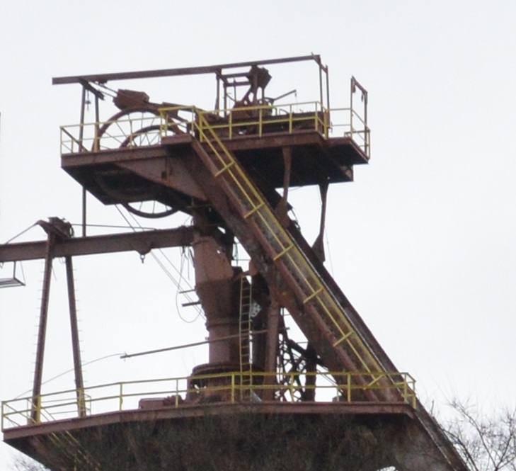
In this close up we can see two sheaves and cables at the end of the tracks. That allows the machinery that hoists the skip cars to be located near the ground where it is easier to maintain. The machinery probably includes an electric motor driving a spiral-grooved drum. My guess is that the system uses one cable. The cable goes from one car up to its sheave down to the spiral-grooved drum and then back up to the other sheave and down to its car.

Looking back at my photos above, this building was the machine room. But I don't know why I can see just one cable going into it.


I know that some blast furnaces still operate in Northwest Indiana, so I used the satellite map to try to find them and their skip hoist. I learned that the US Steel Gary Works seems to be down to just one blast furnace. I remember when driving along the Indiana Tollway in the 1970s that you could see a handful of them belching out orange smoke and the sky itself was orange. And it stank when you drove into the orange cloud. The resolution of this satellite image is good enough to see that it has a skip hoist. But not good enough to find both skip cars.
3D Satellite
I discovered that Arcelor-Mittal has replaced the skip hoists with conveyors.
3D Satellite

3D Satellite
Update:
Art Johnston posted
Hey all! I fell in love with the steel/iron making industry in 2016 when I visited Carrie Furnace. The size, the history of the process, the history of the mills and plants is what made me love it. I hope you enjoy this as much as I did making this image.

Bubba Dubs commented on Art's post
Emma Stephens: Bubba Dubs looks like trees growing out of your bleeders.

Stacy Mays posted
Looking down the skip at Duquesne's #1 blast furnace.
Christopher J Shoppa Wow that’s small....
Stacy Mays Author Christopher J Shoppa At one time she was the oldest operating furnace in U.S.Steel. She was built on railroad the piering.

Stacy Mays commented on his post, Facebook resolution

Stacy Mays commented on his post, Facebook resolution
She only had 10 tuyeres.

I came across the above two diagrams again as the #1 blast furnace at US Steel Duquesne Works.

Chad Bercosky posted
Mickey Sovich: Molten iron 1850 degrees

Stacy Mays commented on Chad's post
Here's another one from Duquesne.

Don Cassata posted
This 190 cubic ft. Skip Car 4 use at blast furnaces.
 
Todd Branch posted
Don't know where I got the picture but Blast Furnace Skip Cars unearthed during excavation for the Tesla solar panel facility on the site of the old Republic Steel Plant on South Park Ave. Buffalo NY. Probably from about 2015.
Bubba Dubs: There are quite a few more things that they unburied fro there as well. They still have them displayed out on the right side of the facility

An unintended view of a skip-hoist car.
The Beauty of Steel posted
Must share this with you, insane. 
Skip car accident at ArcelorMittal Zenica works (Bosnia and Herzegovina). Nobody got hurt, already fixed and back in action. 
Credits: Nermin Gluhic

Screenshot