Georgetown, SC posted
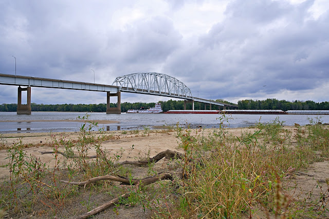
I bet driving over this bridge to Charleston SC gave you nightmares! ➡️ The History of the Cooper River Bridge in Charleston, SC ➡️ Early Transportation Challenges Charleston, South Carolina, with its unique geography, has always faced significant challenges regarding transportation. The Cooper River, a broad tidal river, separates the Charleston Peninsula from the areas to the north and east, including Mount Pleasant and Sullivan's Island. Before the construction of a permanent bridge, residents relied on ferries to cross the river, which could be both time-consuming and unreliable, especially during bad weather. ➡️This article is supported by Jake Lee - Myrtle Beach & Pawleys Island Top Realtor , preserving and sharing the heritage of this extraordinary region. ➡️The Original John P. Grace Memorial Bridge (1929) In response to the growing need for a reliable crossing, the first Cooper River Bridge, known as the John P. Grace Memorial Bridge, was completed in 1929. Named after Charleston's former mayor, John P. Grace, who championed its construction, the bridge was a steel cantilever structure that spanned 2.71 miles. At the time of its completion, it was one of the longest bridges of its kind in the world. The Grace Bridge provided a critical link for vehicular traffic, promoting economic growth and development in the region. ➡️Construction and Features The construction of the Grace Bridge was a monumental task, requiring innovative engineering solutions to address the challenges posed by the river's width and depth. The bridge featured a 1,050-foot cantilevered span, with a clearance of 150 feet above the river to allow for the passage of ships. Its two lanes, however, were narrow by modern standards, which eventually led to concerns about safety and capacity as traffic volumes increased over the decades. ➡️ The Silas N. Pearman Bridge (1966) By the mid-20th century, it became clear that the Grace Bridge could no longer handle the increasing traffic efficiently. To address this, the Silas N. Pearman Bridge was constructed and opened in 1966, running parallel to the Grace Bridge. Named after another former mayor of Charleston, the Pearman Bridge featured a more modern design with wider lanes and a higher clearance of 155 feet. This bridge provided much-needed relief to the congested Grace Bridge and further facilitated the region's economic growth. ➡️ HOMES FOR SALE IN MURRELLS INLET www.JakeLeeRealEstate.com/murrells-inlet ➡️ Safety and Capacity Concerns Despite the addition of the Pearman Bridge, both structures eventually faced criticism for safety issues and limited capacity. The narrow lanes and steep grades of the Grace Bridge, in particular, were considered hazardous, leading to frequent accidents. Moreover, the increasing traffic volumes in the late 20th century necessitated a more robust solution. ➡️ The Arthur Ravenel Jr. Bridge (2005) In response to these concerns, plans were made for a new, modern bridge that would replace both the Grace and Pearman Bridges. The result was the Arthur Ravenel Jr. Bridge, which opened to traffic on July 16, 2005. Named after a prominent South Carolina politician, the Ravenel Bridge is a cable-stayed bridge with a main span of 1,546 feet, making it the third longest in the Western Hemisphere at the time of its construction. ➡️ Design and Construction The Ravenel Bridge was designed to be not only functional but also a striking architectural landmark. Its eight lanes, wide pedestrian and bicycle path, and impressive height of 186 feet above the Cooper River make it a significant improvement over its predecessors. The bridge was constructed with advanced materials and techniques to ensure durability and resistance to extreme weather conditions, such as hurricanes and earthquakes. ➡️ Impact and Legacy The opening of the Arthur Ravenel Jr. Bridge marked a new era for Charleston's transportation infrastructure. It greatly improved traffic flow, enhanced safety, and provided a critical link for commerce and tourism. The bridge quickly became an iconic symbol of Charleston, admired for its beauty and engineering excellence. ➡️ HOMES FOR SALE IN Myrtle Beach, SC www.JakeLeeRealEstate.com/myrtle-beach ➡️ Preservation of History While the Ravenel Bridge stands as a testament to modern engineering, efforts have been made to preserve the history of the original Grace and Pearman Bridges. Parts of the Grace Bridge were preserved and displayed in local parks, and there are ongoing efforts to educate the public about the significant role these structures played in Charleston's development. 🔥 FOLLOW THE HASHTAG #JAKELEEREALESTATE to browse over 16,000 posts of local history, area photography, and exclusive real estate opportunities! LEARN MORE about Jake Lee at www.jakeleerealestate.com/about The history of the Cooper River Bridges reflects the dynamic growth of Charleston and the continuous efforts to improve connectivity and safety for its residents and visitors. The Arthur Ravenel Jr. Bridge now stands as a proud successor to the Grace and Pearman Bridges, embodying the spirit of progress and innovation in this historic city. ➡️ Curious what your home is worth in todays changing real estate market ? Visit the link below for an instant, no obligation, valuation https://www.jakeleerealestate.com/.../homeestimate/default [Please the use the "posted" link to access any of the links in the article.] | 


.png)


