Tuesday, November 3, 2020

1939,1984+2022 US-301 Harry Nice/Middleton Bridge over the Potomac River

(Bridge Hunter; no Historic Bridges; Satellite)


It was rehabilitated in 1984, and the replacement bridge opened in Oct 2022.

LC-HS503-2485
Governor Harry W. Nice Memorial Bridge connects southern Maryland and Virginia across the Potomac River

The length is 10,050' and the longest span is 800'. "'Arch Cantilever' style cantilever through truss with Wichert deck truss approach spans." [BridgeHunter]

Street View

This is the only crossing of the Potomac south of Washington DC and it suffers daily congestion. They reduced the estimated cost from $1b to $765m "by building a bridge lower to the water over a deeper river channel about 100 feet north of the current span....The replacement bridge would be wide enough to accommodate four lanes of traffic — two in each direction — plus a pedestrian and bike path, officials said." The new bridge is a Maryland political football between the republican governor Hogan and the democratic state legislator. Hogan wants it built by 2023, the legislator wants to save $26m annually and open a bridge in 2030. Rahn, the Transportation Secretary, is waffling. He had said that the existing bridge could remain in service another 30 years. But now he is supporting the immediate replacement. Senator Middleton was for it, but Hogan did not invite him to the press conference that announced the $765m project. Maybe Hogan is trying to get his name on the new bridge. Hogan's timeline had construction beginning in 2020. [2016 article in the BalitimoreSun]

Evidently Hogan's timeline is still accurate because the following photos show that construction has begun.

Poseidon Barge posted four photos with the comment: "POSEIDON BARGE LTD - Picture of the Week: Owners Donnie Fain & Mary Habegger-Fox rewarded several shop employees with a jobsite visit last week. They visited our P10 Barge Platform at the Nice/Middleton Bridge Project in Maryland. The SCM (Skanska/Corman/McLean) Group were more than gracious to give the tour and show our team around. Poseidon Barge appreciated the hospitality and thank you for your business!"
Lee Maynard shared
1
Ben Stalvey: Dang that must be one of the worlds biggest piledrivers. A 888 Ringer being used to drive piling. That is just remarkable really.....

2

3
Ben Stalvey: Wow how much weight is on that barge? That is amazing on a sectional barge

4

One of four photos posted by Poseidon Barge
Skanska uses their Poseidon P-10 barges to do some heavy lifting on a bridge project.

MTDA
Traffic peaked at 3.2 million in 1964. The following year, it dropped by a third following the opening of the Capital Beltway, which made it possible for southbound motorists to quickly travel around Washington, venture across the Potomac River, and continue south into Virginia

MTDA
[It is a toll bridge that accepts E-ZPass, the same payment system we use in the Chicagoland area.]


Sulan Katappa posted
Gov. Harry Nice Memorial Bridge. Nightmare Bridge, Route 301, across the Potomac, from Maryland shore

In 2019, they got the estimated cost down to $463m by making it narrower. "Adding a bike path would cost $64m." I wondered why a bike path would cost so much. Then I read that they narrowed the shoulders from 10' to 2'. I can believe that effectively removing the shoulders in addition to getting rid of the bike path would reduce the price tag by $64m. I thought federal funding required wide shoulders. Narrow shoulders is one of the excuses used by Midwest DOTs to get rid of truss bridges. Then I learned that this bridge is funded as just a toll bridge. I find it hard to believe that a DOT would pass up federal funds. "It is expected to be in place for 100 years. The existing Nice-Middleton bridge will be demolished after construction is complete. The state declined to keep the old span in place as a bike and pedestrian crossing, and Charles County could not afford to take ownership of the old bridge and keep it up on its own. Instead, the state argues bike riders will be able to ride with U.S. 301 traffic on the new bridge despite highway speeds." [WTOP]

Maryland Transportation Authority via WTOP
[This May 2014 photo shows that money was spent on a bridge that is soon to be destroyed.]

As we have come to expect, the replacement is a UCEB (Ugly Concrete Eyesore Bridge).
MTDA-home
  • Double the vehicle capacity with four 12-foot-wide lanes, replacing the old bridge’s two 11-foot-wide lanes
  • Improve safety by installing a barrier-separated median between east- and westbound lanes, adding two-foot shoulders and other improvements that meet current safety standards
  • Eliminate lane-shifting safety issues at toll booths by replacing them with all-electronic tolling
  • Enable tall ships to pass beneath its 135-foot clearance
It does look like they are taking advantage of the almost two mile length of the bridge to lower the grades up to the shipping lane spans.
MTDA-gallery

MTDA-gallery

It appears that the girders are steel instead of concrete.
Digitally Zoomed

Brian Smith posted two photos with the comment: "Hey everyone! I’d love to hear your thoughts on the Harry W. Nice Memorial Bridge that opened in 2022. This four-lane bridge on US 301 is a game changer, connecting Maryland and Virginia seamlessly across the Potomac River. It's amazing how much smoother traffic is with this expansion compared to the old two-lane structure. The views are fantastic, too! Have you taken a drive across? How does this new connection impact your travels?"
Brian Smith shared with the comment: "Have you driven on this bridge before?  US-301, did you ever drive on the old 2 lane bridge?"
1

2

3

Wayne K. Thomas commented on Brian's post
Just as the sun was setting and construction was beginning on the new bridge. I rode and drove across that old bridge often.

Peter Moreno posted
View from my plane approaching Washington DC. The new Harry W. Nice Bridge (Potomac River Bridge) connecting Newburg Maryland and Dahlgren Virginia. 
This is the final crossing of the Potomac River before dumping into the Chesapeake Bay at Point Lookout Maryland and Smith Point Virginia.
October 2022 was when it opened.


Monday, November 2, 2020

1919 CSX/ACL James River Bridge in Richmond, VA

(Bridge Hunter; no Historic Bridges; 3D Satellite)

(Feb 2024 Update: if you are here because of a Google search for SAL, I had erroneously included SAL in the title. (I confused SCL, Seaboard Coast Lines, with Seaboard Air Line. SCL was the 1967 merger of the ACL and SAL. A big mistake.) The SAL Bridge is further downstream.)

I'm still learning about big concrete arch viaducts in the USA.
Mark Hinsdale posted
"Florida Bound"
It's December 22, 1983, and holiday travelers are on the move as southbound Amtrak Train #81, the "Silver Star" flies across the impressive, concrete arch James River Bridge in Richmond VA. The dividing line between the Richmond, Fredericksburg and Potomac Railroad to the north, and the Seaboard Coast Line Railroad to the south is in the middle of this bridge (Pier 5) over the shallow, rock strewn James. It's cold in Virginia, and the passengers will certainly appreciate Florida's sunshine and warmth on this first full day of winter. December 22, 1983 photo by Mark Hinsdale


Richmond Parks Poster via Bridge Hunter,
License: Creative Commons Attribution-Share-Alike (CC BY-SA)

Eddie Baird posted
Richmond Virginia James river Bridge
Matthew Hendricks: It was the RF&P up to pier 5 on the bridge. South of that it was ACL.
Randall Hampton shared
Former ACL / SCL, connecting to RF&P on the north end, before crossing C&O / Chessie. Stone footings from an earlier bridge are still in the water, on the right (east / downstream side).

Phil Riggan's blog article about a kayaker's perspective of the bridge
[He implies that he took this view from one of the 1891 RF&P granite-stone piers.]
"The James River Bridge project was among the earliest major projects to rely on poured concrete, Portland cement. Up to that point, railway bridges were made of heavy timbers, iron or stone. In the early 1900’s, concrete was introduced as a new material for bridge construction."

safe_image for John Leopard Flickr
CSX 811 South loaded grain G730-18, Richmond, Virginia
Southbound grain crossing the impressive CSX bridge over the James River west of downtown Richmond. It was completed in 1919 and used to link the Atlantic Coast Line (ACL), and Richmond, Fredericksburg and Potomac (RF&P) Railroads. It was one of the earliest bridge projects of its size to use poured concrete. My thanks to Justin Ross for the tour.
 
Travis Mackey Photography posted
CSX I031 crossing the James River in Richmond, Virginia
Travis Mackey shared
Scotty Myers: Love the orange juice train! Hard to figure out it’s schedule though
Travis Mackey: Scotty Myers they run the juice on the UPS train now

Street View

This is not the Robert E. Lee Bridge, so I presume this photo is of this bridge.
Bridges Now and Then posted
The James River Railway Bridge, Richmond, Virginia, c. 1920. Remains of the previous bridge can be seen in the distance. (Library of Virginia)
Andre LeCompte: Photo from 1922-'25...

Sunday, November 1, 2020

RBMN/RDG 1855 Peacock's Lock Bridge over Schuylkill River near Tuckerton, PA

(Archived Bridge Hunter; Bridge Hunter; no Historic Bridges; Bridge Hunter; HAER; 3D Satellite)

RDG = Reading Railroad
HAER PA,6-READ.V,2--8 (CT)
8. ELEVATION VIEW, LOOKING EAST, WITH TRAIN ON BRIDGE. - Philadelphia & Reading Railroad, Peacock's Lock Viaduct, Spanning Schuykill River at Reading Railroad, Reading, Berks County, PA

HAER PA,6-READ.V,2--2
2. 3/4 VIEW OF EAST ELEVATION, LOOKING NW.

I Love Trains posted
photo courtesy of Bob Krug -
Photo by Bob Krug. Reading Blue Mountain & Northern Santa train crossing the Schuylkill River on Peacock's Lock Bridge. The stone arch bridge incorporated pierced spandrels, uncommon in North America. Steam Locomotive 425; 4-6-2 wheel arrangement built by the Baldwin Locomotive Works.
Tim Shanahan shared

The above photo shows the rough stone piers on which the arches were built. These arches replaced the 1839 wooden trusses. The circular openings are called oculi and they reduce the weight that the foundations have to support. Gustavus Nicolls was the Philadelphia & Reading Superintendent. He first proposed replacing the troublesome wood bridge in 1848, submitted a sketch for a replacement in 1852 and got the directors approval in 1853. [ReadingEagle, HAER-data]
Significance: The Peacock's Lock Viaduct, named after a nearby lock on the Schuylkill Division Canal, may be the only masonry arch bridge in the U.S. with pierced spandrels. The circular openings between arches lighten the structure in both weight and appearance. [HAER]
Several of the nine arches are over the land north of the river, but they are hidden by the trees in the satellite image.
1. OVERVIEW, LOOKING WEST. - Philadelphia & Reading Railroad, Peacock's Lock Viaduct, Spanning Schuykill River at Reading Railroad, Reading, Berks County, PA

As with many railroad viaducts, it is hard to capture the size of the viaduct in a photo, especially in an area with a lot of trees.
"Nicolls' design for the Peacock's Lock Viaduct included nine semi-circular arch spans of rough-cut ashlar, each 64'-0" [19.5m] long, on rock-faced ashlar piers." [HAER_data]
Gavin VanSant, May 2023

Photo by Raymond Klein via BridgeHutner
BridgeHunter also has several detail photos by Raymond

Rich Taylor posted
RDC 9151 or 9152 comes east, probably from Pottsville, across Peacock Lock bridge over the Schuylkill River at Tuckerton; my photo 1/10/76.

A comment on ArchivedBridgeHunter mentioned a similar bridge over Washington Road and a creek. I don't know why HistoricBridges doesn't have an entry for the Schuylkill River Viaduct, but it does have an entry for the Washington Road Bridge.
Historic Bridges
"This is an extremely rare example of a stone arch bridge with pierced circular openings. The design is more often found in Europe and the United Kingdom, but is almost unheard of in America."

Street View, Apr 2025

Facebook Reel

This Little Peacock Bridge served as a prototype for the one over the Schuylkill Valley.
Street View

Peacock Lock was a double-chamber lock, numbers 39 and 40 on the Schuylkill Canal, on the north side and downstream (West) from the bridge. But I have not been able to find the ruins. Are they covered by the tree canopy?

Saturday, October 31, 2020

NS/N&W Bridge over Roanoke River and Barley Drive was destroyed by a derailment

(Bridge Hunter; 3D Satellite)

(Update: the fire department indicates that the derailment was caused by a bridge collapse! It was not the derailment taking out the bridge.)   

Street View

22 of the 26 coal cars derailed. Since some hoppers are in the river and on Bailey Drive, people on the south side of the tracks are cut off from their homes. At least one resident is glad that NS is forced to rebuild the bridge because he thought it was looking rather rickety. [WDBJ7]

Once again, a Class I was lucky that there were no cars travelling under the bridge when the cars fell. The odds of having a bystander fatality is going to catch up with them one of these days.

Hank Dralle provided four photos as comments on a post.
1

2

3

4


safe_image for AIR7 flies over the 26-car train derailment in Roanoke Co.
[They are sending some black plumes of coal down the river. "Out of an abundance of caution, Salem is currently withdrawing water from groundwater wells and not the Roanoke River until the water samples from the river can be collected and analyzed. The City has sufficient back-up water resources and no disruptions to service are anticipated."]
Another share
Kyle Sparks: Wake up. PSR and the FRA turning the blind eye and granting waiver after waiver is causing this. There are more and more big derailments despite more technology. PSR is jeopardizing public safety. Longer trains and less and less inspections.
Steven Monteiro: Lots of track patrolling has been cut off on the railroad.
Mark Walls: PTC is taking the maintenance out of everything!
Another share
Ralph H. White: Dustin Pope After 3 3/4 years of lax enforcement and rule changes by the FRA it is bound to start showing up. "Reduce regulations, reduce regulations cut business loose" . Sound familiar? Engineer 78-18, I saw it all before. More than once!
Stephen Warner: Looks like an open or ballast deck trestle on the Virginian line, not the N&W. Could also have been a broken rail, or a pier undermined by all the water/flooding lately. Will they replace it, or abandon it and route everything over the N&W to the NV connection back to the VGN east of Salem? Reminds me of a similar one in the late 70's that I went to over the Black Warrior River on SR's Northern Alabama RR line. A through truss had a hanger break and all the loaded Big Reds went into the river. Ultrasonic inspection found more cracked hangers in the trestle (grease coating of steel trestles stopped after that since one could not visually see this). SR replaced all the through truss's after that.

Kevin Cooper commented on a share
Luckily the water won't too deep, we got her cleaned up quick but rebuilding the bridge might take a while.

Roanoke County Fire & Rescue Department posted seven photos with the comment:
Agencies Respond to Train Derailment
(Roanoke County, VA—October 31, 2020) Cleanup is underway after a Norfolk Southern Corp. bridge collapsed in Roanoke County near Barley Drive on Friday evening around 11:15 pm. The bridge collapsed while a train carrying coal was crossing the Roanoke River, and a dozen of 22 rail cars that derailed fell into the river releasing approximately 2000 tons of coal.
The Virginia Department of Emergency Management (VDEM) and Virginia Department of Environmental Quality (DEQ) responded to the initial incident and have been coordinating with NSC on the removal of the rail cars and coal from the Roanoke River. Any environmental impacts from the coal are expected to be largely physical in nature. However, DEQ is coordinating with local, state and federal agencies and Norfolk Southern to collect samples to determine whether there have been any impacts to water quality.
The Virginia Department of Health (VDH) is working closely with the City of Salem Water Treatment Plant to ensure drinking water service is not disrupted. Out of an abundance of caution, Salem is currently withdrawing water from groundwater wells and not the Roanoke River until the water samples from the river can be collected and analyzed. The City has sufficient back-up water resources and no disruptions to service are anticipated.
The Emergency Managers from Roanoke County and the City of Salem are also working with Norfolk Southern to ensure the safety of citizens as response efforts continue.
For additional information:
Robert Parker, VDH robert.parker@vdh.virginia.gov
Greg Bilyeu, DEQ Gregory.bilyeu@deq.virginia.gov
Jerry Newcomb shared
1

A2

3

4

5

6
Dot your 'I's' and cross your 'T's', FRA safety man on the scene!.

7


Friday, October 30, 2020

Mystery location of team tracks and coaling tower

<update>
Per the comment, this photo is looking south along the new channel for the South Branch.
</update>

This photo of a dredging operation by the Great Lakes Dredge & Dock Co. (GLDD) caught my eye because of the two gantry cranes and the coaling tower. The gantry cranes indicate there were team tracks on both sides of the river.

GLDD-history-gallery

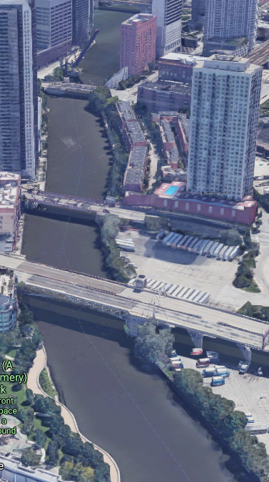
Given the straightness of the river and the Strauss-trunnion bridge on an angle in the background, my theory was that this photo was taken looking southish along the North Branch from Fullerton Ave.
3D Satellite
However, the tracks indicated in the 1929, 1953 and 1963 topo maps are not consistent with the railyards along the river in the photo.
1929 Chicago Loop Quadrangle @ 1:24,000

And historic aerials are consistent with the topo maps rather than the dredging photo.
1938 Aerial Photo from ILHAP

My second theory was that it was looking along the North Branch down closer to Wolf Point and the coaling tower was part of C&NW's Erie Yard. But that Strauss-trunnion bridge doesn't have the elephant ear counterweights and the trunnion is on the wrong side of the river.
3D Satellite


1938 Aerial Photo from ILHAP

GLDD was the contractor that straightened the South Branch, but the angle of the bridge is wrong for that location.

Was this dredging operation even done in the Chicagoland area? Does Milwaukee, Detroit, Cleveland and/or Buffalo have any Strauss-trunnion bridges? Actually, Buffalo has three of them, but the Buffalo River is too curvy around each of the three bridges to be a location for the photo.