(
Satellite)
See
Buzzi/Marquette for the cement plant that was downhill from this plant.
The Chicago Cement Company was started in 1898. It was bought by the Lehigh Portland Cement Company in 1916. This plant was one of the plants that Lehigh chose to shut down rather than modernize in the 1960s. It was closed in 1963 and Marquette Cement bought its quarries. (
CityHistory,
HistoricalProfile,
LehighHistory) Some
pictures of the abandoned site include metal artifacts. One picture shows that the rotary kiln was evidently in a building.
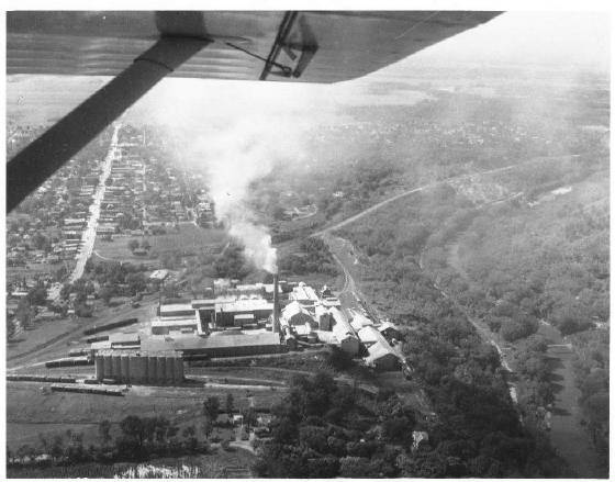
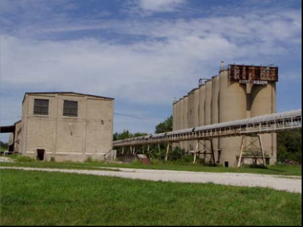
The picture of the conveyor belt between the two buildings was taken
after the abandonment but while the buildings were still in good
shape.
When I looked at the Bing Map, I realized the significance of this
conveyor. It was built by Buzzi Unicem after they bought the Lehigh
quarry to supply their plant because their quarry was depleted. Again,
I'm reminded that Bing maps are over seven years old because this
conveyor has been removed by Buzzi Unicem to make their property more
worthless so that they can get their property taxes reduced. If you zoom out, you can see the conveyor runs from the quarry north of the Vermillion River down to the Buzzi Unicem plant. If you look at the ruins with
Google, you see that the conveyor is now gone.
The Buzzi Unicem plant had a sister plant in
Greencastle, IN that is still operational. This plant also has a sister plant in Indiana that is still operational ---
Mitchell, IN.
 |
Roger Kujawa posted
OGLESBY Illinois Coal Mine and Portland Cement Works col. PPC 1924
[See Oglesby Coal Mine for information about the location of the cement works in this photo.] |
Christie Pasieka
posted two photos with the comment: "Lehigh Quarry and Power Plant."
 |
| 1 |
 |
| 2 |
Roger Kujawa
posted five photos with the comment: "The Lehigh Portland Cement Plant in Ogelsby, Illinois stands abandoned on the east side of town. I’m not sure if this was served by the Burlington or the Illinois Central Railroads. 2021 photo."
 |
| 1 |
 |
| 2 |
 |
| 3 |
 |
| 4 |
 |
| 5 |
 |
David Thomspon commented on Roger's post
Looks like IC and Milwaukee served it(?) 1947 (1958) USGS map |
 |
Harold J. Krewer commented on Roger's post
Milwaukee switched the outbound (south) side of the Lehigh and IC had a spur in the north side primarily to deliver coal for the drying kilns. Aerial photos show the two connected on the east side of the plant, so IC certainly got some of the outbound traffic as well. There was some kind of conveyor from the plant down to a building by the "Q" north of the plant. The quarry pit was across the river from there, don't know if it was part of moving limestone to the plant or for loading cars. Doesn't look like there was a siding: Robert Weber: Harold J. Krewer there are photos showing the Q crossing the Vermillion, and as depicted in the aerial photo, that went into the quarry on the north side of the river. There was also a bucket conveyor later on that transported limestone up the hill to the Lehigh. Harold J. Krewer commented on Roger's share
Here is the portion of the aerial photo showing the Lehigh Cement plant. The IC is the curved line on the left, the MILW comes in over the IC and has all the spurs into the plant from the south, the Q is along the river. The Lehigh's quarry was across the river north of the plant, that building by the Q tracks is probably something to do with the conveyor system feeding the limestone. Does not look like there is a siding there for loading cars: Harold J. Krewer commented on Noah's poste below Here is the 1939 aerial of the Lehigh Portland Cement plant in Oglesby. Top is north. Notice the MILW comes in from the west, crosses over the IC on a bridge, then curves south and down to street level, where a maze of tracks enter the plant from the south to the silos and "bag house" for loading outbound product. The east-west street (Florence) had about 8 or 9 MILW tracks crossing it into the plant. The MILW continued south a short distance to reach a single spur into the Marquette Cement plant alongside the IC. Speaking of the IC, look closely and you'll see a spur off their main into the very north end of the plant by the kilns. They primarily delivered coal to fire the kilns. there may have been a connection to the MILW tracks in the NE corner of the plant to receive outbound loads but hard to tell. Meanwhile, the "Q" was down in the Vermillion River valley, only accessing the original lower end of the Marquette Cement plant further south. IC and MILW accessed Marquette via a loading dock and silos up atop the bluff in a newer section of the facility. Also, what looks to be a loadout down the hill for the "Q" is not...that is a lift house for an overhead bucket conveyor system that ferried raw product from the pits across the Vermillion River to the plant. Decades later, Marquette Cement, running out of property to mine south of the river, bought the remaining Lehigh property and installed a conveyor belt system to bring stone from the old Lehigh pits to their plant. |
 |
Harold J. Krewer commented on Roger's share
Lehigh's loading tracks were switched exclusively by the Milwaukee, but IC could get cars via reciprocal switching. IC had a spur on the north edge of the Lehigh property to deliver coal for the drying kilns. Their trackage connected with the MILW on the east side of the plant. Marquette Cement was originally built along the Vermillion River along the Q and later expanded up the hill to have loadouts on the IC and MILW. Today, Buzzi Unicem (former Marquette Cement) uses the Oglesby facility as a distribution center and owns the former IC tracks over to Lasalle to connect to the IAIS. Map of the Marquette Cement property ca. 1939. The Q is along the river, the IC cuts across the upper left and the MILW is the line from the top right that ends at the plant: |
 |
Noah Haggerty posted
The Lehigh Portland Cement Plant in Oglesby, Illinois probably sometime mid-1980's if I had to guess? The Milwaukee Road served the plant, though I've also heard IC and CB&Q did too. The facility still survives abandoned and off limits. John & Roger Kujawa Photo, Thomas Dyrek Collection. |
 |
Craig Holmberg commented on Noah's post
Sanborn Map Company, Dec 1911 |
 |
Craig Holmberg commented on Noah's post
Illinois Central Springfield Division Track profile 1944
|
 |
Craig Holmberg commented on Noah's post
Milwaukee Road Track Profile Illinois Division 1976
|


No comments:
Post a Comment