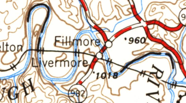
Trail East Bridge: (Satellite)
Abandoned Tunnel: (It was between the two bridges. They can't use it for the trail because it is plugged so the tunnel doesn't drain the reservoir.)
Original Route: (Satellite, just the piers are left)
Trail West Bridge, First Bypass: (Satellite)
High Bridge, Second Bypass: (Satellite)
Dave Kuntz posted five photos with the comment: "The tops of the stone arches barely peek out above the Conemaugh Reservoir in rural Western PA. The tunnel at the end of the bridge is above water now but won't be come the spring rains. This ex-PRR line was abandoned in the early 50's and relocated higher with the opening of the dam downriver. It is also a primitive rail trail when not flooded - note the debris around and on the bridge. Coming tomorrow: the other end of the tunnel and the stone arch bridge at the dam itself."
Bear Marshall: This particular grade is the second iteration of the line. Originally it followed the river in some spots. I don't remember all of the details but I did a bit of research on the area a while back.
 |
| 1 |
 |
| 2 [As a comment observed, this photo shows the plug that keeps the tunnel from draining the reservoir.] |
 |
| 3 |
 |
| 4 |
 |
| 5 |
 |
| Dennis DeBruler commented on Bear's comment That explains why two abandoned routes have been documented. https://www.openrailwaymap.org/ |
Dave Kuntz posted four photos with the comment: "Different fates for 3 RR bridges by the Conemaugh Dam in Western PA: The impressive stone arch bridge at the bottom is now a walking/biking trail; the modern steel bridge above it is still in service although one track has been removed, and the piers nearest the dam date to the earliest bridge that is long gone. Both the unused bridges went to now abandoned tunnels covered by trees in the right of the top photo, one of which still has rails in front of it. The tunnels traversed the hillside to the arched bridge on the other side, which I posted yesterday. The creation of the dam in the background necessitated raising the entire line, hence the newest bridge also being the tallest."
Tim Shanahan shared
Jim Kelling: What is the nearest town or city?
Dennis DeBruler: Jim Kelling This is out in the wilderness. I dropped a pin on the high bridge: https://maps.app.goo.gl/DCafNxKQj29a64qL8.
 |
| 1 |
 |
| 2 |
 |
| 3 |
 |
| 4 |
 |
| Rob Oches commented on Dave's post I’m a union Ironworker and collect memorabilia, I’ve owned this page ad out of time magazine for years but never saw the completed bridge. |
 |
| Andy Hoyle commented on Dave's post, cropped One of the last trains going through the tunnel to Livermore before the town was razed for flood land. |


No comments:
Post a Comment