Hosey Dam (3D Satellite) was built in the 1920s as a hydropower dam.
St. Joe Dam (3D Satellite) has the pumping station that supplies water from the St. Joseph River to the filtration plant.
Cedarville Dam (3D Satellite) is a reservoir dam that creates Fort Wayne's main drinking water supply.
Lost Dam (Satellite)
There was also a dam at the beginning of the feeder canal for the Wabash & Erie Canal.
There was also a dam at the beginning of the feeder canal for the Wabash & Erie Canal.
Hosey Dam

History Center
City Light and Power dam on Maumee Ave., 1930s
[I was not aware that the little building used to be a hydro power plant. I remember it was a big deal to make those two roller gates work again to reduce flood heights upstream. And I was not aware that there was a little Tainter gate.]
Evidently the roller gates are again broken. Only the Tainter gate is operated by City Utilities. Between April 15 and October 15 the gate is normally closed to maintain the normal summer pool for recreational use. The rest of the year it is open to allow the rivers (St. Mary as well as St. Joe) to "fall to a low winter pool level."
 |
| River Levels |
 |
| Becky Osbun commented on Theresa's post Dennis DeBruler I've never seen the Maumee River so low. https://www.google.com/.../@41.082177,-85.../data=!3m1!1e3 [Note that Anthony Blvd. still has its truss bridge over the Maumee River.] |
 |
| Becky Osbun posted ACPL Community Album |
 |
| Greg Michell commented on Becky's post Hosey Dam Plaque on 28 Jun 2016. |
 |
| Daniel Baker, 2014 "The Hosey Dam" The Hosey Dam was named for Fort Wayne Mayor William J. Hosey, who's list of accomplishments included: the City Light & Power Company Plant, the Three Rivers Filtration Plant and getting the elevated railroad tracks project started. The Hosey was built in the mid-1920s as one of the first major public works projects in Allen County. Located on the Maumee River about a mile south of the confluence of the St. Joseph and St. Marys Rivers, it holds back about 10 feet of water to Sweeney and Johnny Appleseed Parks. During its life, Hosey Dam served as a power source providing electricity through its hydroelectric generators. Other purposes are a bit uncertain, though. Some say that it was constructed at a time when most sewers emptied into the rivers. Raising the river insured enough water to dilute the sewage, thus lowering the smell. Another supposed purpose was flood control. But, in reality, the rollers could not be raised high enough to halt the flood waters. The rollers as well as the hydroelectric generators have long been out of service. Rumor has it that there was a study done to see whether or not the Hosey could return to providing electricity. What the outcome was (if there was one), I do not know. Sources: News Sentinel | 07/18/2005 | Low-profile dam important to city www.fortwayne.com, 18 July 2005 Hosey, William J. Findagrave.com findagrave.com/cgi-bin/fg.cgi?page=gr&GSln=hosey&...; |
 |
| Tommy Fitzwater posted TC Steger at Maumee Dam ca 1940 Fort Wayne,IN This is a photo of Theodore Steger working on the Maumee Dam in Fort Wayne for the City Light and Power Company. Victoria Kruse: The Hosey Dam on The Maumee River was built as a hydroelectric plant as the city was transitioning away from using oil for heating and lighting. |
It is a shame that City Utilities can't keep the roller gates operational because they should be all the way up when the river flow is heavy to help relieve the pressure on the river levees. And evidently they can't raise the Tainter gate very high. Normally a Tainer gate on a river dam would be so high that it is horizontal near the top of the structure.
 |
| Screenshot from Facebook Page |
 |
| Photo from 1982 Flood Gallery |
 |
| Jesse Jesus Galvan posted North Anthony Dam November 10th 1954 |
 |
| ACPL, 1982 Flood [Another example that they don't raise the Tainter gate out of a flood.] |
 |
| Tommy Lee Fitzwater posted The Hosey was built in the mid-1920s as one of the first major public works projects in Allen County. Located on the Maumee River about a mile south of the confluence of the St. Joseph and St. Marys Rivers, it holds back about 10 feet of water to Sweeney and Johnny Appleseed Parks. Dave Turpchinoff I passed by the other day and noted it is badly crumbling and in disrepair. |
The first view I've seen of the backside of the dam.
 |
| Jesse Jesus Galvan posted Maumee River Dam . In the background there's a tower on the right. Thank you Bobs Holman for the update information. "the pub is located inside what was originally the American Fork and Hoe Company then later and more well known as the Wayne Candies building" |
St Joe Dam
Becky Osbun posted four photos of the St Joe Dam and its pumping station from the ACPL Community Album.
Neil Wayer 63,64 and 65 we walked through the building and across the dam with our bicycles to play Wildcat baseball in the park.
Dennis DeBruler If I remember correctly, we walked through the pumping station on the balcony along the wall.
Neil Wayer Dennis DeBruler Yes we did and it had the coldest water in their drinking fountain.
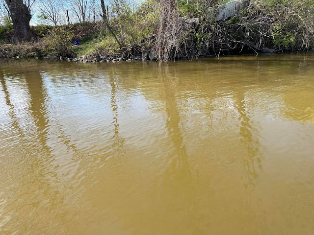
Michael Wagner Been through there several times. We used to fish just below the dam.
 |
| 1 |
 |
| 2 |
 |
| 3 |
 |
| 4 |
 |
| Lowering river to add flashboards |
 |
| Silva Lining Photography posted It’s how you see the world. Look for the good. Ignacio Silva shared [As expected, there were quite a few comments about the Municipal Beach that closed because of the polio virus in the 1950s.] |
 |
| Ignacio Silva shared "The Fisherman" |
 |
| Ignacio Silva shared "Sunset Dam" |
There are more views of the St. Joe Dam in the background of some of the photos of the Municipal Beach.
Lost Dam
 |
| Tommy Lee Fitzwater posted Dam on the St. Joseph River Bruce Flohr I believe there was once a dam on the St.Joe just downstream from the old Van Zile bridge at Hursh. You can still stand on this original bridge & see rapids where the old dam used to be. Hursh was a former village between Leo & Spencerville. The Hurshtown Reservoir was named after it. Adam Daniel I think this dam was in the vicinity of State Blvd. I believe there have been posts about it (and the remnants) before. [In a personal communication with Andrew Harber on Jan 6, 2020, he confirmed the bridge is the Van Zile Road Bridge. He fishes for bass on the river and relayed what he learned from another fisherman concerning good fishing spots. "One of the guys explained to me there was a really good hole, right before the first bridge where an old dam use to be, he told it’s not there anymore but you will see the depth change on your graphs....So the next time I went up, (and pretty much every time since) I slowed down and sure enough there was a small hump that may have been a dam."] |
 |
| Tommy Lee Fitzwater posted 1912 St. Joe River Dam Leo, Indiana |
Below are photos and sonar images of the area of the lost dam provided by Andrew Harber on Jun 10, 2021.
 |
| 1 |
 |
| 2 |
 |
| 3 |
 |
| 4 |
 |
| 5 |
 |
| 6 |
 |
| 7 |
 |
| 8 |
 |
| 9 |
 |
| 10 |
 |
| So heading up river in these pics, you can see the hole that was created from water going over dam circled in black. On top circled in red is the rubble left from the dam. |
Two images with the comment: "These are going down river and you can see how it gets shallow we’re the dam and debris were, and then the hole from the water falling over the dam."
 |
| 1 |
 |
| 2 |
 |
| There is a large chunk of rubble. Like I said I’m 99.9% this was the dam. There is no other rock like that in the river and it was exactly where it should have been according to the picture |
No comments:
Post a Comment