C&IM = Chicago & Illinois Midland
IMRR = Illinois & Midland RR, the successor shortline operator.
This view is another reminder that DOT replaces truss bridges with concrete slabs while the railroads maintain truss bridges.
 |
| Street View |

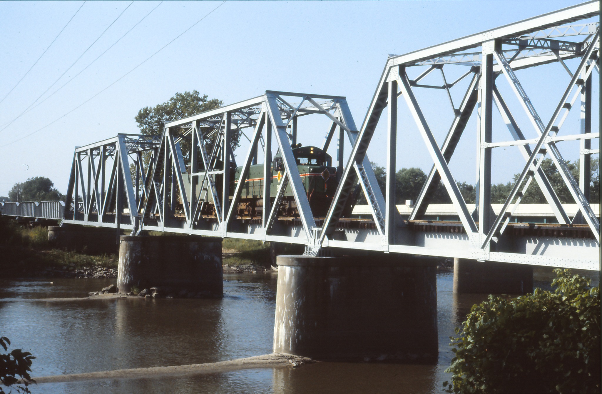 |
| Noah Haggerty posted C&IM RS1325 #31 crossing the Sangamon River along Highway 97 between Kilbourne and Oakford, IL, perhaps around 1985. The locomotive is one of two built, and now resides at the Monticello Railway Museum. John & Roger Kujawa Photo, Thomas Dyrek Collection. Paul Grone: How often does a train go on this line nowadays? In the 90's I can't remember if it once a day or once every other day...🤔 David Jordan: Paul Grone IMRR locals seem to run no more than once weekly, and Kincaid coal trains maybe three loads/three empties per week. Noah Haggerty also posted with the same comment. Ryan Crawford: Gotta say 1985 here, paint still looks fresh on 31 (painted in May 1984). By the way that’s a Chain Gang crew returning to Springfield Shops after returning an empty Havana coal train to the ppu, then swapped for loads and delivered to Havana and then jumped on the shuttle unit and caboose and returned to shops. |
 |
| Larry Senalik Flickr via a Larry Senalick post |
As expected, the highway bridge also had truss spans in 1939. (Thank goodness for the shadows, otherwise I could not see the trusses.)
 |
| 1939 Aerial View from ILHAP, at photo resolution |
Speaking of a flood plain, I noticed this a little further southeast of the main channel.
 |
| 1939 Aerial View from ILHAP, at photo resolution |
That caused me to zoom out. Below is the entire 1939 photo showing that the river did some serious meandering in this area. The white line along the farmer's fields made me wonder if that was a levee. Looking at a contemporary satellite image, it is obvious that there is a levee along this river and part of Tar Creek. I added the "weather" label to these notes because this area floods even if I don't have a photo of a flood.
 |
| 1939 Aerial View from ILHAP, at photo resolution |
No comments:
Post a Comment