 |
| Bill Molony posted From the March 30, 1969 timetable. |
 |
| Christie Pasieka posted The Illinois Central route year 1855 |
 |
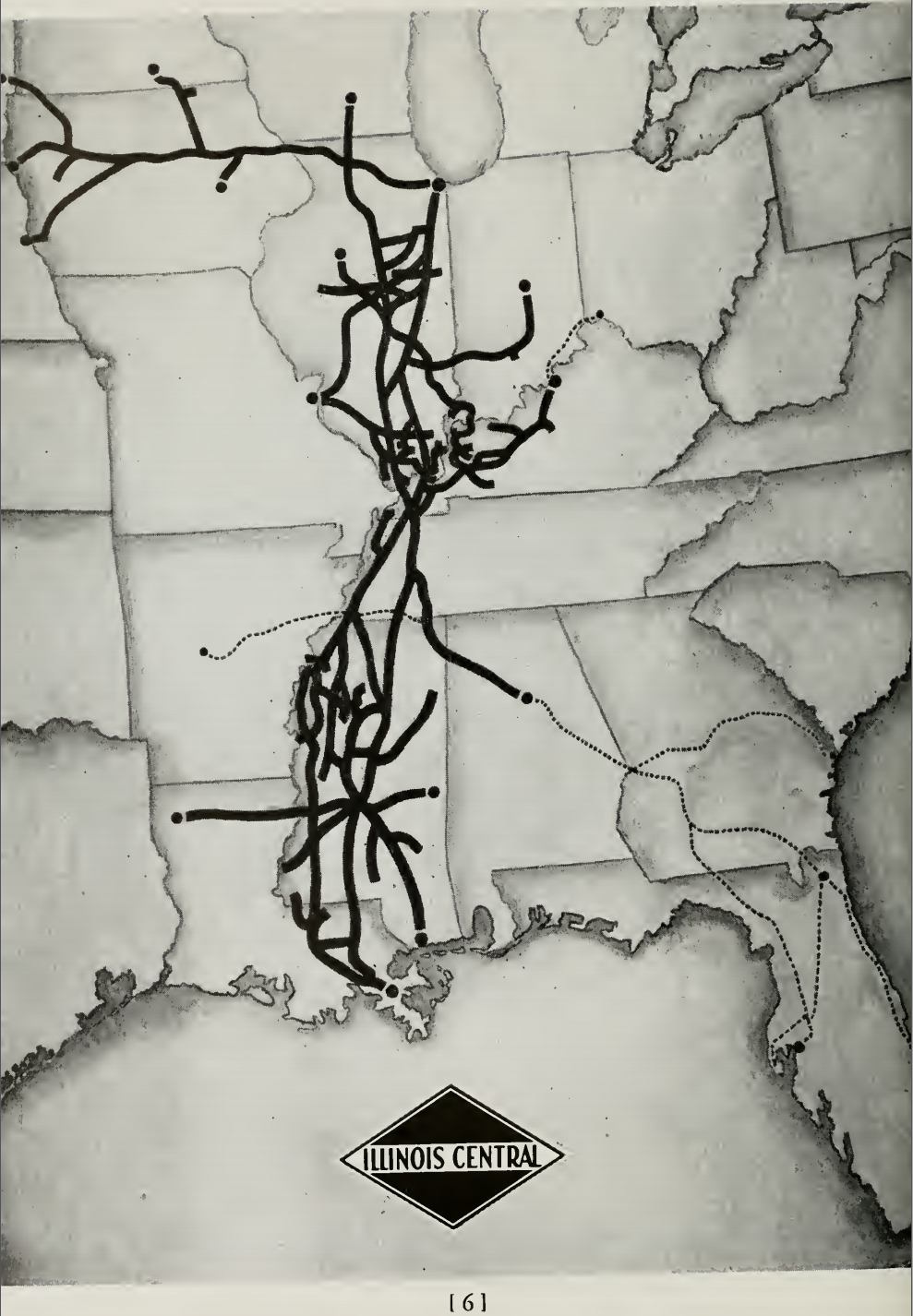
| Bill Molony posted
The original charter of the Illinois Central, granted by the Illinois Legislature on February 10, 1851, authorized a railroad from Cairo, in the southern tip of the state, to East Dubuque in the northwest corner. A branch line was to extend from Centralia,, north to Chicago for a total distance, including both lines of seven hundred and five miles, more than twice the distance of any other railroad then existing.
The charter lines were completed in 1856, with the final rail spiked down on September 27th, of that year a few miles south of Effingham. The first scheduled Illinois Central passenger train pulled into Cairo on January 1st, 1857.
|

 |
| Lisa Ruble posted OUTLINE OF ILLINOIS IN 1861 Includes Railroads in Operation and Railroads Progressing Illinois Central Railroad Company Map 1861 G. Woolworth Colton's railroad map of Illinois. Richard Fiedler shared Owen McCormick: Interesting. Fort Wayne and Lacon??? |
I have researched some of the branches that were discarded by ICG in the 1980s.
The trunk was completed in September 1856 at 705 miles, and the branch had been opened in 1855. When completed, the IC was the longest railroad in the world [tdf23]. Given the completion dates, I speculate that by the mid 1850s, it was already recognized that the originally chartered route was a mistake but it was finished to avoid loosing the land grants. The railroad operated a steamboat line between Cairo and New Orleans. [IChistorical]
The map on the right is a summary. The yellow line is the chartered route, the green line is the branch, and the orange line is the first two segments constructed by the IC described below by La Salle History, p35.
- Peoria, Decatur & Evansville Railway
- Paducah & Louisville Railway
- Rantoul Railroad and Fisher Farmers Grain & Coal
- Chicago, Havana & Western
- Crab Orchard & Egyptian Railroad
- Chicago, Madison & Northern and Chicago Central and Pacific
- Indianapolis Southern Railroad and Indiana Rail Road
The trunk was completed in September 1856 at 705 miles, and the branch had been opened in 1855. When completed, the IC was the longest railroad in the world [tdf23]. Given the completion dates, I speculate that by the mid 1850s, it was already recognized that the originally chartered route was a mistake but it was finished to avoid loosing the land grants. The railroad operated a steamboat line between Cairo and New Orleans. [IChistorical]
 |
| Pre-1967 plus Paint |
The Illinois Central was chartered in 1851. The La Salle-Bloommgton line of the railroad was surveyed in the summer of 1851 under the general direction of Colonel Roswell B. Mason, chief engineer, and under the immediate direction of Timothy B. Blackstone, division engineer, who later figured prominently in railway developments in Illinois. Mr. Blackstone, a native of Connecticut, was one of the organizers and the first president of the Union Stock Yards and Transit Company of Chicago, the company which was largely instrumental in making Chicago the world's largest livestock and meat packing center. The Blackstone Hotel, Blackstone Avenue, and the Blackstone Memorial Library, all of Chicago, perpetuate his memory. In 1854, Mr. Blackstone was elected the second mayor of La Salle; he served one term.
Among the young men who came from New England with Mr. Blackstone was Grenville M. Dodge, who later became an outstanding general in the Civil War. Mr. Dodge also d'rected the building of many of the Western railroads including the Union Pacific, the first railroad to span the Rocky Mountains. Mr. Dodge, when he was in La Salle with the Illinois Central, was a young man of about twenty years of age, and the Illinois Central was his first railway employment. He married Miss Anne Brown of Peru.
The Illinois Central through La Salle is a part of the original main line which was opened between the Illinois River and Bloomington on May 16, 1853, and between the Illinois River and Mendota on November 14th of the same year. The opening of the line between La Salle and Bloomington marked the beginning of Illinois Central train service. The conductor in charge of that first train was A. D. Abbott who also served as United States mail agent handling the mail in bags between La Salle and Bloomington. Mail was heavy over this route because it formed a part of the first rail route for mail between Chicago and St. Louis, and it carried the mail also between Chicago and down-river points including Memphis, Vicksburg, Natchez, and New Orleans. The sixty-mile run between La Salle and Bloomington required four hours.
 |
| Randy Phillips Flip posted Illinois Central 1928 Kaiden Roberts: Isn’t the trackage that pokes into West Lebanon supposed to be Wabash? Logan Rex: Kaiden Roberts yes, but the IC most likely had trackage rights on the Wabash up to West Lebanon. |
Today the "branch" still exists, but the Old Main was abandoned by 1990. A small segment near La Salle, including the impressive bridge across the Illinois River Valley, is still operational because a cement company bought it.
 |
| Satellite plus paint |
(Unfortunately, I did not record my reference for this information.)
- Red: In September 1981, Junction City to Assumption part was abandoned.
- Purple: In 1984, the Maroa to Clinton section was torn up along with the Heyworth to El Paso section part.
- Black: In 1986, the Freeport to El Paso segment was pulled up.
- Blue: In 1990, the part between Decatur and Maroa was pulled up.
Detailed history: https://archive.org/details/historyofillinoi00rail
What's left system map: http://www.trainweb.org/icrr/sysmap/sysmap.htm
Track Profiles: http://www.illinois-central.net/profiles/profiles99.pdf
1980 tonnage: http://www.illinois-central.net/1980_ton_miles.php
Repeating the key to reduce the amount of scrolling needed to interpret the southern abandonments:
- Red: In September 1981, Junction City to Assumption part was abandoned.
- Purple: In 1984, the Maroa to Clinton section was torn up along with the Heyworth to El Paso section part.
- Black: In 1986, the Freeport to El Paso segment was pulled up.
- Blue: In 1990, the part between Decatur and Maroa was pulled up.
 |
| Bill Molony posted This map of the Illinois Central Railroad is from 1921. Raymond Barr No Edgewood Cutoff yet! Raymond Barr Carbondale was the heart of Southern Illinois lines. |
 |
| Kirk Reynolds posted This map of Illinois Central's predecessor lines was issued by the Engineering Dept. on July 31, 1971. I scanned it in high resolution to make it easier to read the data. Randy James  This was produced after the merger. (Post august 9th 1972) Note the solid i ball rail logo, which was illinois central gulf's. This was produced after the merger. (Post august 9th 1972) Note the solid i ball rail logo, which was illinois central gulf's.Richard A. I. Carlson  Actually it is pre-merger. The merger occurred in 1972, the map is dated 1971. In addition the former GM&O lines are not shown. It might have been developed (and had the logo added) as part of the merger studies however. Actually it is pre-merger. The merger occurred in 1972, the map is dated 1971. In addition the former GM&O lines are not shown. It might have been developed (and had the logo added) as part of the merger studies however.Kirk Reynolds  I uploaded it in the files section of this page so you can download it from there. I uploaded it in the files section of this page so you can download it from there.Download .jpg File |
 |
| An excerpt from the downloadable file |
 |
| An excerpt from the downloadable file |
 |
| Bill Molony posted This map of the Illinois Central is from the April 30, 1967 timetable. Randy James The ic had trackage rights over the gm&o out of Jackson tn to corinth ms, where they had their trackage from corinth to haleyville al and from there they had trackage rights over the southern to jasper al. where they then had trackage rights over the Frisco into Birmingham, from there it was over the central of Georgia to albany Georgia, then over the seaboard to albany ga, then over the Atlantic coast line to Jacksonville & on the way to miami. Andre Kristopans Randy James the Florida trains out of Chicago were all multi-railroad thru train operations. Not the same as trackage rights. Trackage rights would mean crews from one railroad operating over the tracks of another, as was the case of IC into Birmingham. A train running thru is a totally different matter. For instance, BNSF runs coal unit trains to Detroit area from Montana that are turned over to GTW in Chicago power and all, and empties come back the same way. But that is a thru train, not trackage rights. |
 |
| A 1948 employee pamphlet (source) |
 |
| Jon Roma posted, cropped Here is a document issued by the IC, dated September 1, 1967, showing the method of signal system in use on each portion of railroad. Scott Rogers Yes, interesting map. With all traffic that used to go via Grenada between Memphis and Jackson now running via Yazoo City (including Amtrak), was signalling installed via Yazoo City? Joe Marascalco Scott Rogers CTC was installed on the Yazoo District in 1994-1995. Jon Roma Scott Rogers, yes. Signaling was added to the Yazoo District route in the Nineties. Prior to this period, it was dark railroad but was the primary freight route due to more favorable grades. After Amtrak was switched to the Yazoo route, some of the signaling on the Grenada District was retired. Joe Marascalco Jon Roma The old ABS on the Grenada District remained active until after CN sold it. They deactivated it between Grenada and Canton in 2010. It was deactivated between Memphis and Grenada in either 2014 or 2015. It’s still active between Canton and Jackson. Scott Rogers I grew up near Freeport and used to live in Cedar Falls on the Iowa Division. Cab signals and ATS between Waterloo and Ft Dodge always seemed like an unusual place for it. Jon Roma Scott Rogers, in 1922 the Interstate Commerce Commision (the predecessor of the Federal Railroad Administration) ordered most of the major railroads of the country to install an automatic train stop, automatic train control, or cab signal system on one crew district. The order was later amended in some cases to add a second crew district. The IC chose which divisions were to be equipped, and they chose the Champaign District – Champaign, IL to Branch Jct. (Centralia), IL and Waterloo and Ft. Dodge, IA. In so doing, the IC selected two districts with different characteristics. The Illinois installation was directional double-track, and the Iowa installation was bi-directional single track. Harold J. Krewer Neat little slice in time: There are just two small pieces of CTC in service east of Waterloo and west of Freeport (CTC would extend over the entire district soon thereafter) and the small section of ABS on the Gruber in the Yard Limits between LaSalle and Oglesby is still shown in service. It would be gone by the time I was old enough to go take photos of IC trains in LaSalle. Jon Roma There was also a small island of CTC in Clinton, IL where tracks went in six directions. There was also Springfield to Divernon CTC. All told, IC was very late to the CTC game with the exception of the big installations between Otto and Gilman, Stuenkel and KX, and between Ballard and Fulton in Kentucky. Chris Balducci Were passenger trains allowed to travel 80 or faster between Waterloo and Fort Dodge? Chris Goepel IC Iowa Division employee timetable of April 29, 1951, showed passenger train maximum authorized speed over the Waterloo District (with ATS) as 70 mph. Mike Bartels Jim Boyd wrote about the Land O'Corn, which dropped the coaches in Waterloo and went on to Fort Dodge with the mail, doing over 100 one night approaching Iowa Falls, where they really had to pinch her down for a curve. Jon Roma Chris Balducci, I do not believe so, but I can't say I am familiar with that part of the IC. To be honest, I don't know if the civil infrastructure of the IC's lines in Iowa would or would not have supported such speeds. Also, bear in mind that the ICC's 1922 mandate was NOT tied to any speed restrictions in territory lacking train stop or similar systems. That piece of regulation did not take effect until the late Forties, by which time the ATS had been in place for 25 years. The Iowa ATS survived long enough to serve the Chicago Central & Pacific during their short history; when the IC bought the Iowa properties back, among the capital improvements they made was to update the signaling – and in so doing, to eliminate the ATS. I regret not ever going out to see it, but I had ATS territory right in my own back yard in Champaign, IL. Randy James Funny it shows the section of gm&o trackage(Jackson TN to Corinth Ms) that the IC used to run it's passenger trains over, namely the city of miami ,Seminole and Chicago to Birmingham through freights, shows it was dark territory but in reality it was equipped with abs, to at least russlor junction (Corinth Ms), I grew up on this section of trackage in the early 80's & remember seeing the abs signals right behind my backyard in South Jackson TN |
Dave Durham posted an employee pamphlet dated June 20, 1921.
 |
| 1 |
 |
| 2 |
 |
| 3 |
 |
| 4 |
 |
| 5 |
 |
| 6 |
 |
| 7 |
 |
| 8 |
 |
| 9 |
 |
| 10 |
 |
| 11 |
 |
| 12 |
 |
| 13 |
 |
| 14 |
 |
| 15 |
 |
| 16 |
 |
| 17 |
 |
| 18 |
 |
| 19 |
 |
| 20 |
 |
| 21 |
 |
| 22 |
 |
| 23 |
 |
| 24 |
No comments:
Post a Comment