 |
| Scott Griffith -> B&OCT RAILROAD preservationists 48TH AVE YARD |
Below I zoomed in on the team tracks. I see four horse&wagons getting their freight. And there are a lot of other cars that need to be unloaded.
In the overview picture, note the constant-pressure gasometer on the left.
 |
| An excerpt from the above |
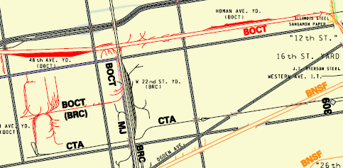
Henry Freeman The Altenheim Branch ran westward for over seven miles from the Western Ave. Wye to Forest Park. The Sears complex and Homan Yard were located about two miles west of the Western Ave. connection. This map locates the current Homan Square Community Center, which is in what is left of Sears. Start here and follow the track east and west.https://www.google.com/maps/@41.8689101,-87.7131919,16.71z
 |
| Excerpt from B&OCT Map |
No comments:
Post a Comment