Showing posts with label rfBrown. Show all posts

Tuesday, March 3, 2026

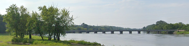
1934+1996 US-1 and Brightline/Florida East Coast Bridges over St. Lucie River in Stuart, FL

1934 US-1: (Archived Bridge Hunter; Bridge Hunter; no Historic Bridges; Satellite) Dixie Highway
1996 US-1: (Archived Bridge Hunter; Bridge Hunter; Satellite) Roosevelt Bridge
FEC: (Archived Bridge Hunter; Bridge Hunter; no Historic Bridges; Satellite)

A view of the railroad and Dixie Highway Bridges from the Roosevelt Bridge. 
Street View, Jul 2017

I noticed in a satellite image that the bridge was built over a lot of water. I hope that the water is shallow here and that the bedrock is close to the surface to reduce the cost of all of those piers. 
There is limestone bedrock near the surface in a lot of places in Florida.
It is 4,487' (1.4km) long with a span length of 260' (79m). [BridgeHunter_1996]
Scott Johnson (sajflorida) Flickr, License: Creative Commons Attribution-NonCommercial (CC BY-NC)

This shows that there are a couple of curves in the bridge.
Street View, May 2024

The 1996 Roosevelt Bridge is a concrete segmental box girder bridge. IT STARTED FALLING APART IN LESS THAN 25 YEARS! [ArchivedBridgeHunter_1996]

In June 2020, both the northbound and southbound bridges were shut down because cracks were found in the southernmost span of the southbound bridge. They also closed the 1934 Dixie Highway bridge because it passes under the cracked span. In fact, there was not just cracks, there was falling concrete! The U.S. Coast Guard overracted and declared the bridge is "at risk of an imminent collapse." The Coast Guard stopped all commercial traffic under the other end of the bridge.  [RoadsBridges]
It is interesting that the story as to how the crack was found and reported changed. Originally, it was by a construction crew on another road project. But later FDOT claimed that it was found by a routine biannual inspection.

wptv
Within hours of the Coast Guard alert, the mayor of Stuart, FL, said "FDOT engineers have not found any evidence that the bridge is at immediate risk of collapsing." "Upon inspection, engineers with FDOT found that rust in the steel cables had been exposed when the concrete fell. Further inspection revealed an area of concern on the northbound side of the bridge as well." Tolls were waved on the Florida Turnpike between Port St. Lucie and Stuart to help detour traffic around the closed bridges.

The railroad bridge is obviously a trunnion bridge because we can see the trunnion. I think the old road bridge is also a trunnion bridge.
Street View, May 2024

The railroad drawbridge was upgraded in 2023 to support better reliability and faster speeds for passenger trains.
5:20 video @ 0:37

Note that traffic is stopped. The road bridge started going up in this segment of the video.
@ 4:04

This is the post that led me down the rabbit hole of St. Lucie River Bridges. This train is one of those faster passenger trains that caused the upgrade of the railroad bridge.
Steven J. Brown posted
Brightline Siemens SCB-40 121 (built 2023) crossing the St Lucie River at Stuart, Florida - February 19, 2026. The train wears a wrap celebrating the 250-year anniversary of the USA.

Saturday, July 26, 2025

CN Bridge over Anderson Creek at Fraser River near Boston Bar, BC

(Satellite)

Steven J. Brown posted
Twenty-three years ago today:
Rock Mountaineer Railtours on the Canadian National along the Fraser River at Boston Bar, British Columbia - July 22, 2002

Street View, Jul 2023

 Daniel Charbonneau Globe-Trotteur, May 2019

Frank Keller Photography posted
A CN intermodal train curves across the bridge at Boston Bar. In the background is the CP. During my visit in 6.89 each railroad ran trains on their own track. Today I understand they use CP for one direction and CN for the other. I would like to get back up to the Fraser River again someday. 
Clark Castle: CP was thru first so they got the grades. CN came later and had to settle for the less easy route. I have been thru here on the Canadian when CP was still running the service.


Saturday, May 3, 2025

1888 CCKY/Southern/Central of Georgia Railway Bridge over Chattanooga River in Trion. GA

(Archived Bridge Hunter; Bridge Hunger; no Historic Bridges; Satellite)

CCKY = Chattooga & Chickamauga Railway

Steven J. Brown posted
Southern Railway 4501 crossing the Chattanooga River at Trion, Georgia - April 19, 1997.
Drayton Blackgrove: I’m so grateful that we can enjoy 4501 in the same spot today. As a youngin’, I never thought I’d get the chance.

It is a pin-connected truss.
Street View, Apr 2024

The approaches are still wooden trestles.
Street View, Jul 2022

2009 Photo by Eddie Douthitt via BridgeHunter

Wednesday, December 18, 2024

BNSF/(GN+NP) 1905 Tunnel in Seattle, WA

North Portal: (Satellite
South Portal: (Satellite)

South Portal:
Street View, Aug 2015

Steven J. Brown posted
Burlington Northern wide-vision caboose 10107 (built as CB&Q 13689) on the Maltby Turn returning to Interbay at South Portal in Seattle, Washington - May 1990.
Billy Irwin: This caboose is still [2025] in service today with a updated paint job in the Seattle Stacy switch yard
Steven J. Brown shared

Bob Squaredancer commented on Steven's post
Cool now I know the name for this location. South Portal, 1979. 📷credit Greg Taggart


North Portal: You can't see the portal with a street view because the road is too high.
MyNorthwest
"It’s still serving freight customers and passengers, with 2,500 people and the equivalent of 12,000 truckloads of goods and other materials moving through the 113-year old subterranean corridor every day [in 2018]."

The north portal before the viaduct was built.
MyNorthwest

I presume the retaining walls were built to help create some more land area for the city.
Photo via pauldorpat, 2020
The tunnel allowed the Alaskan Way to be built where there used to be eight tracks. The 5,141.5' (0.91 mile or 1,467.1m) long tunnel delivered trains to King Street Station and points south. "When completed, it was the highest (25.8 feet [7.9m]) and widest (30 feet [9.1m]) tunnel in the world. The tube was lined with 3-1/2 to 4-1/2 feet of concrete, reaching its deepest point 111 feet below Fourth and Spring. Curiously, it also delved through remains of an anaerobically preserved primeval forest at Fourth and Marion. (Soon after exposure to air, the trees reportedly turned to mulch.)"

The Alaskan Way was built on the land that these tracks occupied.
HistoryLink
"It cost $1,500,000 to build and was intended for use by both the Great Northern and the Northern Pacific Railroads, which split construction costs."
The tunnel went north from the south portal on the west side of 4th Avenue to at least Spring Street.

I've looked at several topo maps, but none of them have dashed lines showing the route of the tunnel.

This shows why the material removed from the tunnel was used to create landfill for Kings Station and the railyards south of the station.
1894/1908 Seattle Quad @ 62,500

And that filled just part of the swamp.
1908/55 Seattle Quad @ 62,500

The route to the original tracks along the waterfront explains the shape of these buildings.
Satellite

railroad_journal posted four images with the comment:
BNSF Tunnel Under Seattle
The Great Northern Tunnel is a 1-mile double-tracked railway tunnel under downtown Seattle, Washington. It was completed by the Great Northern Railway in 1905, now part of the BNSF Scenic Subdivision. The BNSF Scenic Sub railroad line runs about 155 miles from Seattle to Wenatchee, Washington. It is part of the BNSF Northern Transcon that runs from Chicago to Seattle.
The North Portal of the railroad tunnel under Seattle, the mainline winds through a narrow path between buildings before emerging onto the waterfront. There, the line follows Elliot Bay for three miles north to BNSF Balmer Yard. 
The South Portal of Great Northern Tunnel is just north of King Street Station. It’s hard to visualize the 1-mile long railroad tunnel running directly underneath the Seattle Skyline.
Ken Haug: May 14,1979 my first day on the railroad and we worked inside the tunnel laying welder rail. Foreman would yell at us when we accidentally took out a light bulb tossing old rail plates against the wall to replace with bigger plates. Anytime trains passed though we stayed against the wall until the train passed. Worked 1-2 weeks inside before finally seeing daylight.
Clinton Michaels: what happens if there is a fire?
Euphoria Nashwa Rising: Clinton Michaels they don't run flammable cargo simultaneously with passenger.
1

2

3

4

Two standard-cab locomotives with the Swish H1 livery.
Facebook Reel

Note the heavy frame in front of the fuselage to clear icicles, etc.
Same Reel

Tuesday, October 29, 2024

1884,1896+1945 MRL/Northern Pacific Bozeman Tunnel near Muir, MT

East Portal: (Satellite)
West Portal: (Satellite)

Steven J. Brown posted
Boeing 737 fuselage westbound on the Montana Rail Link entering the Bozeman Tunnel on Bozeman Pass at Muir, Montana - October 14, 2002.

1951/52 Bozeman Pass Quad @ 62,500

BozemanMagazine
The first train went through the 3,610' (1,100m, 0.7mile) long tunnel on Jan 20, 1884. The tunnel was originally lined with wood, but it burned in 1895. While trains used a temporary track over the mountain, "the walls were formed from rough concrete and the ceiling arch with thick brick." On Jul 28, 1945, NP switched the tracks to a new tunnel that was 18' (5.5m) wide and 24' (7.3m) tall.

Gallatin History Museum posted
Construction of the new Northern Pacific Railroad Muir Tunnel on Bozeman Pass, 1944.

Steven J. Brown posted
BNSF ES44C4 7021 (built 2012) on Montana Rail Link at Bozeman Tunnel on Bozeman Pass near West End, Montana - September 27, 2020.
[Steven pointed out that this is almost the same angle as the construction photo.]


Friday, September 6, 2024

UP/C&NW Bridge over Cedar River in Cedar Rapids, IA

(Archived Bridge Hunter3D Satellite)

Steven J. Brown posted
Union Pacific 3985 at Cedar Rapids, Iowa - June 18, 2002.

Street View

Marty Bernard posted four images with the comment:
Trains on the C&NW Gauntlet Bridge over the Cedar River, Iowa
C&NW trains crossing the Gauntlet Bridge over the Cedar River at Cedar Rapids, IA on June 29 and Aug. 11, 1979.  The diagram shows how the double track mainline (left) becomes narrow (right) to go over the bridge.  For details see https://en.wikipedia.org/wiki/Gauntlet_track
Bill Kuba photos, Iowa Chapter NRHS collection
𝙉𝙊𝙏𝙀: UP has made it into a double track bridge which can easily be seen south of town on a Google Map.
John Markl: Gauntlet or Gantlet?
Jon Roma: John Markl, both spellings are accepted.
Steven W Panek: John Markl. I've always referred this as a gauntlet.
Marty Bernard shared
1

2

3

4

Patrick Hansen posted
My friend gave me this picture long time ago as he know I like C&NW. if I remember correctly C&NW train got derailed at Cedar River in Cedar Rapids.
Dave Kroeger: This the famous Christmas Day derailment of 1978 on the Cedar River Bridge. Either train 250 or 252 was involved. I remember going to see the cleanup as they used the Clinton and Marshalltown big hooks to remove the rubble.
Dennis A. Wilson: Made it a double track in 2002.
Greg Koenes: They had another one on that bridge a couple of years after they double tracked it

Big Boy 2026:
11:55 video @ 0:27
Big Boy 4014 Crosses the Mississippi River to Chicago!! (Coast to Coast Tour)

Jerry Jackson posted
©Johnny Hansen Photography
During a beautiful and sunny morning, people from all over the place scattered about Union Pacific’s Clinton Subdivision in eastern Iowa to get a view of Union Pacific’s Big Boy 4014 rolling on through. Beginning my chase for the day on the east side of Cedar Rapids, Iowa, we see the Big Boy crossing the Cedar River after departing Beverley Yard on the other side of town. From Cedar Rapids, on this leg of the trip it is enroute to West Chicago, Illinois for its next displaying the following day, and then will continue its journey eastward. The Big Boy is currently on a big tour to celebrate America’s 250th Anniversary, and at this time is enroute to the East Coast for the rest of its busy tour.
📍Cedar Rapids, Iowa
🗓️Photo Date: June 2, 2026. See less
— in Cedar Rapids, IA.


Sunday, July 28, 2024

Wheeled Excavators


Steven J. Brown posted at RWE Power AG - Tgb. Hambach in Niederzier, Germany
RWE Power Bagger 293 (built 1995 as MAN TAKRAF RB293) is a giant bucket-wheel coal excavator. It is 315' tall, 740' long and weighs 14,200 tons. It is recorded in the Guinness World Records as the heaviest terrestrial vehicle (shared with a sibling). The bucket-wheel itself is 70' in diameter with 18 buckets, each of which can hold over 530 cubic feet of material. It works in the largest open-pit mine in Europe. Hambach, Germany - September 8, 2022.
David P. Reaves III: What a huge machine! This hole-in-the-ground is, simply stated, immense. (We've driven past the area; no good view from the main highways).On Google Maps, it appears to be nearly five miles across. From what I've learned, brown coal is really, really dirty, BTW, but it's right at or just below ground level, so relatively easy to scoop out.
https://www.google.com/.../@50.9064099,6.../data=!3m1!1e3

Screenshot @ 1:45
The world's largest wheeled excavator mines coal

W1's posted
Bucket Wheel Excavators excel in coal mining excavation with continuous digging and high efficiency. Their massive rotating wheels scoop large volumes of material, enabling fast and cost-effective mining. Durable and powerful, they are vital for large-scale surface mining operations.

Facebook Reel

16:31 video @ 2:29
Bagger 293: The Largest Terrestrial Vehicle on Earth