Showing posts with label quarry. Show all posts

Sunday, July 26, 2026

1902-15,2002 Trail/B&O Guilford (Granite) Quarry Bridge over Little Patuxent River in Columbia, MD

(Archived Bridge Hunter is broke; Bridge Hunter; Historic Bridges; Satellite)

"Built in 1902 for the B&O Railroad, abandoned in 1925, rehabilitated in 2002 for trail use." The bridge has a 35-degree skew. [BridgeHunter]

2014 photo by Bob Dover via HistoricBridges
"For a railroad bridge, particularly one built in 1902, this bridge has very lightweight members. The laced end posts contribute to this appearance, and also add a nice aesthetic."

Ted Hart, Apr 2024

This photo makes it obvious that it is a pin-connected bridge.
hmdb

Michael Cheek posted
The Guilford Quarry Pratt Through Truss Bridge in Columbia, Maryland. Built in 1902, it was formerly a B&O Railroad Spur over the Little Patuxent River connecting the town of Savage to the Guilford Quarry. Now, it is part of the Patuxent Branch Trail which runs from Savage Park in Laurel to Lake Elkhorn in Columbia.

hmdb
"History: Railroad expansion in the 19th century required strong, dependable bridges to carry trains over ravines and rivers. Early bridges were built of stone that was sturdy but expensive. Timber bridges often had to be replaced as wood weathered or was burned by hot cinders from steam locomotives. When cast iron, and later wrought iron, came into use, bridges could be built of great strength and longer spans. By the turn of the 20th century, steel had replaced iron for railroad bridges.
"In 1844, Caleb and Thomas Pratt developed a bridge that was built with wood and diagonal iron rods. They patented the design, which was made up of sections called trusses. Soon, they built the bridge entirely of iron. This bridge had the advantage of low-cost construction, because the iron parts were made in shops, the parts were easily transported to the site, and the bridge could be quickly erected by semi-skilled labor. It was so popular, it became the standard American truss bridge for moderate spans (from 25 feet to 150 feet), well into the 20th century.
"The Pratt Bridge in Guilford is 83 feet long. The distance between  the side trusses is 15 feet, 6 inches. It is a single-span structure designed to carry one set of train rails. Instead of crossing the river at right angles, the bridge has a built-in 35-degree left-hand skew. There are inclined end-posts at each end, and pin-connected eye-bars.
"This bridge was built in 1902 to carry the Patuxent Branch of the Baltimore and Ohio Railroad over the Little Patuxent River. The train carried heavy loads of granite stone from the Guilford quarries until 1925. The bridge abutments are made from this granite, which was used to construct many other bridge abutments and culverts on the B&O lines. After the railroad spur was abondoned, the bridge surface was planked to serve for a time as a local farm road.
"Although hundreds of these bridges were built, only a few survive. Several miles downstream,
 a similar Pratt bridge, known as the Gabbro Bridge, once carried the quarry train over the Middle Patuxent River. It was washed away by floods.
"Long abandoned, the Pratt Through-Truss Bridge was rescued by the Howard County Department of Recreation and Parks and adapted to carry the Patuxent Branch Trail across the river. Its reopening was celebrated with a ribbon cutting on November 2, 2002 - over 100 years after it was built.
"Caleb and Thomas Pratt were father-and-son team from Boston. Caleb was an architect, and his son Thomas, born in 1812, became an engineer. By the age of 12, Thomas was preparing plans in his father's office. When he was 14, he attended Rensselaer Polytechnic Institute in Troy NY and then went to work for the railroads designing bridges and other structures. He designed his first truss bridge in 1842; then he and his father were granted a joint patent in 1844 for the Pratt Truss Bridge. When they made the bridge entirely of iron, they pioneered the age of iron railroad bridges."

It was easy finding the bridge on this map, but, because of urban sprawl and road construction, it was hard to correlate this map with a satellite image.
1907/12 Laurel Quad @ 62,500

I used a blend of the 1907 map and a modern map to determine that the bridge was northwest of today's intersection of I-95 and MD-32.
1907 @ 30%

Note that the Patuxent Branch still ran to Savage after it was abandoned to the quarry. The branch still served a mill in Savage. The bridge to that mill is a Bollman Truss Bridge that is extant.
1950/50 Savage Quad @ 24,000

Monday, May 18, 2026

Carolina Coastal Railway/NS/Southern Bridge to Nowhere over I-85 near Blacksburg, SC

(Archived Bridge Hunter; Bridge Hunter; Satellite)

The spur to the Reeves - Blacksburg Quarry is out-of-service instead of abandoned. Even though the railroad is not being used, SCDOT had to build a replacement bridge when I-85 was widened.

Street View, Sep 2023

The was the predecessor bridge.
2015 photo by Royce and Bobette Haley via BridgeHunter

The quarry has retained its track, but the railroad has removed its track.
Satellite

It is hard to follow the RoW from the bridge to the NS mainline. But if you zoom out, you can trace it.
Satellite

The fork at Mountain St. is because this industrial spur is a remnant of the Southern branch between Kingville SC to Marion NC. The route kept going south after it crossed US-29. See "Damaged Trestle" for more information about the route that went south from here.

The quarry produces granite aggregate.
The material being mined at our Blacksburg Quarry has a Los Angeles (LA) abrasion test in the low 30’s, signifying a long-term durability and soundness of this material meeting or exceeding the needs of our customers. With the convenient location of our quarry, we serve customer needs in both North Carolina and South Carolina. In addition to the North Carolina and South Carolina Departments of Transportation (DOT), we are also approved for use with the Tennessee and Georgia DOTs.
At the core of Reeves’s operations for the Blacksburg Quarry are several initiatives for protecting natural resources and wildlife. From extensive geologic testing, we know that we have sufficient reserves that will enable us to be an operating facility for decades to come. We are proud to support our local economy as a supplier and employer.
Dave Kuntz Drone Photos posted four photos with the comment: "Trestle to Nowhere:  This railroad bridge over I-85 in Blacksburg SC has never seen a train, nor is it likely to.  Compared to the 1800s bridges I usually drone, It is shockingly modern, having been built this decade for $3.7 million by SCDOT to preserve NS's ROW when the interstate was expanded below.  Look carefully and you can see tracks on a far older wooden trestle before the bridge in the top photo, which will be the topic of my next post."
Christopher Love shared


Tuesday, January 13, 2026

Black River Canal Aqueduct over Sugar River north of Boonville, NY

(Satellite, I don't know why Google Maps calls this Moose River.)

Black River Canal Overview

Cori Wilson posted five photos with the comment:
Sugar River Aqueduct of the Black River Canal, between Boonville and Port Leyden. 
  Not much here, there are some remains of the aqueduct on the north bank and a lot of fragments of its stone peppering the river bed.   Major difference between this and the Buck Hill Aqueduct is size, quality, and color of stone, almost surely the Sugar River quarry blocks. This was 200 feet in length when complete.
1

2

3

4

5

Cori Wilson commented on his post

North of this river, traces of the canal was removed by the construction of NY-12 except for a rest park built next to four locks.
Google Earth, May 2013

This topo map confirms it was Sugar River that flowed into the Black River here.
1905/05 Port Leyden Quad @ 62,500

Was there a town here? Or just a quarry?
BlackRiverCanalMuseum

Tuesday, November 28, 2023

1948 US-31 Drawbridge over Round Lake Channel in Charlevoix, MI

Bridge: (Bridge Hunter broke Mar 22, 2023; Historic BridgesSatellite, 115 photos)
US Coast Guard: (Satellite)


VisitCharlevoix
"The drawbridge is an iconic part of downtown Charlevoix. The drawbridge will open on the hour and half hour for larger watercraft. Watching the drawbridge go up and down is a highlight for visitors."

This bridge caught my eye because the leaves are almost square. Typically, they are longer than they are wide.
The width is 44' (13.4m) and the length is 111' (33.8m)/2 or 55.5' (16.9m). The total length of the bridge is 222.8' (67.9m). [HistoricBridges]
Tony Bidigare posted

Li Zhang, Sep 2019

Chris F, Jul 2023

When I was studying that Round Lake connects to the much larger Lake Charlevoix, I noticed that this is the only bridge in town. If this bridge was closed, the trip from one side of town to the other would be rather long because the crossing at Ironton is just a ferry.
Satellite

And then I learned that it will have closures during the Winter of 2024. And that the MDOT detour route is even further. "From January until April, the bridge will be closed to vehicle traffic from 7 p.m. to 7 a.m. for up to 10 nights, with two weeks’ notice. Traffic will be detoured on US-31, M-66, M-32, and US-131. For as many as 12 nights, and with 48 hours’ notice, the bridge will be closed to vehicle traffic intermittently for 15-minute periods between 10 p.m. and 5 a.m. The exact schedule of these expected closures has not yet been determined." [michigan]
The hospital is on the south side of the bridge.
Satellite

"Repairs are planned to begin in December 2023 and run through April 2024, entailing work on the bridge’s rolling girders, which enable its lifting and closing actions. The entire rehabilitation project will include 20,000 pounds of structural steel repairs, according to MDOT officials during a recent public meeting on the project." [PetoskeyNews]

Bonus: there is a large quarry and cement plant just west of town.
Satellite

Street View, Oct 2023


Saturday, May 13, 2023

IC Branch and a Quarry in Hillside, IL

(Satellite)

Proviso West High School posted
A fantastic bird's eye of the old Hillside Quarry which was located at Mannheim Road and 290. This photo is from around 1980.
"Although farming was the major occupation in the 1850s, Marion Covell discovered a large deposit of limestone just a few feet below the surface of his property. The quarry that he began in 1854 continued to operate until the mid-1970s, supplying crushed stone for road-building throughout the Chicago region. Against the wishes of most village residents, the quarry was acquired by the John Sexton Company in 1979 and used as a sanitary landfill."
John Ryan: Is this now a landfill?
Proviso West High School: It was covered in 2008 per this Tribune article.
https://www.chicagotribune.com/news/ct-xpm-2007-04-13-0704120601-story.html
Proviso West High School shared
Hillside quarry
Stephen Belcher: In the summer of 1962, I was employed at what I remember as Consumers Concrete and Gravel that ran this facility. We did ready mix concrete and road gravel. I was in quality control to make sure the gravel met specifications and that the concrete had the proper mixture of air. At that time there was an expansion at O'Hare and our gravel was loaded from here and taken to form the basis of runways and taxiways.
And always liked that little bridge with train tracks which crossed the Congress there....and breakfast at the bowling alley....lol
Joe Newman: And, boy did that landfill STINK!
Thom Techman: Joe Newman It was Horrible, wasn’t it ? It didn’t matter if you kept your car windows closed, it still got in.
Ardens Acres: They use to sound a siren everyday before they set off dynamite
Jim Vondrak: I remember in the late 60's that on Fridays at around 3:00, the school would shake because they were blasting at the quarry.
[There are several more comments about the smell and the bangs. And a boy who died when he fell in while chasing rabbits under the fence in the late 1960s.]

3D Satellite

The Illinois Central had a branch that went North between the quarry and Mannheim Road. It joined the right-of-way of the CA&E Branch to continue north to connect with the Chicago Great Western Railway. In addition to this topo map, I used the 2005 SPV Map to confirm the route of this IC branch. I don't know the official name of the branch.
1953 Elmhurst and Hillside Quads @ 24,000

1927 Hinsdale and 1928 Elmhurst Quads @ 24,000 via Dennis DeBruler

Thursday, August 4, 2022

Elgin Torpedo Sand Co. Bridge over Fox River in Elgin, IL

(Satellite, some of the embankment for the south end still exists)

Willliam Shapotkin posted a photo of a bridge and asked for some information. These notes are a summary of the responses.

A corrected version of the photo was provided by Roy Vombrack.
William's commnet: This undated photo was recently posted by Linda Hoffman on the facebook page "Elgin Nostalgia & History (Elgin, Illinois) USA." According to the information provided, this location is on the east side of the Fox River near Trout Park (which is located just south of the Illinois Tollway (I-90) north of Elgin).

William Shapotkin commented
A fellow (Craig Holmberg) came up with what appears to be the answer: "Possibly it's the one for Elgin Torpedo Sand. This would make it just south of 90 and just west of Trout Park. (from Steam Trains to Lake Geneva)" Map from said book is below [above]:

Roy Vombrack commented
Here's an interesting article from the Elgin Area Historical Society's "The Crackerbarrel" newsletter, Jan. 2008, about the bridge...
(c)2008 Elgin Area Historical Society
[It was a gravel and sand pit. Near the end they even shipped black dirt. The bridge was removed in 1937.]

Roy Vombrack commented
Here's a topographical view from 1925 which shows the bridge and layout of the tracks on the west bank pretty clearly. Notice the one siding that curves around the quarry. (©HistoricAerials)

Dennis DeBruler commented on Roy's comment
Roy Vombrack Here is the same map from USGS where you can get bigger views and you don't have to worry about the copyright.
https://livingatlas.arcgis.com/topoexplorer/index.html
It appears that the east end of Willow Lake was the quarry pit. The bridge is still in the 1940 map, but it is gone in the 1962 map.

Dennis DeBruler commented on his comment
It takes a while for topo maps to be updated. The bridge was gone by 1939.
 https://clearinghouse.isgs.illinois.edu/.../0bwu03012.jpg

Dennis DeBruler commented on his comment
At photo resolution.


Monday, April 25, 2022

Rogan Granite & Marble near Dryer, IN

(3D Satellite)

This facility is just west of Dryer in Illinois. There is no quarry here. But cutting and polishing stone is an important part of granite and marble consumption.

Street View

HalstEd Pazdzior posted
EJE 659 heads east on the Matteson Sub. L514 is the symbol.  4/21/22 
[It is significant that this locomotive still has an EJ&E livery because CN bought the railroad several years ago. And it has a caboose right next to the locomotive. So it must have been switching some industry.]
Joseph Tuch Santucci: That granite facility there is where the Vietnam memorial wall was produced.

The CN/EJ&E goes along the south side of the plant. The railroad that went along the north side was NYC's Michigan Central. That route was called the Joliet Cutoff.
Satellite

It looks like they were served by the Michigan Central.
1949 Crete Quad @ 1:62,500

Dennis DeBruler

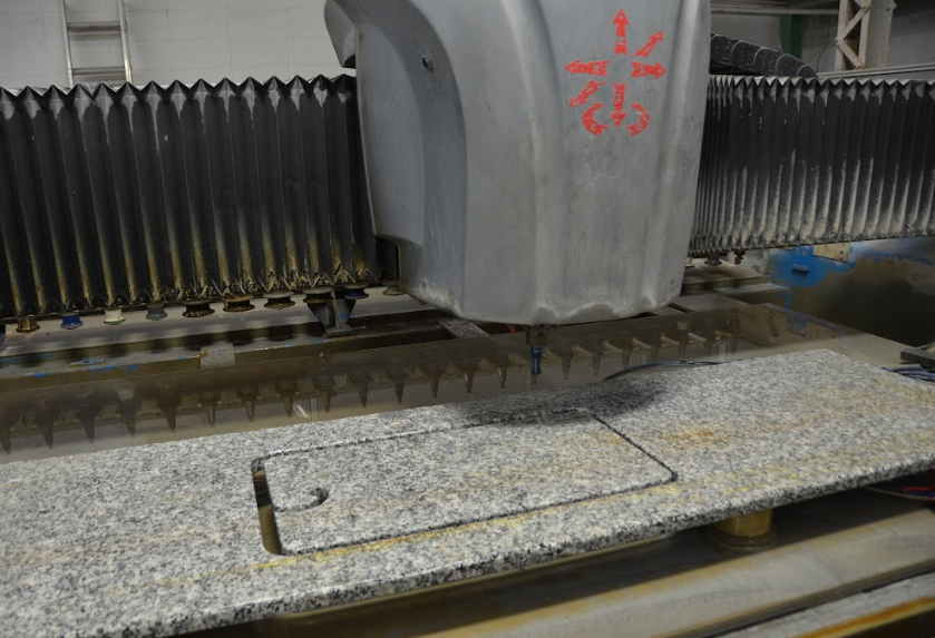
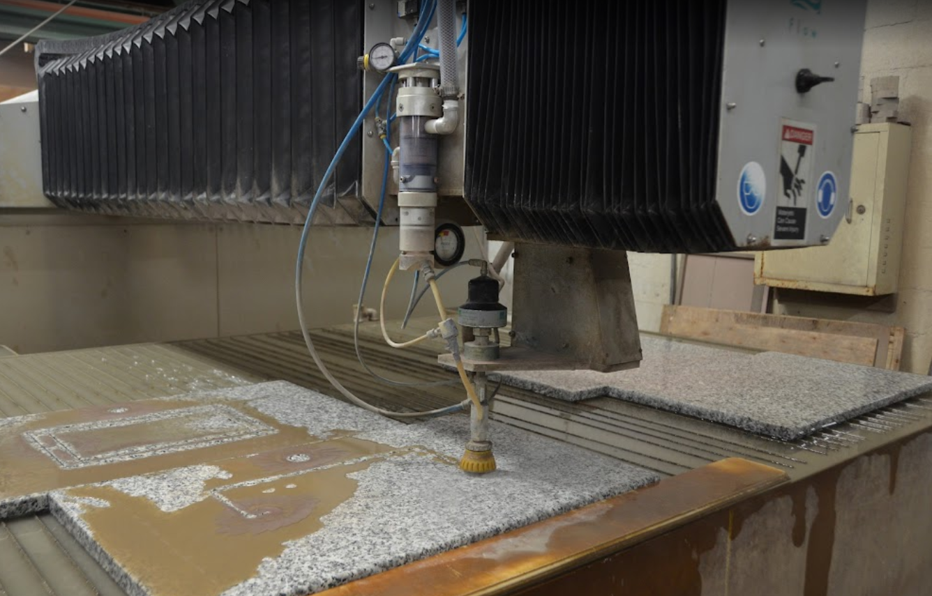
I'm sure that they are glad that granite counter tops became a fad.
American Marketing & Publishing, Mar 2016

A radial arm saw on steroids. Note the yellow overhead crane that they use to move the slabs around the shop.
American Marketing & Publishing, Mar 2016

A router on steroids.
American Marketing & Publishing, Mar 2016

Polishing
American Marketing & Publishing, Mar 2016

Engraving
American Marketing & Publishing, Mar 2016