Showing posts with label rrCaNW. Show all posts

Wednesday, April 1, 2026

C&NW over GM&O Bridge north of Nilwood, IL

(no Bridge Hunter; no Historic Bridges; Satellite)

This bridge is another example that C&NW liked the otherwise rather rare double lattice bridge design.

The GM&O and what's left of the C&NW are now owned by UP.

Richard Koenig posted two photos with the comment:
Slingshot
Here’s a northbound Slingshot on the historical Alton (GM&O/ICG). This was designed to be a fast TOFC train between St. Louis and Chicago. I believe every time I saw this train it was powered by a single GM&O GP35—either in the black and white of the GM&O or new orange and white of the ICG, like this one.
The location is at a spot where the Chicago & North Western flies over—between Girard and Nilwood, in central Illinois.
Two images by Richard Koenig; taken May 21st 1977.
Bill Edrington: This location is known as Green Ridge. The CNW flew over the GM&O and Illinois Terminal main lines as well as Illinois Route 4 here. History repeats itself here, because when the UP abandoned the former CNW line between Green Ridge and Barr (near Athens), it reinstated a long-abandoned connection between the ex-CNW and ex-GM&O lines to allow coal trains from Monterey No. 1 Mine (now Shay Mine) to move north via Springfield. When the CNW’s coal mining subsidiary, Superior Coal Company, first sank coal mines around Benld (at Eagarville, Mt. Clare and Wilsonville) in the early 1900s, the CNW formed and built the Macoupin County Railway to connect those mines with GM&O predecessor Chicago & Alton at Green Ridge. The C&A handled the coal from Green Ridge north to Chicago or Peoria, where it was handed off to the CNW. After a few years of that operation, however, the CNW became dissatisfied with the C&A’s service and built its own line south from Peoria to Green Ridge (about 1913-1914, as I recall), and merged the Macoupin County Railway into the CNW. That’s when the flyover bridges at Green Ridge were constructed.
David Thompson: Thanks for sharing , having family who lived near Towanda growing up in the 1980's these where the only freights that I saw on a regular basis, typically a couple times a day. This would have to be confirmed, but I believe ICG had a ramp in Bloomington that Caterpillar would truck over trailers to send up to Chicago or down to St. Louis.. This seems like a market the big guys have just thrown in the towel. With the truck driver shortages it seems like it would work today but who am I to know.
David Jordan: David Thompson Caterpillar business went to a distribution center in Memphis. The Bloomington ramp opened November 19, 1980 with shippers like Caterpillar in mind, and replaced ICG's use of the P&PU-served ramp at Creve Coeur.
1

2

Bill Crisp commented on Richard's post
In process of being removed.

Bill Crisp commented on Richard's post

One can still see the abutment as well as the embankment.
Street View, Dec 2015

It continues to amaze me how quickly nature takes over.
Street View, Jun 2024

1931/76 Carlinville Quad @ 62,500

Monday, February 9, 2026

1886 Trail/C&NW Bridge over Pecatonica River near Ridott, IL

(Archived Bridge Hunter was broke; Bridge Hunter; no Historic Bridges; Satellite)

2015 photo by John Marvig via BridgeHunter

2015 photo by John Marvig via BridgeHunter

Facebook Reel

Same reel

For those who are bored of bridge photos, you can watch her dance.
Same Reel

Sunday, February 8, 2026

Abandoned/C&NW Bridge over Lick Creek

(Archived Bridge Hunter; Bridge Hunter; Historic Bridges; Satellite)

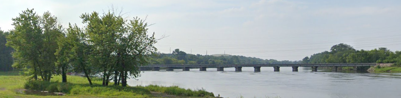
The trusses are from a bridge built in 1883. The trusses were moved here in 1921. The bridge was abandoned in 1997. [ArchivedBidgeHunter]

Street View, May 2012

I thought I saw pins in the bottom cord in the view above. But I see rivets in this photo. HistoricBridges and John Marvig describe this bridge as "an extremely old surviving example of a rivet-connected truss bridge."
HistoricBridges

"This bridge was built 1883 at Geneva, IL as Spans A&D of Bridge #66; these spans were moved here in 1921. I would assume the builder is Alden & Lassig, but I cannot confirm at this time. From what we have figured out, the original Geneva bridge had three truss lines on four spans (two long spans and two short spans).  The outer truss lines were the "light" lines, the inner truss line between the two tracks was the "heavy" line.  It seems that the two short/heavy lines were sent to Spring Creek, and the two heavy/long lines were sent to Lick Creek, along with the four light/short and four light/long truss lines.  These were double trussed to make them stronger. The Lick Creek bridge has three spans, and the north and south spans are the "light" trusses, which were double trussed.  The middle span is the "heavy" truss, which explains why it uses a conventional layout.  I am still trying to figure out if the "heavy" trusses are original to the 1883 bridge, or were added later." [John Marvig via HistoricBridges]

We can more clearly see the use of rivets in this photo.
2015 photo by Steve Conro via BridgeHunter

Facebook Reel

Sunday, November 16, 2025

1865 D Street under C&NW at Mendota is the oldest bridge in MN

(no Bridge Hunter; no Historic Bridges; Satellite, the trail and the abandoned C&NW are buried under the tree canopy.)

Scott Berglund posted
I took this photo a few days ago while my son and I were exploring the area across the river from Fort Snelling State Park.
This is the Sibley Ferry Stone Arch Bridge, a historic railroad bridge built in 1864–65. It’s one of Minnesota’s oldest surviving railroad bridges and now serves as a scenic walking path.
CJ Bahan: It is in-fact THE oldest bridge in Minnesota..
Craig Cilley: D Street. Entrance to some great fat biking. Just be aware of the muddy trails from the Mendota springs.
Laura Duffey: This bridge is also a trail entrance to Fort Snelling State Park (many people may not realize that the park also includes land on the south side of the Minnesota River).
The train track above it was removed in the 1950s.
Pat Cosgrove: Laura Duffey There are two bridges. One has an active track going over it.
Laura Duffey: Pat Cosgrove Correct. The stone bridge had the old, removed track. The new metal tunnel bridge with the active track (and which you can barely see in your photo) replaced an older wooden bridge which was removed about 20 years ago. Fun fact: if you stomp your feet hard against the ground the new metal tunnel vibrates sound in a really cool way. I feel compelled to do that every time I go through it

I used this photo on Google Maps to confirm that I found the correct location.
Ben Zvan, Aug 2013

This view shows the "metal tunnel" mentioned by Laura above.
Street View, May 2023

Caleb Spooner commented on Scott's post
This tunnel was how you got to the old river road, which used to go out on the (then) peninsula which is (now) Picnic Island. The main channel used to go around that peninsula but it was tight curves and hard for boats to navigate. That, and the floods in the early '60's caused the Army Corp of Engineers to cut a new channel across the entire Mendota side, cutting off the peninsula and making it a part of the western shore, where it's now known as Picnic Island. The old channel is now an oxbow lake. There used to be businesses like boat rentals and the River Road Club, kinda where Mpls Rock & Roll started. There was a railroad line that crossed it and a swing bridge that ran trains up along the western side to Minnehaha Falls. All of this is gone now, the businesses, the old River Road, map changed forever. If you look at google maps you can see the old channel around Picnic Island and the new channel that cut it all off from the Mendota side. Hard to believe they could move that much earth! Here is an aerial pic of the area back in 1937 with the tunnel marked.

Caleb Spooner commented on Scott's post
And here's the aerial pic from 1970, with the new channel, tunnel marked.

1967/69 St Paul West Quad @ 24,000

Tuesday, December 10, 2024

1881+1913,1963 UP/C&NW/Chicago, St. Paul, Minneapolis and Omaha Bridge over St. Croix River at Hudson, WI

1913: (Archived Bridge Hunter; Historic BridgesSatellite)

Mark Boettcher, Sep 2020

Mark Boettcher via HistoricBridges
In the late 1800s, much of the original bridge was filled in so that what is left is 568' (173m) long with a main span of 314' (96m).

"This bridge is strengthened and electrified in 1963." [BridgeHunter_1913]


Saturday, October 12, 2024

Trail/CGW overpasses for UP/C&NW and Grace Street in Lombard, IL

Grace: (Satellite)
UP/C&NW: (Satellite)

Rick Burn posted
Chicago Great Western westbound in January 1965 Grace Street Lombard IL

Dennis DeBruler commented on Rick's post
I wonder who paid for the new bridges for the Great Western Trail over Grace Street on the left and UP/C&NW on the right.
 https://maps.app.goo.gl/j7gAJmRJjPmHRiKN7
Mark Petersen: Dennis DeBruler You did as a taxpayer.

They put some sharp curves in the trail so that they could build shorter bridges.
Satellite

I got an old aerial photo to confirm that the CGW went straight over the C&NW. That is why the bridge in Rick's photo is so long for an overpass. I discovered that the route for St. Charles Road has been significantly changed.
1939 Aerial Photo from ILHAP

Friday, September 6, 2024

UP/C&NW Bridge over Cedar River in Cedar Rapids, IA

(Archived Bridge Hunter3D Satellite)

Steven J. Brown posted
Union Pacific 3985 at Cedar Rapids, Iowa - June 18, 2002.

Street View

Marty Bernard posted four images with the comment:
Trains on the C&NW Gauntlet Bridge over the Cedar River, Iowa
C&NW trains crossing the Gauntlet Bridge over the Cedar River at Cedar Rapids, IA on June 29 and Aug. 11, 1979.  The diagram shows how the double track mainline (left) becomes narrow (right) to go over the bridge.  For details see https://en.wikipedia.org/wiki/Gauntlet_track
Bill Kuba photos, Iowa Chapter NRHS collection
𝙉𝙊𝙏𝙀: UP has made it into a double track bridge which can easily be seen south of town on a Google Map.
John Markl: Gauntlet or Gantlet?
Jon Roma: John Markl, both spellings are accepted.
Steven W Panek: John Markl. I've always referred this as a gauntlet.
Marty Bernard shared
1

2

3

4

Patrick Hansen posted
My friend gave me this picture long time ago as he know I like C&NW. if I remember correctly C&NW train got derailed at Cedar River in Cedar Rapids.
Dave Kroeger: This the famous Christmas Day derailment of 1978 on the Cedar River Bridge. Either train 250 or 252 was involved. I remember going to see the cleanup as they used the Clinton and Marshalltown big hooks to remove the rubble.
Dennis A. Wilson: Made it a double track in 2002.
Greg Koenes: They had another one on that bridge a couple of years after they double tracked it


Thursday, September 5, 2024

1891,1993,2014 UP/C&NW/Omaha(CMO) Bridge over Chippewa River in Chippewa Falls, WI

(Archived Bridge Hunter; Historic Bridges; Satellite)

"Built 1891 as a 6-span bridge; two spans burned and replaced with secondhand girders in 1993, Piers Rebuilt 2014" [BridgeHunter]
Historic Bridges calls it a lattice truss.

Street View, Aug 2019

3 of 15 photos posted by Bryan Much with the comment: "an old bridge that looks like it got a major overhaul."
a

b

c

Bryan Much commented on his photo
My friend Jim Klas took this photo of that CNW bridge in 2014 before the foundation was rebuilt. My photo [above] was from 2016 after the work was completed.

John Marvig via BridgeHunter
Mar 11, 2014 comment: "The bridge is getting another face lift. This time, timber components of the bridge are being replaced, and the trusses shifted about 25 feet to the east on new concrete piers. The comparison between 1894 trusses, 1994 deck girders and 2014 piers will be interesting. The trusses were deemed far stronger than minimum freight rail requirements, and are expected to last much longer. Photos coming soon. Work to be complete in May..."

Street View, Aug 2022

Tuesday, July 9, 2024

1916,1947 UP/C&NW+CPKC/Milwaukee Bridge over Mississippi River in St. Paul, MN

(no Bridge Hunter? no Historic Bridges; John A. Weeks IIISatellite)

This is one of the flood incidents of 2024.

According to a topo map and John Weeks, this is UP/C&NW/Minneapolis, St. Paul & Pacific (Omaha) and CPKC/Milwaukee Road. The locals refer to it as the Omaha bridge. A more official name is River Bridge #15. John explains that this structure was one of the original 15 bridges to span the Mississippi River. The first crossing here was built in 1869, and it was a wooden drawbridge.
 
River View, Aug 2016

A bobtail bridge always has a counterweight on the short end to balance the bridge over the pivot.
JohnWeeks
The bridge is 1,055' (322m) long with a navigation channel of 160' (49m).
"Despite a fair number of trains using this crossing, the bridge is maintained in an open position except when trains are using the bridge. The unusual feature of the swing span is that the pivot point is not in the middle of the bridge. Rather, the river section of the swing span is 185 feet [56m] long, while the other side is only 75 feet [23m] long. This feature is called an asymmetrical swing bridge [or bobtail bridge], and it is the only bridge like it on the Mississippi River.According to a local legend, once the bridge was erected, the owner of the land adjacent to the rail line objected to having the bridge swing over his land. To solve the problem, the railroad simply cut off that part of the bridge, and balanced it out with the large concrete slug that hangs off the back end of the swing span. The real reason for the non-symmetrical swing span is that the navigation channel is so close to the shore. The result is that half of the swing span would swing over dry land, so why span that dry land with expensive steel when cheap timber and cheap concrete would do the trick?
[John also describes the corporate history of the bridge.]

Another view of a normal river level.
JohnWeeks

Becky Haag posted three photos with the comment:
Play Bridge
The asymmetrical 1915 Omaha Swing Bridge crosses the Mississippi in St. Paul, MN. On one of my cruises on the Padelford riverboats this summer, I got to see it swing not once, but twice since there were trains waiting as we passed upstream and downstream. It was very cool because I'd never seen it move before.
1

2

3

Becky Haag commented on her post
And you always get a wave from the bridge operator as you go by.

Becky Haag posted two photos with the comment: "I finally got a fairly decent photo of the asymmetrical 1915 Omaha Swing Bridge and the approach in St. Paul this fall on a Padelford Riverboat cruise. It's still used by UP and we got a wave from the bridge tender."
1

2

Andre Wehrle commented on Becky's post
Nice. I got some shots of it in 2021 also from a Padelford boat.

Becky Haag commented on her own post
My dad hit the jackpot on one of his rides. The river was low enough that they could make it without opening the bridge, but he said it was pretty close. He'd never seen the bridge closed, let alone have a train go over them.

.

Flood of 2024


Compare the height on the piers to the river view at the top of these notes.
19:31 video @ 6:46