Friday, April 29, 2022

1941 122mwNet TVA Cherokee Dam on Holston River near Jefferson City, TN

(Satellite)

Just a few weeks after this dam was finished, the "drawings, heavy equipment and seasoned engineers and construction workers" were used to build the Douglas Dam. [TVA-democracy]

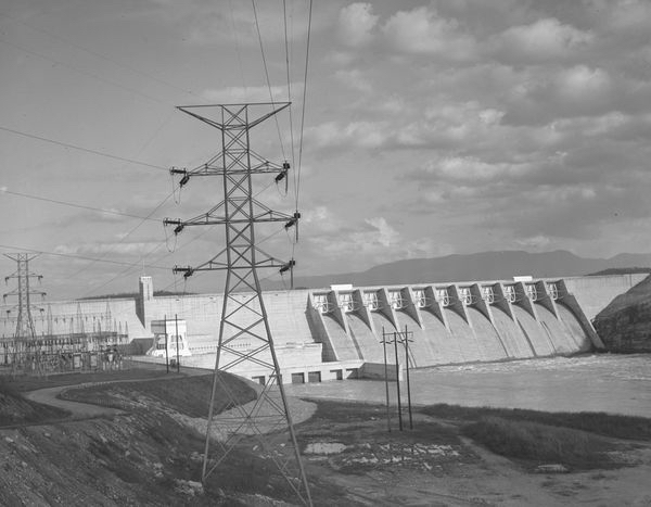
TVA
-- The dam is 175 feet high and stretches 6,760 feet, or well over a mile, from one end to the other.
-- In a year with normal rainfall, the water level in Cherokee Reservoir varies about 30 feet from summer to winter to provide seasonal flood storage.
-- Cherokee has a flood-storage capacity of 749,400 acre-feet.
-- Cherokee Dam is a hydroelectric facility. It has four generating units with a summer net dependable capacity of 122 megawatts. Net dependable capacity is the amount of power a hydroelectric dam can produce on an average day, minus the electricity used by the dam itself.

TVA posted

TVA posted four photos with the comment:
Cherokee Dam, located on the Holston River in East Tennessee, began generating electricity 80 years ago!
This WWII-era dam does more than provide low-cost, renewable energy; it provides flood control, recreation, water supply, and much more.

1

2

3

4

TVA posted without identification
Dennis DeBruler: I'm guessing the Cherokee Dam.

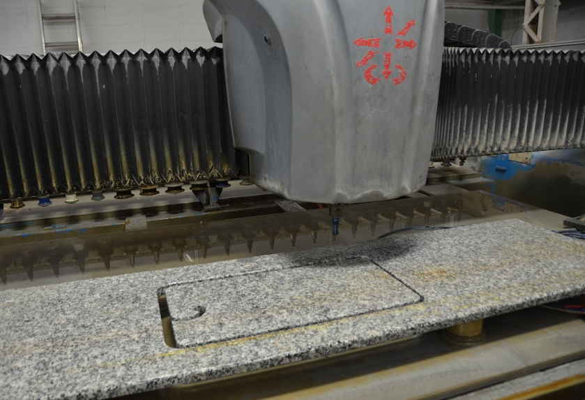
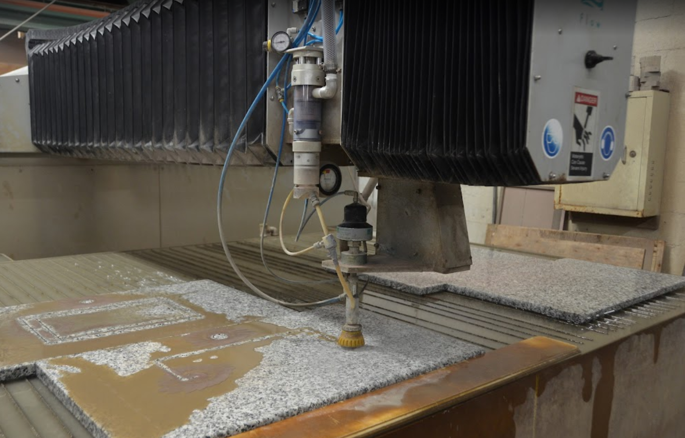
After 80 years, the Unit 1 turbine was replaced by a turbine that can handle 30,872 gallons/sec and that can aerate the water. They have put the old turbine on display.
TVA via wbir

braum denton, sep 2018

Wednesday, April 27, 2022

EJ&E West Chicago Yard

(Satellite) I zoomed in on the curve that Mark has in the foreground in the following photo. He was using a really long lens because the Illinois Prairie Path - Geneva Spur Bridge appears a lot closer than it really is.

Mark Llanuza posted
It's the year 2009 a short Frt train called 20 coming into West Chicago

Unlike most railyards today, this yard still has all of its classification tracks. 
Satellite

C&NW's original mainline that headed west towards Galena went along the south side of this EJ&E yard. As you can see in this topo map, that mainline continued southeast and crossed the EJ&E and Washington Street and then turned more East to go through town. That original mainline made it just to Freeport, IL, when C&NW decided to build a more direct mainline from West Chicago towards Omaha. The old mainline became the Freeport Division. It is now UP's Belvidere Subdivision. 

1953 West Chicago Quad @ 1:24,000

Note that a new C&NW wye was added west of the EJ&E route to connect the Belvidere/Freeport branch to the mainline and UP's West Chicago Yard with more gentle curves. But I was shocked to see that it still has the CB&Q connection in the lower-right corner to the C&NW route. That was removed decades ago. I fired up Google Earth and confirmed that the CB&Q connection is already gone in the oldest usable image, 1993. That image also shows that the new wye has been constructed and that the old mainline no longer crossed the EJ&E and Washington Street.
1998 West Chicago Quad @ 1:24,000

Looking at a satellite image, I noticed the 1998 topo map doesn't have the connection that has been added between UP going to the West and EJ&E going to the South. But that is not an error because, according to Google Earth, that connection still doesn't exist in 1998. Google Earth shows that that connection was built prior to Mar 2002.
Satellite

Looking again at the 1953 map, the junction of the CB&Q and EJ&E was JA Tower and the crossings of C&NW and EJ&E was JB (new mainline) and JC (old mainline).

Tuesday, April 26, 2022

1938,1998 Rainbow and 1991 Veterans Memorial Bridges at Port Arthur, TX

1938: (Bridge Hunter; Historic Bridges; HAERSatellite)

The cantilever truss bridge was built in 1938. The cable-stayed bridge was built in 1991. Then the truss bridge was closed and rehabilitated. In 1998, the two bridges became a couplet that share the traffic load. [HAER-data]

HAER TX,123-POART.V,1--11 (CT)
11. 3/4 VIEW FROM W - Rainbow Bridge, Spanning Neches River at State Highway 87, Port Arthur, Jefferson County, TX

Patrick Feller Flickr via BridgeHunter-1991, License: Creative Commons Attribution (CC BY)

Madison County, Texas Weather posted
On this day [Sep 9, 2022] in 1938, Port Arthur and Orange County were connected by what became known as the "Rainbow Bridge." The bridge replaced the Dryden Ferry.
[There are a lot of comments about how scary it was because it was so steep. Sue's comment is worth noting.]
Sue Newsom: Yes, I had a pinto that even with me speeding down the road to try to reach my highest possible and not get stopped by the law hoping to make it to the top without stalling out and coasting back wards. I would barely being doing 10 mph approaching the top. Finally gave up and took the more then an hour long way around Beaumont to get home from Bridge City to Port Arthur. Ha ha
 
Marianne J Thomas posted
The Rainbow Bridge in Texas 🥰
Tony Rivera Gonzalez: Tallest Bridges in Texas. Been over many times while working at Dow Chemical plant upgrades.
John Peddy: Why do they build them so tall? No ship out there is that tall to fit under a lower bridge.
Aaron Kiker: John Peddy There was when it was built: USS Patoka.
 
Kevo Raney commented on Marianne's post
I did the scaffold maintenance with a bunch of guys on that bridge back in 2015.

Bridges Now and Then posted
The Rainbow Bridge nears completion, Port Arthur, Texas, 1938. (Port Arthur News)

Significance: The Rainbow Bridge, with its vertical clearance of 176'-0", became the tallest bridge in the southern United States and one of the tallest in the world upon its completion. Its height was needed to allow for the passage of ocean-going cargo ships and tankers, for it spans the Neches River linking the busy port of Beaumont with the Gulf of Mexico. The bridge features a 680'-0" central cantilevered span, one ofthe longest in Texas, and an overall length of 7,752! -0". The sixty-three-span structure includes a continuous deck girder, prestressed concrete girder approach spans, deck truss spans, continuous through truss spans, and a three-span cantilever unit. The construction of the bridge required innovative engineering methods not only because of its height but also because it had to be built to withstand hurricane-force winds. Triangular steel piers with V-shaped bracing on concrete pedestals support the deck girder spans, and were designed specifically to transfer up to 150-mile-per-hour winds to the foundations. [HAER]
This was Google Map's signature photo for the Rainbow Bridge. That looks like a rather steep grade for an 18-wheeler to climb. I found that the grade is 5%. [nomination, p10]
Ca P, Oct 2021

There is hardly any traffic on these bridges! John Weeks found a 2002 traffic count of 11,490 for the cable-stayed bridge.
Street View

That made me curious about what I-80 in Joliet, IL, looks like. Actually, this is a rather light traffic flow in my experience. Notice that there are only two through traffic lanes.
Street View

Both the Hartman Bridge and this bridge suffered from a vibration in the cables that occurred during a light rain and moderate wind. The problem was not understood, and threatened to shorten the service life of the cables. The problem was eventually solved by dampening the cables to counteract the vibrations. On the Veterans Memorial Bridge, shock absorbers were placed between the bridge and the cables very close to the base of the bridge. Despite the Hartman Bridge having the same problem, a different solution was implemented on that bridge, a series of cables were woven into the cable stay cables at a right angle to the main cables.

An inspection in 1995 found unexpected cracking in the concrete of the main bridge span. A repair had to be undertaken to change the fasteners holding the internal high-tension cables to better distribute the loads at the endpoints.

Note—The parallel steel arch truss bridge carries the westbound and southbound lanes, and is known as the Rainbow Bridge. The Rainbow bridge is over 170 feet above the water, the tallest bridge in Texas. The reason is that the US Navy wanted every ship in the inventory to be able to pass under the structure. The Navy had a single blimp tender ship that was nearly 170 feet tall, so the bridge was built just a little taller. Ironically, that particular Navy ship never sailed under the completed Rainbow Bridge.

[JohnWeeks]


Monday, April 25, 2022

Rogan Granite & Marble near Dryer, IN

(3D Satellite)

This facility is just west of Dryer in Illinois. There is no quarry here. But cutting and polishing stone is an important part of granite and marble consumption.

Street View

HalstEd Pazdzior posted
EJE 659 heads east on the Matteson Sub. L514 is the symbol.  4/21/22 
[It is significant that this locomotive still has an EJ&E livery because CN bought the railroad several years ago. And it has a caboose right next to the locomotive. So it must have been switching some industry.]
Joseph Tuch Santucci: That granite facility there is where the Vietnam memorial wall was produced.

The CN/EJ&E goes along the south side of the plant. The railroad that went along the north side was NYC's Michigan Central. That route was called the Joliet Cutoff.
Satellite

It looks like they were served by the Michigan Central.
1949 Crete Quad @ 1:62,500

Dennis DeBruler

I'm sure that they are glad that granite counter tops became a fad.
American Marketing & Publishing, Mar 2016

A radial arm saw on steroids. Note the yellow overhead crane that they use to move the slabs around the shop.
American Marketing & Publishing, Mar 2016

A router on steroids.
American Marketing & Publishing, Mar 2016

Polishing
American Marketing & Publishing, Mar 2016

Engraving
American Marketing & Publishing, Mar 2016


Sunday, April 24, 2022

1941 KCS Bridge over Neches River at Beaumont, TX

1941: (Bridge Hunter; no Historic Bridges; 3D Satellite)

BNSF, UP and Amtrak also use this KCS bridge.

Patrick Feller Flickr via BridgeHunter-1941, License: Creative Commons Attribution (CC BY)
Miss Eliza, Neches River, Beaumont, Texas 1302071335
[Patrick also has photos in BridgeHunter-1941 with trains crossing the bridge.]
 
Cleveland State University Library Photograph Collection via BridgeHunter-1941

TxDOT
It is a single-track bridge with a 20mph restriction. The lift span is 239' with a 200' channel. The vertical clearance is 13' when closed and 147' when open.
-- Bridge is opened 231 times per year
-- Second most important rail bottleneck in Texas
[I'm shocked by the number of openings per year I could not find much shipping activity upstream on a satellite image. There were no ships and very few docks. (There is a lot downstream of the bridge.) Then I found a marina for pleasure boats. I wonder what the vertical clearance is when it is closed.]

This is the post that motivated researching this bridge because the towers struck me as rather tall. When I remembered that a bridge in Beaumont may have to accommodate ocean-going ships, I decided to research this bridge.
Steven J. Brown posted
Union Pacific and Kansas City Southern trains meet in Beaumont, Texas - April 17, 2021.
Dennis DeBruler
Judging by the height of the bridge's towers in the background, it was built for ocean-going ships.

Jonathan Konopka posted
A KCS train heading across the Neches River Lift Bridge in Beaumont, TX. Photo credit belongs to Steve Carter.

As we would expect, this lift bridge replaced a swing bridge.
DeGolyer Library, Southern Methodist University via Flickr via BridgeHunter-?
A comment indicates that UP has rights because this bridge used to carry Missouri Pacific as well as KCS.


Saturday, April 23, 2022

Using SPMT's to move an overhead crane from one building to another in Burns Harbor

If I understand the comments on the following post correctly, the upper SPMT was used to move the crane in the buildings and the lower SPMT was used to move the upper SPMT between buildings. They used rail docks to in each building to load and unload the upper SPMT on+off the lower SPMT.

Ryan Boots posted two photos with the comment: "Never seen that before. cliffs burns harbor."
Scott Cuma: I was told they're moving the crane from 1 building to another in the Hot Mill
1, cropped

2, cropped
 
Angel Lock-Holsapple commented on Ryan's post
 
I think this was in the "from" building.
Jesse Poe commented on Ryan's post

Jesse Poe commented on Ryan's post

And this was in the "to" building.
Hoon Richard Jr. Darryll commented on Ryan's post

Mammoet 0:21 time-lapse video @ 0:11
We get by with a little help from our friends! Using rented trailers from Berard, #Mammoet crews provided an innovative solution to relocate an overhead crane weighing 200t in one piece at a steel plant in #Indiana.
Our 500t gantry mounted on 12-axle double-wide #SPMTs carefully lifted the overhead crane from its current location, carrouseled 90 degrees, lowered the gantry and then drove the loaded crane out of the building. The grade elevation outside the building was just over 1 meter (4 ft.) lower than the inside floor elevation, so the SPMT/Gantry combination drove on top of a second set of 12-axle double-wide SPMTs using ro-ro ramps. This expedited the transport operation and eliminated the need to build dirt ramps to drive in and out of the buildings. The task was efficiently completed within the planned three days.
Josh Pace: They did good. They may start carrying extra hydraulic hoses now though. Blew a hole in one and only by luck I was able to repair it. Their end fittings were different than what we have but their connections to fit one hose to another was the same so I was able to cut out the hole and crimp a new fitting on.
Bill Kloss shared

Michael Nielsen provided three photos on Bill's share.
1, cropped

2

3