Showing posts with label wwCalRiver. Show all posts

Friday, May 24, 2024

Holcim/Dundee Cement

(Satellite)

Street View, Oct 2022

Viv Rivera posted the comment: "Is there anything about the two silos that are there by calumet fisheries? I’d like to tell my kids more about them thanks in advance!"
Steve Malachinski: The silos belonged to a cement company. They received cement by railcar and transferred it into trucks.
[Several comments identified it as the Dundee Cement Company.]
Brian McCafferty: Believe Holcim/Skyway Cement (plant on 103rd Calumet River, west bank) recently owned them. Not sure if they still do.

Dennis DeBruler commented on Brian's comment
 Evidently Holcim does currently own it. That blue truck scale was added since I was last there.  wonder if they receive cement via lake freighter and/or barges because the rail service doesn't look intact. https://maps.app.goo.gl/SKXP5RxGHzbspRSo8

Dennis DeBruler commented on Brian's comment
An Oct 2022 street view caught a truck on that scale https://maps.app.goo.gl/nXVwmnxxGMVbvn6n9 According to other street views, the weeds were cleaned up and the scale added between Jul 2019 and Nov 2021.

Monday, August 28, 2023

Omni Material's Lime Silica Elevator on Calumet Lake and Soil Stabilization

(3D Satellite)

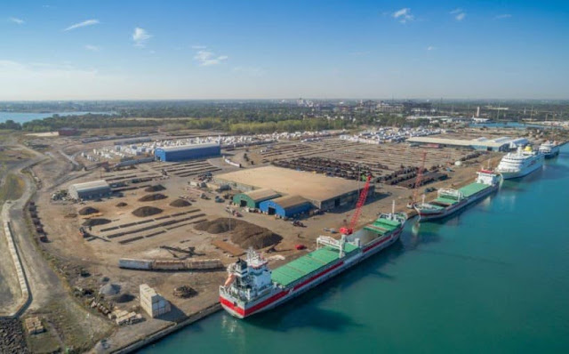
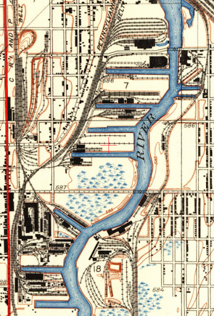
"The southern elevator is packed with lime silica, a component of cement, that a company called Mt. Carmel Stabilization brings in by barge." [Chicago Tribune, Aug 27, 2023, p17]


Street View, Jul 2018

Paul Petraitis shared Daniel Bovino's photo
Port Of Chicago at Lake Calumet under construction Summer of 1956

If you like videos where every platitude, especially customer satisfaction, is said more than once by different talking heads, then this 3:54 video (source) is for you. Fortunately, they did sneak in some interesting video clips between the heads. All of the screenshots below are from this video.

"We can walk into a site that at the start of the day you couldn't hardly walk across in your own boots and at the end of the day they can drive a semi on it and not make a dent in it." [@ 2:52]

Screenshot

They design and build their own spreaders and have 60 of them. Since the focus of the video is platitudes instead of information, it doesn't mention what they are spreading. I think they spread lime silica or cement depending on the soil condition. They do mention that they have 10 storage facilities. I think they said that their total storage is 500,000 tons. (I'm not going to suffer through that video again to confirm that number. BTW, if you want an example of a video that is all information and no platitudes, check out this one.)
Screenshot

Screenshot

Screenshot

mtcsg_timeline
In 1995, they stabilized millions of square yards for the New Denver International Airport.

The next day I came across this alternate solution for soft soils.
Tensar Americas posted
When you build with Tensar InterAx geogrid, you can count on a higher-performing and longer-lasting solution for trafficked surfaces. Learn more about this proven solution and never sacrifice cost for performance again!
 https://info.tensarcorp.com/interax-sample-request

I did not download this eBook because it requires a registration. But maybe some readers are willing to do that.
Tensar Americas posted
Our free ebook compares the pros and cons of stabilizing bad soils with chemicals and geogrid. Download your copy.

Tensar Americas posted
Which is better, chemical stabilization or mechanical stabilization with geogrids? This e-book explains the pros and cons of each method, with actual project examples.
eBook offer

Sunday, August 21, 2022

1914+1977 Indiana Avenue Bridges over Calumet River

1977: (Bridge Hunter3D Satellite)

Comment on BridgeHunter-1977: "this historic crossing was originally a chain ferry est by George Dolton about 1838, replaced by a toll bridge in 1842,wood replaced in the 1850's (bridge timbers went to build a wooden sidewalk in Roseland on Michigan Ave north of 111th) replaced prob around 1900 with a pivoting bridge to let the barges by replaced about 1960 with another bridge as part of the Army Corps of engineers widening of the Cal Sag channel where'd you get the 1915 and 1977 dates from?"
Since HistoricBridges agrees with the 1977 date, I went with the Bridge Hunter dates.

1 of 4 photos available at HistoricBridges

David Ruklic posted
Here is a very interesting view from the air showing the Indiana Avenue bridge spanning the Calumet River and the Illinois Central Railroad bridge as well, from many years ago.

5854x3306 Photo via TheTrolleyDodger (last photo on that page)

Michael Brandt posted
A really neat picture of Pope's Sugarbeet factory at the Calumet River and Indiana Ave. Notice the old Indiana Ave swing-bridge that was replaced in the 70s, I have pictures of that project also.

Street View

The truss members are made with solid beams or built up from solid plates. 
Street View


Friday, July 22, 2022

Iroquois Landing International Terminal

(Satellite)

This landfill was originally created by Iroquois Steel. Youngstown Sheet & Tube bought Iroquois Steel in 1924. YS&T anticipated the steel industry collapse in the USA in the 1970s because it made just pig iron instead of steel. It closed around 1960. [Bob Lalich comment on a post] "In the late 1970s, the Port District built a $15 million container handling facility, Iroquois Landing, on the property. It was designed primarily for containerized cargo." [SEsideIndustrialHistory, p22]

The attempt to be a container port obviously failed. But by 2000 that land was actively servicing ships and barges.
Global Earth Pro with timeline set for 9/26/2000

Rod Sellers posted
Iroquois Landing view south photo from Daily Calumet 1972. Calumet River is to the right, Calumet Park is out of picture to the left. South Slip of U. S. Steel, EJ&E Railroad Bridge and 92nd Street Bridge are top right in photo.

Third photo posted by Tony Arduino
Rod SellersRod manages the membership, moderators, settings, and posts for Southeast Chicago Historical Society. Port District facilities at Iroquois Landing.
George Dosen Transoceanic Terminals. Probably early to mid 60's
Rod SellersRod manages the membership, moderators, settings, and posts for Southeast Chicago Historical Society. Youngstown ceased steel making at the Iroquois Landing site around 1960. The steel maker still owned the land which was leased to Iroquois Terminals Inc.
[It is nice to know that the Calumet River used to see a significant number of "salties" (international) ships.]

Nick Hart posted
After making a pickup and a setout at the Port of Chicago (Iroquois Landing), the "Short Line" makes the short trip back to its yard just a few blocks away. SW1500 #31 leads two bay window cabooses and a train of interchange from the CN. The general cargo ship, Fivelborg (visible along the Calumet River in the background), goes about its business at the port before beginning its trip up Lake Michigan.
November 11th, 2020
Charles Heraver: EJ&E transfer cabooses. Didn't realize they have a pair of them.
Ean Kahn-Treras: Very neat. A google maps overhead view doesn't do this spot justice. Learning a lil bit from this view.
Nick Hart: Thanks. Yeah, it's a pretty big complex. It's no wonder the CN Lakefront Local spends so much time here.
I assume Fuldaborg is a sister ship. This was in July 2017.
(Click the link to see the photo of the ship. Facebook doesn't do a very good job of finding it.)
 
1 of 80 photos posted by Michael Siola
[Why would there be passenger ships docked there? Or is this winter layup? According to the cranes, the two freighters are actively being unloaded.]

safe_image for Lou Gerard Flickr
CSL Niagara being guided by G tug Massachusetts passes the docked salty Federal Margaree in the Calumet River tonight.

Maxima is a new ship design that has the pilothouse on the bow and this is its first trip on the Great Lakes. Because of its revolutionary design, a lot of ship fans have made a point to take photos of it.

Stephen Sostaric posted five photos with the comment: "Maxima arrived in Chicago today, showing off her big red nose as the tug Illinois helped her turn around and back into the Calumet River. July 21, 2022"
1

2

3

4

5

6 of the 12 photos posted by Ken Morrison with the comment: "*Sigh* Been about a month since anything pursuable came to Chicago... But today, the drought ended!"

a
Maxima, entering Calumet Harbor...

b

c
"Welcome to Illinois!" (It's a pun-the G-tug in front of the "Wagenborg" sign is the Illinois) So many watercraft in this picture; to avoid confusion, Maxima is the big red one.

d
Maxima's distinctive bridge

e
and front end

f
heading for Iroquois Landing International Terminal where the Calumet River meets Lake Michigan


1 of 4 posted by Christine Douglas
The Algoma Intrepid arrived in a very windy Port of Chicago late in the afternoon heading to the 92nd Street Salt Dock assisted by Tug Illinois. The two salties in the photo are Beatrix and the Maxima at Iroquois Landing.


Sunday, July 17, 2022

Chicago, IL: Ozinga South Chicago Terminal

(Satellite)

Gary Clark posted
Herbert C. Jackson visited South Chicago today (Ozinga dock) with a cargo of stone from Meldrum Bay, Ontario. It's been a long time since I've seen the Herb Superb around here.
[Does Ozinga buy dolostone from Lafarge's quarry?]

The dome on the left would be for storing the cement. And we can see various piles of aggregates created by the self-unloading freighters. I don't know what is stored in the long brownish building.
Street View

This photo that was uploaded for this location is really for their location in Joliet that handles barges. I recognize the I-80 bridges in the background.
Photo, Jan 2020

Nick Hart posted
With a load of stone for Ozinga, Interlake's Herbert C. Jackson is seen making way through 92nd/Ewing on the Calumet River. July 9th, 2022

Gary Clark posted
Algoma Central Marine’s John D. Leitch was found unloading salt this fine morning. We’re at the Ozinga dock in South Chicago.


Saturday, March 19, 2022

Hohman Avenue Bridges over Grand Calumet River and a Gasometer in Hammond, IN

(Satellite

It is hard to believe that this river was once navigable. But at one time, all of the bridges across it were movable. This bridge was originally a swing bridge.
Rod Sellers posted, cropped
This is a bit of a change of pace. This photo is described as "92nd Street Bridge (?), Trolley Car (South Chicago/Hammond), Black and White, Blank, c. 1905." but I do not think this is accurate. Any thoughts?

Bob Lalich commented on Rod's post
I am nearly certain that the bridge in this photo was Hohman Ave over the Grand Calumet River in Hammond. Paxton Lumber was south of the river on the west side of Hohman Ave, as seen in this 1915 Sanborn map.

Swing bridges were considered a navigation hazard because of the pier in the middle of the river so it was replaced by a bascule bridge in 1910.
Bob Lalich commented on Rod's post
The streetcar line that ran on Hohman Ave was the Hammond, Whiting & East Chicago Ry. They connected to Chicago Surface Lines at 106th and Indianapolis. The swing bridge in the above photo was replaced by a bascule bridge in 1910. Construction of the bascule bridge is seen here - source and photographer unknown.

Dennis DeBruler commented on Rod's post
That bridge is close enough to the state line that a 1939 Illinois aerial photo covers it. You can see the bridge's counterweight on the north side. It appears that only the foundation is left for the two gas holders. That surprises me because most of the gas holders are still standing in these photos.
Bob Lalich: Dennis DeBruler - the gas holders in question here were part of a manufactured gas facility. By 1938, a large natural gas pipeline from Texas to the Chicago region had been completed and much larger gas holders were in use for storage. Small gas plants like the one here were no longer needed.

Tuesday, January 18, 2022

1901 Irondale Grain Elevator on the Calumet River that was served by Rock Island and Pennsy

(Satellite, not only is the elevator gone, the slip has been filled in)

The main post for this elevator is here.

Dennis DeBruler posted four images with the comment:
These three photos came for a share concerning Wisconsin Steel in Chicago, which was on the west side of the Calumet River south of 106th Street.
I copied them because they all include a grain elevator along a dedicated slip. (That slip has since been filled in.) I asked the name of the elevator because it does not show up in the 1901 Sanborn Maps. Dale Windhorst answered that it belonged to the Rock Island Railroad. A topo map shows how the Rock Island used to access this elevator.
1929 Calumet Lake Quadrangle @ 1:24,000
Other topo maps indicate that the elevator and the slip disappeared between 1977 and 1991. Sadly, Wisconsin Steel also disappeared between those years.
Bob Summers: Garvey International had a waterfront terminal in Chicago that if memory serves me correctly it was known as the Rock Island Elevator. It was concrete, so likely was built on the same site that this early wooden terminal occupied. That terminal suffered a major grain dust explosion circa 1980 and was razed.
Dennis DeBruler: Bob Summers The second and third photos show a major concrete annex.
Bob Summers: Ok. Finally saw the 1929 date, so that might be the one.
Brett Ellis: Also Norris Grain later Pillsbury
Dennis DeBruler: Bob Lalich provided the following information in a different forum:
"The ownership and operators of grain elevators changed numerous times over the years. This elevator was known as Irondale Elevator. At various times it was either owned or operated by Rosenbaum Grain, Illinois Grain, Chicago Grain, Norris Grain, and Louis Dreyfus, according to documents in my collection. Both PRR and Rock Island served the elevator. The tracks were retired and removed in 1965. Wisconsin Steel Works bought the land in 1966."
1

2

3

4