Showing posts with label nature. Show all posts

Tuesday, June 6, 2017

I&M Canal: Lock: #2 in Lockport, IL

(Satellite, Birds-Eye View, Follow the signs to the access road to a paint ball facility. When you get to the gate of the paint ball facility, there is an open area to the right where you can park. It also provides room to turn around when you want to leave. (Most of the access road is just one lane with trees on both sides so that you can't turn around. I don't know what the etiquette is if you meet someone on this road.) The lock is a little upstream from this parking spot. But you have to look hard because the trees have taken over the area.

The downstream end of the lock is still fairly intact.
20140614 0211
I found a little "window" in the treeline so you can see the curve of the downstream exit on the right, the top of the west wall in the foreground and some of the cut dolostone construction of the east wall. Since the canal was cut through dolostone from Lemont to Romeoville, they had plenty of stone available for lock and embankment construction.
You can see much of the east gate notch on the upstream side starting from the middle and going to the left.
 I got gutsy and went through that "window" in the treeline to get a shot looking down into the lock.
A bad "window" in the treeline, but I wanted to capture the wall failure and the swift moving water at the upstream end.
 I went back to the better treeline window and repeated the shot looking down to catch the water flow and...
 ...took another view getting more of the length of the lock.
The canal is still rather wide downstream of the lock. Most of the canal remnants you find are narrow or dry because the feeder canals were removed when the canal was shutdown in 1933.

LoC

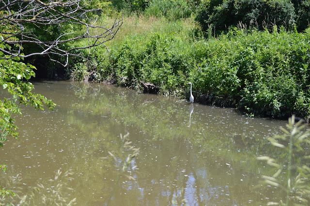
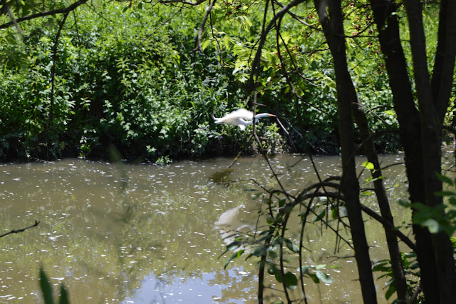
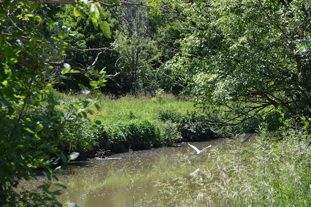
I remind myself that the title of this blog includes "nature." Here are three shots of an egret I saw on the canal as I walked back to my van.
1

2

3

Joe Balynas posted pictures of the lock: looking downstream in 2008looking upstream in 2006, looking upstream in 2008. It looks like he used his trick of putting the camera on the end of a pole. The water flow was higher during my visit compared to Joe's visits.

Wednesday, December 17, 2014

Generating Plant Smoke Plumes (Duke/Gibson + Newton)

(More smoke plumes)

Duke Energy/Gibson Generating Plant


Update: the Big Four railroad bridge over the Wabash River is still used to supply this plant. My notes on the power plant itself


20141211 0181c
While driving west on IN-64 towards the Wabash River, I noticed a power plant plume. It appears that 3 or 4 of the units were operating. Later I passed a sign indicating it was Duke Energy. The Gibson Generating Station was originally owned by Public Service Indiana. It has 5 units generating 3,340 megawatts. It is the third-largest coal power plant in the world, and the largest still operating in North America.

Network Indiana
The 4 original stacks are 550 ft and the 2 newer stacks are 620 ft. No wonder they are easy to see over the treeline. Actually, the plant may be running at full capacity because two of the stacks are now derelicts left to nesting cliff birds such as the peregrin falcon or the bald eagle. That gets a "hidden nature neighborhood" award ("nature" label). In fact, south of the cooling lake is Cane Ridge National Wildlife Refuge, which serves as a nesting ground for the least tern, a rare bird. And they provide public access to the Wabash River on their land. In this day and age of fenced off and gated properties, that is good to hear. It is interesting that they built such a large cooling lake given its proximity to the Wabash River.

This is the largest power plant in Indiana.
From NIPSCO and pro-coal-bill

I believe the plume is dark because I was running out of daylight, not because of particulate emission. They finished adding selective catalytic reduction (SCR) units to reduce NOx emmisions in 2008. To keep the SCR catalyst clean and operational, it is now economically beneficial for the plant to remove fly ash. And their web page indicates that all five units have sulfur dioxide scrubbers. So they probably burn local southern Indiana coal rather than Wyoming Powder Basin coal. My Dad said that the Indiana coal burns hotter and that helps make it economical to run the sulfur scrubbing equipment. In contrast, most Illinois coal burning plants use Wyoming coal or natural gas. The Illinois coal is exported to China! The Gibson plant is now having to deal with high selenium levels in the cooling pond and the possibility of leaking boron into the water tables of the area (Wikipedia).

Looking at a map, the plant has industrial spurs to the former Southern Railroad to the north and the former Big Four to the south. The Southern Railroad is now part of the Norfolk Southern and is their mainline between St. Louis and Louisville. According to my 1928 Railroad Atlas, Big Four had a route from Danville, IL, to Mount Carmel where it forked just south of town and went to Cairo, IL, and Evansville, IN.
www.acwr.com
An NS map confirms that the Big Four remnants are now owned by NS. In particular, the segment from the former Southern route south to the fork and the initial part of the two forked branches are former Big Four trackage. The Evansville branch still has a bridge across the Wabash, but it ends at the power plant. The Cairo branch ends in a loop east of Keensburg.


The following satellite image indicates the loop serves some sort of mining operation. (Update: it was the Wabash Mine. This mine operated from 1970 to 2007 and supplied coal for the Gibson Plant.)
Satellite
The northern Wabash River bridge carries the St. Louis/Louisville traffic and makes economic sense. Note that there is a swing span on the west side with most of the west half of that span over land. A satellite image confirms this. But the southern bridge seems to support just the power plant. Thanks to an error in the Bing road map of terminating the line for the railroad too soon, I can determine that it has a swing span more towards the center of the river.
Satellite

Newton Power Plant


While driving north on IL-130 south of Newton, IL, I noticed another smoke plume off to the West. I have done this trip multiple times, but this is the first time I noticed a plume. I was aware of the Newton Power Plant near the north side of Newton Lake because I had studied a spur that runs south from a CN/IC route along IL-33. I noticed the "flat top" of the plume and kept my eye on it and took several pictures from IL-33 because I was running out of daylight, and I was hoping at least one of them would turn out. The last one I took turned out to be the best.

I'm sure the flat top is caused by layers of the atmosphere being at different temperatures. Probably an inversion of cold air on top of warm air. But why the boundary between the layers causes a ceiling for the plume is still a mystery to me.

Matthew Baltzell posted, cropped
Work’n the night shift baby.
Newton power station. Newton IL.
 
Dynergy
Unlike the Indiana plant, the owners of this 1,225 megawatt plant are still bellyaching about installing sulfur dioxide scrubbers so that it can use Illinois coal again. Ameren got an extension from 2012 to 2017 by holding jobs at other coal burning plants hostage (SourceWatch). Now Dynegy wants to buy this plant and four others in Illinois (Coffeen, Canton, Bartonville, and Joppa) but delay the clean up until 2020. And both companies refuse to consider an offer from a Illinois coal producing company to install the scrubbers. (WXEF, ChicagoBusiness) It is so nice to see the Indiana plant as an example that not all states are as screwed up as Illinois.


If NOx and sulfuric acid are not enough to worry about, I learned that you can also worry about toxic materials and chlorine gas. The page on chlorine gas makes me wonder about the risk of the Chicago Water Filtration plant that is right next to the Magnificent Mile and The Loop.


Thursday, May 22, 2014

"Neighborhoods" of Nature (SantaFe Prairie and Caboose)


One of the things that impressed me when I first visited Chicago in the 70s was how abrutly the neighborhood would change from one ethnicity to another. I'm finding the same phenomena with respect to nature vs. industry. For example, the northeast and southwest quadrants of the 135th Street crossing of the Chicago Sanitary and Ship Canal is industrial. But the northwest corner is part of a Forest Preserve...

20140521 0025c
... and the southeast quadrant also has a bunch of trees.

20140521 0027c

Later that day I was taking 75th Street east of Willow Springs road trying to take pictures of the SantaFe Intermodal Yard in that area, I could not find a good parking spot. So I ended up going east on SantaFe Drive and found River Road. I turned right on River Road, crossed a new bridge, and found:

20140521 0075-rotated

So I went back up the bridge to take a picture of what I had thought was just a plain-old wetlands


 As an added bonus, the little red blob in the background is a SanteFe caboose on static display.


I have exceeded the limits of digitally zooming when trying to read the reporting marks. But you can clearly see the old SantaFe logo and the overhead coupala.

Before I got here, I turned south on Willow Springs road when I should have turned north, and I drove through a lot of forest preserves before I found a place to pull over and read the map. Thus I saw more "nature" on this trip than I had attended.

And then heading East on River Road there was the Des Plaines River on the right and an industrial wasteland of shipping and receiving warehouses on the left. The Des Plaines River was high because we had wide spread thunder storms the evening before. That is why I had made a point of going on a field trip May 21. And on the other side of the Des Plaines River is the urban wasteland of Interstate 55.
A view downstream...


...and upstream...

...and across the river so you can see the trunks of trees covered with water because of the thunderstorms.


Update:
safe_image for Santa Fe Prairie Preserve: Birthplace of the Prairie Preservation MovementIn 1976, a state inventory of natural areas in Illinois found that the prairie had shrunk to 11 acres as a result of the railroad dumping fill onto the land to raise the grade of its tracks above flood levels. But Betz and others, such as Stan Johnson, chairman of the I&M Canal Civic Center Authority, still thought the prairie was worth saving.

On a later trip to tour the McCook Reservoir, I stopped on the way home to take photos of the caboose. They had quite a few interpretive displays along the road.
20170806 1644


Thursday, May 15, 2014

BNSF/SantaFe Bridge over Des Plaines River and Invasive (Asian) Carp Barrier in Lemont, IL

(Update: I have added a posting with more information about Asian Carp. And a railfan post has even more photos.)

When I noticed the SantaFe bridge across the Des Plaines river, which is a few hundred feet north of the SantaFe bridge across the Sanitary and Ship Canal, it was obvious that the river was several feet higher than the canal. The following four images were taken on the same day, May 14, 2014. There were some thunder storms the previous day so not only was the river high, there was a visible water flow in the canal.

Upstream (Eastish) Side


Downstream (Westish) Side


It is easy to see the Egret in the greenery, but it is hard to see the Egret in the water, so I include this closeup:


The Egret in the water is just to the right of the entrance to the channel in the middle of the picture.

Note the waves in the canal in the following picture. You could see the water flowing in the canal. Normally the surface is calm as in a Flickr picture that is referenced by Bridge Hunter. My second trip was delayed until May 14 because we were having rain the previous few days.

Downstream Side of the canal bridge.
(Update: I have posted some additional facts about Asian Carp.)

Because the Des Plaines river is higher than the canal, when it floods, it drains into the canal. At the end of the industrial frontage road that goes under the Lemont SantaFe Railroad Bridge, Canal Bank Road, is the resumption of a trail that goes along the Sanitary and Ship Canal. The US Army Corps of Engineers has installed the following sign. It is followed by the four quadrants so that the text is readable.


The view downstream (westish) of the sign. You can see the barrier heights progress from the white concrete barrier at the end to the four foot and six foot fences.


The view upstream (eastish) from the sign. It appears to be six feet until the trail turns. The fact that some places need an  eight foot fence implies that the flood waters can be over six feet deep.