Showing posts with label wwCR. Show all posts

Thursday, February 19, 2026

Chicago & St. Louis, Armour "C" and Armour "D" Grain Elevators along South Branch

Chicago & St. Louis: (Satellite)
Armour "C": (Satellite)
Armour "D": (Satellite)

See Halsted Street Bridge and National Grain Elevator for the bridge and elevator in the distant background.
MWRD posted
A view to the east showing the South Branch of the Chicago River in an area between Loomis and Halsted Streets on July 9, 1900.
Dennis DeBruler: The grain elevators, from left to right: Armour "D," Armour "C," National (behind the Halsted Bridge) and Chicago & St. Louis.

We are looking at, from right to left in the foreground: 26, 27 and 28. 29 would be out-of-frame to the right.
1901, Image 1

Chicago & St. Louis Elevator & Annex


1901, Image 27

Digitally Zoomed

Armour "C" Elevator


1901, Image 28

Digitally Zoomed

Armour "D" Cleaning House


The piles of lumber west of Masons Canal is a reminder
1901, Image 29

Digitally Zoomed

Friday, November 14, 2025

Grain Elevators on the South Branch west of Halstead

Chicago & St. Louis: (Satellite) 1872, 800k bushels; Annex: 1894, 1,500k bushels
Armour C: (Satellite) 1874, 1,500k bushels
Armour D Cleaning: (Satellite, the land was reused by the Fisk Generation Station.) 1898, 1,600k bushels

We can see the south tower of Halstead Bridge in the center of this photo. The piles of lumber on the left is a reminder that Chicago has a Lumber Street along the north bank of the South Branch south of 18th Street. But what really caught my eye was the grain elevators.
MWRD posted
A view to the east showing the South Branch of the Chicago River in an area between Loomis and Halsted on July 11, 1900.
Dennis DeBruler: This is the first photo that I have seen of these grain elevators. The one on the left was the Armour Elevator "D" Cleaning House. The one behind it, obscured by smoke, was the Armour Elevator "C." The one on the right was the Chicago & St. Louis Elevator.
Dennis DeBruler shared

The grain elevator on the right was the Chicago & St. Louis Elevator and Annex, #26. 
Index, cropped via Dennis DeBruler

Page 26

Digitally Zoomed

This is the elevator behind the smoke and elevator on the left side of the photos.
Page 27

Digitally zoomed

This is the elevator on the left side of the photo. Note the piles of lumber west of the elevator. That is consistent with the MWRD photo.
Page 28

Digitally Zoomed

This map shows Hough Slip that we see going off to the right in the MWRD photo and labeled as such on Page 26.
1889/89 Chicago @ 62,500


Saturday, November 1, 2025

1855+56+69+72+1910-72 Polk Street SUC Bridge on South Branch

(Archived Bridge Hunter; Bridge Hunter; no Historic Bridges; Chicago Loop; Satellite)

SUC = Strauss Underneath Counterweight

Image via BridgeHunter
"Built 1910 to replace 1872 swing bridge; removed 1972"

The Polk Street Bridge is in the raised position in this photo. Obscured by the smoke on the left was the Pennsy Freight House, the tall building north of Polk Street was the Marshal Field River Warehouse and the buildings on the right are more freight houses.
History's Mirror posted
[I'm not copying the description because it is an example of AI gone wrong. Basically, if a statement is not a platitude, it is wrong. The dredge is in the old channel, not the new one. And "Polk and Taylor Streets" implies an intersection, but they are parallel streets. The photo below shows that the photo was taken from Taylor, and we are looking at Polk Street Bridge.
But it is a great photo of the freight houses and of Polk Street Bridge.]
Franklin Campbell shared
Dennis DeBruler: The dredge is digging in the old channel, not creating the new one. But this is a terrific photo of Polk Street Bridge.

This photo confirms that the train shed that we see in the above photo was for the Grand Central Terminal. And because it includes the Pennsy freight house, I could confirm the streets as Taylor looking at Polk.
B&O C&O Grand Central, Chicago Terminal 1890-1971. posted via Dennis DeBruler
[Taylor Street is at the bottom and Polk Street is the next one upstream.]

We are look West because that is the Marshal Field River Warehouse on the right.
DN-0056536, Chicago Daily News negatives collection, Chicago History Museum via BridgeHunter

ForgottenChicago
The first swing bridge was built in 1869. That one was destroyed by the 1871 fire so a second swing bridge was built in 1872. The trunnion bridge was built in 1910, and it was designed by Joseph Strauss. The Marshall Field River Warehouse was built in 1904.The postal service acquired the warehouse in 1974 and removed it 20 years later to make room for their new post office.

Chicagology

King Iron Bridge Co., 1874 Catalog via Chicagology
The 1872 bridge was a tubular wrought iron swing bridge.

Saturday, June 22, 2024

1890 Crystal Springs Dam is the oldest mass concrete structure in the world

(Satellite)

Street View, Apr 2022

CivilGEO Inc. Software posted
More than 130 years later, ingenious design helps California dam stand strong
The Crystal Springs Dam’s interlocking concrete block system enhances the structural stability of the mass concrete.
Photograph courtesy of The Reading Room/Alamy
"Crystal Springs Dam, which has a height of 145 ft [44m], is the oldest mass concrete structure built in the 19th century in the U.S. (Photograph courtesy of The Reading Room/Alamy)"

LC-DIG-ppmsca-17716

filoli
This source specifies 154' (47m) as the height of the dam.
This was the first concrete dam that was taller than 95' (29m). The construction of this dam included the invention of steam-powered machines to mix the concrete.

asce
As with most dams in California, this one was built to provide a water supply. In this case, for San Francisco. Chief Engineer Hermann Schussler advised the board of the Spring Valley Water Co. to buy the land of the 23,000-acre San Andreas Valley watershed, which they did.

asce
Hermann was aware that concrete shrank and became hot as it cured, so he built the dam as a series of interlocking blocks. The first set of blocks in a layer would be built like a checkerboard. Then the empty spaces would be filled in. The center of a block of the next layer would be built over the intersection of four blocks in the previous layer. And this photo shows that the blocks where keyed into the adjacent blocks. This created a dam that was strong enough to survive the 1906 and 1989 earthquakes without any significant damage even though it is only 1,100' (335m) east of to the San Andreas Fault.

asce
The dam is 600' (183m) long and contains 157,000 cu. yd. of concrete. It has a total capacity of 19 billion gallons. A 44" (1.1m) wrought iron pipeline that is 89,500' (27.3km, 17miles) long delivered the water via gravity to a terminal reservoir in San Francisco. "The pipeline performed well for many years before being replaced."


Monday, December 25, 2023

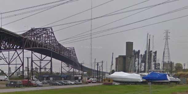
Skyway Yacht Works/Calumet Marine Towing on Calumet River in Chicago, IL

(Satellite)

James Davis posted, rotated
CMT yard early 1980s Calumet River, Chicago
Jason Bundy: Ol Barnaby's yard...
James Davis: Jason Bundy back in early 80s I’d go down Sat mornings-went on tows with CMT and GL !

Clarence Totleben commented on James' post, cropped
When I stopped by this past summer 2023.

Michael W. Cooked provided two photos with the comment: "When I worked there! 1991."
1

2

In 1985, Captain Ed Barnaby had nine tugboats in his yard. Business was already half of what it was two years earlier when they moved 4,000 barges on the lake. In 1985, only one of his tugs was working. [ChicagoTribune]

They have a crawler crane and a floating drydock.
Satellite

Another view of the crane and of part of the drydock. The towboat is Tanner. There is also an interesting trailer to the right of the crane.
Brandon Davis, Jun 2021
Obviously, this photo was taken from a semi-truck on the Skyway Bridge.

During the Winter months, they help provide storage for pleasure boats.
Street View, Nov 2017

I wonder why they rented a mobile crane since they own a crawler crane. Or did they get rid of that crane?
0:26 video, Jun 2020
"They’re coming from all over the world to sail in Chicago. Yuans 37 launched at Skyway’s Chicago Yard."


Wednesday, December 13, 2023

Bridges over North Shore Channel

From north to south:
Maple Avenue/Hill Street: (Satellite)
Oakton Avenue: (no Archived Bridge Hunter; Satellite)
Devon Avenue: (Satellite)
Foster Avenue: (no Archived Bridge Hunter; Satellite)
Irving Park Road: (no Archived Bridge Hunter; Satellite)

Building bridges across the channel had to be a significant fraction of the cost of digging the North Shore Channel.

Linden


MWRD posted
A view looking southwest at the Linden Avenue Bridge over the North Shore Channel in Wilmette, Illinois, showing work on the bridge struts on August 29, 1910, three months before channel construction was complete.
Victor StLawrence What is the average depth of the channel?
The North Shore Channel is generally between 5 - 7 feet deep when the Chicago Area Waterway System (CAWS) is at it’s typical operating height. At some points, it can go as deep as 10 feet and as shallow as 3 feet. You may learn more about the CAWS here: https://mwrd.org/chicago-area-waterway-system
MWRD posted again
.

Maple Avenue/Hill Street


MWRD posted
The nearly completed bridge at Hill Street (now Maple) over the North Shore Channel in Wilmette, Illinois, viewed looking north on January 13, 1909.

MWRD posted
The bridge at Hill Street (now Maple) over the North Shore Channel in Wilmette, viewed looking east after it was opened for traffic on March 2, 1909.

MWRD posted
Workers replacing the deck for the Hill Street (now Maple Avenue) bridge over the North Shore Channel on May 31, 1922.
.

Isabella Street

 
MWRD posted
A view to the east showing workers on the east end of the Isabella Bridge over the North Shore Channel in Evanston, Illinois, on April 4, 1924.
 
MWRD posted
A view to the northeast showing workers on the west end of the Isabella street bridge over the North Shore Channel in Evanston on April 4, 1924.

MWRD posted
A view to the northwest showing workers on the east end of the Isabella Bridge over the North Shore Channel in Evanston on April 4, 1924. 

Lincoln Avenue


MWRD posted
Workers make repairs to the deck of a bridge at Lincoln Avenue over the North Shore Channel on June 14, 1921. 

MWRD posted
Repairs to a bridge over the North Shore Channel at Lincoln Avenue, looking to the northeast, on June 14, 1921. 
.

Emerson Street


MWRD posted
A view to the northeast of a bridge over the North Shore Channel at Emerson Street in Evanston, Illinois, on July 12, 1909. 
.

Church Street


MWRD posted
A view to the west at the Church Street bridge over the North Shore Channel in Evanston, Illinois, on October 17, 1921, prior to repairs to the deck of the bridge.
.

Oakton Avenue


MWRD posted
A view to the north showing work on a foundation for the Oakton Avenue bridge over the North Shore Channel in Skokie, Illinois, on July 12, 1909. 
 
MWRD posted
A view to the north showing the Oakton Avenue bridge over the North Shore Channel in Skokie on May 3, 1911. The North Shore Channel was built by the MWRD between 1907 and 1910.

MWRD posted
A westward view of workers removing an old deck from the Oakton Street bridge over the North Shore Channel in Skokie, Illinois, on October 14, 1921.
Jim Ritchie: looking at the overburden piles on the opposite bank - appears the channel was dredged - referencing todays google earth shows a "straight" channel from Belmont north to Wilmette Harbor.
 
MWRD posted
A view to the northeast showing construction of a bridge over the North Shore Channel at Oakton Street in Skokie on October 14, 1921. 
Hilary Marie Shaeffer: Do you know which direction this photo is facing?? I live up near there now🤩🤩

Dennis DeBruler commented on Hilary's comment
As MWRD mentioned, Northeast. The railroad tracks in the right background were C&NW, and the water towers in the left background were in Weber Yard. 1953/55 Evanston Quad @ 24,000

When I looked at a satellite image, I noticed that the bridge is significantly wider than the street. I presume that is to have more lanes of traffic crossing McCormick Blvd. during a green light. If I ever get up that way again, I need to use the rowing dock to get a photo of the underside of the bridge. I'm currently guessing that I should use the label "bridgeGirderConcrete" instead of "bridgeGirderSteel".
Satellite
.

Devon Avenue


MWRD posted
A view of a new fence and grading along Devon Avenue in Chicago looking west towards the bridge over the North Shore Channel on June 4, 1925. 
.

Foster Avenue


MWRD posted
A view to the east showing material and workers on the deck of the Foster Avenue bridge over the North Shore Channel on August 13, 1921.

MWRD posted
A view looking south/southeast from a rock spoil bank showing the Foster Avenue bridge with the Argyle Street bridge in distance over the recently constructed North Shore Channel on August 29, 1910.

MWRD posted
A view of the Foster Avenue bridge over the North Shore Channel on April 20, 1911.

Street View, Jun 2011

.

Irving Park Road


MWRD posted
A view of Irving Park Road looking east towards the bridge over the North Branch of the Chicago River in Chicago on April 8, 1903.