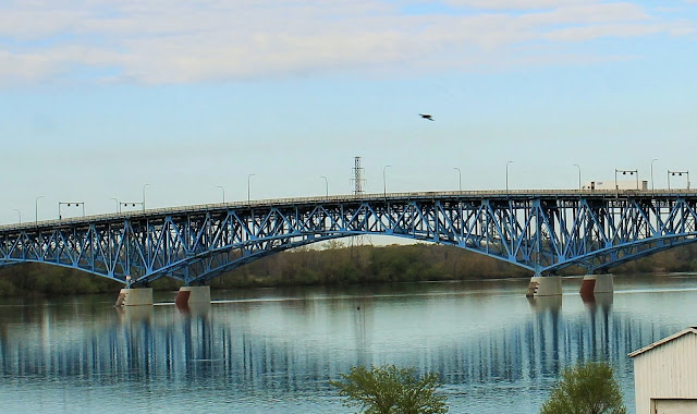
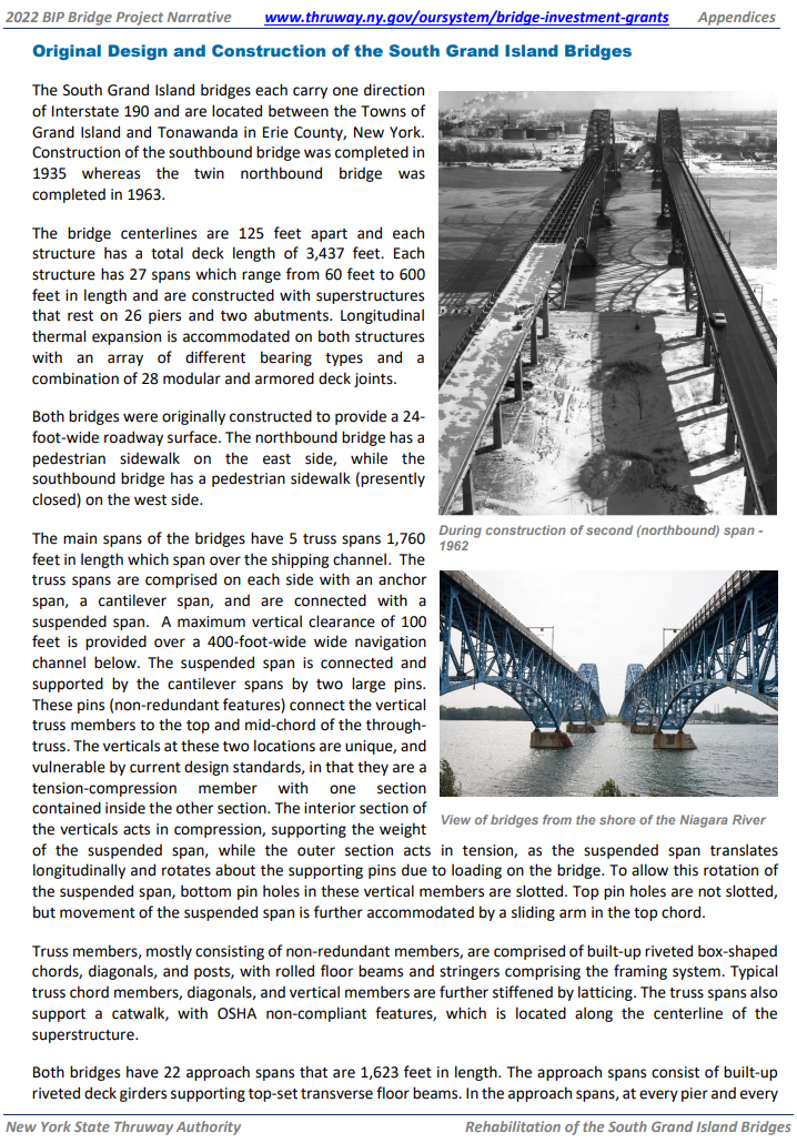
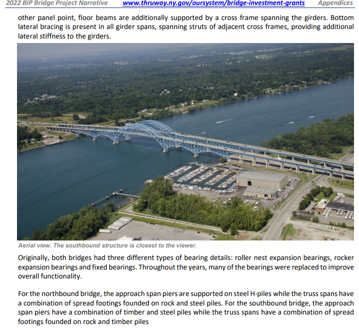
South: (Bridge Hunter broke Mar 22, 2023; Historic Bridges; Satellite, 279 photos)
"Smaller than the bridges at the south end of the island, these bridges are part of the same projects, and one of these two bridges was built in 1935 and the other in 1963, and are nearly identical." [HistoricBridges_North]
NiagaraFallsInfo has the northern bridges longer than the southern bridges at 4,000' (1,219m) vs. 3,400' (1,036m). It also specifies a completion date of 1962 for the southern bridge and 1965 for the northern bridge.
"The appearance of built-up members containing v-lacing and lattice on the [northbound] 1963 bridge suggests that this was an intentional decision to make it blend in with the 1935 bridge. Most 1963 bridges would not feature v-lacing and lattice on so many members.... V-lacing on many of the members of the 1963 span features 'railroad style' v-lacing, which was a heavier design that riveted each bar that formed the v-lacing separately of the other. The 1935 bridge in contrast features the more standard v-lacing which used one rivet to attach two v-lacing bars to each side of the beam." [HistoricBridges_South]
Looking North at the South Bridge
 |
| Street View, Aug 2017 |
Looking West at the South Bridge:
 |
| Street View, Aug 2017 |
Looking North at the North Bridge:
 |
| Street View, Jun 2022 |
 |
| Andy Ligammari posted One bridge, two lanes, 1966. "Going to Beaver Island" Probably ten or fifteen cent tolls. Remember the coupon books? The halcyon days. Jim Myers shared |
 |
| 1 of 3 photos posted by Amy Daggett 𝗧𝗛𝗘 𝗢𝗡𝗘 𝗧𝗛𝗔𝗧 𝗚𝗢𝗧 𝗔𝗪𝗔𝗬(𝗼𝗿 𝘄𝗼𝘂𝗹𝗱𝗻'𝘁 𝗹𝗲𝗮𝘃𝗲) Last night when crew from NEW YORK with her barge DOUBLE SKIN 509A said they would be done dispatching their load of asphalt soon and planned to pull out first thing in the morning, we did what all obsessed Ship Junkies would do. We scampered home to bed so we could get up early to catch it because this was a unique opportunity for a couple of reasons First, these vessels have a special story. In 2020, Vane Brothers which is headquartered in Baltimore Maryland expanded their fleet to service the Great Lakes with this this tug barge combination. The double-hull tank barge utilizes a sophisticated thermal heating system that keeps asphalt at approximately 300 degrees Fahrenheit so that the highly viscous liquid remains relatively thin and flows more easily. Next, the route they would take leaving the Niagara River takes them through the the Black Rock Channel and the Black Rock Lock. This provides safe passage for vessels between Buffalo Harbor and Tonawanda Harbor around the rapids that exist in the upstream portion of the Niagara River. The present Lock, which was constructed by the Corps of Engineers from 1908-1913, can accommodate large Great Lakes vessels with a lock chamber that is 650 feet (200 m) long, 70 feet (21 m) wide, and rises 6 feet according to canals.ny.gov with an actual lift time of 12-15 minutes. There are also bridges along the channel. The Ferry Street Bridge was constructed in 1913. It is a bascule bridge, a kind of lift bridge, built by the Strauss Bascule Bridge Company, and is considered a rare and historic design. Seeing this bridge lift is a unique opportunity. But alas, it wasn't meant to be. We woke to steady rain but forged ahead. We mapped our route in preparation and timed the transit between our viewing location to be certain we wouldn't miss the bascule bridge. When the skies cleared we have a little cheer and went to see if they were getting ready to move. Our excitement was squelched when we told the Lock was closed due to wind and their departure was delayed until tomorrow morning 😭 What did you think Ship Junkies? Do I make my retired husband go back tomorrow to try again 🤔 |
 |
| PD Cappola posted |
 |
| LC-DIG-highsm- 52618 (ONLINE) [P&P] Aerial view of the twin spans of the South Grand Island Bridge, which cross the Niagara River in five sky-blue steel arches (four of them below road level), north of Buffalo, New York Credit line: West Virginia Collection within the Carol M. Highsmith Archive, Library of Congress, Prints and Photographs Division. Carol M. Highsmith's photographs are in the public domain. |
 |
| James Cavanaugh Photography posted From my Archive. A 2005 view of the east branch of the Niagara River looking NE towards the Tonawandas with the south Grand Island Bridges in the foreground. Jim Cavanaugh shared [same comment] |
Neil Ferguson posted two photos with the comment: "Buffalo's newest pedestrian bridge has arrived on-site at Ralph Wilson Park near downtown Buffalo, NY. The pedestrian bridge was fabricated in Italy, then shipped across the Atlantic, up the Hudson, and along the full length of the Erie Canal. On Friday [Jul 19, 2024?] night it docked on the Erie Canal in Tonawanda, NY before making the final leg of the journey down the Niagara River on Saturday Morning." [The south bridges]
 |
| 1 |
 |
| 2 |
1935 V-lacing:
 |
| Street View, May 2023 |
The V-lacing on both bridges looks the same to me. The vertical member uses "railroad lacing," but that was true on the other bridge as well.
1965 V-lacing:
 |
| Street View, May 2023 |
 |
| KwikBondPolymers The new decks for the four bridges "utilized a Polyester Polymer Concrete Overlay." The deck replacement was done during 2010-2017. |
South Bridge:
.webp) |
| AmericanBridge_south, Photo by Brianna82 Total length: 3,437' Longest span: 600' |
North Bridge:
 |
| AmericanBridge_north, Photo by Brianna82 Total length: 4,038' Longest span: 400' |
 |
| Thruway, p2 |
 |
| Thruway, p3 |
Deborah Brown posted two photos with the comment: "Good Evening Buffalorians 🚶🏽♀️ Ongoing construction of the South Grand Island Bridge northbound 1961, 2nd photo SouthGrand Island Bridge today 🚧"
Jim Myers shared
 |
| 1 |
 |
| 2 |
 |
| Andy Parker posted Tonight's sunset over the South Grand Island Bridge. Taken by Dave Vogan Photography. |
WGRZ - Channel 2, Buffalo posted two photos with the comment: "From Traffic Tracker 2’s Dave Cash: A stranded motorist blocks the right lane on the 190 North before the top of the South Grand Island Bridge - traffic is bumper to bumper & backed up on the 190 North & on the 290 West."
 |
| 1 |
 |
| 2 |
 |
| Adam Rudnick posted |
 |
| NYC Thruway Authority posted 🌉 NEWS: A $1.6 million federal grant will allow the Thruway Authority to conduct a Planning and Environmental Linkages (PEL) study of the Grand Island Bridges. The aim is to develop the framework for the future maintenance, rehabilitation and potential reconstruction of the structures. Read more ➡️ https://www.thruway.ny.gov/.../2024-08-14-gib-grant... Mike Kaminski shared |
Robert Preskop posted two photos with the comment: "The South Grand Island bridges spanning the east channel of the Niagara River in Tonawanda New York."
 |
| 1 |
 |
| 2 |
No comments:
Post a Comment