Wednesday, April 23, 2025

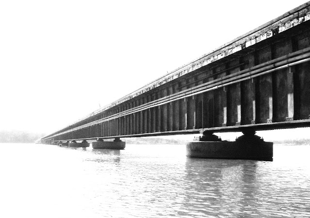
1904,1984,2010 Riegelsville Bridge over Delaware River and Trail Bridge over Delaware Canal


The town was established because of a ferry crossing. In 1832 the Delaware Canal opened and the town had another burst of growth.  A covered bridge that was built in 1838. This 1904 bridge replaced the covered bridge.

This 577' (176m) long bridge was built by the John A. Roebling's Sons Co. and has a longest span of 200' (61m). "Its design is unusual because it contains multiple, relatively short suspension spans. Most suspension bridges that are familiar today are much larger bridges that contains only two suspension towers." [HistoricBridges]
 
Delaware River Joint Toll Bridge Commission
"Current bridge is the third oldest existing superstructure in the Delaware River Joint Toll Bridge Commission’s 20-bridge system....The Commission posts bridge monitors at the bridge on a 24/7 basis to prevent crossings of overweight/oversized vehicles on the unique multi-catenary weight-restricted suspension bridge."

Kevin Coffer, May 2020

Gary, Oct 2022

Chris Herschel, Oct 2023, cropped
 
Bob Dover posted
The structure of the Reigelsville Suspension Bridge connecting Bucks County, Pennsylvania to Warren County, New Jersey, has cute little oil derrick-shaped towers about 15 feet high sitting on massive white stone piers 30 feet high. The tiny towers straddle the sidewalks on either side of the bridge, seeming to make the sidewalks part of the structure and not an appendage added on to its side. Plaques above the roadway on the suspension towers signify the construction by John A. Roebling’s Sons Company of New York in 1904, in fancy decorative script. At the eastern end, the carved stone date plaque from the original bridge, showing its date of 1837, has been incorporated into the 1904 anchor block.
The town of Riegelsville clearly takes pride in being the location of a lovely Roebling bridge. The western approach to the bridge crosses the remains of the Delaware Canal, the towpath of which has been converted into part of the regional Pennsylvania Highlands Trail Network of hiking and biking trails. Historical plaques along the towpath discuss the history of the canal, the 1837 covered bridge, and the 1904 Roebling bridge. The village is a National Historic District, and the best access to the bridge is to park at the historic Riegelsville Inn, which features the image of the little oil derrick-shaped suspension towers on its sign.
I have posted several other photos this bridge, and some other Delaware River bridges, on www.bridgespotting.com. There is also a detailed discussion of the bridges of the upper Delaware River, including a recommended tour, in Chapter 9 of my book, Bridgespotting Part 2: A Guide to Even More Bridges that Connect People, Places, and Times.
Sloan Farrell: Amazing bridge! Back in the early 80's, I worked for the Delaware River Joint Toll Bridge Commission as a summer job and this bridge was one of the bridges we worked on. The Riegelsville bridge had timber planks and we used to test the strength of the planks. If there was a rotted plank, we would rip up and replace. The next summer we got to rip up all the planks and put down steel open-grid roadway deck. Did we haul away the creosol soaked planks and properly dispose of them? Ummm, not so much. Most floated, sank, or fell on the piers until the Delaware rose up to wash them away. Yup. I don't think we had any safety harnesses as well. Also, because of the size of the bridge and weight limit, the bridge had a guard on each side to stop any trucks from trying go over. May still have them. Though we had constructions jobs up and down the river, we did a lot of grass mowing and painting. If we finished early which happened a lot, we were told by the foreman to get out of the public eye which meant getting on the bridge by a pier, climbing off the bridge onto the pier and under the bridge were it was shaded. We just hanged out bsing till we had to go back. The last thing is that there was a old dive bar, called Hootz, on the NJ side. During lunch, we would go in get very good burger and I think 50 cent drafts. Might be 75 cent. Over 40 years ago. https://www.drjtbc.org/bridges/riegelsville/
Laura Mirsky: Sloan Farrell Hootz is still there!

Andrew Iwanowsk commented on Bob's post
March 2005

Chris Herschel commented on Bob's post

Chris Herschel commented on Bob's post

Chris Herschel commented on Bob's post

This bridge reminded me of an extradosed bridge because of its multiple short towers. But an extradosed bridge is a variant of a cable-stayed bridge rather than a suspension bridge.
MNDOT Banner via Dennis DeBruler

Trail Bridge


Just west of the suspension bridge is a new bridge over the former Delaware Canal.
Pennelope Blakely, Oct 2021

2012 Photo by Andrew Pearce via ArchivedBridgeHunter

Deirdre Gallahue-Thorp, Oct 2022

1887,1973 Hammersmith Bridge over River Thames in London, UK

(Historic Bridges; Satellite)

This 700' (213m) long bridge has a 400' (122m) main span. This bridge gets Nathan's highest ratings for historic value. [HistoricBridges]

I added the "bridgeRare" label because it is an eyebar suspension bridge.

Boat View, Aug 2013

Street View, Nov 2017

A closeup of the eyebars.
Street View, Nov 2017

The B1M posted
Is this how we save London’s Hammersmith Bridge? The 138 year-old Grade II listed structure over the Thames has been closed since April 2019 after cracks appeared in its pedestals, with only pedestrians or dismounting cyclists allowed to cross it.
The bridge was today reopened to cyclists after a £2.9M project to upgrade its main deck. But with the cost to reopen it to road traffic ballooning to more than £250M, its future as a vehicle bridge remains in doubt. 
Now, architects Sybarite have teamed up with engineers at Buro Happold to propose a bypass consisting of two “ribbons” around the main structure. The new road routes would be constructed in mirror-polish stainless steel to help them blend into their surroundings and avoid taking any focus away from the original bridge itself. The heritage structure would then be turned into a public park and footbridge, similar to New York’s High Line. 
In a statement on its website, Sybarite said: “How much longer will politics and bureaucracy hold London hostage while Hammersmith Bridge remains a crumbling symbol of inaction? [The bridge] has become a symbol of stagnation due to political and financial delays, leaving residents and visitors disrupted. We propose a design that reimagines the historic structure while respecting its past.”
📷 Sybarite

Ohio & Erie Canal Upper Trenton (#15) Lock in Tuscarawas, OH

Tuscarawas: (Satellite, it was a half-block west of Main Street)
Upper Trenton (#15) Lock: (Satellite)

Street View, Oct 2012

Jay Villilo, Oct 2022

I included a branch that went from the canal to the river. Given the diversion dam on the river, this must have been a supplementary feeder canal. It shows another lock downstream from #15. I think that would have been #16. There is no trace of it because OH-416 was built on the old canal bed.
1909/56 Uhrichsville Quad @ 62,500

Tuesday, April 22, 2025

Holton Street Viaducts over Milwaukee River in Milwaukee, WI

(Bridge Hunter broke Mar 22, 2023, 3D Satellite

Brendon Baillod posted
Here's a nice, historic Milwaukee view that is rarely seen.  This hand-colored, divided back postcard dates from about 1907 and shows Milwaukee's original Holton Street Viaduct.  It was built in 1892 to link Van Buren and Holton Streets, making access to Milwaukee's north side more practical.  The viaduct was replaced with a more modern structure in 1926 and has been substantially modernized since.  The beds of the concrete caissons are all that remains from the original structure.
It is interesting to note the large steel hulled freighter on the left of the image.  Large Lake boats used to navigate far up the Milwaukee River to reach the big tanneries that once stood around Holton and Van Buren.  The boat shown here is moored at the Milwaukee Western Fuel Company, where she is unloading coal.  I believe the A.F Gallun & Sons tannery is visible on the right.
[From Brendon Baillod's private collection. Used with permission.]
Pam Grillj: I can remember having to take the streetcar - or rapid transit as we called it back then - over the viaduct to go shopping in downtown Milwaukee. Back then - in the 40's and early 50s, it was the only place that department store shopping was available.
It was always kind of a scary ride over the viaduct. You looked out the window straight down at the river. When I was in college at Alverno, my friend Joanne Pural and I liked to go to an Italian restaurant for lunch. It was right underneath a part of one of the viaducts where it ran over land. Creepy, location but good food.
 
Rick Jennings, Aug 2021

Brendon Baillod posted
This exceptional early Milwaukee woodcut engraving arrived today.  It comes from the November 5, 1892 edition of the illustrated newspaper The Graphic and was accompanied by other detailed downtown Milwaukee engravings.  It was made to accompany an article about the great Third Ward fire of 1892 which burned over 440 buildings.
The view shows the three-masted schooner Ruby bound up the Milwaukee River with a large deckload of tan bark, bound for the tanneries near Holton Street.  
The Ruby was an interesting vessel, having built built in 1875 as a sidewheel steamer.  She burned at Chicago in 1880 and was rebuilt as a schooner, running primarily in the lumber trade on Lake Michigan.  
She is shown here near the end of her career as she was abandoned due to age and decrepitude at Chicago in 1894.  For more about the Ruby, see my previous post at: post.
[From Brendon Baillod's private collection. Used with permission.]

EarthExplorer: Apr 26, 1955 @ 17,000; AR1VDG000060030

Digitally Zoomed

Monday, April 21, 2025

1842+1862+1933,1996,2011 Milford-Black Eddy Bridges over Delaware River

1842: (Archived Bridge HunterBridge Hunter; wood Burr arch truss)
1862: (Archived Bridge HunterBridge Hunter; wood Burr arch truss)

1862


Just the superstructure was replaced.
BridgeHunter_1862, cropped

BridgeHunter_1862

1933


The length of the spans in this 700' (213m) long bridge is 228' (69.5m). "Most of the other historic truss bridges along this stretch of the Delaware River feature parallel chords, so this polygonal top chord truss bridge stands out as something different." [HistoricBridges]

Postcard via BridgeHunter_1933

Raymond Klein photo via BridgeHunter_1933

The Bridge Appreciation Society posted
The Milford-Black Eddy Bridge crosses the Delaware River between Milford, New Jersey and Upper Black Eddy, Pennsylvania. The original bridge at this location, a wooden covered bridge, has lasted from 1842 through 1933, although it was repeatedly damaged by floods and underwent repairs. By 1933, the structure was found to be unsafe, and it was replaced by the current steel through-truss bridge. I have posted a few photos of the bridge, together with photos of some other bridges on the central Delaware River, onto www.bridgespotting.com.

Robowarrior834, May 2021
 
Delaware River Joint Toll Bridge Commission
This source provides a Jan 13, 1934, date for the opening to traffic.
This bridge is also built on the original 1842 piers but they have been recapped with reinforced concrete.

The concrete capping retains as much of the 1842 cut-stone pier as it could
Ronald Wozniak, Sep 2015, cropped

This is one of the younger truss bridges maintained by the Delaware River Joint Toll Bridge Commission and that is why it does not have a weight restriction, just a speed restriction. [HistoricBridges]
Street View, Oct 2016

Sunday, April 20, 2025

1902-2025 Skinners Falls Bridge over Delaware River

(Archived Bridge Hunter; Bridge Hunter; Historic Bridges; Satellite)

This 467' (142m) long bridge has spans of 232' (70m). [HistoricBridges]

Shelly, Nov 2023

While trying to verify that it is a pin-connected truss, I noticed the full height of the truss uses a Pratt-truss design with some half-height panels added that use a Howe-truss design.
Thomas Rue, May 2024

An older street view is not available. 
Street View, Aug 2024

"Bridge Status: December 24, 2024: After being closed since 2019 and with an ongoing Section 106 Review, which included plans to non-destructively disassemble this bridge for future preservation, this bridge is now slated for imminent demolition on claims that the piers have deteriorated to a point where the bridge cannot even be safely picked with a crane for disassembly." [HistoricBridges, Nathan says a lot more about the decision to destroy this bridge. This quote is just a summary.]

And there are a lot of comments on ArchivedBridgeHunter. Basically, the feds rule of funding 80% of a new bridge, but 0% of a rehab, effectively destroyed this bridge.

Try-County Independent posted
See the photos: Workers are taking down the Skinners Falls Bridge over the Delaware River.
Tri-County Independent: Full photo gallery: bit.ly/4jBc32S
[According to some comments PennDOT spen $4m studying it and $8m to destroy it, but it would have cost $1m to repair it for traffic.]

Saturday, April 19, 2025

1898 Sutliff Bridge over Cedar River southeast at Sutliff, IA

(Archived Bridge Hunter; Bridge Hunter; Historic Bridges; HAERSatellite)

The 833' (254m) bridge has three 215' (65m) spans. [HistoricBridges]

Street View, Jun 2022

The near span was built in 2012 to replace the span lost in the 2008 flood. I wonder how many pin-connected spans have been built in the 21st Century.
Street View, Sep 2024

Street View, Jun 2022

Provided by Iowa DOT
Description: The Sutliff Bridge spans the Cedar River in the small town of Sutliff, named after long-time resident Allen C. Sutliff. Dry crossings of the Cedar River at this location date to the establishment of the Allan Sutliff's Ferry Service in 1838. Sandbars eventually formed in the river, however, rendering the ferry inoperative, therefore forcing travelers to make a long detour in order to find a suitable crossing. Dissatisfied with this state of affairs, area residents petitioned county supervisors for a permanent structure at Sutliff. City officials finally voted in December 1896 to construct a steel bridge at the old ferry site. To design the bridge, the county turned to an engineer named G.W. Wynn who, it appears, had rather dubious credentials. Referring to Wynn, one Iowa City newspaper reported that the bridge builder's "work has been severely criticized by engineers of high standing." Fortunately, the Sutliff Bridge proved to be a sound structure. The county awarded the contract to erect the bridge to J.R. Sheely and Company of Des Moines on January 8, 1897. Completed for approximately $12,000 in April 1898, the bridge was the longest in the county at that time. Over a thousand people, responding to a local newspaper's request for "All hands to turn out and have a good time," gathered at the new bridge on a beautiful June morning that year for its opening day ceremonies and celebratory picnic. Many decades later, area residents again rallied around their beloved bridge when they worked together to raise money to purchase the Sutliff Bridge from Johnson County in 1984. Currently used as a pedestrian bridge in connection with a surrounding public park, the Sutliff Bridge retains an exceptionally high degree of both historical and structural integrity. It is an outstanding example of an uncommon early wagon truss design.

Built 1897-98; destroyed by flooding June 13, 2008, Restored summer 2012

[ArchivedBridgeHunter]
 
Nov 2008 photo by Quinn Phelan via BridgeHunter

Iowa Road Trip posted
Sutliff Historic Bridge in Johnson County, Iowa.  Brian Abeling / Iowa Road Trip

In addition to building a replacement span, they reinforced the other two spans.
Rehabilitation Presentation via HistoricBridges

"Significance: Based on current findings from the Iowa Department of Transportation's truss bridge inventory, Sutliff's Ferry Bridge is believed to be the longest (approximately 825 feet) and oldest, Parker truss span presently known on the state's secondary road system. It was built to facilitate farm-to-market travel, at the site of a ferry chat had operated from the early 1840's until the late 19th century. Sutliff's Ferry Bridge was designed by Johnson County Engineer George W. Wynn- Steel, supplied by Jones & Laughlin Steel Corp. of Pittsburgh, Pennsylvania, was fabricated by Fair-Williams Bridge and Manufacturing Co. of Ottumwa, Iowa. Contractor for erection was J. R. Sheely & Co., of Des Moines, Iowa." [HAER_data]
HAER IOWA,52-SOLON.V,1--22
22. J Ceronie and Robert A. Ryan, photographers PIER 3, JUNCTION OF SPANS 2 & 3, LOOKING SE - Sutliff's Ferry Bridge, Spanning Cedar River (Cedar Township), Solon, Johnson County, IA

This confirms that the spans were of the same length.
HAER IOWA,52-SOLON.V,1--35
35. Photocopy of original drawing in possession of the County Auditor, Johnson County, Iowa. [SPECIFICATIONS] FOR BRIDGE OVER THE CEDAR RIVER AT SUTLIFF'S FERRY JOHNSON COUNTY, IOWA - Sutliff's Ferry Bridge, Spanning Cedar River (Cedar Township), Solon, Johnson County, IA

CSX/C&EI over White river at Decker, IN

(Archived Bridge Hunter; could not find in Bridge Hunter; no Historic Bridges; Satellite)

This 715' (218m) long bridge has a main span of 219' (67m). [ArchivedBridgeHunter]

April 2025 Flood:
Chicago & Eastern Illinois Railroad Historical Society posted
The flooding White River crested at 30' on April 12, 2025 at Hazleton, Indiana.  The White River hasn't been this high since the historic flood of 1937.  Brian Vieck took this drone photo of a CSX train crossing the former C&EI bridge over the White River between Hazleton and Decker about the time the river crested.  The flood level at Hazleton is 16' and the normal level is about 3-5'.


Friday, April 18, 2025

1999 KY-81 Bridge over and 1956 Lock and Dam #2 on Green River at Calhoun, KY

Bridge: (Archived Bridge Hunter; Bridge Hunter; no Historic Bridges; Satellite)
L&D: (Satellite)

Note the lock in the background near the right side.
Street View, Aug 2023

The 1138' (347m) long bridge has a main span of 492' (150m). [BridgeHunter]

Lock #2 is the last lock still operated on the Green River. It provides navigation to Rochester, KY. I could not find a size specification for the locks. [USACE_tag]
 
USACE_article

Jack Boyles, Aug 2021

Adam Paris, Aug 2020

Roy Mclevain, Dec 2018, cropped

Whtwolff, Feb 2017

April 2025 Flood:
We are looking Southish, so the lock is above the bridge. It appears the lock walls are completely submerged. That means the gate and valve machinery got wet and will have to be cleaned when the river goes back down. The bridge is above water, but it is useless because the road is underwater.
Wayne Hart posted on Apr 11, 2025
Aerial view Thursday (4/10/25) of the Green River floodwaters in & around Calhoun & Rumsey in McLean County, KY. Courtesy of the NWS National Water Center.

noaa

US National Weather Service Ohio River Forecast Center posted
Major flooding persists in the lower portions of the Green, Wabash, and mainstem Ohio Rivers.  These will slowly start to recede as all the water in the lowlands and farm fields of the lower Ohio Valley makes its way to the Mississippi.