Tuesday, February 28, 2023

1922+1929 Burgess Falls Dam, Flumes and 360kw Power House on Falling Water River

Dam: (Satellite)
Upstream Flume Suspension Bridge: (see below for satellite)
Power House: (Satellite, it was somewhere downstream of the falls)

"The first dam was completed in 1922. The dam was 26 feet high and 310 feet long and had a concrete section and an earthfill section with a concrete core wall. The project used the dam to divert the flow of the Falling Water River through a flume to a power house located below Burgess Falls. It had a 500 horse power turbine with a 360 kilowatt generator." The 1922 dam and power house were destroyed by a flood on Jun 29, 1928. Replacements were completed in Sep 1929. [Cookeville]

Alex Mullins, License: Creative Commons Attribution-Share-Alike (CC BY-SA)


"A new steel-reinforced-concrete dam and powerhouse were built in 1929, and the plant operated continually until 1951, and its contents were sold for salvage. In 1973, the City of Cookeville sold its interests in the property to the State of Tennessee which has developed the domain as a state natural area." [nps, p19]

Karen DeBruler, Released into the Public Domain
The falls is about 135' tall.

Karen DeBruler, Released into the Public Domain

Karen DeBruler, Released into the Public Domain

Karen DeBruler, Released into the Public Domain

The photos are of the northern bridge. If you look on the left side of the southern bridge, you can also see the suspension cables.
Satellite plus Paint


Monday, February 27, 2023

Trail/Erie/D&H Quadrangle Lattice Bridge over Starrucca Creek

(Bridge Hunter; no Historic Bridges; B&T; Satellite)

"1904 lattice through truss over Starrucca Creek. A parallel plate girder bridge was added in 1929. It appears that the truss was abandoned prior to the abandonment of the line itself." [BridgeHunter]
It was renovated for use by the D&H Trail in 2019-20. [B&T]

2015 Flickr Photo by Russ Nelson via BridgeHunter, License: Creative Commons Attribution-Share-Alike (CC BY-SA)

1 of 4 photos posted by Bridges & Tunnels
The Starrucca Creek Bridge, a unique quadrangular lattice through truss, was erected over Starrucca Creek on the Delaware & Hudson Railroad in northeast Pennsylvania. The quadrangle lattice through truss was built in 1904, and a parallel plate girder bridge was added in 1929. The route between Carbondale and Lanesboro, including this bridge, was abandoned in 1982.
The unique crossing has since been renovated and incorporated into a scenic rail-to-trail.
A history of the Delaware & Hudson Railroad Penn Division can be found at my partner site, Abandoned, at https://abandonedonline.net/.../delaware-hudson-railway.../
Jarrett Spamiels: I thought the Penn division was Closed by Guilford in 86.
Bridges & Tunnels shared
 
1 of several photos in B&T

We can see from the exposed eastern abutment that the girder bridge has been removed.
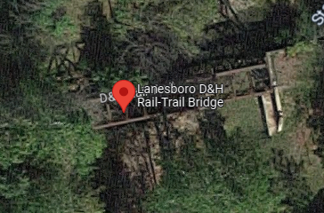
Satellite

This bridge is just a little over a 1000' upstream from the famous Erie Starrucca Viaduct. In fact, the viaduct went over the D&H.
Satellite

dcnr

Sunday, February 26, 2023

1857-1963 B&O Tunnels #15, #16, #17 and #18 near Cairo, WV and #22

B&O either daylighted or bypassed these tunnels in 1963. The abandoned Parkersburg Branch of the B&O is now the 72-mile North Bend Rail-Trail.
#15: (Bridge Hunter, daylighted in place)
#16: (Bridge Hunter, daylighted in place)
#17: (Bridge Hunter, see below for satellite, still exists because the new route bypassed the tunnel)
#18: (Bridge Hunter, daylighted in place)
#22: (Bridge HunterSatellite, by passed)


One of several photos uploaded by Robert Elder to BridgeHunter-#17
"I spent about an hour in this tunnel this morning [Oct 30, 2014]. I will upload photos as soon as I can. Because this tunnel was bypassed in 1963, it retains a very high degree of historical integrity. One can clearly see that the stone is the original material and the brick was just use for patch work. Although it is not the longest tunnel on the trail, it is perhaps one of the most significant given it's relatively unaltered condition."

This map illustrates that when an engineer designs a railroad route along a river in the mountains, she or he has to make a difficult decision concerning the height of the route. A higher route has shorter tunnels but more expensive bridges. A lower route has cheaper bridges but longer tunnels. 
1926 Harrisville Quad @ 62,500

The topo lines clearly shows where the cuts were made. The bypass for #17 is just south of the tunnel.
1964 Cairo Quad @ 24,000

#17 tunnel is highlighted with the red line.
Satellite plus Paint

2 of 4 photos posted by Jane Marshall-Cost with the comment: "Abandoned #17 Tunnel    Cornwallis, Ritchie Co., WV."
a, cropped

b

Neal Reynolds commented on Jane's post
from this website, a great read for rail buffs.
[But I could not find a link to the web site!]

"I have not yet been able to determine the locations of all of the lost tunnels on the Parkersburg Branch of the B&O Railroad. But, looking at the topography between Cornwallis and Cairo, and noting the tunnel numbering sequence, the locations in this area are obvious. I have also field checked the locations of Tunnels #14-#17. Tunnel #17 is extant, just abandoned. The other tunnels between #13 (Bonds Creek Tunnel) and #19 (Silver Run Tunnel) have been daylighted." [Robert Elder comment on BridgeHunter-#18] Tunnels #13 and #19 not only still exist, the trail goes through them.

"North Bend Rail Trail stretches 72 miles across north-central and western West Virginia. This wilderness path takes travelers across 36 bridges and through 10 tunnels and is part of the 5,500-mile American Discovery Trail, which spans the length of the United States. The trail has become one of the most renowned recreational trails through the Appalachians, and is known for its mountainous scenery and varied views of shaded tree canopies, rock cuts and farmland. Highlights include a 2,297-foot tunnel and the 'haunted' Silver Run Tunnel." [wvstateparks]

The name of the longest tunnel is Central Station Tunnel, but I have not been able to find its location. [traillink, specifies a length of 2,207'.]

I had to hunt for a while, but I did find an overview map of the trail.
BikeWashington


Bonus: #22 (Rodimer)


Austin Greenlee posted three photos with the comment: "Rodimer's Tunnel."
Crew Heimer shared
1

2

3

1957 Petroleum Quad @ 24,000

Satellite plus Paint

Saturday, February 25, 2023

1897-1938 Brown's Bridge over Monogahela River at Homestead, PA

(no Bridge Hunter; Satellite, at the end of the Old Browns Hill Road)

Stuff Thats Gone posted four images with the comment:
... the 1902 Fowler 'map' of Homestead PA shows the original 1897 Homestead & Highland Bridge aka Brown's Bridge... built for the streetcar line from Highland Park... it's eastern end landed at 2nd Avenue and was subject to congestion because of two 9-ft lanes... In 1937 the Homestead High Level Bridge now Homestead Grays Bridge was constructed which landed at 8th Avenue, flying over the multiple railroad lines... and was a wide four lanes... They dropped the "Low Level Bridge" span by Span in early 1938...
... The STG boys visited the remaining bridge abutments in the 1990s...
Photos courtesy of Library of Congress and Carnegie Library
1

2

3

4

SquirrelHillHistory
"Brown’s Bridge, also called the Homestead & Highland Bridge, opened in 1895. The 1,300-foot truss bridge with five spans cost $150,000 to build. It rose 54 feet above water level."
[This article also talks about Homestead Grays Bridge.]

Friday, February 24, 2023

1939 124mwNet Guntersville Dam on Tennessee River near Guntersville, AL

(Satellite)

TVA posted
 
124mwNet with four units
nrc and TVA
"The dam is 94 feet high and stretches 3,979 feet across the Tennessee River....The larger of Guntersville’s two locks was built in 1965 to handle the growing river traffic."

Richard D. Hamilton Sr., Mar 2021
 
John Lisby posted
TVA Guntersville Dam

TVA-tour, 15th photo of 17

TennesseRiverValleyGeoTourism
In addition to fishing, "eagle watching has become popular on Guntersville Lake, where over 20 mating pairs visit each year. One of the most easily viewed nests is on the north side of Guntersville Dam and can be observed from a small parking area at the intersection of Dam Reservation Road and Painted Bluff Road." There are several trails, one of which goes to "a cave that was used during the Civil War to mine saltpeter, a basic ingredient of gunpowder."
This photo is also on NorthAlabama.

6:47 video tour @ 0:38 via tva-virtual-tour

@ 2:09

It uses Kaplan turbines.
@ 4:40

lecbiz
To clean the stators, walnut shell blasting is used.
[I think the worker is standing on the stator.]

Guntersville Lock posted five photos with the comment:
Intermittent closures at Guntersville Lock have you scratchin your head, trying to figure out what’s going on? 
Lock and dam mechanics from Wilson Lock, Pickwick Lock, and Guntersville joined forces, and expertise to repair a bent valve stem in the Guntersville Lock main chamber. The functionality of the valve stem is crucial because it connects the valve machinery and the valve together to lift and lower the valve. Left in disrepair, Guntersville Lock and Dam would only have one filling valve. If it were to fail, Guntersville’s main lock would become completely inoperable bringing all commerce on the Tennessee River to a screeching halt. 
We want everything to...flow (like water) so, we’re working hard to get things up and running and resume normal operations soon!
Pickwick Lock shared
1

2

3

4

5


Railroad Overpass in Kilmany VIC, Australia

(Satellite, they are building a new alignment for Princes Hwy south of the existing road.)

These photos caught my eye because the arch struck me as being very flat. And then I learned that this rather big bridge is just taking a railroad over a 4-lane highway.
Major Road Projects Victoria posted two photos with the comment:
Numbers in action 🔢
On the Princes Highway Upgrade between Traralgon and Sale, we’re installing an impressive-looking rail bridge for the Bairnsdale railway line in Kilmany. Here’s a snapshot:
- 16 arch segments  
- 450 tonnes of structural steel  
- 800 tonne mobile crane and 350 tonne crawler crane to handle the lifting 
- 1000 cubic metres of concrete poured once we’re finished
In layman’s terms, that’s a lot! It’s made out of z-grade steel, a low-sulfur steel with an ability to bend and warp, which is a good thing, meaning it can flex for heavy loads.
With new lanes now open between Sheepwash Creek and Flynn’s Creek Road and Velore and Templetons Road, we’re getting close to sliding in the bridge structure in the middle of the year.

[I wish the numbers included the length of the span.]

1

2

The arch looked flat because the photos are showing just the top part of it. The railroad overpass is so big because it is heavily skewed with the highway and they dug a deep valley for the road.
Eb Rabich commented on the above post

This view shows that they are building the new road alignment south of the existing road.
Street View, Jul 2022


Thursday, February 23, 2023

1945 Monighan 200-W draglines were initially built in Chicago, IL

I have not been able to determine the location of the Chicago factories for either Monighan or Page.

PAmining posted
In 1945, Bucyrus-Monighan introduced the 6 cubic yard, 200-W walking dragline. This turned out to be a popular model, as over 50 machines were produced before the Monighan Chicago plant closed in 1958. Production was then transferred to the South Milwaukee plant, but no more 200-Ws were built.
 This particular unit was owned by Jader Fuels of Illinois, and is seen here idled in 1982.
Trevor Harbor: Hi All there were 3 of these machines in NSW Australia . used through out the state to construct irrigation channels. they were last used around the early 60's . There is a Town named Coleambally in NSW and the local community in the 80's restored 1 and it runs every 2yrs they have a local fair with the main event being the starting of the bucyrus,
Franz Sontag: Trevor Harbor is steam or electric over diesel

Dennis DeBruler commented on Franz's comment
I presume the fan and radiator on the back are for a diesel engine.
 https://www.google.com/.../data=!3m7!1e1!3m5...

Andrew Davidson, Jan 2018

Draglines are another example of "necessity is the mother of invention." John W. Page invented the dragline in 1904 to help him with a contract for work on the Chicago Canal. In 1907, Page placed an order with Monighan's Machine Works of Chicago for hoisting machinery. In 1908, Monighan changed the name to Monighan Machine Co. and started building draglines himself. "In 1913, a Monighan engineer named Oscar Martinson invented the first walking mechanism for a dragline....This gave Monighan a significant advantage over other draglines and the company prospered.... So popular were these machines that the name Monighan became a generic term for dragline.....Bucyrus purchased a controlling interest and the joint company became known as Bucyrus-Monighan until the formal merger in 1946." Draglines were like tractors and generators in that there were several manufatures of them when they were new but now there are only two. [liquisearch]

EquipmentJournal
Bucyrus-Erie 200W dragline at the Canada Cement Company plant in 1958
Page Engineering Ltd. was also based in Chicago in 1910 when Bucyrus started "manufacturing medium to large-sized draglines for surface mining operations." Bucyrus aquired Monighan in the 1930s to acess its dragline walking system.

PAmining posted
This diesel powered Bucyrus-Monighan 9-W uncovered anthracite coal on the side of the mountain, overlooking the Susquehanna River in Luzerne County PA about 70 years ago! 
Tim James: Is this a walking drag line? Looks like it from the picture.
Glen Kayser: Tim James yes it's a walker, and was a very popular one. I believe the diesel models originally had low rpm motors like Cooper Bessemer or maybe even a Fairbanks Morse.
David Stigall: fairbanks morse locomotive engine . guess who had to take the oil plug.
Alan Engnes: Boy that sure brings back memories! Back in the 60's worked on two Monigan's near Pella,Iowa. Both were powered by FairBanks Morse engines, and Cat D315 powered generators . One Fairbanks blew up and replaced it with a 6-110 Detroit. Remember the noise it created was off the charts compared to the constant thumping of the Fairbanks. Both machines worked 20 hours a day, 6 days a week. Both machines were scraped mid/ late 70's. Thanks again for the memories.