In addition to stopping all traffic on I-695 for a long time, this also stops all shipping traffic. Trucks carrying hazardous material used this bridge because they are not allowed to use the tunnels that cross the harbor. I noted above that 40 ships are trapped in the harbor and 30 ships were headed to this port. I wonder how quickly they can yank the trusses out of a channel.
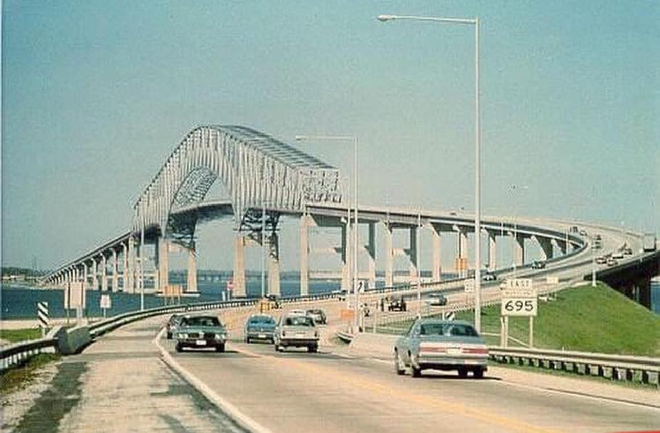
Grabbing a street view while I still can. I've noticed with some other bridges that the street views were removed once the bridge was removed.
Two of the planned four heavy lift cranes arrived by Mar 29. The reporter implied that the yellow crane is rated at 1000 tons.
The yellow crane is the largest crane on the east coast. I basically shoved the cursor across the rest of the video. I don't need an official to stand at a podium and tell me that the cleanup is going to be complex or that the closure of the port has a big impact on Baltimore's economy.
Two cruise ships won't be able to return people to their planned destination.
The clousre impacts the nation with respect to cars, coal and sugar. 8,000 people worked at the port.
Lucibello Heavy Equipment photography
posted five photos with the comment: "As part of the Francis Scott Key Bridge removal effort @donjonmarine has deployed the Chesapeake 1000. So for all the people wondering here’s a history of the Chesapeake 1000. This Derrick barge was originally flagged as the Sun 800. Built in 1972 the derrick portion of the barge was constructed by the American Hoist and Derrick company who would go on to become AMCLYDE. Side note this is the same company who built Weeks 526. Originally the main block was capable of picking up 800 ton at 65ft but after being upgraded the crane is now capable of 1000 tons at 63’ from the stern fendering. Now for some size context the barge has a length of 191’ and width of 101’. She weighs in at 2484 tons gross and has changed hands 3 times in her career. Sun sold her off to the Penn Ship company who renamed her to the Penn 800. Eventually Penn would upgrade the capacity to 1000 tons after experiencing some boom damage during a storm. After her time at Penn Ship she was sold to Donjon Marine who currently operates this shear leg. The severe bow list, in some of the photos, is the result of the water ballast used as counterweight."
Kevin Wright: I am wondering what the name and capacity of the Huge Barge Crane used tearing down the old bridge next to the New Coumo Bridge in NY .. I drove by there a few times and that crane was huge..
Sean McQuilken: Kevin Wright that is the Left Coast Lifter, ~1900 ton capacity. She is currently “dry stacked” in NY harbor and wouldn’t be able to respond quickly as she hasn’t worked in a number of years. [I was wondering about this crane.]
Kevin Wright: Sean McQuilken Thanks for the info.. so after working on the bridge it was dry docked and hasn’t worked since..??
Mar 28:
 |
Merchant Marine Updates by CompMan posted
Baltimore Bridge's Weight is Pinning Container Ship Dali to the Bottom PUBLISHED MAR 28, 2024 3:26 PM BY THE MARITIME EXECUTIVE In a reversal of the usual order for a major marine salvage operation, the U.S. Army Corps of Engineers (USACE) and its contractors will make the first big move in getting the wrecked container ship Dali out of Baltimore's ship channel. Dali's bow is technically aground in the channel, said Vice Adm. Peter Gautier at a press conference Wednesday, because of the vast weight of the steel bridge span resting on top. The ship is pinned to the bottom and cannot move. There are no indications of damage below the waterline from this unusual load on the hull, but the wreckage of the span will have to be removed before the salvor - Resolve Marine - can take over and get the ship safely out of the channel. A dive inspection of the bow is scheduled for Thursday. The span is in the USACE's set of responsibilities, Gautier said, and the Coast Guard will be working closely with the agency and its contractors as they perform the delicate task of pulling off the steel. The wreckage will be transported to a scrapping site at nearby Tradepoint Atlantic, Dredging Contractors of America CEO Bill Doyle told The Maritime Executive. He could not give an exact timeline for the work's completion, but said that it would be faster than many observers might think, thanks to an abundance of available private-sector resources. The span is the biggest complicating factor in the salvage, but not the only one. Once it is removed, the response team will have to survey the bottom for debris and determine how entangled the vessel is with the remaining pier structure, Gautier said. There are also about a dozen containers on the bow of the ship that were damaged by the falling bridge, and two more that went into the water. National Transportation Safety Board chair Jennifer Homendy said Wednesday that some of the damaged boxes on the bow contained hazardous materials, and a sheen from a containerized cargo release has been observed in the water around the ship. The ship has about 1.5 million gallons of fuel oil and lube oil on board, but no signs of petroleum release have been spotted, Gautier said. compman source : The Maritime Executive I find the statement that the bow is grounded pretty amazing. There must not be much leeway underneath. |
I hope
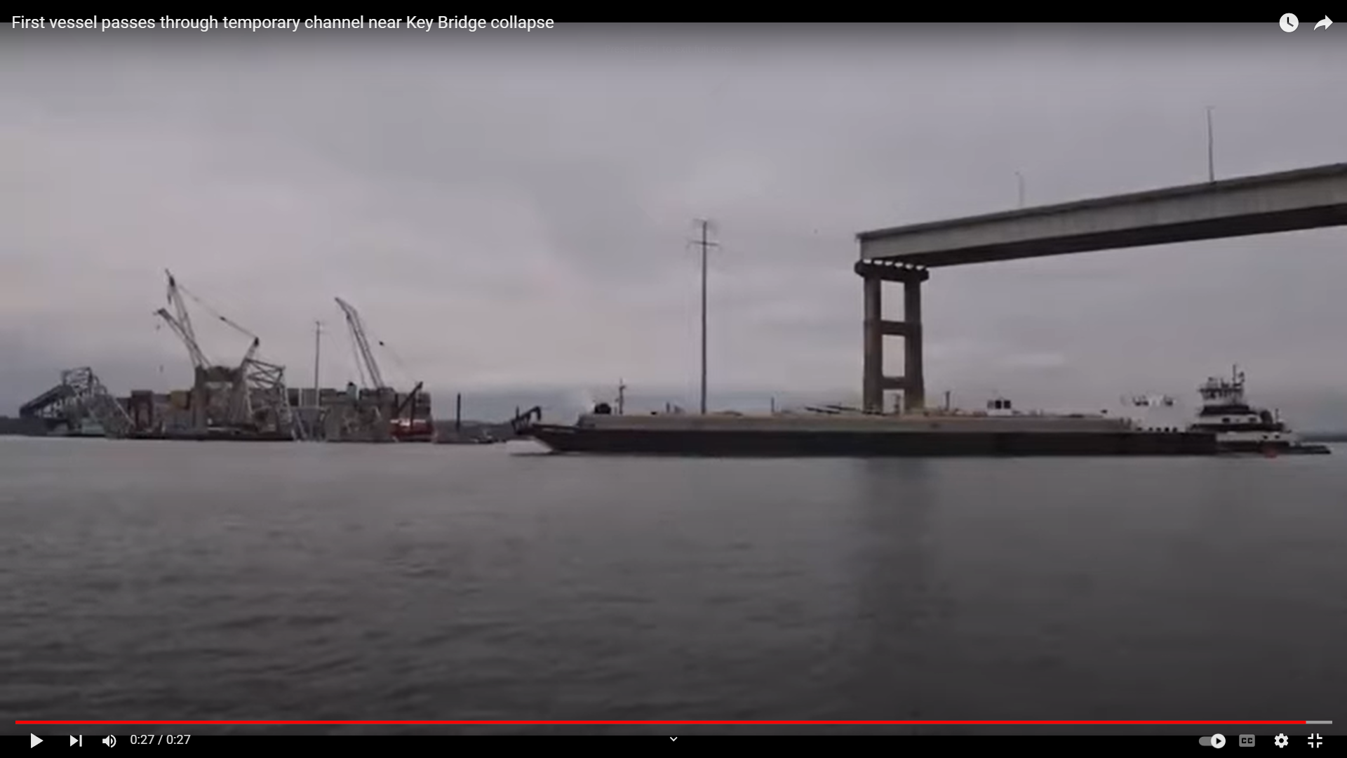
this news on Apr 1 of opening two auxiliary channels is not an Aprils Fools joke.
It's not. An 11' (3.3m) channel is open on the north side. They are dredging to create a 13' (4m) channel on the south side. (It appears that the north channel just needed some marker buoys to be placed by the Coast Guard. So now I wonder why someone didn't think of this earlier.)
This was the first vessel that went through on Apr 1.
Apr 2: the second alternate channel on the south side is open. " It has a controlling depth of 14 feet, a 280-foot horizontal clearance, and a vertical clearance of 124 feet." [
Apr2]
 |
1 of 22 added by Mike Hugg Media
Due to my work schedule and upcoming travel, I’ll be posting what I can every so often regarding the recovery efforts of the Key Bridge. Unfortunately it won’t be as many updates as I was hoping for, but I’ll still capture what I can. 03.31.2024 Cranes have began moving in to start removing the first pieces of steel from the collapsed bridge in an effort to open a passage for other vessels. [The crane on the right is the Weeks 500 that I have heard about. I saw a video where a yellow boom was skewing, but I have yet to see anything lifted.] |
Apr 8, 2024:
 |
Facebook reel
[Using the 500-ton Weeks crane to remove containers strikes me as overkill. Especially since most of the containers on the bow are empty. I've seen a video that showed at least four cranes on barges. It seems like they could handle containers. I have seen some truss segments on barges, but I have yet to see a lift of a truss segment.] |
So some of those cranes are helping to create liftable truss segments.
Apr 11, 2024: The second auxiliary channel is big enough that the Weeks 500-ton crane can work on the up-river side of the bridge.
This confirms that they are using the big 500-ton crane for the little container loads and a standard crane-on-a-spud-barge for the truss segments. This seems backwards to me.
They are using more of the capacity of the 500-ton crane. The radius or reach also affects the capacity of a crane, and this reach is significant. Maybe a mobile crane on a barge can't handle 3 containers at that radius.
Apr 14, 2024: finally, I've been able to see the Chesapeake 1000 in action.
Mallory Sofastaii
posted three photos with the comment: "Here's the Chesapeake 1000 in action. It's the largest floating crane on the Eastern Seaboard, and it's being used to remove large pieces of the Key Bridge as crews work to open a Limited Access Channel that allows one-way ship traffic to the Port of Baltimore. Photos courtesy of the
Baltimore District, U.S. Army Corps of Engineers"
 |
| 1 |
 |
| 2 |
 |
| 3 |
Note the annotation that it is a 440-ton lift.
Baltimore District, U.S. Army Corps of Engineers
posted two photos with the comment: "NEW TODAY [Apr 14, 2034, a Sunday]: Unified Command salvors use the crane barge Chesapeake 1000 to move a large piece of supporting steel from the collapsed #FSKBridge on Sunday. 🏗 The Chesapeake 1000 is the largest floating crane on the Eastern Seaboard, and removing these large pieces will help open a Limited Access Channel that allows one-way ship traffic to the Port of Baltimore."
 |
| 1 |
 |
| 2 |
This video catches the actual lift. I wish they would specify how much the video was sped up.
 |
| 41:44 video @ 21:26, I shoved the cursor until found this. |
Apr 25, 2024: first commercial ship through the new limited-access, 35'-deep channel.
This video is worth noting because it shows the removal of the first truss piece off of the
Dali, closeups of the bridge debris laying on the
Dali, the big hydraulic claw
in action and an explanation that they are going to use "precision cutting" to cut up the big truss. From context, "precision cutting" means that they are going to use a controlled demolition (explosives), but the
spokesperson would not admit they are using explosives. He insisted on using "precision cutting" every time. An "energetic felling" allows them to make all the cuts at once with no workers near the truss so they don't have to worry about how things will fall after a cut is made.
Both the crane and the claw are rated for 2,000,000 pounds. The claw is the largest in North America and is named "The Gus."
This is a proposal for the new bridge that was done on speculation by a design company. I don't understand why there would be piers under the side spans that also have cable supports.
Now that they have found the sixth, and final, worker's body, they can get on with precision cutting the 4000 ton truss to get it off the Dali. He said the crane count is up to 22.
After some wether delays, the precision cutting of the truss happened on May 13, 2024.
This is Minorca n Mullet's own 4k camera.
On May 20, 2024, they moved the ship away from the bridge and took it to a dock.
This post is a nice update.
Last Bridge Section Removed Clearing Way for Reopening Baltimore Channel
PUBLISHED JUN 5, 2024 1:22 PM BY THE MARITIME EXECUTIVE
The last large sections of the collapsed Francis Scott Key Bridge have been removed from the channel in Baltimore clearing the path for the reopening of the full channel over this coming weekend. Normal navigation is expected to resume next week.
The Army Corp of Engineers reported on Tuesday, June 4, that the last of three pieces of what they called Section 4, the parts of the bridge truss that had been resting on the Dali and the area around the ship, was lifted from the water. The first of the three sections, weighing 140 tons, was lifted on May 24 and the second section weighing 470 tons was lifted on June 1.
The operation for this portion of the recovery was called “extensive” requiring approximately 200 tons to first be cut and removed before they could handle the main pieces. A spokesperson for the Army Corps explained that these sections were buried deep in the river mudline. They said the effort was more complex than initially estimated and required “shaking and hammering” to free the steel from the mud.
Using concrete breakers, underwater surveys, and oxyacetylene torches, they separated tons of concrete roadway, cable, and steel rebar from Section 4 while removing debris with clamshell dredges.
“The final truss lifts are an important next step to re-opening the full 700-foot width of the federal navigation channel,” the Army Corps noted. The sections lifted from the water have been moved to the Sparrow’s Point area, where the recycling is being staged.
The last phase of the operation will include dredging and a final inspection of the channel to ensure that there are no remaining hazards. Some of the teams working on the operation have already been reported to be packing their gear and leaving the site.
No official timeline was released but reports are widely saying that the last work on the federal channel will be concluded between June 8 and 10. The channel is expected to officially be reopened to its 700-foot width by Monday, June 10 from the current 400-foot limited access channel.
The Dali remains at the Seagirt Terminal although local media reports have shown images of ongoing work removing additional debris from the vessel. It is still expected that the vessel will be shifted in the coming weeks to a shipyard in the Norfolk, Virginia area.
Baltimore officials are highlighting the work will have been completed in approximately 80 days. The focus is already shifting to the replacement efforts with Maryland's Transportation Authority having issued a first request for proposals. The deadline is June 24 with media reports saying a contractor will be selected this summer, and the final design will be selected within the next year. The bridge is expected to be completed by the fall of 2028 at a cost of $1.7 billion.
compman
source : The Maritime Executive
[A comment indicated they also sent four tugboats with it. The containers were not removed in Baltimore because it needs the weight to get under the bridges. Lots of comments about "out to sea." I looked at a map and it is true that you can get to Norfolk without leaving the Chesapeake Bay.


%20Barge%20collides%20with%20bridge%20in%20Oklahoma%20-%20YouTube.png)


%20Facebook.png)


%20Facebook.png)


%20Facebook.png)
%20Facebook.png)


%20Facebook.png)


%20Facebook.png)