|
| River View, Oct 2015 |
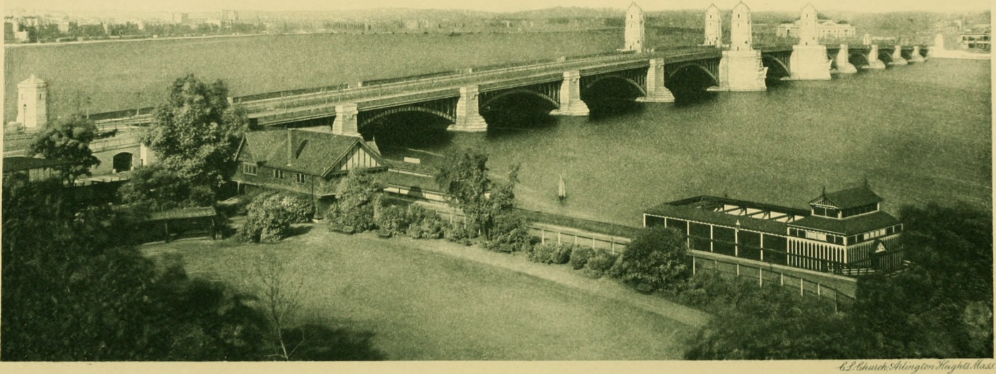
"The deck, 105 feet
wide and 1728 feet long, is supported by eleven steel-arch
spans varying in length from 101 to 188 feet." [HAER_data]
Bridge Hunter and Historic Bridges disagree with the HAER_data:
Length of largest span: 243.1 ft.Total length: 2,134.9 ft. (0.4 mi.)Deck width: 90.6 ft.
 |
| HAER MASS,13-BOST,80--3 3. Detail view of the piers and towers - Longfellow Bridge, Spanning Charles River at Main Street, Boston, Suffolk County, MA |
"The restoration of this bridge is the first known bridge in Massachusetts to use historically correct riveting in the restoration project. Specifically, rivets were used to create replica v-laced columns for the arch spans." [HistoricBridges]
They have sacrificed traffic lanes for bike paths. The tracks carry the Red Line.
 |
| Satellite |
 |
| Street View, Nov 2022 |
 |
| Roger Williams added Looking at the Longfellow Bridge in Boston in front of the Prudential Center Roger Williams shared Roger Williams shared |


.jpg)
.jpg)