These are notes that I am writing to help me learn our industrial history. They are my best understanding, but that does not mean they are a correct understanding.
Marty Bernard shared a Flickr link CB&Q 4960 taking a fan trip across the Fox River Bridge at Montgomery, IL on June 20, 1965. Please look at it full screen. Robert Chawgo: Beautiful....and the C&S auxiliary water tender. Marty Bernard posted
CB&Q 4960 Crossing the Fox River at Montgomery, IL
(Satellite, some of the embankment for the south end still exists)
Willliam Shapotkin posted a photo of a bridge and asked for some information. These notes are a summary of the responses.
A corrected version of the photo was provided by Roy Vombrack.
William's commnet: This undated photo was recently posted by Linda Hoffman on the facebook page "Elgin Nostalgia & History (Elgin, Illinois) USA." According to the information provided, this location is on the east side of the Fox River near Trout Park (which is located just south of the Illinois Tollway (I-90) north of Elgin).
William Shapotkin commented A fellow (Craig Holmberg) came up with what appears to be the answer: "Possibly it's the one for Elgin Torpedo Sand. This would make it just south of 90 and just west of Trout Park. (from Steam Trains to Lake Geneva)" Map from said book is below [above]:
Roy Vombrack commented Here's an interesting article from the Elgin Area Historical Society's "The Crackerbarrel" newsletter, Jan. 2008, about the bridge... (c)2008 Elgin Area Historical Society [It was a gravel and sand pit. Near the end they even shipped black dirt. The bridge was removed in 1937.]
Dennis DeBruler commented on Roy's comment Roy Vombrack Here is the same map from USGS where you can get bigger views and you don't have to worry about the copyright. https://livingatlas.arcgis.com/topoexplorer/index.html It appears that the east end of Willow Lake was the quarry pit. The bridge is still in the 1940 map, but it is gone in the 1962 map.
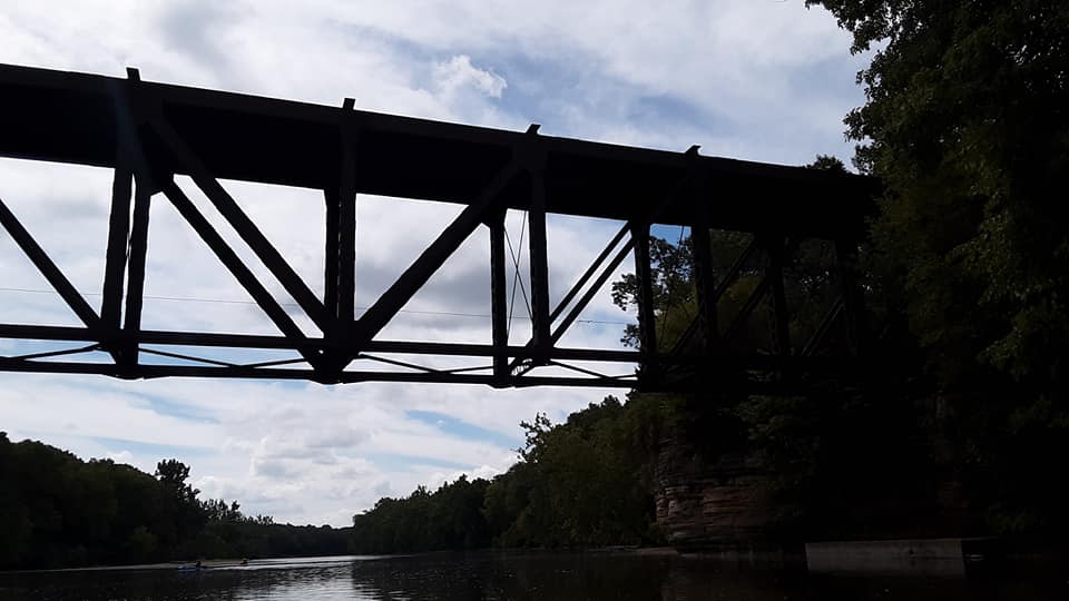
A photo of the downstream side of the West Channel Bridge from a trail bridge.
20170401 8350
An "artsy" photo, but it is more useful as a memory aid photo to remind me that I shot it from the trail bridge.
I had a hard time finding a clear view of the bridges because there are trees along the shores of Hurds Island. This is the East Channel Bridge. Note some leaves of the trees are in the river. I made this field trip because the local rivers were running high.
20170725 0614
This is the West Channel Bridge. Note the river was almost on the trail. There were parts of Hurds Island that were under water. In fact, the drive to the parking lot on the island was closed during this trip.
HalstEd caught the river during a more normal flow. Note the extensions on the north side of the pier. They were covered in my July 25, 2017, photo because of the high river level. The extensions must be more than just ice breakers. I presume that they help the current in the river to use the east and center parts of the river rather than pile up against the west bank and cause erosion.
HalstEd Pazdzior posted RCHI476 over the Fox River. 7/7/22 [Not only did he catch a Blue Bonnet, the BNSF loco is H1.]
Note that during the Apr 1, 2017, trip the river level was right at the top of the extensions. I was able to park on Hurds Island during this trip. (I don't know why the exposure is so dark. Did I catch a lot of glare off the river?)
20170401 8354
Since the leaves were still off the trees, I got a little more of the East Channel Bridge.
On the July 25, 2017, trip, I caught a train going across the East Channel
The train continued to roll across the bridge as I walked on Hurds Island from the east side to the west side. Note the water under the swings because the river was running high.
Jeff Wojciechowski posted [On the west side of Hurds Island on the downstream side.]
Chuck Pfeiffer posted two photos with the comment: "Saw this parked on the Fox River bridge just south of downtown Aurora earlier this week. That's a horrible spot to park. The bridge has crumbling concrete."
1
2 [This would be the downstream side of the West Channel. HistoricBridges-west points out that this bridge is skewed.]
On July 25, 2017, after we had a lot of rainfall, I did a trip to take photos and videos of dams with a high river flow. This is from the east bank of the Fox River in Montgomery, IL.
20170725 0601
(new window) As the comments in my video indicates, I was surprised to see multiple hydraulic jumps.
Because I was in the area, I checked out what the dam looked like when there was less water in the river. I'm learning that the flow in the river is evidently always rather brisk. The river must be on a rather significant gradient. Also, the multiple hydraulic jumps may be caused by the dam's design since I still saw them with less water going over the dam. If so, I wonder what the design looks like.
I got a closeup of the high water mark on the dam's abutment. I can't figure out what caused the "jagged" watermark that is way above the regular watermarks.
I took this photo to record that the water level was rather low. During my July 2017 visit, the water had been up on the flat grass that we see on the far bank. And the trunks of some of those trees were in the water.
At the end of the second video, I was surprised by how clear the water was. I wonder what the white stripe signifies.
A standard ogee crest dam has a curved top and a rather vertical drop to the river bed. But that design causes dangerous undertows at the face of the dam that have drowned people. It appears that this dam has a short vertical drop that then has a shallow incline down to the river bed. So instead of one huge hydraulic jump that causes a backflow towards the dam face, this design seems to have multiple, smaller jumps that acts more like a rapids instead of an undertow. Even though it is not a rolling dam, I used the "wwDamRolling" because it seems to be an alternative (safer) design to the rolling dam.
Given the cut-stone piers and a trail going under a truss, I'm going to have to up my priority for a field trip to the South Elgin area.
Nikki Burgess posted 10/10/2015 at CN's Illinois Central Fox River Bridge in South Elgin. Then brand-new CN 3007 East leads train M338 over the river in the perfect fall sunshine. Of course, in a REALLY perfect world, the FRTM would have shown up with a trolley and sat in that clear spot on their tracks in the lower left, LOL. But you can't have everything.
Rotwang Manteuffel posted The Aurora Elgin & Fox River Electric was abandoned in the mid 1930s, except for a few miles of track between the Illinois Central interchange in Coleman, Illinois and the Elgin State Mental Hospital. Flat motors were used to deliver coal to the hospital and service the Kerber Packing Company. The freight service was dieselized after WW2 and continued to 1974. Today, the Fox River Trolley Museum operates over these tracks. Scott Greig: Fox River = tracks in foreground. The IC's Iowa Division is overhead. Edward Kwiatkowski shared
The Dillon Collection at the Illinois Railway Museum’s Strahorn Library, is largely a collection of steam photos but not exclusively so. In this picture, Illinois Central 4-8-2 number 2452 is shown crossing the Fox River at Coleman, Illinois, just a short distance south of Elgin. In the foreground is Aurora, Elgin & Fox River work motor number 49 on track that is now used by the Fox River Trolley Museum. Unfortunately motor 49 is no longer there and was almost certainly retired and scrapped, as was 2452 in February 1960.
The Strahorn Library houses thousands of books, tens of thousands of periodicals and more than a hundred thousand photographs, all centering on the subject of trains and railroading and all held to support research and scholarship into the railroad history of the United States. It is at 118 E. Washington Street in Marengo, Illinois, is normally open from 10AM to 2:30PM on Wednesdays and visitors are welcome. For those unable to visit, we can provide access to our collections via telephone (815-568-1060), e-mail (strahorn@irm.org), or online catalog (librarycat.org/lib/IRMStrahornLibrary).
All materials are provided only for non-commercial purposes according to the “fair use” provision of U.S. Copyright Law which permits use of copyrighted material for criticism, comment, news reporting, teaching, scholarship and research.
[Source: Dillon 1686, Strahorn Library, Illinois Railway Museum. Posted by Jan Young]
Robert Dillon: So glad his collection is available so others can appreciate his years of collecting and his passion for IC.
Jan Young: Robert Dillon it is now fully cataloged and archivally stored for access far into the future. Thanks for your support.
Pyroman Walper posted five photos with the comment:
Hello,I'm new here, but love what I see. I travel alot, and keep thinking about all the places im Going to pic n post.Then I got to thinking... I live in a very old, very small town, and drove around the block today and found four amazing abandoned structures, all within 5 minutes.This first one, the old Millbrook one lane Bridge. The deck is made out of railroad ties.It's been abandoned for at least 30 years, and it's scheduled to be torn down soon.As a kid we would climb to the top of the trusses and jump into the Fox River over and over again.They recently condemned the bridge to everyone, even foot traffic.I drove my car and truck over that bridge hundreds of times, and watched my Uncle drive a semi truck and trailer over it. I would drive that bridge today (if I could get away with it, lol)
Leigh Ann RentschlerI would freeze up with fear driving over that!! I’m not scared of much, but the fear of a bridge collapsing while I’m driving over it (and spiders) makes me sweat just thinking about it. Pyroman WalperLeigh Ann Rentschler naw, that bridge is solid. It survived the big flood back in 2002(ish). It had 6' of water over the top of the deck. Loved climbing to the highest point and jumping into the river as a kid. It's usually only 3' to 5' deep, but we waited for it to get to 6' before jumping in, lol Pyroman WalperOh, and if u went 30mph+ and look out ur mirrors, u could see the RR Ties bouncing up into the air as u drive.
1
2
3
4
5
It continues to amaze me how stone piers can pass the test of time and floods.
The piers do have the slant on the upstream side to help break up ice flows.
Steve Conro via Bridge Hunter
Although they do need some maintenance or mother nature will win.
Steve Conro via Bridge Hunter
I added the label "bridgeLost" because the NIMBYers won. The village blocked the forest preserve's effort to save the trail bridge. Evidently the local police couldn't keep the noisy late night parties off the bridge. It is costing the county $76,600 just to study how to tear it down. [WSPY]
Forgotten Railways, Roads, and Places posted A historic bridge in Millbrook, IL is slated for demolishment due to structural deterioration. The Kendall County Forest Preserve tried to save the bridge by attempting to enter into an intergovernmental agreement with the Village of Millbrook in 2015. The forest preserve wanted an easement to allow its trails to pass over Dobson Ln., but (unfortunately) Millbrook trustees voted unanimously against the intergovernmental agreement, bowing to neighbors' complaints that late night parties on the bridge were a nuisance. Christian Landorf I was at a meeting with the bridge last night, an engineer agreed that temporary repairs are possible and for way under a million dollars, these temporary repairs can prolong the bridge a few more years and hopefully money will become available for a full restoration then. Christian Landorfhttps://www.change.org/.../kendall-county-forest-preserve... Frank Furter I read they recalled the demolition contract. Pending the next board meeting
"Bridge once had two truss spans. A Whipple Deck Truss and a Pratt Deck Truss. The whipple was replaced with I-Beam Spans" [BridgeHunter] They have not only kept the Pratt truss, they still have wooden approach trestles on the east side.
John Joseph Walsh III posted twelve photos with the comment: "Just a few pictures I took of the bridge in Sheridan while kayaking on the Fox River with my future in laws and family on Saturday 08/29/20."
1
2
3
4
5
6
7
8
9
10
11
12
Charles Heraver posted
Sheridan, IL 7-16-12. The Illinois Railway's Ottawa - Eola train is crossing the Fox River. THe SD50s look nice, but EMD's 50 series was pretty much junk when new. Chris Paciocco Nice Tunnel Motor sandwiched in the middle. Kevin Vahey They were still complete junk this many years later. I hated running those things. Ben Teeters I didn’t mind em, as long as I had a set of black engines to go with. Kevin VaheyBen yeah cus the 45s would do all the work!
[Note the short sand cars. Sand for fraking is what provided the revenue to rebuild this route.]
It is obvious that one of the trusses of this bridge was replaced with steel bents and girders. So I dug deeper. "Bridge once had two truss spans. A Whipple Deck Truss and a Pratt Deck Truss. The whipple was replaced with I-Beam Spans." [Bridge Hunter]
1. CB&Q 4960 at Sheridan, IL on July 21, 1965 crossing the Fox River. Roger Patelski photo
2. CB&Q 4960 at Sheridan, IL in July 1963 crossing the Fox River. Roger Patelski photo
3. CB&Q 4960 at Sheridan, IL in October 1965 crossing the Fox River. Roger Patelski photo
Marty Bernard posted four photos with the comment: "CB&Q 4960 out on a fan trip crossing the Fox River Bridge at Sheridan, IL on June 10, 1962."
1
2
3
4
Don Crimmin posted
Oakway painted SD60 9041 spent some time on the IR about five years ago. Here it leads a heavily-powered westbound over the Fox River Bridge at Sheridan, IL 3-10-14. It sure added some color and variety to the roster.
Gilbert Sebenste posted Over the river and through the woods, to the sand plant we go! Led by BCOL 4605, the IR westound sand train on 6/29/19 heads across the Fox River at Sheridan in the blue light.
Jason Leverton Flickr 2012 Photo has four locomotives, three paint schemes and a former SP tunnel motor. It is probably pulling a "sand train." It is well worth clicking the link.


%20Chicago%20Area%20Railroad%20Historians%20_%20This%20undated%20photo%20was%20recently%20posted%20b.png)


.jpg)