Wow! Someone asked about the story behind the locks in Akron, OH; Thank you! I never expected more than a passing interest in them. But the story is long, even in my abbreviated version, so here goes. I hope you enjoy:
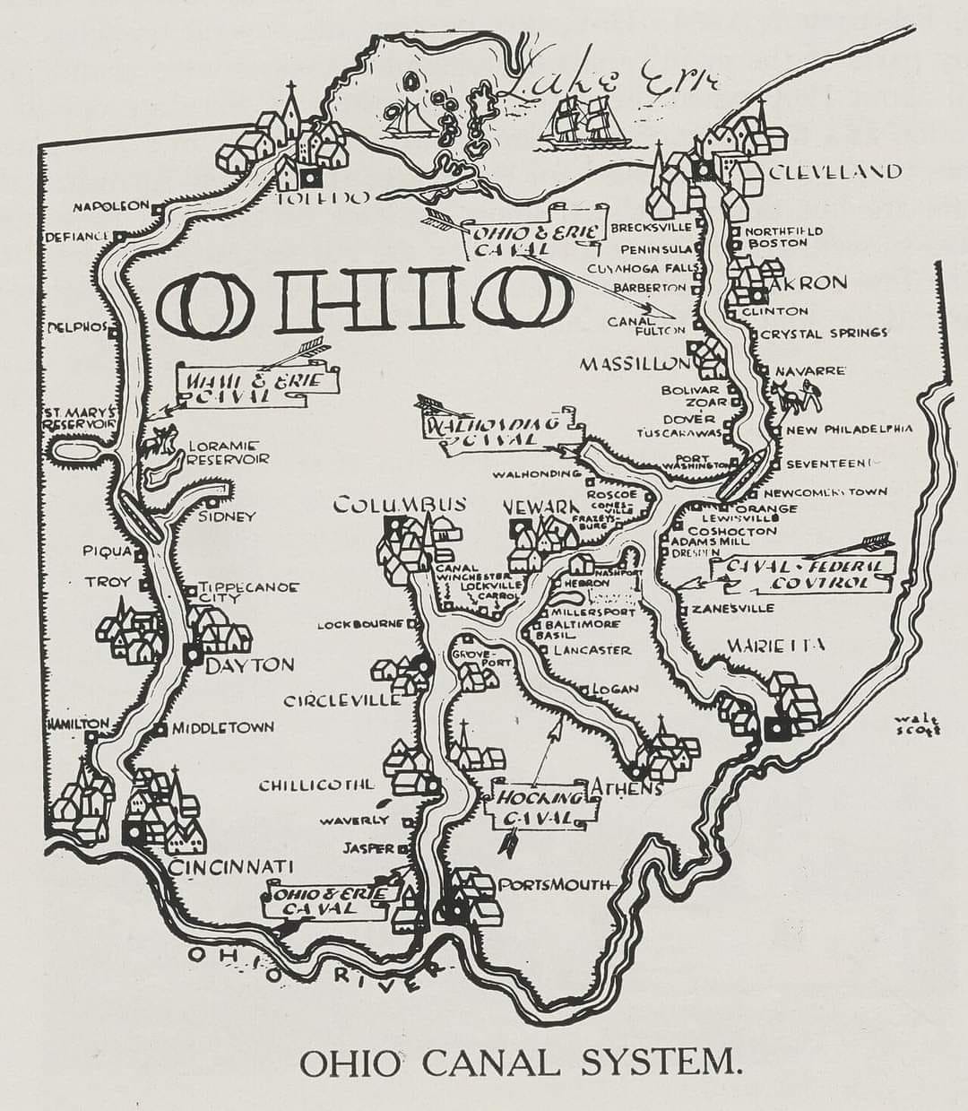
Akron’s name comes from a Greek word meaning elevation, high point or peak. Akron and its bigger region, Summit County, were both named because they were the highest points on the Ohio and Erie Canal when the canal was operational, directly following the watershed path between Lake Erie to the north and the Ohio River to the south.
The stretch of canal began in the early-mid 1820s and was completed in 1827. At the time the region and Ohio were growing rapidly and industries moved into Ohio and needed a means of moving people, crops and food, workers and goods. A set of 24 locks comprised the works completed in 1827 and became a significant thoroughfare in the Ohio Erie Canal Circuit. The 24 locks leading to Cleveland were in a stairstep pattern, leading to them being commonly called “The Cascade”. Some writers have stated locks 1, 2, and 3 were the most famous: I would amend that somewhat and simply say they were the most commonly known. As a kid in the 1960s even I was familiar with them.
The initial decades after the locks were in place were an enormous boon to industry and The Ohio and Erie Canal System stood as one of the greatest engineering feats in the country. Several industries and companies made their home in Akron right along the lock route: in particular perhaps the last industry giant to use the canal for its original purpose. A German immigrant and mill worker, Ferdinand Schumacher began mass producing oatmeal in Akron in 1856 (his company would later merge with several others and become Quaker Oats, also headquartered in Akron). Demand for oats skyrocketed during the Civil War as a cheap and convenient alternative to meat or other high-calorie foods, and the canal and hub of railroads in Akron allowed for easy milling and shipping.
In 1863 Lock 3 was opened for private businesses to use, and I do know a lumber yard used it. I believe the 3 locks were also allowed to be sold: I can't remember if the lumber company actually bought Lock 3.
But in the paragraph above I mentioned another mode of transport, which would be the death knell for the Cascade: the locomotive. As technology improved it was clear railroads had far fewer limitations to travel, and their range was far greater. But, as events would unfold the locks weren’t dead: just morphed.
When Goodyear (and Goodrich) started gaining steam in Akron Goodyear learned the process of vulcanizing rubber; a chemical binding process that strengthens rubber by heating it with sulfur and other additives. The process creates a chemical reaction that bonds the rubber molecules, making the rubber more durable, flexible, and adaptable. At first neither company did well but after vulcanization and the World Wars Goodyear became synonymous with Akron. And how did the locks fit? The water and engineered pathways were necessary for the vulcanization process.
The history of The Erie and Ohio is fascinating, and these bits of information are what I remember clearly-but there is so much more. It is really worth the time to study it. The locks drew in many Irish immigrants to build and work them: the first mass production company in the US started along the locks route, making clay marbles for children’s games. Companies also found a workable, strong clay in the area and as well as the toy marbles made sewer pipes and tiles, many of which were used in the New York City subways.
Akron is the Rubber City alright, but its history to me always seems unusual for the region. Locks 1, 2, and 3 still exist in one form or another and several organizations are trying to save them permanently. One, I think Lock 2, was turned into a canal-side restaurant about 6-7 years ago.