Sunday, July 27, 2014

Fairbanks Morse Generator and Howitzer

(Update: content that was here concerning tractors and marine engines has been moved to Beloit, WI factory.)

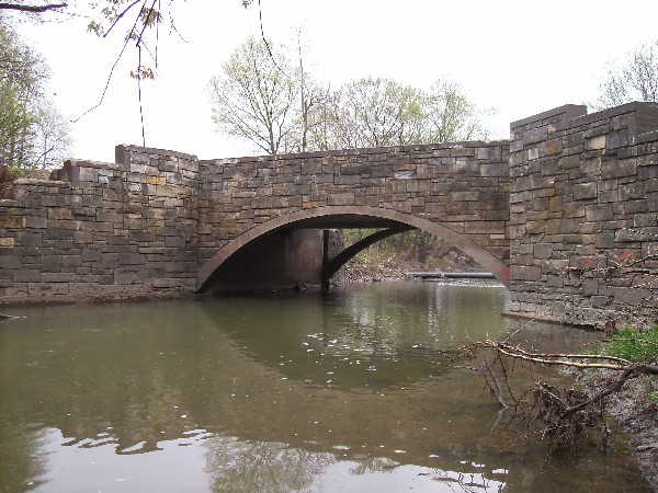
While driving through Williston along US Alt 27 in Florida, my eye caught a grey machine off to the right, so I pulled into the next parking lot. In a city park they had a Fairbanks Morse engine coupled to a flywheel, a Fairbanks Morse generator, and a couple of belt pulleys.

20140723-24 0027
Note the spanish moss hanging on the tree in the background. And that is the first time I've seen an exhaust pipe that looks more like a smokestack.

The sign says:
An electrical distribution system was purchased for $33,000 on June 11, 1923, from the Williston Manufacturing Company. Included was the generator, ice plant, cold storage plant, water tank, a ten-year-old bay horse named Charlie, and a wagon with a harness. This generator was used for seven years to produce electricity and had a capacity of 100 kilowatts.
 I assume one of the belt pulleys drove the compressor for the cold storage and ice plants and the other drove a pump for the water tank. I recognize the Fairbanks Morse name as one of the companies that made diesel-electric locomotives in the 1940s and 1950s. They made an opposing piston design that did not work very well in locomotives, but did work very well in the submarines of WWII.

The coils on the engine side of the generator are in good shape. This shot is framed by the rim and a spoke of the flywheel.


But a lot of the coils on the pulley side have been damaged. Most of the coils on the left side are gone or severed like those that you can see at the bottom. Also the 2 contacts are not aligned with the 2 slip rings. And I had expected to see 3 slip rings because normally 3-phase power does not have one of the phases at ground level. I guess it worked for only 7 years because something slipped or fell off and caused a lot of damage. I don't think vandals would have enough energy to cause this kind of damage.


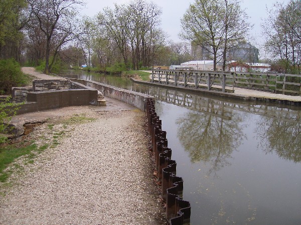
The city park that is displaying this generator is also displaying an 8-inch Howitzer.


You can see the generator in the background below the elevation arm and the exhaust stack to the right of the tree. The sign says "This Howitzer 8" M2 Cannon was secured by the City from the Anniston Alabama Army Depot on April 30,1975."

Both signs had the information:
Williston was incorporated as a town in 1897 and chartered as a city in 1929. On October 10, 1915 this area was designated as a public park by the Mayor and Town Council in a deed from J.B. and P.A. Epperson It is known as Epperson Park.

Update:
Steve Bolte posted four pictures with the comment: "For the Fairbanks Morse aficionados. 300 horsepower and 300 RPMs." But the fourth picture seems to be a different engine.

1

2
3

4
They made small engines as well.

Screenshot from Ted Gibbons' posting
1945 Fairbanks Morse used to run the Vacuum pump in my great Grandpas cow barn we believe it's been in our family since new.
Bill Adams Love those salt blocks!!
Ted Gibbons It's hard not to love them so simple and robust.
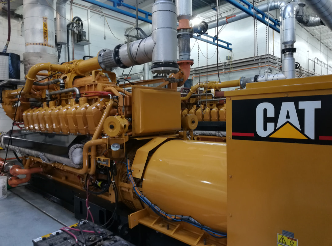
This power plant has 1940 and 1960s generation of F-M engines plus the first and second generations of EMD engines. I don't care for the "tour" format, but there are enough useful scenes to make these videos worthwhile. For example the slow and fast starter motors on the modern EMD self starting generator.
(new window)
z

(new window)


Tuesday, July 22, 2014

Morris, IL: Former Gebhard Brewery

(Satellite)

When driving north on Calhoun Street in Morris, IL, past Washington Street, my wife saw some neat buildings at the end of the street to the West. So I went around the block and checked it out. Later, I learned they were the Former Gebhard Brewery. Joe Balynas reports that it was built in 1866, and the tower was added in 1896.

20140710 0088
Because of the fence, this is the best angle I can get on the incinerator in the back and the building on the south side.


Bill Law posted
The Gebhard brewery, Morris, IL built 1896, before the fencing was put up.
Joseph Da Hoff Address please?
Bill Law Joseph Da Hoff https://lmgtfy.com/?q=gebhard+brewery+morris+il
Dennis DeBruler I had to look it up to fix my own notes:
https://www.google.com/.../@41.3572817,-88.../data=!3m1!1e3

Bill Law posted eight photos with the comment: "Gebhard Brewery, Morris, Il."
1

2

3

4

5

6

7

8

Morris Nettle Creek Aqueduct

I noticed that the I&M Canal State Trail had signs posted along Calhoun Street in Morris that the trails were closed. So I went to Gebhard Woods State Park to try to go to the Nettle Creek Aqueduct from the downstream end. But I encountered more "trail closed" signs. I came across something later that indicated the trail was closed because a flood destroyed the aqueduct. In fact, an April 19, 2013, article in the Morris Daily Herald indicates it would have been the same flood conditions that caused the Marseilles Dam accident last year.

8Nuts MotherGoose
8Nuts MotherGoose
Note that the grain bins in the background would be of the third facility pictured near the end of the Two Towboats posting.

American Canals has some 1998 photos and then additonal photos posted April 27, 2013, that shows the flood damage.

Paul Braun has made a panoramic shot that is well worth the mouse click. It includes the overflow waterfall. And Joe Balynas has another nice shot including the waterfall. Some of his other canal pictures are also quite artistic. Steve Conro has several photos including the sluice gates that control the spillway and the original wooden version. And Skip Maskeri got some pictures of this and other I&M Canal spots during the flood.


Monday, July 21, 2014

Two Towboats near Morris, IL

The I&M Canal in Morris is within a few hundred feet of the Illinois River. While I was taking pictures of a railroad bridge over the canal, I heard a diesel engine running hard. So I trotted upstream along the canal to the park between the canal and river. And confirmed that the diesel engine was on a towboat.

20140627 0123
So I ran past the trees so that I could get a clear view.


I'm glad I did because, looking at the picture, I see it has a pilot house that goes up and down and the rest of the towboat is significantly lower than a normal river towboat. One advantage of taking pictures is that I can later spot things that I did not notice in "real time." I'm very surprised to see a "low rider" towboat this far downstream from the low bridges over the Sanitary and Ship Canal. These towboats can be low because they don't need living quarters because they are normally used just locally. They can return to their home marina each evening.

This picture also documents how high the river was on June 27, 2014. June 2014 had been a very wet June, and all that rain had impacted the rivers. The metal truss is part of the boat launch of the Stratton State Park. The park was closed because of the flooding. Another indication that the river was high and flowing fast was that you could barely hear towboats that were heading downstream. But towboats that were heading upstream were loud. During the time I was in this area, I did not spot a tree limb or other debris floating down the river. So I could not observe the river flow directly.

Later, while taking pictures of the road bridge and what might be an abandoned bridge abutement, I noticed a towboat working downstream. I added a red line to highlight the abandoned concrete structure.


I noticed that the tow was turning around to head upstream.

So I switched to the telophoto lens to catch the action. Or as close to "action" as barge towing gets. I started to use picture captions to record the timestamps. But then I discovered that I can't put two pictures side-by-side with captions. So I removed them and recorded the times in text.

6:41:32, 6:42:44
  6:42:18, 6:43:30
 6:45:02, 6:45:20

 6:45:48, 6:46:14
 
 6:46:24, 6:46:28
 
 6:46:50, and then I backed off to get boat-under-bridge shots 6:46:56
 
 6:47:10

And then I switched to taking a video. I am still trying to figure out how to take videos with a SLR camera. Even when my camcorders had LCD screens, I used the view finder. But the SLR forces me to use the LCD screen and I have learned that it is a lot harder to hold it study. But then I learned that YouTube will stabilize the  video. So I include it.


You can tell from the prop wash that the towboat is pushing hard against a flood current.

The barge would have pulled out from one of the following grain transfer facilities on the downstream side of Morris.


Satellite
Note how four trucks are queued up to unload at the right-most transfer facility. I noticed that the shadow for that facility was very different than the shadow for the other three. And then I noticed the green river vs. the grey river. And the end of the barge going upstream is blurry. The more I looked, it became obvious that two different satellite photos meet along a vertical line. But they do a good job of joining the photos because I did have to look carefully to find the seam.


Looking back at the upstream barge pictures, not that the barge is full. So does that mean the grain is headed to a ship for export through the St. Laurence Seaway? That would explain why a "low rider" is also going upstream. They will probably switch towboats up by the Lockport lock when the barge is in the canal and out of the river's flow. This raises the question of how much of the flow in the Illinois River is due to the Kankakee River vs. the Des Plaines River?

The photo with timestamp 6:43:30 is down by the power lines. The power lines don't show up on the above flashearth image, but they do show on the Bing and Google maps. And those maps have a scale. But Bing indicated 900 feet between the power lines and the bridge whereas Google indicated 1400 feet. The next time I go to Morris, I'll have to drive down Griggs Street to see which one is right. The towboat was at the bridge at 6:46:56. So it took 206 seconds to get from the power lines to the bridge. Using Bing I compute 3 mph, and using Google I compute 4.3 mph.

Since 3 barges fit in a 600 foot lock, each one is 200 feet long. Using the 6:46:28 and 6:46:56 pictures and estimating that it traveled about 220 feet gives me 5.4 mph. Backing off to a traveled distance of just 200 feet gives me 4.9 mph. So my estimate that the towboat was near the power lines at 6:43:30 must have been wrong.

The main reason I took the video is to give me another time-and-distance reference to compute the speed. But I'm leaving that as an exercise for the reader for now.


Sunday, July 20, 2014

Seneca LST Shipyard Location

(satellite info below)

Seneca Historical Guild posted
On this day in Seneca history - 1942... The first LST (197) was launched into the Illinois River.
Ron Cook: They went down Illinois river,got out on the ocean and was taken back there to install bigger guns.than travelled back down the Illinois river receiving battle pay of $66.00 mth
Jeff Maierhofer: The masts were not completed until they got to New Orleans as, yes, they couldn’t pass under many of the bridges on the Illinois River.

Michael Sutfin shared

While researching the Seneca Grain Elevator, I finally found confirmation that the shipyard was located where the industrial park is now located rather than close to where the LST Memorial is located.

Page 26

I assume the launch way was were the rail to barge transfer facility is now located. The red circle marks the intersection of the following roads. Shipyard Road is the west and south street. LST Drive is the street to the North. The industry in the southeast corner posted No Trespassing on the road towards their buildings. Far away from the buildings themselves.


20140710 0123c
2009 Satellite
The 1937-47 aerial photos must have photographed this area in the 1930s.

1937-47