Showing posts with label junction. Show all posts

Monday, February 7, 2022

Seeger Junction: C&NW vs. C&NW in Des Plaines, IL

(Satellite)

Paul Musselman posted four photos with the comment: "At "Seeger", a point on the CNW NW Line just east of Mt Prospect Rd., was where the O'Hare Line joined the NW Line...."
Dave Hammer: Now it’s the CP/UP New Line. This is where the UP freight line diverges onto the NW line. Still in use as well. [Actually, it is a connector (Norma Seeger Connection Subdivision) from the Harvard Subdivision/NW Line to the Milwaukee Subdivision/New Line.]
Junior Farmer: This was the double track wye that ran between the interlocking plants of Norma and Seeger . One track is named the Live Wye which was the preferred route of the trains and the other track was called the Dead Wye which was also connected at both ends into the Live Wye right before the interlocking plants. Hand throw switches connected the Dead Wye to the Live Wye .
The tracks I'm talking about connect the Milwaukee sub to the Harvard sub via Norma and Seeger interlocking plants . This is the line your pictures show .The Dead Wye switch was connected just north of Thacker to the Live Wye . There were two tracks off of it on this end to service the cement plant . The north end of the Dead Wye hooked back up to the Live Wye just short of the double track signal bridge at Seeger which has since been replaced by a single pole signal . We eventually moved that connection to a block south of Golf Road. The Live Wye was used for train movements while the Dead Wye was used ,among other things , for setting out the ex-DM&IR ore cars used specifically for hauling sand , to the cement company which is located between the Dead Wye , Milwaukee sub (formally New Line sub ),Thacker and Wolf Road. Norma interlocking plant is the connection of the Live Wye to the main line immediately south of Thacker . This was my territory for 37 years on this railroad .
1
NW Hwy to left....view SE....O'Hare line is at right..

2
O'Hare line coming from Des Plaines on right..

3
Point where O'Hare line joins NW line..view to NW..


4
Between Golf Rd. and NW Hwy......signal with 'Begin CTC' on O'Hare line...view towards NW line...

Dennis DeBruler commented on Junior's comment
So the upper-left corner of this excerpt is Seeger and the lower-left corner is Norma. The eastern track is the Dead Track. The cement plant looks closed. And the triangle of tracks near the right-center is the Deval Junction.
The upper-corner crossing of Deval is built on an overpass over the Northwest Hwy.
Junior Farmer: If you are referring to the east track of the double track curving off to the left as the Dead Wye , correct. The Live Wye is immediately to it's left. The double track curving off to the right is the Milwaukee subdivsion . Deval is misspelled on the map . There was also at one time a switch coming off the West end of the wye servicing a large printing company located just off the intersection of Wolf and Golf roads .

Dennis DeBruler commented on Junior's comment on Junior's comment
This 1980 version shows the industrial spur. The 1993 version has removed it.
1980 Arlington Heights Quadrangle @ 1:24,000
Your details about the Live and Dead Wye allow us to calibrate the accuracy of topo maps. All of the versions (1927, 1953, 1963, 1972, 1980, 1993 and 1995) show the double track, but none of them show the Dead Wye joining the Live Wye before it joins the Harvard Subdivision.


Dennis DeBruler commented on Junior's comment on Junior's comment
Thanks for the official name of "Milwaukee Subdivision" for what Paul is calling the O'Hare Line. I think of it as the New Line, even though it is now decades old.
In fact, the "New Line" already existed in 1925, but with the original alignment that went south through what is now O'Hare.
1928 Elmhurst and 1927 Arlington Heights Quadrangles @ 1:24,000


Thursday, August 12, 2021

Cragin Junction: BRC vs. Metra/Milwaukee and Aban/C&NW

(Satellite, tower was in the northeast quadrant.)

Thomas Manz posted
Cragin Jct which way are we looking? Hemry Wilhelm photo
Bob Lalich: The view is east and the passenger train is WB. Then and now, the passenger mains are north of the freight mains. Also, the tower was in the NE quadrant of the crossing.
 
Jon Roma commented on Thomas' post
Here's a crop of a Milwaukee Road right-of-way map showing the crossing at Cragin. The C&NW track runs due north/south about two blocks east of Cicero Ave. I left some of the cross street names in here for context. You can see the location of the tower on this map.
In case anyone's missed the commentary (thank you, FB), this photo was taken along what is now the Metra Milwaukee West line. The photographer is facing Chicago, and Elgin is to his rear.

Dennis DeBruler posted
While I was looking for the Grayland Junction, I found a Milwaukee vs. C&NW junction further south (pin drop).
41°54'50.0"N 87°44'28.4"W
This junction raises a couple of questions.
1) What is its name?
2) Did it control the connection to the BRC just to the West? If not, what is the name of the BRC vs. Metra/Milwaukee junction?
3) And the second question raises the question of where is the transition of ownership on this route between Metra and Canadian Pacific?
Larry Amaloo: This area was and is still called Cragin Jct., http://chicagorailfan.com/mainrftt.html states that for many years it was controlled remotely from Tower A5 but does not say a specific year. CP ownership of the Elgin Subdivision infrastructurewise does not start until Randall Road if I am not mistaken.
Dennis DeBruler
Admin
Larry Amaloo I found that it was remoted from Tower B-12:
"6.4 Cragin Jct. (remote-Tower B-12 Dispatcher)"
Larry Amaloo: Dennis DeBruler That's for the current day junction with the BRC, the previous junction with the CNW and BRC when it was still a diamond crossing was remoted to A5 until presumably when either the diamond removed or when Metra took control in the 1980s
Andre Kristopans: Crossing to the east was with CNW line from Mayfair to 40th St Yard. Gone south of about Palmer where last customer is.
[The "last customer" that Andre mentioned is Alpha Bakery.]
Glen Koshiol: BRC/MILW. connection was Craigin JCT.


Wednesday, August 11, 2021

Grayland/South Mayfair Junction: C&NW vs. Milwaukee and a Gasometer

(Satellite)

I learned the modern and old names of this junction from comments in this post. And I've seen two names for the north/south C&NW branch: Cragin line and 40th Street line.

Dennis DeBruler commented on the comments
Even if it doesn't have "diamonds in the air," the Grayland/South Mayfair junction was of interest because it was missing from my notes. This junction would still be active because UP delivers covered hoppers to Alpha Bakery further south.
41°55'16.3"N 87°44'28.6"W

Paul Musselman posted three ca. 2006 photos of and around this crossing.
1

2

3
[Note that the Cragin  line used to be double track.]

Junior Farmer commented on the third photo

While studying the Mayfair Junction, I noticed that there was a gasometer a little southwest of this junction.
1938 Aerial Photo from ILAP

Peoples Gas still owns that location, but now it is a service facility.
Street View, Jun 2019

This was how I verified it was Peoples  Gas.
Street View, Jun 2019

But then I was shocked to learn that the satellite image of a vacant lot is correct.
Street View, Aug 2022


Saturday, February 13, 2021

Upton Junction: CN/EJ&E vs. UP/C&NW

(Satellite)

EJ&E is the east/west route. Because the EJ&E makes a half-circle around Chicagoland, geographically eastbound trains are going westbound according to the timetable.

Kevin Piper posted
Leaving Waukegan and going east, the first junction we come to is "Upton." Upton is where we cross the lightly used C&NW (UP) "freight line" around Waukegan.
Unit taconite trains were once interchanged from the C&NW here to avoid the 1% ruling grade out of Waukegan. Due to this grade, the Upton wye that had been taken out in the 60's was put back in during the early 70's, so the trains could go that way instead. EJ&E power would run to Upton to get the trains. Sets of three C&NW Alco C-628's were commonly used on these heavy trains when they came in. EJ&E used three 900-series Centercabs or SD38's to pull them out.
Upton is just a junction point. No town is there. The interchange is no longer used, and the wye was again removed.
Note the spilled load from an earlier derailment.
Michael Steffen: When unit ore trains were interchanged here railroads were still using the caboose. The J would leave their caboose on the main, shove the loaded train back onto the caboose, get the interlocking signal and shove the train westward towards Waukegan until it was in a bowl. This made starting the train easier with the rear end coming down a slight grade while the head end was pulling uphill.


Bob Guhr posted
Upton, Illinois; C&NW-EJ&E crossing just west of Lake Bluff, Ill. ca. 1950's. Photo courtesy of Trains Magazine.


Saturday, August 15, 2020

Calumet Western and Hegewisch Junctions: Pennsy vs. Pennsy

Calumet Western: (Satellite)
Hegewisch: (Satellite, since the SC&S has been abandoned north of here, the northern wye connection is also abandoned.)

A 2013 d.w.davidson Flickr photo of the Calumet Western Junction where the Calumet Western joins the Calumet River.

The Hegewisch Junction is where the Calumet River joined the SC&S (Bernice Cutoff). [Ian Contreras' comment on his Flickr, ChicagoRailfan]

1916, also chi_term_1916.jpg in Files section of the Chicago Area Railroad Historians Group 

Looking at a satellite map, the SC&S north of Hegewisch Junction has been abandoned. So the north leg of the wye at the junction has also been abandoned. I found a topo map that shows where the tracks used to be.
1973 Lake Calumet Quadrangle @ 1:24,000 plus Paint


Saturday, June 20, 2020

Goff Junction: EJ&E vs. South Shore and City Track

(Satellite)

George M Stupar posted
1980 Gary IN, Monstrous 88' 10" electric freight motor 803 is seen working at Goff on Gary's east side.
Miguel Chairshiseetos Class 800 or Little Joe
R. Scott Sulich Miguel Chairshiseetos both
Dennis DeBruler I learned of Goff and the junction with EJ&E's City Track just a couple of weeks ago. It is nice to see what it looked like.
https://www.google.com/.../@41.5962972,-87.../data=!3m1!1e3

Charles Rothbart posted his Flickr photo
Two years ago when I was in Chicago we shot a westbound coal train with UP power on the South Shore Railway in Ogden Dunes. I assume this was coming from the NIPSCO plant in Michigan City. How was this train routed past where we shot it? I'm not aware of an obvious connection from the South Shore to the UP, but I could be missing something.
Kevin Vahey they used to go via CN/The J to West Chicago, now we get them off the BRC.
Joel Kirchner Back during CNW days, CSS would deliver the trains to Proviso with their own power.
Matt Lastovich CSX Miller is strictly CSX trains for Arcelor Mittal. The NORX (NIPSCO) trains come via the BRC with DP’ed UP power. We also get NORX trains from the NS at Millers (CP 490-492) and we have BNSF/CP trains that come from Canada via the BRC for Arcelor. Those are run with CSS power and are 98% nocturnal.
The NORX trains with UP power would come via The J at West Chicago to Goff (City Track) but due to our traffic increase with CN at Kirk yard they now come via the BRC.
Matthew S. Smith Matt Lastovich is the CSS going to Clearing to get them? I can't recall seeing any sitting and waiting on the city track anymore especially sense the CSS took over the city track.
Matt Lastovich No, we pick them up at Pullman.
Dennis DeBruler NIPSCO now plans to close Michigan City in 2028. Some are pressing for this plant to be closed before Schahfer is closed.
https://industrialscenery.blogspot.com/.../nipsco-is...
None of my regular references for Chicagoland junctions listed Goff. But this reference allowed me to find it.
Dennis DeBruler commented on Charles' post
 Is this goff?https://www.google.com/.../@41.5972715,-87.../data=!3m1!1e3

So the coal trains have to pull into Kirk Yard and then change direction to get onto the Outer Belt? That would explain why Kirk congestion impacted this routing.
https://www.google.com/.../@41.6291388,-87.../data=!3m1!1e3


The satellite caught a coal train setting on what I presume is the City Track.
https://www.google.com/.../@41.6041376,-87.../data=!3m1!1e3


Matt Lastovich Dennis DeBruler good job doing the homework. The answer to all three questions is yes!

Dennis DeBruler commented on Charles' post
Thanks to taxpayer's money, there is a good connection between IHB+BRC and UP.
http://www.createprogram.org/factsheets/B2.pdf

But how does the CSS and BRC connect? Do they use the IC to get to Pullman Junction? If so, doesn't the train still have to change direction to use the belt railroad?
Ean Kahn-Treras The connection at Burnside is on the north side of the BRC embankment. No direct access from the south as that ramp up to the BRC feeds into the ex-NKP trackage to Calumet Yard. No crossovers allow movement to the BRC from the south side.
Matt Lastovich Dennis DeBruler yep, we either shove up or shove off the Belt with manifest and coal. CN refers to that little area as Fordham.
Dennis DeBruler And shoving (backing) on the northeast quadrant rather than using the southeast quadrant leaves the train in the correct direction for the trip around the belt.
https://www.google.com/.../@41.7234148,-87.../data=!3m1!1e3

Ean Kahn-Treras big guy, are both the north side and south side connection called Fordham?
Matt Lastovich CN actually has a power switch and signals that Desk 2 operates on that south east connection, it’s called 95th St on the sign.
Matt Lastovich Markham General “runs” track 3 and north of 95th Markham runs 4, 3 and Fordham.

George M Stupar posted
3-25-2020, Gary (east side) IN, Coil train on the City Track.
Dennis DeBruler A demonstration that South Shore, instead of EJ&E, now operates the City Track.

Another photo


According to some comments, this train is also on the City Track.
River Rail Photo posted
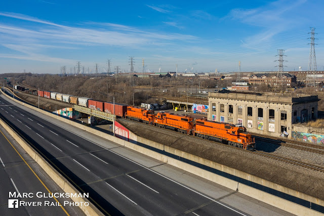
South Shore Saturday [Jan 16, 2021. Union Station in Gary, Indiana, a 111 year old Beaux-Arts Style building, was added to the National Register of Historic Places in 2019. It is in between and served the Baltimore and Ohio (B&O) the New York Central operated Lake South Shore & Michigan Southern line. It served the newly founded city of Gary, which was rising up near the US Steel Works. There has not been passenger service to this station in may years. Freight is operated by Anacostia Rail Holdings in cooperation with the South Shore passenger operator, the
South Shore Line
. Seen on Saturday, Decemeber 26, 2020, CSS 2005, 2009, and 2002 are all GP38-2s built in 1981 and have spent their whole career working here. The units have been painted in South Shore's orange, a throwback to the heyday of the area's Insull Interurbans.

Marc Glucksman shared
Tad Dunville
 South Shore Freight actually owns/leases the track he’s on from the EJE/CN. The CSX mainline is the two tracks closest to the depot.
The City Track used to be the J’s interchange up and over the complex at Pine Jct, towards the east to Curtis Yard and the B&O, and also the portion pictured here further east to the interchange track at Goff with the CSS, just east of the I-65 overpass.
South Shore Freight only established rights over the City Track about a year and a half ago.
I had no idea who was out there, I just looked out the window and saw a random drone following my train. Where’s the shot of me halfway out the window?
...wonderfully captivated Mr 
Glucksman
, timing is everything, I cannot imagine no vehicle traffic on I-90, amazing!!!

HalstEd Pazdzior posted
Chicago South Shore heading east past the ruins of Gary Union Station
7/5/22
Joe Millspaugh: With a Kirk bound coke train welded to the rail on #2 main. No where to go. Curtis yard is full. Lol
HalstEd Pazdzior: Joe Millspaugh yes sir. They had a crew though.
[The CSS now operates the former EJ&E City Track.]

Tad Dunville commented on Marc's share
Ean Kahn-Treras
 Totally forgot about that. Serves me right for moving south, I haven't seen a South Shore train in person since November. I don't think I've been aboard in over a year.
Also, I notice your NPS profile pic. Supposedly the Gary Union Station is the farthest west land of the Indiana Dunes NP now, on a very narrow spit of land. It would be cool to see the building renovated as the park headquarters, but perhaps it's too far away from the action to be useful.

George M Stupar posted
Line car 1100 is en route to its work site on the South Shore Line, as it speeds through Goff near the east side of Gary Indiana in 1979.

George M Stupar posted
Gary (Goff) Indiana, South Shore Line freight motor 802 is seen sorting out cars at around 0900 hrs in September 1978.

Marty Bernard posted
South Shore (CSS&SB) freight motor 802 waiting for a passenger train to pass near Gary, IN on 11/26/76.
Called 800s, not Little Joes, built by GE in 1949 for the USSR but the Cold War interrupted their shipment and they went to the Milwaukee Road and South Shore. The Milwaukee's were called Little Joes after Josef Stalin.
Paul Arden: Looks like Goff - the then interchange with the EJ&E.

Monday, June 8, 2020

Grayslake Junction: (Metra+WSOR)/Milw vs. (CN+Metra)/WC

(Satellite)  


I'm still learning about the Chicagoland railroads one junction at a time. And researching this junction taught me something more about Metra routes.

Rob Conway posted
Another view of the Grayslake diamond replacement in 1976.
Mike Heiligstedt All that and a Fairmont !! [The speeder on the right.]
Sam Carlson Watching jewelers mount a diamond!

Metra's route on the former Milwaukee tracks is Milwaukee District North (MD-N). Metra would own this route in its service area. I presume that WSOR would own the rest of the route and provide freight service on the Metra part.

Metra's route on the former Wisconsin Central tracks, North Central Service (NCS), is complicated because the WC tracks between the BRC and the loop are either out-of-service or no longer exist. And they are owned by B&OCT, which is now owned by CSX.

I looked at using this topo map to document the lost WC route. But it has the serious error of showing the B&O (actually, B&OCT) route turning south and joining the Pennsy route rather than continuing across the river and turning north to the Grand Central Station.
1953 Chicago Quadrangle @ 1:250,000

The 1957 1:250,000 topo had the same error. But the 1980 version below accurately shows the B&OCT/WC route to the Grand Central Station. I used the following color code.


1980 Chicago Quadrangle @ 1:250,000 plus Paint
So I checked a Metra map to see how the North Central Service trains get between the WC tracks and Union Station.
Metra-NCS
The answer is that they use the Milwaukee District West (MD-W) route, which Metra owns, until they get to the B-12 Junction (red oval on map) and turn North onto CN/CP(Soo)/WC tracks.
Metra-ND-W plus Paint

NCS is obviously the Metra route that provides service to O'Hare. It has a station that is a couple of blocks from the People Mover terminal that supports some rental car companies. I remember that it took a while after Metra was created to get this route running. In fact, the first regular service train didn't run until 5:27am on Monday, August 19,1996. [History-NCS] Unlike the other routes where railroads were running commuter trains for over 70 years before 1996, the Wisconsin Central did not have commuter service. It was not built to create suburbs like some other routes were (e.g. MD-W's Chicago & Pacific [History-MD-W]). It was built to connect the WC to the Chicago freight market. So $131.4m had to be spent to get the 53-mile route ready for commuter service. The towns along the route helped pay for the stations and parking lots. Shortly after Metra was formed in 1984, they began planning this route. In 1987, Soo, a subsidiary of Canadian Pacific, sold the line to a new corporation that revived the name Wisconsin Central. Canadian National obtained ownership of the line in 2001. "Rails and signals were upgraded to allow for 60-mph commuter trains. Sidings were added or elongated so freight trains could move out of the way of commuter trains and vice versa. Gates were upgraded at 69 crossings and rebuilt at 23 crossings." Between 1997 and 2006, Metra spent $218m to add a second track and four more stations. [History-NCS]

Friday, May 29, 2020

Tod Ave+Republic+McCook Ave+Kennedy Ave Interlockings: B&OCT vs. IHB

The railfan post below got me looking for the "Republic interlocking" in East Chicago. My 2005 SPV Map shows that there were four interlockings between B&OCT and IHB in about a mile along the B&OCT. So I'm doing all four in one post.

Instead of a satellite, I'm using a topo image because it still has the tracks that were in these interlockings. The numbering convention is the one used by the 2005 SPV Map except that I added 99 to represent what is labelled as Calumet Tower.

  • Tod Ave: 8
  • Republic: 9
  • McCook Ave: 10
  • Calumet Tower: 99
  • Kennedy Ave: 11


1953 Whiting Quadrangle @ 1:24,000 plus Paint
Interlocks 8-10 were obviously connections between B&OCT and IHB spurs. Kennedy Ave confused me until I looked at a contemporary satellite image. It was a crossover.
Satellite

This is how I learned about the Republic interlocking.
Steven W Panek posted
With the Indiana Harbor Canal a little higher than normal due to recent thunderstorms in the past week,
CSX 3168 was the rear DPU on an eastbound manifest that had just cleared Republic interlocking on the CSX Barr Subdivision in East Chicago, Indiana on 5/23/2020

Today, the spurs associated with interlockings 8 and 10 are gone.
RR Aban Map
And the connection in the southwest quadrant of Republic is gone.

Evidently the water level of the Indiana Harbor Canal is normally rather high. I'm guessing from the images of the bridge that the girders are concrete instead of steel. It appears the purpose of the south fork of the canal is to help drain Grand Calumet River rather than navigation because all of the bridges across it are fixed.
Street View