Showing posts with label wwKKK. Show all posts

Friday, August 20, 2021

NS/NYC/Kankakee Belt/II&I Bridge over Kankakee River

(Satellite)

Kankakee Belt

Dave Fry posted
III Railroad over the Kankakee river in Indiana. As a kid and teen this was home away from home for lots of my friends and I. We all loved to camp along the river.
Arthur Todd: Is the line still operational?
Dave Fry: Arthur Todd yes it serves a power plant and local lumber yard.

Dennis DeBruler commented on Dave's post
It took a few minutes before it sunk into my brain that "III" is the Indiana, Illinois & Iowa Railroad. I think of it as NYC's Kankakee Belt.
41°11'43.8"N 87°18'44.0"W

Sunday, July 4, 2021

Aban/Pennsy and CKIN/C&O Bridges over Kankakee River near English Lake, IN

(Satellite)


The Hoosier Valley Railroad Museum uses part of the CKIN route for their tourist trains.

Hoosier Valley Railroad Museum posted
Thank-you to everyone who came out today enjoying the beautiful weather after the large amounts of rain and storms this past week. The Kankakee River at English Lake definitely shows how much rain we had recently. Lots of visitors and lots of riders on both trains. We hope everyone has a wonderful Independence Day tomorrow!
Kyle Flanigan shared
Dennis DeBruler shared
This Hoosier Valley Railroad Museum tourist train uses the former C&O route.
41°16'17.0"N 86°49'39.2"W

Normally, we see the piles upon which the pier caps set.

Miles Jajich, May 2021
[C&O in the foreground and Pennsy peaking through underneath.]

Adam Harney, May 2021
[C&O taken from the Pennsy.]


Friday, March 10, 2017

KB&S/NYC/Big4 Bridge over Kankakee River in Aroma Park, IL

(no Bridge Hunter, 3D Satellite)
Mark Hinsdale posted
Picking up interchange cars from Canadian National at Kankakee.
2x Facebook
resolution
They seem to be using a tank car instead of a covered hopper car as the buffer car between the engines and the PROCOR tankers. Or maybe it is a mixed freight that has a bunch of tankers at the beginning. The PROCOR cars have a black and white Placard. It is not flamable, because the card would be reddish. It is not explosive because that is orange. Black and white cards are things like inhalation hazard, poison, toxic, corrosive, or marine pollutant. (BTW, Inhalation Hazard will require PTC routes in the future.)

This Kankakee, Beaverville, & Southern/NYC/Big Four bridge seems to have escaped the attention of the Bridge Hunters as well as mine.

Update:
American-Rails.com posted
A New York Central 'Hudson' has train #406, the southbound "Carolina Special," hustling across the Kankakee River at Kankakee, Illinois during the 1950s. A.C. Kalmbach photo. American-Rails.com collection.

Sam Carlson posted
On November 10, 1994, three KB&S RS11s cross the Kankakee River in Aroma Park, IL.
[He posted all three photos below and asked for opinions. Since this group is public, I'll let you read the comments yourself.]

Two of six photos posted by Marty Bernard with the comment: "I am posting steam engine slides taken by A. C. Kalmbach and sold by Blackhawk Films as a group of 48 slides.  They are quite enjoyable but have slightly deteriorated over the years.  The dates that Kalmbach took the slides and the dates Blackhawk sold them are not given.  The captions are as printed on the slides and as you will see are not as technical as a railfan would want.  The slides were donated to the Iowa Chapter of the National Railroad Historical Society.  Please enjoy!"
a
Marty Bernard shared

b
Marty Bernard shared

Larry Candilas commented on Marty's second share of the "b" photo.
Aroma Park; exact same angle a few years later.

Sam Carlson posted three photos with the comment:
Here we have the KB&S crossing the Kankakee River in Aroma Park, IL on October 10, 1994. The first one is as the train starts across the river, with ducks on the water. The next shot is in the middle of the bridge. The third photo shows the train crossing over while a father and son fish from the bank. Which one is best - ducks, middle, or fishers? And, why?
Rob Scrimgeour The first photo is probably closest to a traditional railfan photo. I like the angle to the train, and the scene overall. The ducks seem to me to be more of a distraction than a good addition. Similarly, the greenery in the bottom centre seems distracting, while the branches in the lower right fit well. Finally, the lead locomotive merges a bit with the trees, as they are both the same height.

The second image seems the least dramatic to me. No real angle to the train, yet not a flat broadside. The lead locomotive's nose separates from the background much better than the first image. The greenery in the lower left and the bright bridge pier on the very left are both a bit distracting to me, but these could disappear with a tiny crop off the left.

The third image is the only one that really has a story to it. The story might be stronger if the fishers were more prominent. It would definitely be stronger if the train wasn't as far into the scene. If the lead locomotive was 1/3 to 1/2 way into the image there would be more chance it would look like the fishers are looking at the train, and the two points would likely balance better. Finally, the lead locomotive is merging into the trees again.

Of these images I'd likely prefer the first. I'd probably crop it into a panoramic shape to remove the distracting greenery at the bottom and some of the excess sky.

Be aware, my comments are based on viewing on my small phone screen.

Thanks for sharing.
Mike Tisdale I'll go for the ducks as you also got some fall color in the photo and gave it more of a sense of place. The fishermen are a nice touch, but a bit small to be a really significant element of the photo. I do that too, see something in a scene and think it will be a good feature of the photo, only to sometimes realize that when I see the photo on a monitor that what I noticed in real life is a tiny speck on the overall photo.
Sam Carlson To tell you the truth, I didn't see the fishermen when I copped the shot. I didn't notice them til I got the shot back.
Dennis DeBruler Sam Carlson I think the key thing is what I have seen you advocate in other forums: take advantage of the economics of digital photography and shoot early and often. It is nice to have the "problem" of having to pick the best shot. It is the first photo that caught my eye. But I'm not experienced enough to explain why I like it. I'm also learning for the other comments.

1

2

3

Sam commented on his post
20 shots later, we got this one. One of the units was put on the rear so they could switch a facing point siding. It was a great day!

Bill Molony shared
Kankakee County Museum Photo Archive
Rich Westerman This bridge is now owned by KBS.

Steve Drassler also posted
Photo from the Kankakee Daily Journal archive of an eastbound Big 4 passenger train crossing the Kankakee River at Aroma Park, IL long before the James Whitcomb Riley streamlined service began in 1941. This train would have stopped a few minutes earlier at the Kankakee Big 4 depot, mentioned in an earlier post.
Steve commented on his post
Here's a view now, sans train, looking the other way. KBSR still has a regular interchange with the CN (ICRR) at Kankakee. Not every day but frequently.

MarMarinou
Caption: “KB&S train rolls south across the Kankakee River bridge in Aroma Park, Illinois. This was actually two trains in one. They combined the cars and power in Kankakee before departing south. You can see the headlight of the second unit just off the end of the bridge.”
Kankakee, Beaverville & Southern Railroad
Aroma Park, Illinois
December 26, 1994
Photo by Barry Lennon

Junior Hill posted
SB KB&S train returning from Kankakee crosses the Kankakee River at Aroma Park, IL.11/15/2011

Junior Hill posted


Kenny posted six photos of the bridge.

Saturday, February 4, 2017

Aban/CR/NYC/Big Four Bridge over Kankakee River near Schneider, IN

(no Bridge Hunter?, Satellite)
20150510 1134
Considering how long this route has been abandoned south of Schneider, I'm surprised the steel has not been salvaged. The satellite image shows that even the rails are still present. I made a point of taking its picture because I knew the river was running high. I need to make another trip by it to see if I can catch a low-water image. Notice all of the flotsam jammed up against the bents of the wood trestle.

Joe M McMillan caught the river even higher and with a northbound Milwaukee Road train on May 22, 1983.

Apr 2024:
safe_image for Bridge that attracts logjams on Kankakee River will be removed
They will remove the closely spaced wooden bents; the concrete supports will remain in case the railroad decides to reuse the line.
Removing the debris buildup should reduce flooding. The difference between minor and major flood stages on the Kankakee River is 11.5' (3.5m) vs. 12.5' (3.8m).
NS handled the necessary approvals, and river commissions will fund the work.

John Eagan posted
Well there goes your hopes that the NS line south of Schneider will ever see a train again!  The timber approach to the south end of the Kankakee River bridge has been removed as of 8/30/2024.  
Photo by John Eagan
Harold J. Krewer: Don't think that would prevent them restoring service if they REALLY wanted to. Chances are good that if the line was ever reactivated they'd replace the entire bridge anyway.
For all the supposed wailing and grinding of teeth about how they wish they'd never have abandoned the ex-Wabash north of Gibson City, they've had this perfectly-good alternative running north from Danville ever since the Conrail split and have done nothing with it.
John Eagan: Harold J. Krewer I agree that the bridge would have needed work to bring it into standard anyway. And for reactivation all that is needed is a big customer or two!
I’ve always thought that if the elevator at Ade wanted service that it would be easy for the TP&W to open the line from Kentland north. Just look at how easy it was the car repair shop to reopen the line from Sheff north nearly to Kentland.

Saturday, July 30, 2016

Trail/Wabash Bridge over Kankakee River at Custer Park

(Bridge HunterSatellite)
Bill Molony posted
Looking railroad south through the Wabash Railroad's bridge over the Kankakee River at Custer Park. 
Undated, but circa 1950's.
The Custer Park station can be seen in the background, by looking through the bridge.
It looks like one of the trusses was allowed to deteriorate so much that it was replaced by a steel girder span.
Birds-Eye View
I'm going to have to do another trip on IL-102 from Wilmington, but find Rivals Road and go south to Rivals Lookout Park. One reason Custer Park is now a small town is that it does not have a road bridge to go along with the railroad bridge.

Update:
Bob Dodge posted
Richard Fiedler commented on Bob's posting:
'm thinking the building at the end is the pump house for the water tank in Custer Park
Forest Preserve District of Will County posted
Walking or riding the Wauponsee Glacial Trail bridge over the Kankakee River is one thing, but flying over it offers a whole different perspective. The view Monday afternoon ... (Photo by Chad Merda)

Richard Mead shared
http://johnmarvigbridges.org/IL%20Pictures/Custer%20Park%20Derailment%20Newspaper.jpg
Richard FiedlerGroup Admin Derailment occurred in the summer of 1968.

The Blackhawk Railway Historical Society posted
On August 22nd, 1968, 23 cars of a southbound Norfolk & Western Railway freight train plunged into the Kankakee River at Custer Park.
The freight train was enroute from Chicago to Decatur and totaled 97 cars.
A spokesman for the Norfolk & Western said that two wrecking crews were attempting to clear the track and recover the cars.
"There were about 29 cars involved in the derailment and 23 of them are in the river," the spokesman said. He said the N&W may have to detour its trains to tracks of either the Illinois Central or Penn Central railroads in order to cross the Kankakee River.
Police said the southbound freight train consisted in part of flatcars carrying old railroad boxcars. Some of these cars apparently shifted in transit and struck the side of the bridge causing the collapse, they said.

Alan G Lowery posted
[Bob Dodge posted several photos as comments.]


Forgotten Railways, Roads, and Places posted a then+now photo.


Friday, July 1, 2016

Kankakee Rolling (Drowning Machine) Dam

20160603 3425
When I followed the CN/IC tracks to the Kankakee River to take pictures of the bridge, I discovered the town has a rolling (drowning machine) dam. I included the hydro-electric plant on the right (south). But I got just the corner of the big fishing platform they built on the left.

<update>
The "fishing platform "is the foundation of a water mill that used to stand here. Probably a grist mill. That would be the reason the dam was built.
Paul Petraitis posted (I cropped it)
Here's the full 5x7 negative...the Kankakee image I posted earlier was just a little detail of this...that's how fantastic glass negatives are! That's the ICRR bridge!

Roggy Gragg posted
A pair of GTW GP9Rs, both still in their classic blue paint, lead the local north across the Kankakee River in its namesake town of Kankakee.


Dennis DeBruler You also caught a heavy flow over the dam.
</update>
Satellite
In this satellite image you can see the big fishing platform between the road and the dam. This allows fisherman to safely cast into the boil of the dam.


The view on the left is from the fishing platform. Below is a closeup where I noticed three volleyballs caught in the rolling boil that flows back towards the dam. That backflow can catch people and flood boats. The backflow can pull people down under the water. That is why this dam design is considered a "drowning machine."


Of all the fishermen I have seen fishing downstream of dams, this is the first time I have seen one catch a fish.

Follow one of the sticks in the hydraulic jump close to the dam. You can see that it goes upstream and then is pushed down into the water. This also happens with boats and people that go over the dam.
Storm Chaser Clint Hendricks IV posted via Dennis DeBruler
Catastrophic flooding occurring across portions of the Texas Hill Country this July 4th [2025]. The Llano River in Llano, TX is currently (as of 5pm) flowing at over 109,000 cubic feet per second, when 5 hours ago it was about 500.

Thursday, June 23, 2016

Two NYC Bridges over the Kankakee River in Kankakee, IL

(Bridge Hunter Belt, Bridge Hunter K&S, no Historic Bridges)

The Kankakee Belt was part of the NYC. The NYC also controlled the Big Four, which operated the Kankakee & Seneca. So NYC had two different routes going east/west through Kankakee, IL that crossed the Kankakee River on the west side of town. The Kankakee Belt route is now used by Norfolk Southern. (Update: I already had a posting on the Belt bridge.)

Satellite
20160603 3433
I followed the NYC tracks from their junction with the IC by following the roads west and east as I was forced to turn. I ended up at the end of Stone Street where I added a mark on the above satellite image. You can see the deck girders of the Kankakee Belt track going across Kennedy Drive and the river. I then backtracked to get onto Kennedy Drive (US-52). Driving north I saw a little park by the river but not soon enough to safely make a left-hand turn into it. So I continued up to River Place where I could safely turn around and go back and turn into that park. While on River Place, I took a picture of the north elevation of the bridge.


I parked the van and walked along the sandy/muddy "beach" to get a shot of the south elevation.

Using GIMP to crank up the exposure by 1.5 stops.

Note the Belt route has five piers. Let's number the Belt piers from right to left (east to west). The abandoned piers of the K&S are on the right side of Pier 1 and between Piers 2 and 3. The second K&S pier is covered with some trees so it is hard to see it against the background of the shore trees.

The Bing map has a better view of the various piers. And you can clearly see the V-shape on the upstream side of the piers to help break up ice flows.

Birds-Eye View
The Piers 1 and 3 have a stone base and a concrete tower added on top. I'm sure that the current bridge is a steel girder bridge that replaced a former truss bridge that rested on the stone piers. Since the depth of the girders is less than the depth of the trusses, they had to add the "towers" on the stone piers to maintain the original track height. Note Piers 2 and 4 are completely concrete. That is because the girder spans are half the length of the truss spans so piers 2 and 4 had to be added when the bridge was upgraded. Note that the old piers align with the K&S piers.

Dan Tracy shared
Taken on March 20, 1942, this photograph shows a steam crane mounted on a flat car placing the last section of the New York Central's new bridge spanning the Kankakee River. The bridge is located at Kankakee's Kennedy Drive.

A different exposure:
Kankakee County Museum posted
This photo, taken 83 years ago today on March 20, 1942, captures the replacement of a section of the New York Central Railroad Bridge that passes over the Kankakee River.
George Mosier Jr.: Here’s more information on this bridge  http://industrialscenery.blogspot.com/.../two-nyc-bridges...
Joseph Obrien shared
Gabriel Birkey: How did they connect to each end of the span if they were coming from different sides of the bridge? [I was wondering that also.]

1939 Aerial Photo from ILHAP
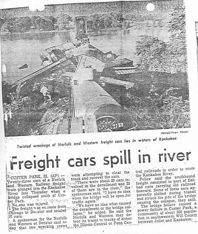
I was expecting to see an old truss bridge in 1939 since the above photo shows that steel girders were installed in 1942. But the shadow and number of piers look like a steel girder bridge. Were they building a second girder bridge in 1942? (Update: maybe they were upgrading the girders in an existing bridge.)


The river was higher when Gene Smania took a picture in Feb. 2012

The river is very high in this photo. We don't even see the stone part of the piers.
American-Rails.com posted
New York Centra's train #406, the southbound "Carolina Special," hustles across the Kankakee River at Kankakee, Illinois during the 1950s. A.C. Kalmbach photo. American-Rails.com collection.
Greg Burnet shared

Ken Smith posted six photos with the comment: "the NS bridge over the Kankakee river in Kankakee Illinois...formerly NYC, PC, and Conrail...photos by Ken Smith..."
1

2

3

4

5

6

Kankakee County Museum from Bridge Hunter
Westbound train on the bridge. Post rebuild Circa 1920 History: Built in 1882. Rebuilt from a Howe Truss to a Deck Truss in 1915. Demolished 1933.
[Note the Kankakee Belt bridge in the background.]
Kerry Bruck posted
In 1885 a 40 car flour special was run across the K&S to Kankakee. led by CCC&STL Big Four 4-4-0 type

The brown bridge in the background of this photo taught me that they have built a trail bridge on the Kankakee & Seneca RoW. Judging by this photo, they tore out the old piers and built new ones.
George Mosier Jr. posted
UP 7292 NS 3664 west bound mixed train on Kankakee River 6-7-20

Brandon Elliott posted
B14 heads over the Kankakee River
10/13/20
Kankakee, IL

Before the trail bridge was built. 
Bill McCabe posted
Back just a few years...

This street view catches both the NS/NYC Kankakee Belt and the trail bridges.
Street View