Sunday, December 31, 2017

1917 Market Street Bridge over Tennessee River in Chattanooga, TN

(Bridge Hunter, Historic Bridges3D Satellite)
Officially named the Chief John Ross Bridge because he started the first ferry service here in 1815 and  he led the Cherokee Nation west on the 'Trail of Tears.'.
Completed in 1917 and rehabilitated in 2006. [Bridge Hunter]

20171217,18 9085
Market Street and Walnut Street Bridges, Boston Public Library on Flickr, License: Creative Commons Attribution (CC BY)

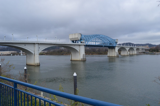
I was playing peek-a-boo with the sun during my visit to these bridges. The sun was hidden by clouds when I took these pictures from the riverfront walkway.


While I was taking pictures on the Walnut Street Bridge of truss details, I noticed the sun peaked out of the clouds to shine on the Market Street Bridge, but by the time I hustled over to the west side of the bridge to get a picture of the bascule spans, the sun was disappearing again.


I took a closeup view of the machinery on the south (left) pier, but later, when we were coming back across the the Walnut Street Bridge to the van, I noticed you can see the machinery better on the north pier because the bridge tower is not in the way. Thanks to the resolution of the camera, I can easily zoom in on the machinery part. It is nice that they painted the shaft of the pinion gear yellow because that makes it is easy to spot. It struck me that the rack was rather short. Then I noticed the round member that this Scherzer Rolling Bridge rocks back on was just a 45-degree arc or so. I'm used to seeing that round member in the Chicago area being  closer to a 90-degree arc.

Digitally Zoomed
Screenshot of Dawn Kropff catching the raising during an inspection
A smaller rolling member means that the bridge's raised position is far from straight up. Evidently, the only time it is raised is during its quarterly inspections. Even then, I can tell by the location of the pinion gear on the rack, they went only half way up the designed angle.
Excerpt from
screen shot

Image: TDOT, from Historic Bridges and WTVC
Jonathan Konopka posted
This is the Market Street Bridge in Chattanooga, Tennessee. It is a double-leaf bascule bridge that was built in 1917 and carries Market Street over the Tennessee River.

Douglas Butler posted
From Wikipedia Market Street Chief John Ross Bridge in Chattanooga, TN.

If it never is raised for boats, just for the quarterly inspections, then it really doesn't matter how high it goes.

(new window)


Below this photo of an interpretive sign, I have typed the text. Unlike many major projects, it appears construction continued on this bridge during WWI.

By 1911, load limits and costly repairs of the Walnut Street Bridge led officials to begin planning for a new bridge. Many officials and residents of Chattanooga wanted a Market Street Bridge because so much of the traffic crossing the river was destined for Market Street, the commercial center downtown. But officials also wanted a concrete bridge because maintenance would be easier. A Market Street location, then, was problematic in several ways. First, this location would destroy part of the wharf. Second, the level of the land at this location would dictate a low bridge, and the Army Corps of Engineers would only approve a bridge with channel spans 300' wide with 100' clearance because of the possibility that gunboats might have to travel the river. A concrete bridge would be unable to meet these requirements at Market Street without a drawbridge, and the necessary width of the spans also made the use of concrete unlikely.
Fortunately, the city's chief engineer, B. H. Davis, came up with a design that would please both the City Commissioners and the Army Corps of Engineers. the approved design was for a concrete bridge which would have the required 300' channel span, with shorter spans from the banks of the river to the central piers. In order to meet the federal height requirements, the central span would be a steel drawbridge of bascule design. This type of drawspan lifts, like one side of a see-saw, because of a counterweight. On the Market Street Bridge, each wing of the drawspan is conterbalanced by a block of concrete which moves toward the roadbed as it lifts the center of the span.
Construction began in late November 1914. The city issued $500,000 in 5%, 30-year bonds to finance the construction of the bridge, but as the engineers ran into more and more difficult problems, it became apparent that the bridge would cost far more.
The biggest problems arose because of the piers. In one site, an underground stream flowed into the cofferdam, preventing the concrete from drying; eventually the spring itself had to be plugged with concrete. Another site had, not a solid bottom, but a collection of large boulders. Caissons were built so that workmen called "sand hogs" could work underwater, excavating the boulders to reach bedrock. On top of their caisson rested a concrete pier 55 feet high, which weighed more than a million pounds. As their excavation moved closer to the bedrock, the pier moved down with them.
To build the concrete arches and the roadbed to span the piers, the contractor had to erect wooden falseworks. These were strong and fairly elaborate pieces of work, but they required constant attention because they prevented driftwood from passing. If left to accumulate, the driftwood formed an obstacle movable only with explosives. On December 19, 1916, a 28-foot flood caused driftwood to accumulate at a rate too fast to be controlled, and when the falseworks were dislodged by the pressure of the river, the span had to be abandoned because the concrete had not yet cured. The year of 1916 saw continued cost overruns and construction difficulties, and in March of 1917, the bridge faced another challenge. All of the masonry work was complete and work on the concrete counterweight had begun when the river again flooded, cresting on March 7 after reaching the fourth highest water level recorded in Cattanooga's history.The left inset photograph shows this flood as it appeared from Cameron Hill. The bridge, however, was largely undamaged, and work continued. The drawbridge was successfully tested on August 3, and on November 17, 1917, the bridge was officially opened and presented to the county. It was named to honor Chief John Ross, who led the Cherokee Nation west on the 'Trail of Tears.'
There was not as much pomp, nor were there as many attendees as there had been when the Walnut Street Bridge opened, but the bridge remains an engineering feat. Even though it cost twice as much as the county hoped it would, it remains the largest bridge of its type in the U.S., and the third largest in the world.
The inset photographs show some of the boats that traveled the Tennessee after the construction of Market Street Bridge. The Joe Wheeler was the last of the active steam packets, and in 1920, some of its parts were used to build the Captain Lyerly, which was used as a towboat. Towboats became the main type of commercial craft as the century progressed, and while this change took place, the engines changed as well. Diesel-powered engines pulled heavy loads faster and more efficiently than steamboats, and they were soon the only commercial boats on the river. The right inset is a U.S. gunboat, wharfed at Chattanooga during World War II.

A photo dump of the pictures I took while I walked towards and under the bridge along the riverside trail and then north and back south along the Walnut Street Bridge.


The beam of sun that was peeking through the clouds finally fell on the truss span. So I took pictures as a walked south on Walnut Street Bridge until the sun disappeared behind the clouds again.


Thursday, December 28, 2017

A Cut Stone Embankment Made with Some Coal?

(Satellite)
In towns like Joliet and Lemont that have outcroppings of dolostone, many buildings such as churches were made of cut stone. Even utilitarian structures such as embankments and bridge abutments and piers used cut stone.

20171217,18 9030
When we first approached a stairway that took us up from river level to the south side of the Walnut Street Bridge, it struck me that the stones in the embankment had a lot of coal soot still left on the stones. I've seen coal soot survive into the 21st Century. Here is a 2015 photo of an embankment along 18th Street in Chicago, IL, where the street goes under the Red Line. The elevated line above the embankment is the Orange Line.
20150513 1468
But the closer I looked at the stones, I decided some of them were not building stones covered with coal soot, but they were cut coal.

I took an overview of the stairwell and embankment from the bridge. That is our van, but you have to walk to the right to get to the walkway that takes you down to this stairwell. That walkway also goes under this parking area to the river so that you can get to the riverwalk without having to cross the busy Riverfront Parkway.

Obviously, this is a view down the stairwell on our way back to the van.
I took a closeup to confirm this is a black stone, not a normal building stone covered with black soot.
And then I saw these that look even more like coal.
An overview that catches the thickness of the wall.


Wednesday, December 27, 2017

NYC water supply: 1905 Croton Dam and Spillway Bridge

(Bridge Hunter, no Historic Bridges, HAER; B&T; see below for satellite information)

This dam replaced the original Croton Dam.

There is also a Croton Dam in Michigan.
This is another example of a dam using a tumble bay in its emergency spillway.
The 1894 pin-connected Quaker Road Bridge is just a little downstream from here.

According to Bridge Hunter comments, the 2005 bridge had to be rehabilitated in 2011. And then because of 9/11 arguments, it was closed to traffic. It is now for pedestrians and bikes.
3D Satellite
3D Satellite

Thomas Engel posted three photos with the comment:
The Croton Dam Spillway in New York State has had three, open spandrel steel arch bridges, 1905, 1976 and the current one shown in the first photo, 2005. Shortly before the construction of the latest, we did some inspection and evaluation of the 1976 version. The last step off that ladder is 200'.
1

2

3
Jeremy John Gibson Brown And the purpose of the ladder is?
Thomas Engel You get on the inspection scaffolding by going over the side on that ladder and taking a sideways step. The wire supported scaffold in visible in the second photo. The ladder was also used to enter the "spider" basket, as in the third photo.
Thomas Engel commented on his posting
The original span under construction. The rebuilding in 2005 was faithful to the initial concept.

1 of 5 photos posted by Bridges & Tunnels
The construction of the New Croton Dam in Westchester County, New York, necessitated the erection of two distinctive steel arch structures: a steel arch structure over the spillway and another over the Croton River. The spillway bridge was initially constructed by the Baltimore Bridge Company but was replaced in 1975 with a simpler arch design built of Corten steel due to deterioration resulting from exposure to roadway salt and spillway spray. Seismic capacity, deck-bearing details, and anchorage at the arch bases were among the design and structural issues that compounded the bridge’s deterioration, leading to its emergency closure in 2003 and replacement in 2005.
➤ Check out our latest Journal entry, "Croton Dam and Bridges," at http://bridgestunnels.com/2023/02/21/croton-dam-and-bridges/

This is the New Croton Dam which was built between 1892 and 1906. It is not obvious that the Theodore Roosevelt Dam is a masonry dam. But you can easily see the cut stones in this masonry dam. The Old Croton Dam was completed in 1842.

As I suspected, it is part of the water supply complex for New York City.
At the time of its completion, it was the tallest dam in the world.[5] New Croton Dam impounds up to 19 billion US gallons (72,000,000 m3) of water, a small fraction of the New York City water system's total storage capacity of 580 billion US gallons (2.2×10⁹ m3).[6][Wikipedia]

Cristian Opazo caught the spillway in use, License: Creative Commons Attribution-Share-Alike (CC BY-SA)

UP/C&NW 1913 Lattice Bridge over Mackinaw River

(Bridge Hunter, no Historic Bridges, John MarvigSatellite)
Street View
Hal Collins shared Flickr 1996 Photo of a CNW and two UP locomotives on the bridge and the river is almost to the top of the pier.
Dennis DeBruler I'm surprised that a lattice truss bridge is still in Class I service.

Tuesday, December 26, 2017

Ross's Landing in Chattanooga, TN

Along the River Walk near Walnut Street Bridge is a sign about Ross's Landing.


 A closeup of the sign:

A transcription of this sign:

Large text: Ross's Landing: River Crossing and Port

Medium text: Once a ferry crossing connecting the worlds of the Native American Cherokee and the Anglo-American settler, Ross's Landing was the heart of the town of Chattanooga.

Small text:
This place was once a river crossing known as Ross's Landing. John Ross, an individual of mixed Scottish and Cherokee heritage, operated a ferry crossing and trading post near this spot from 1815 to 1826. An elected chief among the Cherokee, John Ross and his Native American people were forced from these lands in 1838 under the terms of the Treaty of New Echota.

In 1839, the Anglo-American settlers at Ross's Landing created a town that they named Chattanooga. A swing ferry anchored at the foot of Maclellan Island swiveled on the Tennessee River from shore to shore, connecting the northern portion of Hamilton County to its principle town.

A key port on the upper Tennessee River, Ross's Landing had also been selected as the northern terminus of the Western and Atlantic Railroad. The W&A originated at the railhead that would become Atlanta, Georgia. As a commercial riverport with rail connections, Chattanooga assumed new prominence among the cities of Tennessee.

By 1835, regularly scheduled steamboat service from Bridgeport, Alabama to Knoxville, Tennessee was a reality; these vessels distributed manufactured goods and collected agricultural products for shipment by water and rail. By 1848, Chattanooga would collect more than 10,000 bales of cotton a year, much of this valuable cargo being stacked along the riverbank and streets adjoining the wharf.

Bulk commidities such as cotton and corn were frequently shipped by flatboat to Ross's Landing where the cargo was carted to the railyards south of town and the boat was broken up for lumber. In later years, the wharf at Ross's Landing would be crowded with the timber cut from the headwaters of the Tennessee and rafted down to the sawmills built along the banks of the river.

Navigation of the river in the 1800's was not without hazards. Below Chattanooga were a series of dangerous shoals and narrows. In the dry summer months, the river level would frequently be too low for passage of even shallow-draft steamboats, making loss of life and cargoes common on the Tennessee.

Walnut Street Bridge over Tennessee River in Chattanooga, TN

(Bridge Hunter, Historic Bridges, HAER3D Satellite)
This bridge is now a trail.
Posted December 18, 2014, by Alan Walker (awalker1829 [at] yahoo [dot] com)This bridge was found unsafe for vehicular traffic and stood abandoned and unused for more than twenty years, despite repeated petitions by the Coast Guard to either repair it or remove it. Community interest in preserving this bridge led the City of Chattanooga to include the restoration of the bridge as a key part of the Tennessee Riverpark. Most folks today do not realize how close we came to losing this bridge. [Bridge Hunter]
The text on an interpretive sign describing the 1867 Great Flood also describes how this bridge was built.
20171217,18 9025 +30+30, western elevation framed by the Market Street Bridge
The poles on the right in the above photo hold a dock that can be used only by boats that are tieing up along the river front. That is, there is a gate because the general public, including fisherman, are not allowed on the dock. The height of the poles shows how high the river might get when the Chattanooga Dam opens up its gates.

Market Street and Walnut Street Bridges, Boston Public Library on Flickr, License: Creative Commons Attribution (CC BY)

This part of Chattanooga on the south side of the river is on a bluff, so the former street bridge begins with spans.
The north side is a flood plain, so there is a significant trestle between the bridge spans and Frazier Avenue.
I don't know if the handrails have been preserved all these years or if they were restored, but either way, it is nice to see the more ornate handrails that were used in the 19th Century.

The purpose of this photo is to capture the cables that were added at some point to provide more tension strength for the tie-bar members. I have to confess that my wife is the one that first caught that detail.

The roof line near the left of the photo is on the aquarium.

Note the "kinda snowflake" lights. ("kinda" because snowflakes have six points instead of eight.) I wonder if these are up year round or if they are up because we were visiting during the holiday season. They are a reminder that we are further south than the Chicago area because I don't think most Chicagoans think snowflakes are special enough to be an inspiration for a decoration.
The bridge had tie-rods with turnbuckles as well as tie-bars. Note the medallions in the lower-left corner. (Unfortunately, one is missing already.) They obviously had a fund raiser to preserve the bridge because I assume the name on each medallion was that of a donor. There were a lot of medallions along both crosswalks.
My wife and daughter provide scale. I wonder if the bridge was one way and switched directions according to rush hour flow. Those are horse&buggy width lanes. Certainly not the Federal Standard 12-foot lanes that today's kids are used to driving in. You would definitely not want to text while driving on this bridge. Now that I'm aware of them, the cables to reinforce the tie-bars are obvious in this photo.

A photo dump of the other photos I took while I crossed the bridge.


This view to the north catches the river trail as it descends from the bluff down to river level. It reminds me of that windy street in San Francisco. The Hunter Museum of American Art is the building on the bluff.
I was playing peek-a-boo with the clouds.
On the way back, I noticed the Hunter Museum had an older building as part of their complex.
And now a photo dump of the other pictures I took while walking along the river front. We first walked away from the bridge, and then we walked back to climb some steps up to the bridge's deck.

I transcribed this sign in Ross's Landing.


It appears that some of the stones have been replaced. It appears the height of the piers was increased with an extension. There was probably a predecessor bridge that was a deck truss. When they switched to a through truss, the height of the old deck truss had to be replaced by the pier extension. Switching from a deck to a through truss significantly increased the height of boats that could go under the bridge.