Thursday, March 31, 2016

Former Salerno Cookie Factory

Tim Paske posted
Salerno cookie Factory, 4500 w. Division. Oh, those butter cookies, couldn't eat just one ! The former Salerno Cookie Factory, home of that familiar and delicious butter cookie, at 4500 W. Division, an orange-rated building, has apparently been cleared for demolition, despite the fact that it is a rare example of famed architect Harold Zook in an industrial context.
Adrian LaTrace Jr.'s posting of a link had many comments. A couple of comments provides pictures after the first day of destruction. They won't be using the Art Deco entrance way somewhere else.

Mary Kobialka

Joe Kus 
You could tell by the curvature of the building on the west side that this building used to be rail served. In fact, I think we have seen this building before in satellite views. But I can't remember which posting that was in.

Satellite
Bird's Eye View
Bing's Streetview

Wednesday, March 30, 2016

Great Lakes Basin RR Bypass of the Chicago Terminal Area

GLB RR
I've discussed routes that could have been used to bypass the Chicago area such as ferries across Lake Michigan, the east end of the Kankakee Belt: 1 & 2, and Kankakee and Seneca.

An $8 billion "really outer" beltway is being proposed to handle trains running through, instead of to, the Chicago area. It should reduce the transit time from 30 to 8 hours.
GLB RR
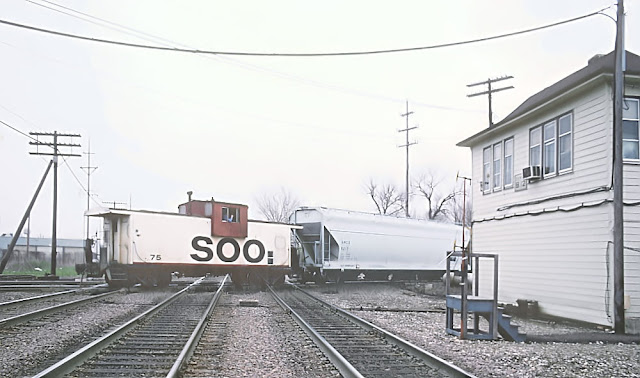
The Chicago Tribune article notes "Great Lakes estimates 15 percent to 25 percent of freight traffic doesn't start or end in Chicago." After watching all of the unit trains run on the BNSF/CB&Q route through Downers Grove, IL, I would have thought the percentage is higher than that. Now that most of the area coal plants have been closed or converted to gas, there are not a lot of facilities in the Chicago area to which these unit trains would be destined. Also, part of the congestion problems are that CSX cannot handle the trains. When I took a trip across Indiana during the Fall of 2015 using US 6, I noticed that there were trains sitting still on the mainline. At least the new bypass would have the waiting trains parked out in the country rather than on urban  roads.

The Tribune article indicates that Union Pacific would be unwilling to use the new bypass. One comment I saw indicates it is because they don't want to short haul their traffic. That is, they don't want to reduce the mileage they get paid for by about 50 miles. I presume another reason is that they don't want to share the revenues with another party. (UP owns part of some of the other belt railways so they would get part of the interchange fees.)

In addition to the CREATE program inprovements, Canadian National continues improving the Elgin, Joliet and Eastern (EJ&E) that it bought from United States Steel to bypass Chicago.

Furthermore, a lot of the congestion is going to fix itself because of reduced rail traffic. Coal cars and fracing sand cars are already setting on storage tracks rather than rolling through Chicago. The bigger Panama Canal should reduce the container trains from the west coast to eastern cities.

So by the time a super bypass processes EPA and regulatory studies and is built, the congestion in the Chicagoland area may already be gone.


Update: people didn't want their rural life disturbed by a railroad, so let's tear up the land with a railroad, tollroad and a South Suburban Airport. A new expressway was proposed, but it was shot down by a governor. Before that, a new airport was proposed down by Peotone, IL. Some government agency had already bought a lot of land for that, but it was shot down. And every time I drive by that I-57 exit, I'm glad I don't have to drive that far just to pick someone up from the airport. Since then they have bought more land at O'Hare and built more east/west runways. But they never did get the planned west entrance built.

Monday, March 28, 2016

Milw's Tower B-12: (Metra+CP)/Milw vs. IHB (Franklin Park Junction) + CN/Wisconsin Central

(CRJSatellite) Since the tower was closed on July 19, 1996, it was moved on November 11, 1997 to help create a railfan park.

Marty Bernard posted
Caboose 75 at Tower B-12. A Roger Puta photo.

Bird's Eye View
Bing's aerial view is similar to Google's view linked above and shows the new track alignment. But, fortunately, the Bird's Eye View still has old images and shows the old alignment. It does show the new alignment as almost done.
Bird's Eye View
20160328 1922
After checking out the railfan park, I went over to checkout what you could see from the park in the southeast quadrant. It started sprinkling when I left the railfan park, and I see now that a drop got on my lens. By the end of my stay, I was glad I was standing under that pavilion.

I included the playground equipment because I had never seen this design before. I see they don't have slides anymore. When I took my kids to the main playground in Downers Grove, they had multiple slides, the biggest of which was probably 12-14 feet high. Even I thought twice about going on that slide. I noticed the tall slides did not last long. It is interesting how playground equipment has become lower and has less movement as cities become more worried about liability. When is the last time you have seen a merry-go-round or teeter-totter? I've seen kids get off a merry-go-round and puke. My own daughter got a concussion with a teeter-totter.
Same spot as the first picture but turning to the northwest so that you can see the northeast quadrant connector. Also note the chain link fence is now about 8 feet tall. Note below in Jerry's photo that he was not only inside the fence, out could easily shoot over it.
A view of the junction from the west side of the pavilion. Between the trees and the fence, I decided I'd never railfan here so I didn't get out in the rain to take any more pictures. I tucked the camera under my coat and went back to the car. Besides, CN/Wisconsin Central would seldom run freights through here because CN bought EJ&E. And any IHB trains on the southern spoke turn west and pass the railpark. Furthermore, all of the CP/Milw traffic also goes past the railpark.

Jerry Jackson posted
Coming off the north end of the IHB, a pair of their venerable SW1500's pull through Franklin Park, headed for Bensenville Yard. 1990
Fred Van Dorpe commented on the above posting
Here's a similar shot I took on 8/7/14.
Anthony Caciopo posted three images with the comment:
Tower B12! Last week I posted an old newspaper clipping of mine of my visit in 1992 inside Barrington Tower when I was a staff photographer with Pioneer Press newspapers in suburban Chicago. This week, here's coverage of Tower B12 taken in 1993 by my former boss and colleague, Jon Langham. To see these images large enough to read the text, click on them and then at the bottom select Options, then Enter Full Screen. (And once again, please know that the photographer typically does not write the full captions).
1
2
3
William F Kane posted
Jeff Lewis That's tower B-12 on what used to be the Milwaukee Road. It's been moved about a ¼ mile further west and preserved. BTW, this is the new Soo (now CP) crossing the old Soo (now CN.).
Jerry Jackson posted two photos with the comment: "Speaking of the old IHB-MILW connector... Franklin Park 1990. It's always nice to get an Alco (C-630) with your CP/SOO EMD's."

1

2
Update: I can change the label from junction to towerJunction because Jerry caught the tower in this photo.
Jerry Jackson posted
SOO LINE GP9 4227 passes the tower at the WC crossing in Franklin Park, IL 1987.
Jerry Jackson posted again
Calling, "B12!" Franklin Park, IL 1990 IIRC.
Jerry Hund posted
Here's the B12 tower in Franklin Park, IL. For years it served the intersection of the Milwaukee Rd. and the Soo Line railroads. Just a short distance away was the IHB. I worked a short distance to its Northeast for almost two decades. Several years ago it was shut down, but happily moved about a half mile West to serve its new life as a museum.

Three photos from an eBay listing with a minimum bid of $500. Comments on the source post identified it as the model board that was in B-12.
[This reminded my that junction was the northern terminus of IHB.]
1

2

3

safe_image for B12 Diamond Replacement Video

Before 2007, the IHB had a bunch of grade crossings in Franklin Park. Note the dotted lines on this map.
1997 River Forest Quad @ 1:24,000

Then IHB curved east and joined CN/SOO/Wisconsin Central.
USGS

Aaron Grace posted five photos with the comment: "Some pictures of Franklin Park I took prior to the CN-IHB reconfiguration and Grand Avenue underpass project that was completed in 2007."
1

2

3

4

5

Steven J. Brown posted
Canadian Pacific AC44CW 8026 (built 1995) crosses the CN/WC at (Tower) B12 in Franklin Park, Illinois - June 17, 2022.


Franklin Park's Railfan Park (Tower B-12 restored)

20160328 1911 Looking northwest from the parking lot
While researching the B-12/Franklin Park Junction, I learned that the tower had been moved 4.5 blocks west to be a museum. So, even though rain was predicted, the clouds were bright so I went to check it out on (Easter) Sunday at 3pm. (The expressways were jammed. Was everybody going to grandma's for dinner? Fortunately, the side roads were good.) The tower, of course, was closed. I could not find any hours posted.

RR-Picture-Archives has pictures of this park rather than pre-1997 pictures at the junction.
Looking North

Looking Southwest
Looking east from the far west corner of the park

Turning 180 degrees for the view looking west down the tracks. I could see the headlight of a train in Bensenville yard, but it never moved while I was in the area. (3:34-4:21)
The east end had a gate open so that I could step out onto the Calwagner Street crossing. This view is looking West.
Looking East
My lens was wide enough to catch all eight of the levers left in the house. The rest of the interior was some chairs and pictures. And maybe they let you open the windows on the side to take pictures of the trains.
Even on a cloudy day, I had trouble avoiding a my shadow
showing in the picture. At least the text itself has no lines.
It takes effort to move a tower.
I assume this was originally red instead of pink.


I took a closeup of this sign thinking I would post it to Fallen Flags. But when I got home I realized it was rather faded. I should have taken a picture of the sign on the caboose because it looks like it has been restored.

Dennis DeBruler posted five photos with the comment:
I searched the group and I could not find this one. It is on display next to the preserved B-12 interlocking tower in Franklin Park, IL.
License: Creative Commons Attribution: Dennis DeBruler (CC BY)
41°56'12.9"N 87°52'08.9"W
41.936915, -87.869142
1

2

3

4

5

Three photos from an eBay listing with a minimum bid of $500. Comments on the source post identified it as the model board that was in B-12.
1

2

3

Michael Melone posted
3/26/2023 in Franklin park. Interesting to come across and watch crews pull them off the ground.
Melissa Brand: I have video of it happening. So glad it wasn't going faster!
My Instagram @lissahhb it's split in 3 videos there and excuse my language. I have the whole thing going from start with 7 engines but I cut those off for posting. It started with the 11th car which was empty and then the hopper following it. A few cars over was a tanker so I'm really really glad they finally stopped.
[Some comments explain why this timetable westbound train, #247, was going east on this track.]
Edward Moran: Tower B6 is also known as tower A5.

Something forced the lumber car to tip over. It is not at all clear why it tipped. But as it went back to vertical, it jerked the truck of the hopper car off the tracks.
1:36 video

A June 2007 Flickr photo of a former SOO engine pulling an eastbound CP freight past the tower.