Showing posts with label rrMilw. Show all posts

Thursday, July 2, 2026

Trail/Milwaukee Renslow Trestle and Johnson Creek Tunnel near East Kittitas and Boylston, WA

Trestle: (Satellite)
Tunnel: (Satellite)

Looking East:
Street View, Jun 20223

John Harker posted four images with the comment: "This scene was photographed on June 30th 1965, looking up from Boylston Road east of East Kittitas, Washington.  A Milw east bound freight with EF-5 Box motors E39 B-C-D-A and a GP9 was crossing Renslow Trestle (EE-320), climbing a 1.6% grade for about five miles to Johnson Creek Tunnel just east of Boylston.  A Milw Coast Division 1964 employee time table, a track profile and a USGS topo map are included for reference.  No photographer was listed.  John Harker image scan and editing from an original Kodachrome slide."
1

2

3

4

West Portal:
Franklin Wirtz, Aug 2022

East Portal:
Franklin Wirtz, Aug 2022

In addition to trestles and tunnels, the Milwaukee had to build a lot of cuts and fills. 
Cut:
a z, Jun 2020
a z, Jun 2020

And this is what the fill and cut looks like on a topo map.
1953/57 East Kittitas Quad @ 24,000

Once you know what to look for, the fill and cuts are easy to find on a satellite image. The two blue dots are the locations of the "a z" photos above.
Satellite

Wednesday, July 1, 2026

1913 (CM+BNSF)/Milwaukee Judith and Indian Creek Trestles between Lewiston and Denton, MT

Judith Trestle: (Archived Bridge Hutner; Bridge Hunter; no Historic Bridges; Satellite)
Indian Creek Trestle: (Archived Bridge Hutner; Bridge Hunter; no Historic Bridges; Satellite)

CM = Central Montana

By 1913, between Lewiston and Danvers, MT, Milwaukee built the Judith Trestle, Indian Creek Trestle, Sage Creek Trestle and Sage Creek (Hoosac) Tunnel.  That route is now operated by Central Montana Rail. The route is also used by the Charlie Russell Chew-Choo. The Dinner Train features western entertainment including a staged train robbery. They also operate a North Pole Adventure Train.

CM/Milwaukee Judith Trestle


"The first trestle the train goes over is the Judith River Trestle. This 33-span bridge is 138 feet [42m] high and 1,953 feet [595m] long. The trestle was severely damaged in the spring of 2011 and was approved for a five million dollar grant for repair which took place in 2014." [MontanaCowboyFame]

montanatom1950 via ArchivedBridgeHunter_judith via Flickr

CM/Milwaukee Indian Creek Trestle


"Indian Creek Trestle, the second trestle on the Charlie Russell Chew Choo, is a 22-span bridge that is 150 feet [46m] high and 1,303 feet [397m] long. It may be seen just off the Danvers gravel road." [MontanaCowboyFame]

2015 photo by David Jones via BridgeHunter_indian

Tracy Scott posted
The Indian Creek Trestle was originally part of the route constructed by the Chicago, Milwaukee, St. Paul and Pacific Railroad during its expansion across Montana in the early 1900s. This line required numerous major bridges and trestles to cross the deep coulees and river valleys of the Judith Basin region. This trestle is located in the rugged coulee country west of Lewistown in Fergus County. It carries the former Milwaukee Road line, now operated by the Central Montana Rail, across a deep drainage carved by Indian Creek. At 1303 feet long, it was built in 1912-1913. The line remains one of the few surviving segments of Milwaukee Road trackage in Montana still carrying freight traffic today. Central Montana Rail continues to serve agricultural customers throughout the Judith Basin.


Monday, February 9, 2026

(CM+BNSF)/Milwaukee Sage Creek Trestle and Sage Creek (Hoosac) Tunnel near Danvers, MT

Trestle: (Archived Bridge Hunter; Bridge Hunter; no Historic Bridges; Satellite)
Tunnel: (Satellite)

CM = Central Montana

Davonte Pagac posted
Reaching back a long time, Dad would have been about 5 years old when the Milwaukee Rail came through Danvers.  They had to build a trestle over several streams, one of the longest/tallest being over Sage Creek, which was pretty much in Dad's back yard.  Additionally, they had to dig a tunnel between Danvers and Hoosac.  He remembered going to the work camp in the evening, where a number of folks from the community would gather up all of the uneaten pies and food that the camp had left over, which sounded like it was substantial.  Must have been quite an operation to construct all of that.  I came across this picture on a site called smokstak.com, (I'm sure Gary is familiar with it), of the trestle being built. The caption states: "This is a great photo I own of the construction of the steel trestle over Sage Creek in Montana's Judith Basin, on the Milwaukee Railroad's new line from Lewistown to Great Falls in 1913. There is a locomotive providing steam as well as a donkey engine up high on the equipment providing winch lines for erecting the pillars onto the concrete pads below."  Kind of a neat picture.
Rob Biggs: Google maps has a pretty good shot of the tressel, you can see each concrete pillar it sits on, and the shadow of the tressel shows on the ground. How long was the tunnel!?? I found it on Google Maps as well, It looks like its a long one, maybe 1,500 feet or more??

"The Sage Creek Trestle is the last and longest of the trestles on the way to Denton. It is a 27-span Trestle, 163 feet [50m] high and 1,698 feet [518m] long. The 1996 movie Broken Arrow filmed dangerous train sequences on the Sage Creek Trestle in 1995 with a 150-person crew over six weeks. The 2,014-foot [614m] Sage Creek Tunnel nearby is 300 feet [91m] underground." [MontanaCowboyFame]

2014 photo by Nathan Morton via BridgeHunter

Dennis DeBruler commented on Rob's comment
Found it: https://maps.app.goo.gl/hmLLqnUXvQpFPjcZ8
[The comment was declined with the feedback: "Your comment was automatically declined based on certain criteria in this group."]

Treasure State Lifestyles Montana posted three photos with the comment: "The Hoosac Tunnel near Denton, Montana was built in 1912-1913. The 2,014 foot [614m] tunnel is 300 feet [91m] underground and the Charlie Russell Chew Choo goes thru this tunnel."
1

2

3

I easily found the trestle and tunnel with this map.
1954/67 Lewistown Quad @ 250,000

When I noticed that the route still has tracks, I checked if BNSF owns this route. It does. I traced the route on Google Maps from Judith Gap near the middle of this excerpt north to this trestle and tunnel. A comment on a post of the Indian Creek Trestle says that this route is also operated by Central Montana. Those notes on the Judith and Indian Creek Trestles also describe a tourist train railroad that uses this route.
BNSF


Tuesday, December 16, 2025

Milwaukee Amphitheatre Tunnel was Daylighted


Milwaukee map location

Kenn Milewski posted
https://youtu.be/o1SOgXjZtqs?si=VGwjC5smqDKIpD1g
Michael Sol: The "ground" in that particular portion of the Milwaukee Road's long branch-line to Great Falls and Agawam was "shifty." Tunnels did not stabilize that ground, and it was finally easier to just "daylight" the tunnels, or, at a minimum, remove the overburden so that it no longer would push the tunnels around. Problem solved!
[It looks like the problem was not solved because the cut had a landslide and covered where the track would have been.]

I tried watching the video Kenn links to, but the narrator kept saying the land was scenic. I gave up at 2:23 because of too much scenery talk and because it looked like it was going to be a "come explore with me" video.

Saturday, November 15, 2025

1910,1998 Tail/Milwaukee Trestle over Hull Creek west of Garcia, WA

(Archived Bridge Hunter; Bridge Hunter; no Historic Bridges; Satellite)

K H, Jun 2023

"Middle span built in 1998 after a 1988 storm caused a mudslide that destroyed the original middle spans." [BridgeHunter]

This 1951 photo caught it while it was still electrified and was not yet damaged by the mudslide.
John Harker posted four images with the comment: "When I was editing this gray mount Kodachrome slide, I realized it was taken over 74 years ago.  H. M. Stange photographed west bound Milw train 15 the Olympian Hiawatha on May 29th, 1951 crossing Hull Creek Trestle west of Garcia, Washington. He must have taken it from a Pullman 10-6 sleeper in front of the “Skytop” lounge sleeper.  The consist is pretty easy to see in this view.  A Milw 1951 passenger time table and equipment list along with a USGS topo map segment are included for reference.  John Harker editing and collection"
1

2

3

4

Lance Gouty commented on John's post
I'm thinking Hull Creek, based on my bike ride a couple of years ago.

Lance Gouty commented on John's post

Gene Bisbee Flickr via ArchivedBridgeHunter
HullCreek15
Old railroad bridge at Hull Creek in Iron Horse Park. It once carried the old Chicago-Milwaukee-St. Paul-Pacific Railroad, also known as the Milwaukee Road.
It now carries the John Wayne Pioneer Trail across the Cascades from the Columbia River in the east to a point about 30 miles from Seattle.

Saturday, October 18, 2025

1880+1902 MNNR/Milwaukee Short Line Bridges over Mississippi River in Minneapolis, MN

1880: (Archived Bridge Hunter; Bridge Hunter)

MNNR = Minnesota Commercial Railway

1908 postcard via BridgeHunter_1902
[Note the Meeker Island Lock and Dam .]

HistoricBridges
pin-connected Baltimore deck truss with stone piers

John Harker posted three images with the comment: "Bob Wilt photographed six Milw SD40-2s pulling WEPX empties across Short Line bridge over the Mississippi River into Minneapolis, Minnesota on February 1st, 1980.  Of course, the train was heading west to pick up more coal.  The empties were coming back from Wisconsin Electric Power (WEPX), the Columbia Power plant near Portage, Wisconsin.  In the background the train was curving around to the bridge near Signal Tower at MP 417.3.  A Milw Northern Division employee timetable for the Short Line and a USGS topo map are included for reference.  John Harker image editing, research and collection"
Fred Hyde: now a branch operated by Minnesota Commercial to get to the elevator district in South Minneapolis.
1

2

3

John Harker posted four images with the comment: "Bob Wilt captured this scene on July 6th, 1974 of a Milw westbound freight crossing the Short Line Bridge over the Mississippi River from St Paul to Minneapolis, Minnesota.  He had written on the slide train 261, Bensenville to Tacoma.  I zoomed in on the three SD40-2s and they were included in the first order of 41 units, 3000 – 3040.  However, the front two units have been renumbered, I believe, 159 and 162 with the third one still with its original number 3028.  A Milw employee timetable, a USGS topo map segment and a Google Earth 3D image are included for reference.  John Harker image editing and collection."
NancyandDennis Leonard: I maintained the navigation lights on the bridge during my career with the Milwaukee Road. Walked on wood planking to the piers and middle of bridge on lower level with wire rope for handrail.
Christopher Robert: The Midtown Greenway gets fairly close to the West end of the bridge.
The tracks are there, but there's a gate at the bridge, so I don't know how heavily used it is.
Ron Thums: Christopher Robert The Midtown Greenway actually stops at the Short Line Bridge. We used to walk across it into St. Paul until 10-15 years or more ago, when kids launching fireworks at night set the span afire. Then came the remote-controlled gates. Very short trains cross it daily -- usually only a handful, but earlier this week a full dozen cars.
1

2

3

4


The 1880 bridge did not use falsework under the main span.
Prior 1923 via BridgeHunter_1880

Saturday, August 9, 2025

1888+1982 BNSF/(CB&Q+GN) Bridge over Missouri River at Sioux City, IA

1888: (Archived Bridge Hunter; Bridge Hunter; HAER)
 
Street View, Sep 2024

Street View, Sep 2024

Photo provided by the Smithsonian Institution via BridgeHunter_1888, Public Domain

I found this bridge while researching how the CB&Q Railroad that was south of Sioux City connected with the Great Northern Railroad that was north of Sioux City. It looks like the bridge also helped C&NW connect some of its routes.
- Burlington Northern Railroad (BN)
- Chicago & North Western Railway (CNW)
- Chicago, Burlington & Quincy Railroad (CBQ)
- Chicago, St. Paul, Minneapolis & Omaha Railway (CMO)
- Great Northern Railway (GN)
[BridgeHunter_1888]
Except for the navigation span, the new bridge is a steel girder bridge.
2018 photo by John Bernhisel via BridgeHunter_1982

The BNSF is made up of four routes in the Sioux City area. The CB&Q was the unlabeled routes on the south and west side of the area. The middle route in the upper-right corner was the Great Northern. And BNSF bought the Milwaukee route to the northwest. (The Milwaukee to the southeast is abandoned.)
1955/67 Sioux City Quad @ 250,000

This BNSF system map summarizes the four routes.
BSNF_network

It is interesting that the former-CB&Q route to the west is omitted from this map.
BNSF_subdivision

Monday, July 7, 2025

2025/1902 CRANDIC (CIC)/IAIS/Milwaukee 18.15 Bridges over Iowa River near Middle Amana, IA

(Archived Bridge Hunter, broken link; Bridge Hunter; no Historic Bridges; Satellite)

CRANDIC = Cedar Rapids and Iowa City

The 1902 bridge is being replaced.
travero_project
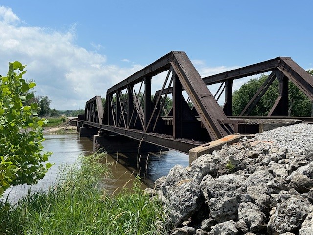
"Built in 1902, this bridge is the final outdated structure on CRANDIC’s Amana subdivision south of Cedar Rapids, Iowa." It will raise the bridge 30" so that it is above the 100-year flood height and it will increase the load capacity to 286,000 pounds. "On average, 90,000 railcars—including over 27,000 carrying hazardous materials—cross it each year." The replacement was funded with a grant from the FRA. "Since 2008, CRANDIC Rail has replaced the other eight bridges in the Amana subdivision, which connects the Iowa Interstate Railroad (IAIS) to its interchange point with CRANDIC Rail at its yard outside Cedar Rapids."

Some sources say an HAER was made, but none of them provided a link.

18:26 video
It is a pin connected Pratt truss bridge, which is becoming more and more rare.

Same video

Same video
The video goes on to provide a history of the Amana Colonies. It also talks about the start of Amana Refrigeration, which became Maytag and then Whirlpool in Middle Amanda. The video gets back to railroading at 10:08.

@ 16:18

@ 17:44

When looking at a satellite image, I noticed the wide flood plain that this railroad crossed and that most of the crossing is an embankment. This bridge provides a very narrow gap for the flood waters to flow through.
Satellite

So, I looked closer and found that they have a secondary bridge over the floodplain.
Satellite

I think this is that secondary bridge. Obviously, it is a concrete girder bridge. And it has a longer opening than the main bridge has.
@ 6:02

This looks like the building of that secondary bridge. It is 458' (140m) long. It was replaced in 18 hours. These are three photos from amcohron-son.
1

2

3

This is the post that motivated these notes. The new bridge is a steel girder bridge.
Federal Railroad Administration posted
Cedar Rapids and Iowa City Railway Company (CRANDIC) is scheduled to complete construction this fall on a new span across the Iowa River near Middle Amana, Iowa, replacing the existing 120-year-old bridge. Once complete, the new bridge will support the growth of the local economy by ensuring safe and efficient rail car movement. This project was made possible by $5.4 million in FY 2020 funding from a FRA Consolidated Railroad Infrastructure and Safety and Improvements (CRISI) Program grant.

The FRA posted three photos with the comment: "Cedar Rapids and Iowa City Railway Company (CRANDIC) is scheduled to complete construction this fall on a new span across the Iowa River near Middle Amana, Iowa, replacing the existing 120-year-old bridge. Once complete, the new bridge will support the growth of the local economy by ensuring safe and efficient rail car movement. This project was made possible by $5.4 million in FY 2020 funding from a FRA Consolidated Railroad Infrastructure and Safety and Improvements (CRISI) Program grant."
1

2

3