Thursday, October 30, 2014

CREATE: P1 - Metra/Rock Island Flyover

Update: In 1965, Marty Bernard took several photos from the Englewood Union Station. The Rock Island had 3 tracks crossing 4 Pennsylvania tracks.

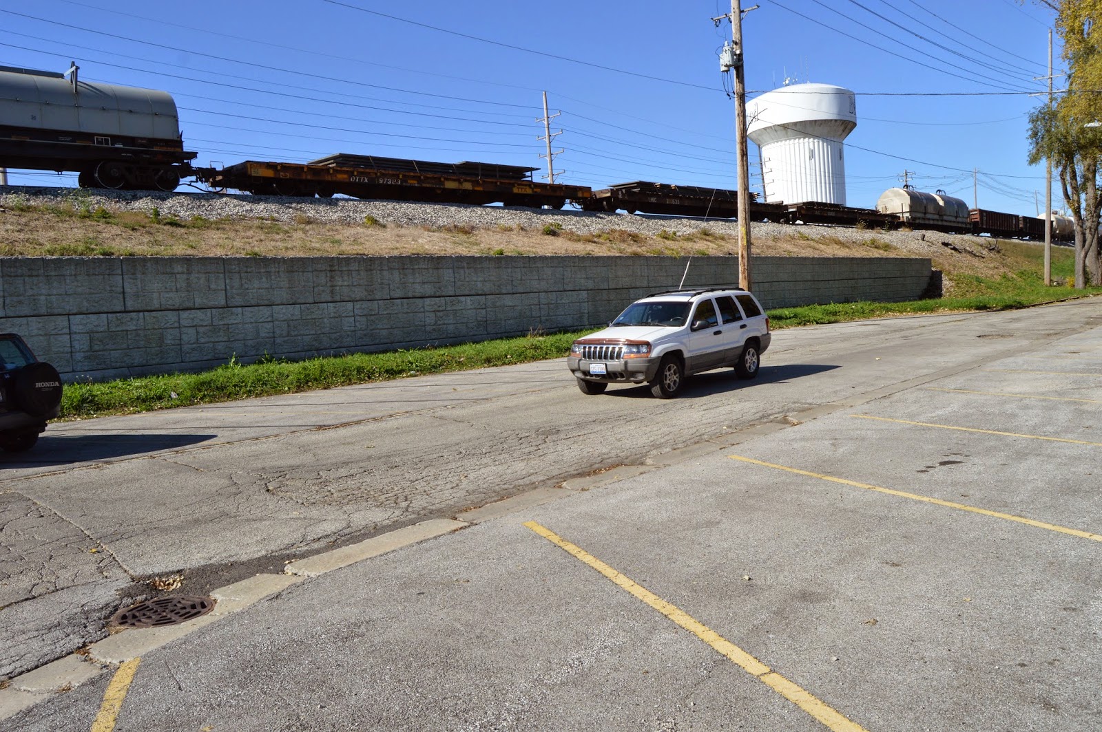
On page 6 of the main section of the  October 24, 2014, Chicago Tribune had an article by Richard Wronski announcing the completion of the CREATE project P1. So it is time to research that project.
Once again, the CREATE web site has not been updated to record the cost nor the completion date. So I'm really glad I tripped across the page 6 article. The cost was $142 million. This project is easy to understand -- the former Rock Island tracks (now Metra) are raised over the former Pennsylvania (now NS) tracks at what was the Englewood Junction. Amtrak also uses the NS tracks. Update: a video of the dedication ceremony has some interesting background activity.

Completed in late 2014, the Englewood Flyover replaced a heavily used Metra and Norfolk Southern Railway crossing at 63rd and State streets in Chicago. Now each day, nearly 80 Metra trains cross the bridge over tracks used by about 60 freight and Amtrak trains. [ProgressiveRailroading]
Photo – Norfolk Southern Railway

Kevin Piper posted
Robert Petit: I believe that this is a Mark Llanuza photo for Metra on the dedication of the flyover.
Marshall Beecher: I, too had the pleasure of being here to get these shots, but non disclosure agreements prevented any of mine from seeing the light of day back then. It was truly a rare thing with the Rock both above and below the NS Chicago line, at the time.
Sayre Kos: Marshall Beecher You may recall the Amtrak movement was a bonus: That was the annual AAPRCO special headed east.
Here’s one above and one below:

Chicago Tribune, Oct. 24, 2014
Satellite before construction
 Since the current satellite images are not new enough to show the construction, I save one of them as a before picture.

At first the cost surprised me because I remembered that the B2 project cost "just" $83 million. But then I identified some reasons why P1 would cost more:
  • The bridge+approaches can carry 3 tracks instead of one.
  • Since the project description indicates the scope of work extends to 69th Street, it appears the southern approach needed to go over I-90/94. This is a lot bigger span than the NS tracks.
  • The bridge is "double high" since it is going over tracks that are already elevated.
  • Since the new construction is west of the existing tracks, some urban property may have been purchased.
This project needed to be completed before other CREATE projects will move more commuter trains to the Metra route and more Amtrak trains to the NS route.

A construction video confuses me. Since the span behind the crane crosses the NS tracks, what is the purpose of the span for which it is lifting girders? That seems to be an rather expensive span over dirt. I need to give some more thought as to whether or not I'm going to go to that neighborhood to take my own pictures.

The Tribune article also explained the controversy concerning the usage of minority-owned contractors. I believe it is a fair summary that the Metra CEO, Alex Clifford, thought he was being asked by the Metra chairman, Larry Huggins, to bribe the over site hiring monitor -- the National Black Chamber of Commerce -- with $50,000. Also Clifford thought that a $200,000 no-bid contract that Huggins helped Target Group get did not fullfill the terms of the contract. These were some of the issues that caused Clifford to leave Metra in May 2013. If you Goggle "metra scandal" you are offered several to choose from. I saw that soon after Clifford left, 6 board members were gone. I was looking for a reminder of which disgraced Metra executive committed suicide by stepping in front of a Metra train, but I could not find that information.

Todd Hollritt posted
Update: Todd's comment:
Norfolk Southern 20K the 63rd Street – Chicago, IL to Croxton Yard – Jersey City, NJ intermodal freight arrives at the former Erie Lackawanna.
Calling it 63rd Street cost me some time. There is nothing at 63rd Street. Even after the planned extension, the yard goes to just 59th Street. I believe the train is going to the intermodal yard that combined the former Wabash and C&WI/Erie yards.The train is still several blocks away from the yard.

An aerial photo by the Tribune showing the flyover and a NS train crossing the expressway. Also some of an NS intermodal yard on the right side of the picture.


Train Watching: IHB+UP/CNW

I started taking a video of an northbound IHB train south of the UP/CNW crossing.


But the train was so slow that I switched to taking pictures of just the "fallen flag" vehicle cars and then the remaining cars since it ended up being a mixed freight. (I computed that the train was going 6 mph.)
The Diesel Shop has a link to an IHB locomotive roster. That page indicates locomotives 2163 and 2161 are NRE 3GS21B gensets built in 2012 in Mt. Vernon, IL. The gensets use three 700 hp Cummins engines. 2161 was built on a SP SD45T-2 frame whereas 2163 reused a SP SD40T-2 frame. In the following screen shots, we can see that in each locomotive the 2 gensets nearest the cab are active.


In terms of the fallen flags,
20141025 0063
there was a Chicago & North Western car...

 ...two Grand Trunk cars...
 ...three Conrail cars...
...and a Southern Pacific car.


The UP locomotives are model C41-8W 9451 and 9453 and model C44-9W 9721. In addition to the transfer train climbing the new connection to the IHB, around timestamp 2:50 is a train backing into Proviso Yard on the ground level.


I believe the bulk-head flat car was carrying steel I-beams.


There was only two gondola cars with a visible load -- coils of wire.

All four flat cars were carrying steel plates. I include a picture to record how low the steel is stacked. A reminder of how heavy steel can be.


And I looked closely for a red light on the End-of-Train device and did not notice any, blinking or otherwise.

The number of vehicle cars in the IHB train was computed from the timestamps on the video and photos and an estimate that it took 10 seconds for each 88-foot car to pass. The speed computes as 6 mph. Even I can jog that fast, for a little bit.


An analysis of the car types in the three trains. Note that I could not analyze all of the cars in the UP trains because I ran out of battery while taking the video.


IHB UP->IHB UP yard
tank 13

3-bay covered 4 44 18
2-bay covered
3
gondola 9

coil 7

vehicle 40

lumber
1
flat 4

bulk-head flat 1

box 3 17
refer 4
13

82 82 30

Wednesday, October 29, 2014

CREATE: GS6 - 25th Avenue

GS6 is a grade separation between 25th Avenue and CNW/UP tracks in Bellwood, IL. On the CREATE status map it is supposed to be in the construction phase. But the only activity I could see is that they have erected a sign.

20141025 0058
I was not aware of this CREATE project when I did my field trip. The reason I was in this neighborhood was to check out projects B2&B3.

I was going North on US-12 to check out the pedestrian walks on the bridge over Proviso Yard. The good news is that it had walks on both sides of the bridge. The bad news is that those high fences that curve inwards is an indication that I'm in a "questionable" neighborhood. So I kept on driving until I got across the bridge and could turn right. And then I drove east until I could turn right again, which was on 25th Avenue. I had noticed that many of the parking lots were surrounded by fences with barbed wire on top. Another indication that the neighborhood has had issues. But when I saw the sign, I pulled into a driveway to take a picture. When I was done, I noticed that a security guard was walking towards me. I explained that I was just taking a picture of the sign, and I left.

Since there was no traffic behind me, I stopped on the C&NW/UP crossing to take pictures looking West and then East. But you can tell by the crooked picture I was nervous about setting on the crossing too long. The rail overpass in the west-looking view is the IHB.

20141025 0055c


I was surprised that they plan to do an overpass instead of an underpass because the tracks are a few feet higher than the road here and we have seen that the project managers seem to prefer underpasses.

Update:
I have a friend that used this street in his commute. He reported a couple of years ago that they shut it down completely for the work. There are not a lot of crossings so any detour he tries is bad.

Bill Molony shared and IDOT posting of an IDOT Instagram, Sep. 16, 2016
Here's a look at the CREATE GS6 project at 25th Ave. between Lake Street and St. Charles Road in Bellwood.
The improvements eliminate grade crossing, reduce congestion and improve safety for 21,000 vehicles and 38 Pace buses per day.
The new overpass opened Dec. 22, 2016. "The railroad overpass project was made possible by a $22.2 million contribution from Illinois Department of Transportation (IDOT), $2.4 million from the villages of Bellwood and Melrose Park and $16.4 million from federal, railroad and other state sources." I noticed they dodged the question of how much Union Pacific and the Feds contributed to the $41 million project.

Satellite
A satellite image downloaded in Nov 2017 shows that they had done some of the pier work for the overpass.

An Arturo Gross Flickr 1994 photo of a westbound intermodal at 25th Avenue provides another "before" photo. (source)

Jerry Jackson commented on Arturo's posting
This was right off the northeast corner of the 25th ave crossing.
Probably mid-80's.
Update: I did a satellite image check on 10/30/2018 and it has not changed.

CREATE: B2, B3, B4 and B5

CREATE projects B2 and B3 improve the connection between the IHB and UP/C&NW/Galena&Chicago. To better understand what the projects did, I verified that the http://www.bing.com/maps/ images are old enough to provide a "before" picture.

Satellite
That means that they are older than September, 2009, because that is when the B3 project was completed.This project double tracked the connection between the CNW Proviso Yard and the IHB to feed a new fourth track on the IHB.
I can't figure out how to remove the labels when I zoom in on the bird's-eye view, so the image to the right is the highest resolution I can get without labels.

I compared Bing's roadmap with Google's roadmap to confirm Google is accurate at high resolutions concerning track layout, but Bing is not. Note that Bing missed the old connection between CNW and IHB (the curved track in the closeup on the right). Even with the label lines in the way, you can see that the IHB has only three tracks crossing the CNW. In fact, you can see the expanded bridge abutments for the fourth track and one of the spans for the new bridge.


I discovered that the Bing maps in FlashEarth do allow you to display the maps without labels, but this version is the same up-to-date images that the other satellite sites use. But the labeled version still has errors because it is now missing both the old and the new connections. (Google's road map shows both connections.)

Satellite
I don't understand this project. The writeup said the old connection blocks the IHB mainline. But the mainline has 3 tracks. There don't seem to be many yards north of this connection. Is there really more traffic than 2 tracks could handle? And why does the IHB have to run its trains so slowly? A northbound IHB train was going so slow that I quit taking a video of it and switched to taking pictures. Increasing the speed would not only reduce the time a freight car spends in Chicago, it would increase the capacity of the IHB tracks. Surely the slow speed is not because the IHB skimps on track maintenance. Proper track maintenance has got to be cheaper than building another bridge. Furthermore, the mainline is down to just 3 tracks anyhow soon after the new track is across the bridge. So does a few hundred feet of length really help that much? I noticed that the this project description page does not include the cost of the project.


Below is the bridge that was built by the B2 project. According to an ASCE article, the project was completed in September, 2013.

20141025 0102c
Below is a newer version of the first map above to illustrate the B2 project.

Satellite
I marked up the above image with a red line to highlight the new connection.

This $83 milllion project does make sense. If you look at the first satellite image at the top of this page, you will see that freight trains leaving the IHB using the old connection had to travel on the bottom track for a few blocks before it took the S-curve connection up to the freight yards. And the new track reduces the incline of the connector because the rise is now spread across the relatively long east-west section.

That bottom track is the track used by the commuter trains. I caught a freight train on the connector while I was there, and I learned that the UP also runs it trains slowly. (Around 2:50 in the video another freight appears on the lower yard lead.)
Screenshot
Since this track is just a year old, it should not be running slow because of bad tracks. Is it because of the sharp curves? Because the freight trains are so slow? If a commuter train is blocked by a slow freight movement, it could incur a significant delay. This freight flyover removes a commuter train being blocked by a freight train.

Flickr from John W. Barriger III IHB Album
Bob Lalich 5y 
Overpass of CNW mains and connection to Proviso.

Carlos Ferran posted four photos with the comment: "Yesterday was a good day if you were on the Harbor/Proviso. A UP manifest had quite the lashup that afternoon, consisting of a UP SD70M, CSX C40-8W, and two former BHP Billiton SD70ACe's. They departed Proviso last night on the M-ELNP-21. Word is these former Aussie ACes are bound for Progress Rail in Marshalltown, IA." (Used with permisson.)
1

2

3

4


Projects B4/B5 were signalling and track work for a 7-mile stretch of the IHB. It demonstrates that Chicago still has 19-th century rail technology in the 21-st century because it upgraded over a dozen hand-thrown switches to power switches. It also added and improved crossovers. Instead of taking 2 hours to cover the 7 miles (3.5 mph, walking speed), it takes "just" 20 minutes. That is still just 21 mph. The report is excited that the track speed is now all the way up to 30 mph. This makes me appreciate how fast freight trains run on the BNSF/CB&Q racetrack near my house. What struck me was the cost -- $38 million for "just" track and signalling work. Track and signalling work is more complicated than I would have guessed.

(For my reference: if I can force myself to describe how B4/B5 wasted a lot of our federal tax money, I'll need this posting that confirms the connection on the north side is seldom used.)

Monday, October 27, 2014

Chicago Passenger Stations Overview

WanderWisdom provides an overview of the stations.


Another overview of Chicago's main passenger stations

Chapter 5 of Rail City Chicago USA and Chicago Stations & Trains Photo Archive describe the 6 long-distance passenger stations that used to exist to the west and south of downtown Chicago. For reference, I marked up a satellite image and a 1938 aerial photo according to the convention:
MapQuest plus Paint
For the 1938 image, I include just the 4 southern stations so that I can include the service and approach tracks in the image because these yards are long since gone.

IHAP plus Paint

Bill Molony posted
Chicago station lead tracks, taken from the Board of Trade building:
Far left - Dearborn Station
Center - La Salle Street Station, with a New York Central train leaving
Right Center - Grand Central Station and lead tracks
Far Right - Coach yards and lead tracks from Chicago Union Station
[The IC Central Station is out-of-frame to the left and the C&NW Station is way behind the photographer's back.]
Jim Vecchitto what a great picture.. Pre Congress x-way which opened in 53.. Any idea actual date of photo..

Bill Molony posted again
Chicago's downtown stations, photographed from the Board of Trade building.
On the far left is Dearborn Station, served by the AT&SF, the C&O, the GTW, the Erie, the C&EI, the Wabash, the CI&L and the C&WI.
In the center is La Salle Street Station, served by the NYC, the NKP and the CRI&P. An NYC express train can be seen leaving.
To the right of center is Grand Central Station, served by the B&O, the Pere Marquette, the Soo Line and the CGW.
On the far right is the coach yards and leads from the south side of Chicago Union Station, served by the PRR, the CB&Q and the GM&O.

David Daruszka commented on another Bill Molony post
Exposure adjusted.
John Ullrich You can still see the air. Somethings have really changed for the better.
David Church The coal burning years in the city were truly dreadful. Soot on window sills everyday. Air foul much of the time. Folks today have no idea how far we’ve come with clean air and water.
David Daruszka Dearborn survived as an office building. LaSalle Street was sold by the people handling the bankruptcy of the Rock to satisfy creditors. Grand Central was demolished by the CSX because they no longer wanted to pay the property taxes on improved land. The City of Chicago and various planning agencies put forth numerous schemes to consolidate the passenger terminals that never came to fruition. If you are interested in the politics of the downtown railroad terminals I refer you to Fred Ash's excellent book "Chicago Union Station". http://www.iupress.indiana.edu/product_info.php...

On Lake Michigan posted
A view of downtown Chicago in 1930
Melanie Palen Shebel shared
Chicago, 1930
Craig Stenseth: Merchandise Mart was new?
William D Brown: Craig Stenseth As Was the Civic Opera House and the tallest building in chicago the Board of Trade
Dennis DeBruler shared
This view includes five of Chicago's six main stations and their trains sheds. And it includes C&NW's freight houses and Erie Street Yard along the west side of the North Branch. Also note that the Old Post Office is just the original skinny building.

Dennis DeBruler posted
1927 aerial view    In addition to the train sheds of the Grand Central and La Salle Stations, we see the Chicago Board of Trade being built. But of particular note is the team tracks in the lower right corner. Not only are they all occupied with boxcars, there is a lot of unloading action. https://catalog.archives.gov/id/23939689 via https://catalog.archives.gov/search-within/512841?q=chicago
Jimi Krentkowski: Dennis, how did you know about this photo? Really neat for sure. I can get pics from Illinois historical photos, but this goes back 12+ years!
Dennis DeBruler: I came across a link to a different photo. That taught me about https://catalog.archives.gov/. Then I did the indicated search for Chicago. I didn't carefully analyze the result, but the above photo caught my eye as a new view of the Chicago railroad scene.

Bill Molony posted a lower resolution copy of this map, Bill Nimmo provided this resolution in a comment
This railroad stations of Chicago map is from the Pennsylvania Railroad timetable effective April 30, 1967.
Bill Edrington: Note that the "Michigan Central" used La Salle Street by that time but the "Big Four Route" was still using Central. I wonder how many travelers in 1967 even knew what those railroads were. But then the PRR wasn't going to make it easy for NYC passengers, I guess.

Rom Bedwell commented on Bill's post
Here is a 1957 map. See the major differences? The Blue Line Subway only goes to La Salle St Station. There is a west bound El line off the loop that connected with Union Station. Many time I got off the El and walked right into the station. Even the part of CUS where you did that is now a large parking lot.

In the following table, the row that spans 3 columns lists the railroads that used the station.

NameOpenedEndingOwner(s)
Dearborn Street1885Closed 1971, Re-purposed in the 1980sChicago & Western Indiana
Santa Fe, Chicago & Eastern Illinois, Chicago, Indianapolis & Louisville (Monon), Erie, Grand Trunk Western, Wabash, Chesapeake & Ohio (initially, moved to Grand Central)
Grand Central1890Demolished 1971, still (2015) a vacant lotBaltimore & Ohio
Chicago Great Western, B&O, Pere Marquette, Wisconsin Central (Soo), C&O (later)
Central1893Demolished 1974Illinois Central
IC; Cincinnati, Chicago & St. Louis (Big Four); Michigan Central (MC and Big Four used this station initially. They changed to La Salle when they became part of the NYC System)
La Salle Street1903just commutersRock Island and New York Central
RI; NYC; New York, Chicago & St. Louis (Nickel Plate Road); Chicago and Eastern Illinois Railroad (joining RI tracks in the Ashburn neighborhood)
Chicago & North Western1911just commutersC&NW
C&NW
Union Station1925commuters and AmtrakCB&Q, Penn, Milwaukee
Chicago and Alton(GM&O), CB&Q, Milwaukee Road, Pennsylvania. After Amtrak was formed in 1971, all long distance passenger trains were moved to this station.


Bob Lalich commented on a posting:
NYC did not abandon the original MC line between the state line and Kensington after gaining control of the LS&MS and MC. The MC line hosted Detroit passenger trains which terminated at Central Station well into the 1950s. In 1957, Detroit passenger trains were rerouted to the LS&MS line at Porter and used LaSalle St.
Comments on a posting:
Bob Lalich After constructing the SC&S in the late 1880s, most of the Panhandle passenger trains used the SC&S between Bernice Jct and Colehour Jct, then the Ft Wayne line to reach the south end of Union Station. I believe any remaining secondary passenger trains using the original Panhandle line into the north end of Union Station were gone by the 1920s.
David Schnell Bob Lalich Yes. The last Panhandle Route passenger train to use the North Concourse was 1927.


Dearborn Street

Contents moved to Dearborn Station.

Grand Central Station

Contents moved to Grand Central Station.

Central Station

Contents moved to Central Station.

La Salle Street Station

Contents moved to La Salle Street.

Chicago & North Western

Contents moved to Chicago & North Western.

Union Station

Contents moved to Union Station.

Bill Molony posted
The seven central Chicago passenger depots - 1892.Baltimore & Ohio - depot #5Chicago & Alton - depot #3Chicago & Atlantic - depot #6Chicago, Burlington & Quincy - depot #3Chicago & Eastern Illinois - depot #6Chicago & Grand Trunk - depot #6Chicago, Milwaukee & St. Paul - depot #3Chicago & North Western - depot #2Chicago, Rock Island & Pacific - depot #4Chicago, Santa Fe & California - depot #6Chicago, St. Louis & Pittsburgh - depot #3Chicago, St. Paul & Kansas City - depot #7Chicago & Western Indiana - depot #6Illinois Central - depot #1Cleveland,Cincinnati, Chicago & St Louis - depot #1Lake Shore & Michigan Southern - depot #4Louisville, New Albany & Chicago - depot #6Michigan Central - depot #1New York Chicago & St Louis - depot 

In a later posting of the above  map, David Daruszka added the comment:
The map also predates the World's Columbian Exposition of 1893. Central Station does not appear on the map (built to coincide with the Fair) #1 on the map was the original IC station (also known as Central Station). #5 is the B&O depot that was in the Exposition Hall located on the site of today's Art Institute, also built for the Fair.

Bill Molony posted
Ken Molinelli shared Jeff Curran's post.
Chicago Stations 1930. Northwestern and Union Station in the upper left corner, LaSalle at the center, Grand Central to the left of LaSalle and Dearborn to the right of LaSalle. The IC station is out of the picture to the right.
Bill Molony posted
This 1893 Rand, McNally & Company railroad map of Chicago shows seven different downtown passenger stations being served by a total of 22 different railroad companies.
Numerous additional passenger stations were located at various locations in the outlying areas of the city. 
Then, as now, Chicago was the railroad capital of the United States.
Bill Molony posted a light version

Seventh photo posted
Lake Shore & Michigan Southern Depot-demolished 1902
Chad Brown posted a description and photos of several of the depots. Of special interest is this LS&MS Depot because I don't remember hearing about it, let alone seeing a photo of it. Was it a precursor to the La Salle Street Station? LS&MS was absorbed by the NYC and was its main route between Chicago and New York.
Nickel Plate had their own depot until they moved to La Salle on the orthwest corner of Roosevelt Road and Clark Street that is now occupied by a Target Store. [Facebook, Wikipedia] Location "9" on this 1897 Chicago Railroad Map.
1897 Chicago Railroad Map
Marty Gatton shared
1958 Photograph by J. Sherwin Murphy, ICHi-020187
[The station specific notes indexed above have many photos like this of trains at a station. I include this one here because you can see where all three south loop stations were with respect to each other. The "barn" in front of the Lee advertisement is the trainshed of the Dearborn Station. The tallest building would be the Chicago Board of Trade, and that is where the La Salle Station was. The clock tower on the left side was at the northeast corner of the Grand Central Station.]

I found information on the railroad's passenger coach yards.

1910 LaSalle Station approach tracks including freight houses and RI grain elevators

1941 tracks and buildings around LaSalle

A video of WTTW's Geoffrey describing the passenger stations