Below are several pictures I took of the
Will County plant because it is next to
135th street in Romeoville. I knew that the Fisk and
Crawford plants did not have scrubbers and would be shutdown. But I was not aware of this plant, so I did not know if it had scrubbers. Even if it did have scrubbers, it may soon become history because the coal (and nuclear) plants are having a hard time competing with gas-fired plants because of the increase in supply of natural gas caused by horizontal drilling and fracking. According to
Romeville Patch, none of the plants have scrubbers because they were grandfathered with respect to the Clean Air Act when Midwestern Generation bought all of ComEd's coal-fired plants in 1999. The article also indicates that Fisk, Crawford, and two of the four stacks of the Will County plant were shutdown in 2012. The Chicago Tribune also has an
article on the closing of the two Chicago plants. It indicates that mercury emissions is the pollution issue. But I read something on the company's web site that bragged about them recently adding pollution controls. I wonder if they added scrubbers soon before they closed them.
(Update: It should be no surprise that Midwest Generation went bankrupt rather soon after it closed some of its plants. (I wonder if it owned
State Line as well. That plant has not only been closed, it has been torn down.) NRG now owns these plants.)
1903 Fisk
reference.insulators.info:
Jan 6, 2906 and
May 16, 1908
Fisk went into service October 2, 1903 and closed 2014. The demand for electricity from Samuel Insull's Chicago Edison Company (see below, HAER says Commonwealth Electric Company) was growing so fast that Insull pushed GE it increase the size of the generators. The 1894 16,200-kilowatt Harrison Street Station that used reciprocating engine units was overloaded in less than 6 years.The original 5MW (million watts) steam-turbine generating unit ordered for Fisk was such a significant advance in capacity that when it was retired it was returned to GE's headquarters in Schenectady, New York, to be preserved.
(Sep 2020: I see that
the GE link to the photo that I had here has broken. Fortunately, I think I found another photo of the same generator. While looking for a replacement photo, I found
TurbineHistory and
500k.)
 |
SchenectadyHistory.org via ASME
|
The state-of-art before this unit was a 0.6MW unit by GE and a 1.5MW unit by Westinghouse. It was designated a
national engineering landmark by the American Society of Mechanical Engineers in 1975.
In 1914, the plant continued its innovation by replacing the vertical-shaft turbines with horizontal-shaft turbines. This spread the weight better across the foundations so that larger, faster spinning turbines could be built.
Because this plant is in the Illinois & Michigan Canal National Heritage Corridor, the
Historic American Engineering Record has documented it as (HAER) No. IL-105, "
Commonwealth Electric Company, Fisk Street Electrical Generating Station". Of note is that it says the Fisk Plant was built by the Commonwealth Electric Company which merged in 1907 with the Chicago Edison Company the Commonwealth Edison Company. The plant can receive coal from barges.
 |
Photo from HAER ILL, 16-CHIG, 140--6 from il0671
VIEW OF BARGE SLIP (CALLED MASON'S CANAL, WHICH EXTENDS OFF THE SOUTH BRANCH OF THE CHICAGO RIVER) AND COAL DOCK; TO THE RIGHT IS THE EAST FACADE OF THE 1959 GENERATING STATION. LOOKING SOUTHWEST. - Commonwealth Electric Company, Fisk Street Electrical Generating Station, 1111 West Cermak Avenue, Chicago, Cook County, IL | | | |
|
|
ComEd
posted two photos with the comment: "These pictures show the interior of the Fisk Generating Station, a coal-fired electric generating station still located on Cermak Road, though now inactive. Fisk began service in October of 1903 and was hailed as "a monument to engineering genius" by industry peers due to its productive capacity being nearly doubled that of any steam-powered generator built at the time. Today, however, Fisk is obsolete thanks to increased #EnergyEfficiency standards and our industry-leading environmental commitments. But the building still stands tall as a proud reminder of our history #PoweringLives in Chicago and beyond! #ThrowbackThursday"
Mary Kerr O'Toole: I worked there as their first female coal plant supervisor and your facts are a bit off. Fisk was retired but well before energy efficiency programs were created...or had their impact on generating!! Check your facts!
Harrison Estepp: A couple more facts about Fisk Street Station:
Fisk was the “first all steam turbine” generating station, and for several eras was the largest generating station in the country.
Unit 1 was a 5MW vertical steam turbine (with Units 2-4 being identical). Frank Sargent (of Sargent & Lundy) was the engineer for Unit 1. Unit 1 is an ASME Historical Landmark and was returned to GE HQ in Schenectady, NY and is still on display there.
Unit 19 was the last steam unit in service there, a late-50s vintage Allis-Chalmers 340MW machine.
Bill Stephan: Harrison Estepp 19 was another cross compound unit with a HP, IP and a secondary half speed LP that was across from the Quarry Street Staion that was still recprocating steam in the kW range...
Frank Romano: In 1903, did it generate DC power?
Harrison Estepp: Frank Romano Many units there were 25Hz (including Unit 1 I believe ). 25Hz was one standard at the time, and was used by the CTA.
 |
| 1 |
 |
| 2 |
 |
Bill Stephan commented on Brett's share
Then came Crawford Station at 3501 Pulaski (Crawford Ave, Chicago) in 1923 had six chain grate stoker fed furnaces with six 75 (?) MgW Parsons turbines with G.E. generators. It was billed as the worlds largest generating facility at the time. Repowered in 1956 ish with a 265 cross compound GE unit and a 345 Westinghouse tandem unit. Shuttered in 2010 and now a prarie. Bill Stephan ComEd 1976 to 2005. This is Fisk's turbine building front. |
Sarah Vitone
posted two images with the comment: "Part II of some older scans. The postcard scan is courtesy of a friend, I used it to create the colorized version as accurately as I could at the time.
Some gentlemen rewiring generator armature in 1906 - Fisk Generating Station in Chicago"
[Some comments identified this as Fisk Station.]
 |
1
[15,000 horsepower is 11mw.] |
 |
| 2 |
1924 Crawford (HAER)
According to
Wikipedia, this plant could also burn natural gas, so now I'm surprised that it was closed. It was built in 1924 and closed in 2012.
 |
HAER ILL, 16-CHIG, 141--2
2. GENERAL VIEW OF GENERATING STATION; SOUTH FACADE OF SWITCH HOUSE AND ADMINISTRATION BUILDING (MIDDLE), PUMPING STATION (FOREGROUND) - Commonwealth Edison Company, Crawford Electrical Generating Station, 3501 South Pulaski Road, Chicago, Cook County, IL |
The buildings were designed by the renowned architectural firm of Graham, Anderson, Probst and White. The building in the foreground is the pumping station on the edge of the Sanitary and Ship Canal.
Four photos provided in comments made by Bill Stephan on Brett's
share in the Fisk section above.
 |
1
No personal life but lots and lots of $$$ |
 |
2
Unit 6 last run in 1976. |
 |
3
Original 1923 voltage regulation equipment. |
 |
4
This is Crawford Unit 7 & 8 with the original 4,5 & 6 remnants in the floor. |
 |
Dan Genuario posted
High voltage testing lab - Crawford generating station |
Update: Ramon took a lot of pictures of this plant because he plans to use it as a photo backdrop on his model railroad of BNSF. He got his pictures while both smokestacks were intact.
Edward Kwlatkowski has
a 1989 Flick photo that also shows both smokestacks.
A view from the river side.
Had at least one if not two SW1s based there.
When I took a picture in 2015, the red striped smokestack had already been cut down.
Former Little Village coal plant to be demolished, replaced with distribution center
 |
Mike Croy posted
Here is an overview of the "new" Corwith yard as seen on the cover of the Santa Fe's 64th. annual report.
[Note the Crawford Plant in the left background with at least three smokestacks.] |
 |
| Steven J. Brown posted, cropped |
 |
Edward Kwiatkowski posted
The coal burning Commonwealth Edison Company's Crawford Generating Station electric power plant ,on South Pulaski Road along the north bank of the Chicago Sanitary & Ship Canal. Photogeaphed facing north on top of the South Pulaski Road highway overpass bridge. Chicago Illinois. April 1989. Closed in 2012. Gone- Demolished. Site redeveloped. Eugene Klichowski: The demolition caused a huge cloud of debris dust that blew over the Little Village resulting in a 12 million dollar class action suit which led to $300 + checks to those affected. Barely a bandaid for those hospitalized. |
 |
Mark Lucas commented on Edward's post
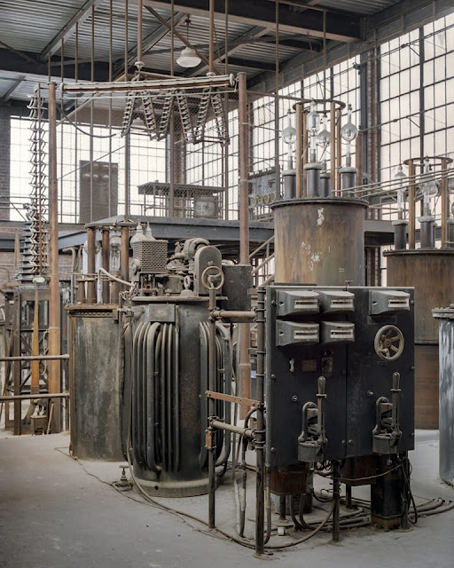
Worked there off & on as a Division Substation Testing Engineer in the 80's & early 90's during my ComEd career. Included was the time of the 12kV substation fire in the lighter red brick building on July 28, 1990. The place had a number of historical electrical artifacts still preserved prior to the sale to Edison Mission Energy in the late 90's. My favorite was the Kenotron Room, a high voltage test setup that was used to test the insulation integrity of equipment. From this room, Hi Potential tests could be preformed on the equipment ranging from the 12kV feeders all the way to the 138kV lines. I was lucky enough to have the Station Operators (Union rules) let me operate the 100kV DC Kenotron set a few times. It was most spectacular at night when the Kenotron Tubes would light up light a Frankenstein movie. The Kenotron would be operated from the elevated cage platform, a 4kV inductor regulator would power up the step up transformer and the Kenotron Tubes. Literally when running the test, one would feel the 60hz vibration on the steel floor. Back in its day like many other utilities, ComEd had many great testing facilities and equipment – re-orgs took care of that. A few youtube urban explorers (the Proper People & Free4all) have clips out there on Crawford before the wrecking ball cleaned house. |
 |
| Bob Lalich commented on a post |
 |
MWRD posted
A view to the north showing construction of the Crawford Avenue bridge on August 15, 1928.
MWRD posted again
Roman Keating: Old Crawford station in the background!! |
 |
GM&O E7As #102 & #102A at Chicago, IL (2.23.63)
Chris Hudson Southwest side..near old GM&O freight house 37th & California..
|
The comment "
Southwest side..near old GM&O freight house 37th & California.." confirmed the smokestacks in the left background is the Crawford Generating Station. I've never seen photos of that station with more than two smokestacks, so I found the station on an old aerial photo.
Not only did it use to have four units, the units were of the same design. We can see in William's posting that two of the units have been upgraded. It is worth noting that even the 1938 units were running with very little soot in the smoke.
 |
|
Here's an urban industrial grab shot that I took (probably with "car trouble") at Forest View in 1983. "Power and Bare tables" -- 9 units with a GP20 as the leader!
Dennis DeBruler I had never noticed the coal handling equipment at the Crawford Generating Station before. But it still stands:
Andre Kristopans Crawford was a steam station. Ridgeland (long gone) at Pershing and Ridgeland was another. Most ComEd stations received coal by barge, but each had an SW1 for interplant movements as most cases the coal pile was at the "land" end of the plant. |
 |
David Wilson from his photoset
19880514 02 ICG CM&W IMX, Chicago, IL
IMX was a combined Illinois Central Gulf and Chicago, Missouri and Western facility.
[The Crawford plant is the smokestacks on the left side. The smokestacks on the right side are still standing and are for the powerhouse for the Cook County Campus.] |
 |
Dave Durham posted
It's the summer of 1895 and we are on site at the Lockport Division of the Chicago Sanitary Channel. The view is to the East. To the right of the channel is the Illinois & Michigan Canal, curving to the right, and if you have a large enough screen, the tracks of the Chicago, San Francisco & California RR. HATHITRUST, 1896, Unknown photographer. |
 |
Bass Bass posted
HAER ILL, 16-CHIG, 141--1 1. GENERAL VIEW OF GENERATING STATION AS SEEN FROM FLY ASH STORAGE TANKS; WEST FACADE OF POWERHOUSE AND BOILER BUILDING (FRONT) - Commonwealth Edison Company, Crawford Electrical Generating Station, 3501 South Pulaski Road, Chicago, Cook County, IL. |
 |
| Tom Kehoe commented on Bass' post |
 |
| S Dilla Thomas commented on Bass' post |
Historic Building Designations are just another opportunity for Chicago city officials to accept bribes? They don't seem to slow down the destruction of a building. [
ArchPaper]
I had saved the articles about the 378' smokestack being blown up on Apr 11, 2020, but didn't get them processed. The "energetic felling" created a dust cloud that covered 100s of homes in the Little Village and beyond. This dust cloud added to the respiratory problems people already had because of COVID-19. The Nov 20, 2020, Chicago Tribune reported that a lawsuit has been settled for $375,000. "Hilco Redevelopment Partners is required to pay $250,000 under the settlement. Subcontractors MCM Management and Controlled Demolition will pay $60,000 each. The settlement also requires Hilco and its contractors to comply with dust mitigation plans for the remainder of the demolition project....Little Village leaders and some aldermen called on Lightfoot to strip Hilco of its $19.7 million in tax subsidies after the demolition. Last month, City Council approved an ordinance that would take away tax incentives in the future from developers who fail to comply with environmental rules and other city regulations." [
ChicagoTribune]
Comments on a
post:
“Extensive dust control and mitigation efforts including watering techniques such as water trucks, water cannons and direct-drive misting systems” will be employed, officials said. The Chicago Fire Department will be on hand for dust suppression.”
[Evidently, the firemen just stood and watched.]
 |
| Mary Janetos, cropped |
 |
| Dale Roger |
Accessed Mar 2022.
1955 Will County (Romeoville)
This plant has four units:
- 184 MW, built 1955, retired 2010
- 188 MW, built 1955, retired 2010
- 299 MW, built 1957
- 598 MW, built 1963
From
SourceWatch we learn the emmissions were:
- 2006 CO2 Emissions: 6,177,903 tons
- 2006 SO2 Emissions: 17,306 tons
- 2006 NOx Emissions: 6,324 tons
- 2005 Mercury Emissions: 261 lb.
To my surprise, a
Chicago Tribune article indicates this plant is dirtier than the old plants. Perhaps because it is bigger and burns more coal. Specifically:
A 2010 report by the National Research Council estimated that pollution from the Romeoville plant costs
surrounding areas $187 million a year in hidden health costs, compared
with $127 million for neighborhoods near the Fisk and Crawford plants in
Chicago.
Council estimated that pollution from the Romeoville plant costs
surrounding areas $187 million a year in hidden health costs, compared
with $127 million for neighborhoods near the Fisk and Crawford plants in
Chicago.
According to a
press release, they are trying to upgrade at least some of their units rather than close them.
 |
Jeff Everts commented on a post
Josh Biggers indicated that the Bug Line was extended to the plant in the mid 90s. So I guess they got coal only by barge before then. |
The plant is on the southwest quadrant of the intersection of
135th Street and the Sanitary and Ship Canal in Romeoville.
The
beam in the upper-right corner is part of the
coal-unloading gantry
that we saw in the background of the 135th Street bridge picture. Past the west end of the bridge, I could safely cross the bridge and get a better overview.
It is easier to see the south coal-unloading gantry in this view. I assume the two close smokestacks are for the 2 units that have been shutdown. The main reason for taking this picture is to note the size of the coal storage yard. I had noticed that I had not seen much coal storage at the Fisk and Crawford plants. In fact, one Fisk source talked about dumping the train hoppers right into the conveyor that fed the boilers. Another source talked about underground storage. But you can't store a lot of coal underground. So I wonder if this coal pile was used as the backup inventory for all three plants. That would explain why it is now just half full.
A couple of bulldozers were pushing coal towards the empty part of the coal storage yard. The top on one coming up the hill is visible just to the left of the big pile and the other is just to the right of that pile. I waited a while to catch a better view of them.
A close up of the north gantry:
The following view indicates that the canal-side structure between the two unloading gantrys is a barge loading facility. That reinforces my conclusion that this storage yard provides inventory for other plants.
During a later visit to the bridge (I keep looking for barge activity on the canal), I noticed that they were using an earth mover and a bulldozer to help move the coal towards the empty part of the storage yard.
 |
| This is the second of some photos posted by Jerry Jackson in the area. |
 |
Halsted Pazdzior posted
Will County Coal Handling bringing in loaded coal cars. Romeoville. 2/7/19
Andrew Shafer Nice catch! I think this one is staying open a few more years now.
Richard Scott Marsh ICG SD20 they never die
Aaron Grace Awesome! Street running on a bridge!
Dennis DeBruler I triple checked your date. That is a recent photo. I read a few years ago in multiple contexts that this plant was converting to gas. But I have noticed that their coal pile was really big. I wonder why they changed their mind and stuck with coal.
Adam Powell Trump regulation rollbacks maybe.
Adam Powell Coal maybe toxic but it works great for generating power. Where are they going to get the power from when the coal fired units shut down? They won't convert the whole plant to gas. They will install gas fired generators for peak usage time.
Dennis DeBruler I had read a few years ago that they were going to shut down the small units and switch a big one to gas. But maybe they then found out how big the gas pipe needs to be for a boiler of that size and the gas company told them they did not have the capacity to serve it. I read about Midwest Generation, the owner before NRG, bragging about adding mercury control to Fisk, Crawford, and some other plants. It struck me as rather poor planning to put money in Fisk and Crawford soon before they closed them down. I also wondered how can you close down your plants and not go bankrupt. The answer is that you go bankrupt. The plans to turn the Fisk land into a CTA repair facility have yet to happen. I've read recently that someone wants to turn the Crawford land into an "order fulfillment facility." Having a big warehouse in the urban area is be a big deal for quick deliveries.
Mark Egebrecht What street is that?
Dennis DeBruler I wonder how many other places in Chicagoland still has "street running" now that the railroad on Goose Island is abandoned.
https://www.google.com/.../@41.6294047,-88.../data=!3m1!1e3
Jeff Lewis Dennis DeBruler, there's the South Shore in Michigan City of course. Metra Electric 93rd St. branch runs down the median of 71st and Exchange Streets. Metra BI branch runs down the median of 121st St. Maybe some industrial trackage somewhere, but I can't think of any.
Halsted Pazdzior posted another photo of a coal train on the bridge on 11/29/2019.
Johnny Hansen posted #1802 on the bridge with snow
|
 |
Adam Powell commented on Halsted's post
I don't remember where I got this from. Not my picture. This is a little past the end of that line. |
 |
Dennis DeBruler commented on Halsted's post
That would explain why they added a big concrete bumper. |
 |
Jay Uryt posted
Will County Coal Handling SD20 #1802 rests behind barbed wires & metal fencing in Romeoville, IL awaiting its next assignment.
1/26/20
Charles Heraver Rebuilt in Paducah for the IC. Most of these SD20s were Southern and UP including a few SD24Bs.
Steve Kraus SD20 isn’t a real EMD model number; it was strictly an ICG rebuilding project unless someone else also adopted the designation.
Noah Fowler It’s next assignment will be sitting there as it’s been doing for years. |
 |
Steve Bruns commented on Jay's post
Not the same locomotive unless it was renumbered but this derailment happened roughly 14 years ago when the train crew at Midwest Generation Will County Station in Romeoville IL ran their locomotive off the end of a stub track and halfway across the E/B lanes of 135th Street. It's a remote control locomotive with the "engineer" sitting in an office watching a computer screen and in this case the groundman pulled the pin in the wrong location so when the engineer pulled ahead he never saw the cars separate on his screen so he gave it another notch, and another, and another until he was in 8th notch and going across the road without any train tracks. I can't imagine the panic any motorists must have felt. |
 |
| Steve Bruns commented on Jay's post |
 |
| Steve Bruns commented on Jay's post |
 |
Halsted Pazidzior commented on Jay's post
That unit is still in operation today. They work everything "manned" these days. Engineer in cab and conductor follows in pickup truck.
Steve Bruns I thought it was a different one but I wasn't positive. I used to work out of Joliet yard for EJ&E and CN for years but bumped out to Griffith IN 3 or 4 years ago and I'm pretty much out of the loop with Will County anymore. |
 |
| Jerry Jackson commented on Jay's post |
A couple of bulldozers were pushing coal towards the empty part of the coal storage yard:
 |
20140518 0029
|
A close up of the north gantry:
 |
Frank Smitty Schmidt posted
135th St in Romeoville, just north of ComEd's Romeo station, 2002.
ComEd had just started using remote control on the locomotives in their plant.
If I'm not mistaken, that exact same unit is standing on the NRG side of the fence today- at least, it was Monday. It's labelled "Will County Coal Handling". It was being refueled from a truck Saturday morning.
[There are more photos and some comments about the accident being caused by remote control in this post] |
 |
Dave Rodriguez commented on the above posting
Here's a shot I took in 2012. |
It looks like they have had more than one locomotive because here is one of four photos
posted by Andrew Urbanski that shows 1802.
 |
| 1 |
There are quite a few barges parked at the material handling yard that is south of the power plant. And a couple of pleasure boats are headed towards Chicago.
David Gulden
posted three photos with the comment: "LIL ILLINOIS WORKHORSE. KIOWA. BUILT BY BRENT TOWING 1966"
 |
| 1 |
 |
2
Anne Jeffries: This, with the one below, looks like it was taken as it was passing Madison, Indiana. |
 |
| 3 |
 |
Dennis DeBruler commented on David's post
How old are these photos? I haven't seen coal barges by that power plant since I started towfanning 2014. They have been receiving coal by rail.
41°38'14.8"N 88°03'39.1"W
David Gulden: Dennis DeBruler like 2006 |
 |
Dennis DeBruler commented on Anne's comment
That view is looking north from the bridge over the CS&SC in Romeoville, IL. This is the stretch that the USACE has electrified in an attempt to keep the Asian Carp out of the Great Lakes. |
 |
Greg Kozlick posted
WCCH 1802 rests with a cut of coal hoppers at NRG in Will County. Taken August 13, 2022.
Jacob Metzger: I believe these cars are there for storage. They are NRG cars typically used for a plant in Houston but I saw them go north in May and haven’t seen a TGNX set since. |
It is time for another trip to verify that the coal pile is gone.
 |
| Greg commented on his post |
Jan 2023:
%20Facebook.png) |
0:29 video @ 0:07, cropped
Saying goodbye for good so sad and so many memories. |
Steve Haare commented on a
post: "Units #1&2 were cyclone Units#3&4 were T-Fired CE units."


.jpg)


%20Facebook.png)