Friday, February 25, 2022

C&NW Grain Elevator Along the Main Stem of the Chicago River

(Satellite, the land was occupied by Sun-Times and is now occupied by Trump Tower)

This elevator was served by the C&NW/Galina & Chicago Union railroad and it was located in its State Street Yard.

ChicagoTribune
Mile 326.4 A cofferdam was built in 1902 so that workers could pour concrete for the subsection of the State Street Bridge. But the wooden barrier often leaked, which added to construction delays. This view is from the south bank looking northeast. The Rush Street Bridge is in the background. — The Lost Panoramas, May 16, 2013

1901 Sanborn
Sanborn fire insurance map provided courtesy of the Map Library at the University of Illinois at Urbana-Champaign.

1901 Sanborn
Sanborn fire insurance map provided courtesy of the Map Library at the University of Illinois at Urbana-Champaign.

It is the elevator near the middle background of this view down the Main Stem.
Glen Miller posted
Wolf Point in 1885
Raymond Kunst shared post
Neil Gale My article https://drloihjournal.blogspot.com/.../wolf-point...
ChicagoLoopBridges posted

MWRD posted
A northeasterly view of the State Street Bridge over the Chicago River on March 1, 1903.

Historic Chicago posted
Rush Street Bridge (1900)
ChicagoHistory
[I include this photo of the Rush Street Bridge because it provides another view of the grain elevator.]


MWRD posted
A view from the Chicago River looking toward the east side of State Street on the north side of the Chicago River on February 25, 1902. The stairway at left leads up to the street and what remains of an old State Street bridge that was being replaced. The new bridge would be completed in 1903 and was later replaced with the current bridge in 1949.
[The yard would be to the left of the warehouse and grain elevator. Is that the Kraft factory in the background?]


Thursday, February 24, 2022

2000 Oresund Bridge, Island and Tunnel between Denmark and Sweden

(Satellite, 39,163 photos!)

Oresundsbron-home

World Beauties and Wonders posted, cropped; also on Oresundsbron-facts
The bridge that comes from Sweden turns into a tunnel under the sea and reappears in Denmark; both countries united by this wonderful work of Engineering.
It has a total length of 16 kilometers and connects Denmark with Sweden through the Øresund Strait. The Oresund Bridge was built in 2000 and allows the passage of cars (highway) and trains between Denmark and Sweden. Before its construction, all traffic between the two countries was carried out by ferry.(Las huellas del pasado quote)
André Hintermann shared
Charles Olson: Fun fact: the transition from bridge to tunnel was originally planned to be built on a nearby island named Saltholm (Salt Island). For environmental reasons they decided to build an artificial island instead, and named it... Peberholm (Pepper Island).
James Simms: On the Copenhagen side, work was delayed as engineers & construction workers discovered numerous bombs fromWW2.
KevandSus Dickman: One way is about $55. If you have a season pass it's about $23 one way.
Debbie Rullman Hill posted
The bridge that comes from Sweden turns into a tunnel under the sea and reappears in Denmark; both countries united by this wonderful work of Engineering.
Architectural Engineering Discoveries posted an uncropped version of this photo
The bridge that comes from Sweden turns into a tunnel under the sea and reappears in Denmark; both countries united by this wonderful work of Engineering.
It has a total length of 16 kilometers and connects Denmark with Sweden through the Øresund Strait. The Oresund Bridge was built in 2000 and allows the passage of cars (highway) and trains between Denmark and Sweden. Before its construction, all traffic between the two countries was carried out by ferry.
Awesome World posted
Oresund Bridge Between Sweden and Denmark is, Longest Bridge and tunnel in Europe !! 
The bridge that comes from Sweden turns into a tunnel under the sea and reappears in Denmark; both countries are united by this beautiful work of Engineering.
It has a total length of 16 kilometers and connects Denmark with Sweden through the Øresund Strait.
John Rich: The Chesapeake Bay Bridge-Tunnel in Virginia is 18 miles long or about 30 km.
Patrik Wirén: It's only the fifth longest bridge in Europe.
[The toll is 70 Euro each way in Jun 2023.]

Abas Nekzad commented on Awesome World's post
I took this pic last year [2022]!
 
Yuri Vasilev commented on Awesome World's post

Michaela Koňarik commented on Awesome World's post
 
Abas Nekzad commented on Awesome World's post

A comment on a post

scandification, has a history of the bridge

Highway Engineering Discoveries posted
Sweden
 The Öresund Bridge is a combined bridge and tunnel system that connects the Swedish city of Malmö to the Danish capital, Copenhagen. It is an impressive engineering marvel that spans across the Öresund Strait, connecting the two countries. The bridge is approximately 8 kilometers long and includes a 4-kilometer underwater tunnel. The Öresund Bridge serves as a vital transport link, facilitating both road and rail traffic. It has greatly improved connectivity and accessibility between Sweden and Denmark, making it easier for people to commute and travel between the two countries. The bridge has also had a positive impact on trade and tourism in the region. 
PHOTO@robindeblanche
 
Highway Engineering Discoveries posted
The Oresund bridge between Denmark and Sweden

structurae ID: 172570, License: non-commercial use. This is one of several photos
"Cable-stayed bridge with harp system"


I believe the type of "immersed tunnel" means that it is cut&fill like the Germany-Denmark Bridge rather than dug with a tunnel boring machine.

Oresundsbron-timeline

Google, the roadtraffic-technology
The pontoon crane Svanen places the last bridge section on 14 August 1999.

14:02 video @ 1:13


Wednesday, February 23, 2022

1961+2008 I-95+495 Woodrow Wilson Memorial Bridges over Potomac River

1961: (Bridge Hunter)

escsi
The deck was replaced and widened in 1982-83 with precast panels that used novel lightweight aggregate concrete and post-tensioning.

RosalesPartners, 1 of 10
"Curved steel girders & V-shaped concrete piers"

Structurae, ID 17157
"The new 12-lane bridge includes 4 side-by- side, double leaf bascule spans, each with a 82m (270') center-to-center trunnion spacing and an overall bridge width of 76m (250'). The bascule span is supported on delta-shaped concrete bascule piers. Provides a 53m (175') horizontal channel for navigation. Open position affords unrestricted vertical clearance within designated channel and a 21m (70') minimum vertical clearance, span closed, for navigation."

aisc
2009 Special Purpose Award, $680m

aecom
"The $2.35 billion Woodrow Wilson Bridge Project was featured on the Discovery Channel’s Extreme Engineering Series and was termed 'the world’s largest drawbridge.' The Project has received over 70 major awards, including ASCE’s Opal Award, and has been referred as ‘Washington DC’s Newest Monument’ which has successfully eliminated the worst traffic bottle neck on Interstate 95 between Maine and Florida."
[I can't reconcile the $2.35b cost with the $600m and $680m figures I saw in other sources. Perhaps the billions include highway interchange improvements and environmental protection projects as well as the bridge itself.]
The 1000 steel pipe piles where up to 72" in diameter and 210' long. "Amazingly, over the course of 15 years of design and construction, the cost of the project was actually reduced by $86 million from the original estimate of $2.44 billion to the final cost of $2.35 billion, thanks to diligent program management and cost control by AECOM and our partners."

Bridges Now and Then posted
Building the Woodrow Wilson Bridge over the Potomac River, linking Oxon Hill, Maryland, and Alexandria, Virginia, 2005. (Sanjay Arwade)
Structurae, ID 59124

Ričardas Vidutis posted
A cathedral of engineering--the Wilson Bridge spans the Potomac between Virginia and Maryland and is a place of grandeur and beauty. Beneath the 12 lanes of traffic that the bridge supports, the combination of the V-piers and the girder haunches form an architectural motif of arches suggesting cathedral vaulted ceilings. The details of the arched piers are what drives me to come here again and again to photograph. Even though there is the constant hum from the traffic noise above, people find sanctuary among the arches to picnic, ride bikes, play ball games, fish, jog.

Tuesday, February 22, 2022

1962 I-5 and 1919 University Bridges over Lake Washington Ship Canal in Seattle, WA

1919,1933 University: (Bridge HunterSatellite)
1962 I-5: (Bridge HunterSatellite)


Bridges Now and Then posted
Building Seattle, Washington's, Ship Canal Bridge over Portage Bay, c. 1961. (Seattle Post-Intelligencer)
Chris Evans: Still using rivets.


I-5 is the truss bridge on the left and University Bridge is the drawbridge on the right.
Street View

The predecessor to the University Bridge:
Mark Ramey posted
Long before the Ship Canal Bridge and even before the University Bridge, there was the Latona Bridge!  Built in 1891 and demolished six weeks after the University Bridge opened in 1919.
Barbara Abelhauser: I'm a bridgetender at University bridge. I may have to print these pictures out and put them on the wall in the tower. Thank you for sharing them! And while it is a beautiful structure, it was wooden and falling apart quickly, so it had to be replaced. There was no choice.
Mark Ramey: Barbara Abelhauser How is the University Bridge holding up?
Barbara Abelhauser: Mark Ramey it's rusty, torqued so that it squeaks when it opens and closes when it's hot, and down below all the plaster is melting away because the dirty water from up above is seeping down. So, in a nutshell, not the best. But it rarely breaks down, compared to the other bridges in town, so it does keep on trucking. It's my favorite bridge to work on. Oh and it's badly in need of a paint job but that's a couple years off.
Barbara Abelhauser shared

Jann Mayer 2013 Photo via BridgeHunter-1962, License: Creative Commons Attribution (CC BY)

2014 Royce and Bobette Haley 2014 Pano via BridgeHunter-1962, they provided many more photos

As with many of our interstate bridges, this one is now falling apart. The parks under both approaches were closed in 2019 because concrete was falling from the bridge! "When asked why the Ship Canal Bridge was allowed to deteriorate, Secretary Roger Millar told the editorial board: 'Because we need to be spending $2 billion a year (on maintenance and preservation) and we’re spending $925 million dollars a year.'...The 182-foot tall structure carries more than 200,000 vehicles a day, and it’s vital to the state’s economy. It has been 22 years since the last major preservation project." [SeattleTimes]

Photo via HistoryLink
Lake Washington Ship Canal Bridge (Interstate 5) under construction over Lake Union, with University Bridge below, 1961.
Courtesy MOHAI (2009.23.57)
"It is a steel truss double-deck bridge, which carries eight lanes of traffic on the upper deck and four reversible lanes of traffic on the lower deck." [Priscilla Long, License: Attribution-NonCommercial-NoDerivs (CC BY-NC-ND 3.0)]

The eight regular lanes go up and over the four reversible (express) lanes.
Street View


The original approaches to the University Bridge were built with temporary wooden trestles. The 1933 rebuild replaced the approaches and doubled the width of the bascule spans. To reduce the weight of the wider deck, the entire deck was replaced with a open-mesh steel deck. So it must have been a "hummer." The use of an open-mesh steel deck was novel in 1933. I cannot reconcile the description of how they added the extra lanes and walkways with the photos I see today. The description says the new lanes and walkways were cantilevered outside of the truss lines. But the photos show only the walkways are cantilevered. [Engineering News-Record]

2016 Patrick Gurwell Photo via BridgeHunter-1919
 
Bridges Now and Then posted
"University Bridge under construction, Seattle, October 4, 1918." (University of Washington)

2014 Royce and Bobette Haley 2014 Photo via BridgeHunter-1919, they provided many more photos

Cris LeCompte posted
As my flight was arriving in Seattle, I snapped a photo and today discovered I caught the University Bridge during an opening.

A 12:52 video starts with this bascule bridge  It refers to the this type of bridge as the "Chicago-style fixed trunnion bascule bridge." And the bridge uses pony trusses, which are above the deck as well as below the deck. At 3:00, the video provides details of the trunnion and the pinion gear in action. (The details may not be of this bridge in particular, but the trunnion designs would be similar.) At 3:39, the video describes the BNSF/GN Ballard Bridge. The video revisits the University Bridge at 8:21.

Monday, February 21, 2022

1917 Lake Washington Ship Canal and Ballard (Hiram M. Chittenden) Locks

(Satellite) The official name for the locks is Hiram M. Chittenden.

"The U.S. Army Corps of Engineers began construction of the Lake Washington Ship Canal and Hiram M. Chittenden Locks in 1911. They were dedicated on July 4, 1917. The 30-foot-deep canal connects Puget Sound on the west with Lake Washington eight miles to the east. A dam, gated spillway, fish ladder, gardens, visitors’ center and two navigation locks are located 1.5 miles east of the entrance on Puget Sound. The locks and canal materially contribute to the industrial, municipal, commercial, environmental and recreational development of the area while serving multiple functions: (1) Controlling the elevation of Lake Washington within a narrow range allows for east-west highway traffic across two floating bridges, Interstate 90 and Washington State Highway 520, which are key to commerce for Ports of Seattle and Tacoma. (2) This is the busiest navigation lock in the nation. The Alaska fishing fleet is home ported in Lake Union. The canal and locks provide a navigation link from freshwater Lake Washington and Lake Union to saltwater Puget Sound. (3) The fish ladder and locks are the only connection for salmon moving from Puget Sound to freshwater Lake Washington and its 607-square-mile watershed. (4) The Locks is a popular destination in Seattle and receives more than 1 million visitors per year." Once again, we have a major civil engineering project over 100 years old that has become a funding issue. In this case, a loss of pool would not only jeopardize a lot of commercial boating, but a $10b floating bridge infrastructure. (
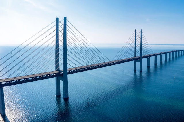
I-90 is one of those floating bridges.) [USACE-canal]


Canal bridges that I have documented so far are:
Look at the number of pleasure, and maybe fishing, boats queued up in both directions to use the small lock. Maybe they should do a batch or two of boats through the big lock.
Satellite

It looks like they do sometimes put a batch of boats through the large lock.
nwboatinfo

The BNSF/GN Ballard Bridge is in the background.
BallardLocks, the map is interactive on the web site.

MyBallard
Once in the lock, the water level drops as much as 26 feet to bring the boats even with Puget Sound. The fresh water is exchanged with salt water. Ten to fifteen minutes after the process began, the boats are on their way. During busy times, though, long lines of boats form on either side of the locks.

MyBallard
A viewing area allows visitors to watch one of the last “weirs” before the spawning fish head into freshwater. The best time to see large, spawning king salmon is in mid to late-August. For coho salmon, late September. For sockeye, the month of July. And for steelhead, late February through March.

This aerial caught the dam spilling quite a bit of water. Since there is no hydropower plant here and there is a lot of rain in the Seattle area, the only priority for this dam is maintaining the correct water level for Lake Washington. The locks and dam also prevent saltwater intrusion.
USACE-lock
"The complex includes two locks, a small (30 x 150 ft, 8.5 x 45.7 meter) and a large (80 x 825, 24.4 x 251.5 meter). The complex also includes a (235-foot, 71.6 meter) spillway with six (32 x 12-foot (3.7 m), 9.8 x 3.7 meter) gates to assist in water-level control. A fish ladder is integrated into the locks for migration of anadromous fish, notably salmon. The grounds feature a visitors center, as well as the Carl S. English, Jr. Botanical Gardens."
This web site has several videos including a Fisherman's Terminal video (satellite) where much of the Alaskan fishing fleet spends its offseason.

Bill Edgar posted
I realize this photo is of the same bridge I posted (and photographed) yesterday...the Salmon Bay rail bridge, but I thought those who do not live in the area might be interested in the location WRT Seattle and what the area looks like where the bridge crosses the ship canal. The open waters of Puget Sound are to the right (west in the photo). This view is looking south from a pontoon plane I was on for a flight to Victoria, BC a few years ago.
Dennis DeBruler: And that is a nice view of the Ballard Locks.

5 of 10 photos posted by Fort Loudoun Lock with the comment: "Some rare pics taken today by one of our staff members touring the currently dewatered Hiram M. Chittenden main lock chamber, smaller auxiliary chamber and moveable tainter gate dam in Seattle, WA. Good stuff!!"
a

b

c

d

e