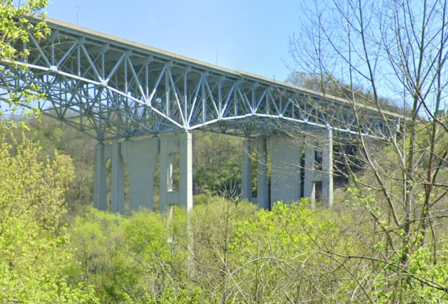
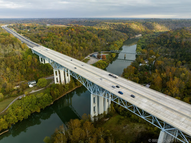
The 1998 bridge replaced the truss of the 1946 high-level bridge [HistoricBridges_new]
The old bridge:
 |
| Street View, May 2023 |
1869 Bridge:
 |
| HistoricBridges_new |
 |
| Bridges Now and Then posted and kyphotoarchive_1944 "The Clays Ferry bridge was under construction over the Kentucky River in November 1944. The task of laying superstructural steel work on the pylons was done by the Mount Vernon Bridge Co. of Mount Vernon, Ohio. The structural work was started from the Fayette County side of the river and rose at a three percent incline to the Madison side. This slight grade can be seen in the photo. The bridge was 280 feet [85m] high at river level, the highest structure of its kind east of the Mississippi River at the time, and was more than 1,500 feet [457m] long. Published in the Lexington Leader." (Kentucky Photo Archive) [You can see the old truss in the background.] |
HistoricBridges_new explains that a parallel bridge was added in 1963. Then in 1998, when they replaced the trusses, they added the solid center piers and turned two 2-lane bridges into one 6-lane bridge.
 |
| Street View, Apr 2023 |
 |
| kyphotoarchive_1989, photo by Charles Bertrarn "The bridge on the right was built in 1946 as a link over the Kentucky for U.S. 25. The bridge at left was added in 1963, and the two bridges became part of I-75." |
 |
| HamburgJournal "The Clays Ferry overlook wall was built in 1934, as a scenic overlook on the Old Dixie Highway." The bridge is 250' (76m) above the Kentucky River. |
 |
| 1 of several photos on Bridges & Tunnels Construction started in 1941, but it was slow because it competed with the war for steel and workers. In 1944, only 20 employees were working on the bridge. [This webpage has a detailed history of the bridges.] |
 |
| Salma Moli posted Construction of Clays Ferry (Kentucky) bridge (1-75) |
B&T mentioned that the old bridge is just one lane, so I took a closer look. That is quite a bit of traffic for a one lane bridge.
 |
| Street View, May 2023 |
April 2025 Flood:
%20Facebook.png) |
| Facebook Reel |
%20Facebook.png) | |
|


I own a piece of property on Adams Ln on the Fayette Co. side of river above the old Clays Ferry Bridge, the property and house I was told is the first property bought and built on the old Ceder Hills Subdivision in the late 30s and I have found a lot of interesting things around the property one of which is an old 4’ oval metal sign with BARGOL and the image of some kind of riverboat in the background. I’ve been trying to find out what business this was and thought that maybe you could help me, I’m thinking it may have been from around the area so any help would be greatly appreciated. Thanks, Greg Maiden
ReplyDeleteSorry. I only know how to research bridge information.
Delete