Post Civil War: South Water Street Market
 |
| Jeff Davies posted
South Water Street Market. Chicago. 1926.
Photo courtesy of Bruce Kelleher.
|
 |
| Chicago History Museum from WTTW |
 |
| Leon Paa Rios posted Chicago water market.... Found this framed at my job |
 |
| Richard Pitchford posted Water Street Market ran parallel to the river, with buildings that backed up onto the water. Notice the booking office for the South Haven Line – the company that owned the ill-fated steamship Eastland. Original Chicago posted Water Street Market ran parallel to the river, with buildings that backed up onto the water. Notice the booking office for the South Haven Line – the company that owned the ill-fated steamship Eastland. The elevated line is the Lake Street Elevated Railroad (later part of the Green Line). It crossed South Water Street (now Wacker Drive) via a terminal stub on Market Street near Madison Street. This structure operated from 1893 until its demolition in 1948. It served as the original eastern terminal before the Loop was completed. Paul Webb shared |
 |
| Patrick Stevens posted |
 |
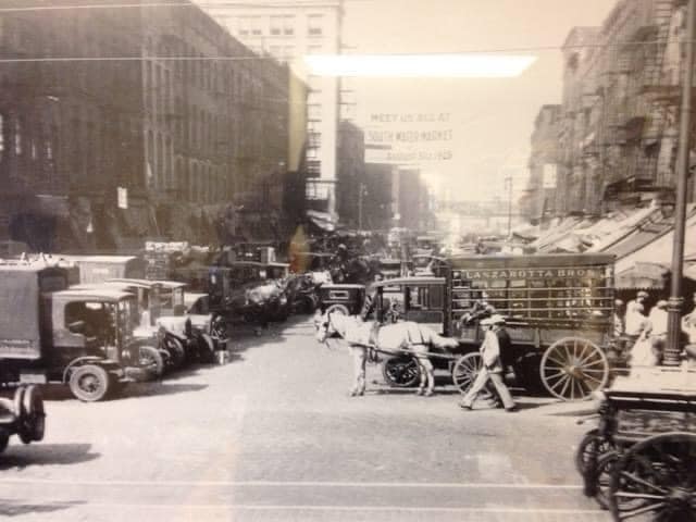
| George Coy posted Came across some old pics of Chicago in the Library of Congress, I thought your group might enjoy them This one is dated April 1915. Hope this is okay with your group This is the description: Looking west on South Water Street, Chicago, crowded with horse-drawn wagons and motor trucks filled with produce for market, Apr. 1915 |
 |
| Dragi S. Trajkovski posted POSTCARD CHICAGO - SOUTH WATER STREET ,looking WEST from STATE STREET -1905 |
 |
| Dominic Rossi posted South water market 1941? [Some comments indicated it would be this market.] |
 |
| Xavier Quintana posted From Vintage Tribune: South Water Street Market, circa September 1925. (Vintage Tribune) Xavier Quintana also posted David Utech: Wacker Drive under construction at the top of the picture. |
GettyImages
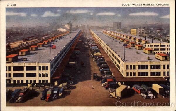
To quote Northwestern's caption of this picture: "When South Water Street was made over into Wacker Drive there was a wholesale exodus of the scores of commission houses. This shows the new home of the South Water Market between Fourteenth Place and Fifteenth
Street from Morgan Street to Racine Avenue." This 1929 photo would be looking West. Of note is that there are still a lot more horse and wagons then trucks. When I see pictures like this, I have to wonder what do they do with all of the "road apples?"
Update: Northwestern seems to have allowed their security certificate to expire. But I came across another copy of the picture on Facebook. Patrick's comment indicating 1956 is a good example of not being able to believe everything you read on the web. There were not that many horse and wagons in 1956!
I could not find rail access in a 1938 aerial photo. Later I found confirmation that it did not have rail car access. (Update: CN&W's 1947 video indicates their Morgan Street Yard was close and dedicated to perishable freight. The video shows blowing snow ice into a car to keep it cold during warm weather and warm during really cold weather. When the merchants were forced to move to South Water Market, the IC and Santa Fe built the Chicago Produce Terminal for them and other railroads to use. The trucks had to travel less than two miles to get to the merchant market.)
1920's: South Water Market
 |
| Northwestern University |
 |
| Patrick Stevens posted SOUTH WATER MARKET 1956 |
 |
| ILHAP |
 |
| Dominic Rossi posted Original south water market Dominic Rossi: I worked there 88- till they closed in April 1993, my father was there for 23 years |
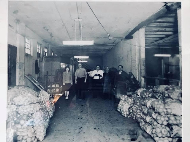 |
| George Dana commented on Dominic's post My grandfather owned Jiffy Spuds and then City Wide Produce. This photo might have been before south water market. He’s in the middle with the white shirt. |
 |
| Jeff Nichols posted South Water Street Market, 1955. University of Chicago Library, Special Collections Research Center, apf2-09929 Paul Jervert shared |
When I studied the aerial photo of the 16th Street Corridor for the St. Charles Air Line Railroad posting, I wondered what the long, horizontal buildings in the middle of the photo were used for. Now I know --- South Water Street Market.
 |
| ILHAP |
 |
| Satellite |
Fulton Street Market
 |
| Patrick Stevens posted FULTON STREET MARKET - FULTON & GREEN LOOKING WEST |
21st Century
 |
| Satellite |
 |
| Satellite |
I checked with a 1938 aerial map to confirm that they filled in a couple of slips originally created in the 1800s by the South Branch Dock Company to create land for this new market building. Even though it is built in the 75-acre industrial park that CB&Q created with the dock company when it built its access into Chicago in 1862-4, the market building does not have rail access.
The hours are from 3:30-4:00am to noon. "CIPM merchants offer the widest possible selection of fresh fruits and vegetables, nuts, dried fruits, herbs, spices, and specialty dry goods." (Agrilicious) The warehouse contains "ripening rooms" that control temperature, humidity, gassing, and ventilation, which controls ripening rates. Estimates are that produce in Chicago is a billion dollar business. This terminal supports not just the Chicago land area, but a tri-state area. (WBEZ) And they are trying to expand their reach to Iowa, Michigan, Ohio, and additional Midwestern states. There are other competitors such as Central Grocers in Joliet.(ThePacker)
 |
| FourSquare |
If you skip to 1:00 in the video you can see about 20 seconds of loading doc activity. Timestamp 6:04 was also interesting because it shows an order picker filling an order from a selection of 300 products and a view of the size of the cooled warehouse rooms. Note that the video was made in 2009, so the market was viable even during the recession.
Updates
 |
| Glen Miller posted [I have heard of this, but I don't know where it is. I don't have time to research it now.] |


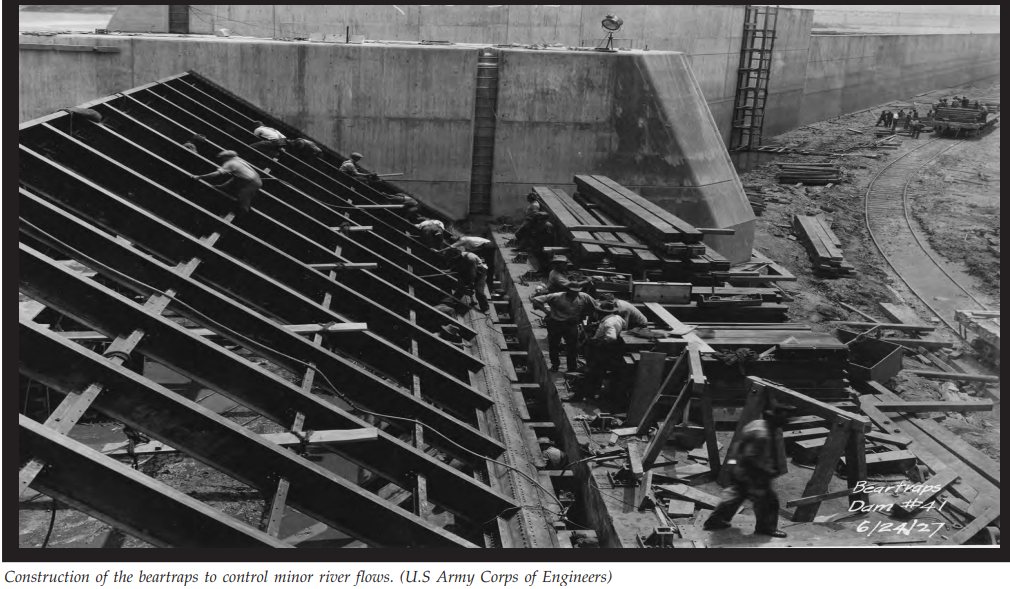




When traversing this thing while it's active, the issue really isn't pressure.
Hydrodynamically, there are three components to the fluid's "head" at any given point ("head" is a way of expressing the total energy potential of a dynamic fluid at any point, and is expressed in metres).
1. Potential energy (height above datum). All the energy is potential at the entrance, and by the time it exits most of it is converted to...
2. Kinetic (speed). As there is negligible difference in atmospheric pressure at the entrance and exit, ignoring friction, we can assume all of the potential energy becomes kinetic as the water falls. The only way to get significant pressure on the way down would be to steal some kinetic energy by constricting or kinking the pipe, and since that would slow the water (defeating the hole's purpose) it will be a smooth ride. So there is very little head converted into...
3. Pressure. This will be pretty much 1 atmosphere throughout the system. It is designed this way precisely because this water needs to flow as fast as possible.
So no, the pressure won't kill you. What WILL kill you is turbulence and friction. Unless the water is verrrry slow, you get turbulent flow, which will buffet you around and basically bash your brains and bones all over the pipe, especially at such speeds. Given how smooth cement isn't, you'll probably also be flayed alive as you go. If the turbulence is particularly bad (although they try to avoid this so not too much speed is lost to friction), then localized pressure from vortices may burst your ear-drums.
Personally, for survival purposes, I'd wear scuba gear and go in a Zorb (a big inflatable hamster-ball) coated in kevlar. And set up a big, BIG net at the bottom to catch me :-)
By the way, the turbulence will probably still kill you, so PLEASE don't try this.
PyroTyger