Tuesday, January 4, 2022

1871+1875+1876+1901+1984 BNSF/NP Bridges over Mississippi River in Brainerd, MN


I was surprised that the Mississippi River was this wide so far north in Minnesota.

1871

Either this is the 1871 bridge that collapsed later that year or it is the 1871 bridge with new 1875 spans because the bridge collapsed in 1871. Note that this bridge appears to be made with wood.
Marty Bernard posted
2. Northern Pacific Railroad bridge across the Mississippi River at Brainerd, MN circa 1875.
Photographs and captions from the Minnesota Historical Society
Chris Hennebry: Didn't this one collapse, when a train went over it?

Dennis DeBruler commented on Chris' comment
Yes, during the year this photo was taken. I wonder if the men are standing on the replacement span.

 Minnesota Historical Society via CrowWingHistory-nprr
Northern Pacific Railroad Bridge, ca. 1871.

Scientific American, Volume XXVI, Number 13, New York via BridgeHunter-1871 via CrowWingHistory-brainerd,
Public Domain: Published Prior to 1923; Courtsey of the Crow Wing Count Historical Society

A 13:45 video about the bridge colapse

1876

This bridge was probably built with iron.
BridgeHunter-1876

1901

This bridge would have been built with steel.
BridgeHunter-1901

1984

Street View

Street View

Monday, January 3, 2022

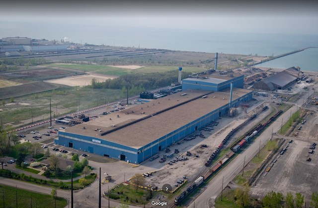
NLMK/Beta Steel in Portage, IN

(Satellite)

While studying the Sharon Steel Corp. in Pennsylvania that is now owned by the Russian company NLMK, I learned that the Russians also own this plant in Indiana. Then the next day I came across this post that referenced it. So this topic tripped my "twice in a couple of days" rule.

Josh Whitson posted
John Slowikowski: Three steel mills in one shot. Midwest steel, the Russians at NLMK [this plant] and the former Bethlehem plant.
[The four white tanks near the center are part of the Cargill Grain Elevator. NLMK is to the left of them at the end of the far slip.]
 
Bill Staniec posted
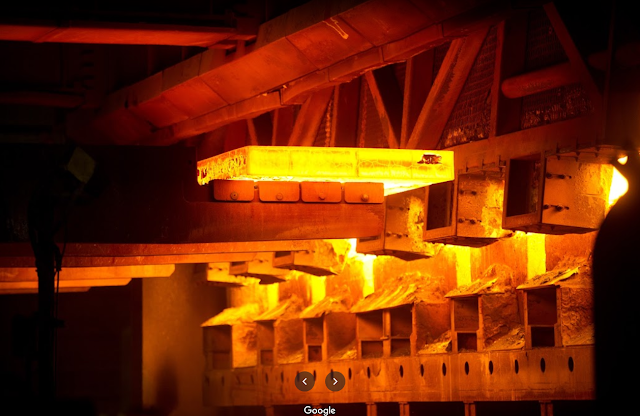
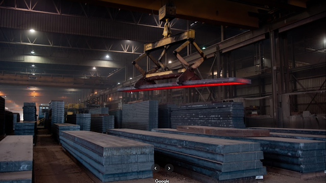
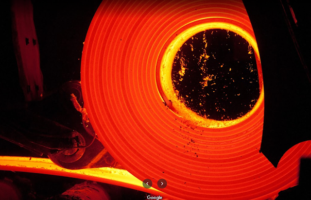
From my days as an Industrial Photographer. Beta Steel in Portage,  Indiana.

"NLMK Indiana operates an electric arc furnace, a ladle metallurgy furnace, a continuous slab caster and converts slabs into coils in its hot strip mill. NLMK Indiana is a prime supplier of hot rolled and hot rolled pickle & oil products. NLMK Indiana offers both EAF and integrated melted products, ranging from 1006 through 1095 grades, HSLA grades and various alloy grades. The facility is strategically located in the Port of Indiana on the shores of Lake Michigan, enabling barge shipment as well as truck and rail. The major markets we service are pipe and tube, energy, agriculture, construction, automotive and service centers." [NLMK-Indiana] I think the "integrated melted products" are provided by importing the slabs from Russia. I wonder if  salties dock here.
 
Raymond Boothe posted
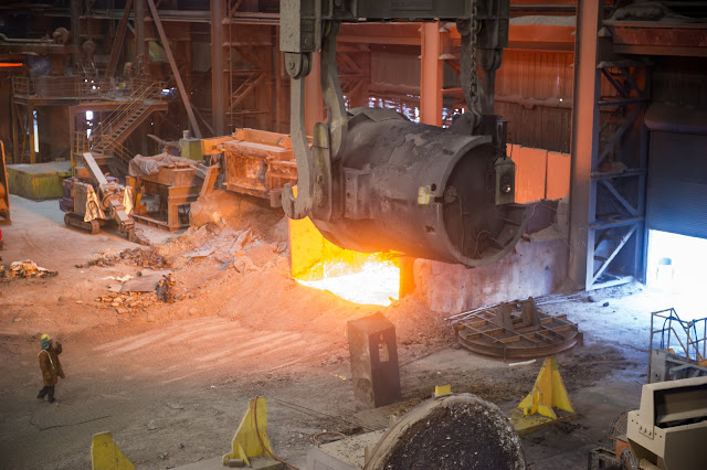
Dumping slag at the NLMK EAF steel shop in Portage, Indiana (NLMK photo).
 
Raymond Boothe posted
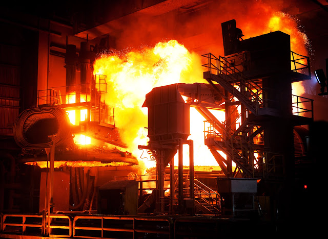
NLMK Steel-Portage, Indiana: View of an EAF in operation (NLMK photo).

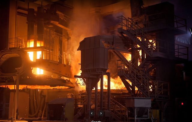
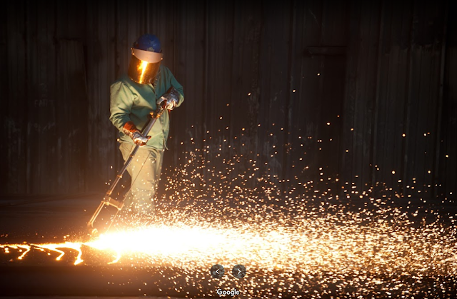
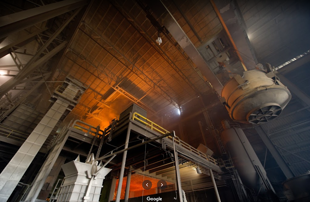
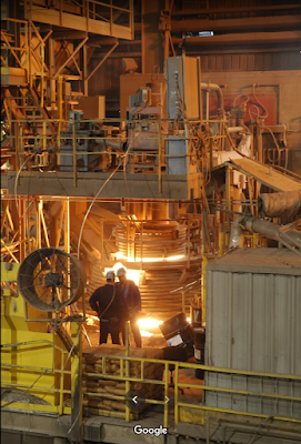
Following are some of the photos provided by NLMK on Google Maps between 2007 and 2011.
1

2

3

4

5

6

7

8

1910-1983 Aban/Pennsy Concrete Arch Overpasses in Cambridge City, IN

Foote Street: (Bridge Hunter; Satellite)
Center Street: (Bridge Hunter; Satellite)

I normally don't note overpass bridges unless they are over an Interstate with lots of lanes. But I can't remember seeing a concrete arch used for an overpass.
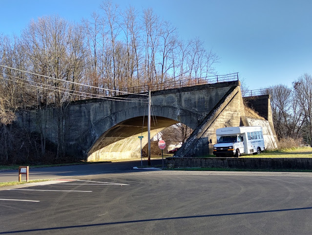
Street View

Bryan Monaco posted
The Pennsylvania Railroad once crossed over Foote St., in Cambridge City, Indiana. This line was abandoned in 1983.
Matthew Lappin: They tore this down in early 2000s as it literally cut this town in half.
Phillip A. Finnerty: I have seen on the Google map and looked at it on street level, that the former Pennsylvania railroad line from Richmond Indiana, to Indianapolis Indiana was elevated in 4 different locations that I have seen so far, it was elevated in cambridge city, Lewisville Indiana, raysville Indiana and knightstown Indiana. There might be other locations.
Phillip A. Finnerty: I heard from some one that they had a hard time back then taking other bridges down in cambridge city Indiana and just gave up and left the other bridges on Foote street and another street east of foote street alone.
Ethan McDowell: Cambridge City used to be all concrete arch. Over the decades it was torn down to make more room to grow.
The PRR was at least double tracked along most of its route.
Mark Backhaus: This was an earth filled bridge. The fill inside the bridge was probably partially removed when the fill was removed beyond the bridge to prevent it from collapsing off the end of the bridge.

Tim Shanahan shared
Bruce Bridges: This picture gives you a very good idea of how these concrete arches are put together! It's basically a one piece poured structure with the dirt built up around it.

Looking at a topo map, it becomes clear that Pennsy elevated their tracks through town to reduce the size of the cuts needed through the hill west of Walnut St. and the hill between the two river valleys on the east side of town.
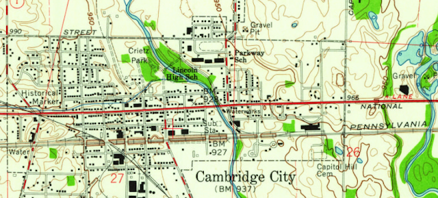
1960 Cambridge City Quadrangle @ 1:24,000

I haven't seen concrete overpasses because I don't live in the right area. I'm reminded that Pennsy liked arch bridges. They started with masonry bridges. For example, the Rockville Bridge. Given that culture, it is not surprising that most Pennsy overpasses in this city were built with a concrete arch. (Meredith Street may have used steel girders.)

The builder of these overpasses in Cambridge City, P.F. Brendlinger, was evidently using precast segments rather than casting-in-place. The wood structure in the photo below is not forms for reinforced concrete, but falsework to hold the segments in place until the arch is complete. So Brendlinger was using masonry techniques with "big stones" made with concrete.
Digitized by Google, p136 via BridgeHunter-Center

You can still clearly see the segments used to build the arch.
Street View

Mark's comment about the arches being earth filled and this photo explains what we see today.
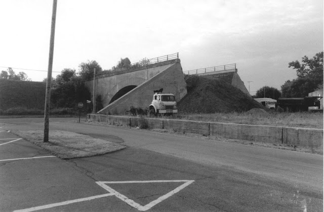
Indiana State Department of Natural Resource, Division of Historic Preservation and Archaeology via BridgeHunter-Foote

This view better shows the retaining wall that they added so that they could remove the remaining embankment dirt.
Street View

So it is now rather obvious that the city removed the overpasses from Walnut, Jones and Green Streets, but that they gave up when they got to Foote Street except for Plum Street. That arch was narrow enough that they did remove it.
Street View

Since the arches were built with "big stones" instead of reinforced concrete, they should not have been that hard to take down. So why did they stop at Foote Street? The topo map helps answer that question as well. The depot was obviously built on an embankment just east of Foote Street.
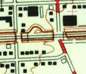
1960 Cambridge City Quadrangle @ 1:24,000

In fact, parts of the retaining wall used to construct the depot's embankment are still peaking through the vegetation. Look in the upper-right corner of this excerpt.
Satellite

This photo is what motivated me to look for the depot's location.
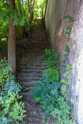
Photo by Jim Grey via BridgeHunter-Foote


Saturday, January 1, 2022

Watco's Fox Valley & Lake Superior Rail System (FOXY)

Rich Karding's post taught me about this CN sale to Watco. A comment on the post provided the FOXY reporting mark for the new railroad, Fox Valley & Lake Superior Rail System, created by Watco to operate these assets. Several of the comments give insight about which customers CN was unable to drive off of their branch lines by providing bad service. The red+blue lines for joint operation must not show up properly on the map because I could not find any. And because FOXY surely has connections between its various blue segments. Of note, WSOR is also a Watco railroad.
Watco via Trains

I was surprised that the map did not show a route to Chicago. I'm sure that CN does not use WSOR to gain access to Chicago. So I found a CN map to show a more complete network. A capacity map is useful because it effectively documents the routes that CN cares about, i.e. the green lines. I wonder if the route to Canada via Sault ste Marie is a lightweight route by today's standards because of the several bridges needed to cross the shipping channels and St. Marys River. Otherwise, I would think that CN would care about that route.
CN

While I was looking for a CN map, I found this diagram. It is worth noting.
Pinterest


Friday, December 31, 2021

1927,2014 Ambridge-Aliquippa Bridge in Pennsylvania

(Bridge Hunter; Historic Bridges; B&T; 3D Satellite)

I discovered this bridge in a "Bridges & Tunnels with Sherman Cahal" post. Any cantilevered bridge that a state DOT restored is worth noting. In fact, HistoricBridges reports that Pennsylvania's original plans were to replace it. However, HistoricBridges explains that the state could not afford a replacement and did just a partial rehabilitation good for 25 years rather than a complete rehabilitation that would have been good for 75 years.

Street View, Sep 2021

Some of the detailed photos in BridgeHunter caught my eye since they showed pin connections. I was able to catch some pin connections in a street view. Note the lower-left and upper-right corners in this view. This bridge must have been a transition design between pin connections and gusset plates because descriptions of the $16.6m 2011-14 rehabilitation include "repairing all gusset plates."
Street View

This view was taken while the rehabilitation was in progress.
Street View, Oct 2013

Thursday, December 30, 2021

1906-1987 Milwaukee/Chicago Southern Railway Jenkins Ford High Bridge over Vermilion River near Danville, IL

(Bridge Hunter; Satellite, a couple of miles east of Westville, IL over the Vermilion River)

BridgeHunter
A view of the trestle and the then current mode of transportation. The bridge that they will cross is barely visible on the other side of the trestle towers.

Better resolution:
Michael Rogner posted
Vermilion River bridge south of Danville at Jenkins Ford during the Walsh era. View is more or less southwest. Right side of trestle looks like it's hanging in mid air, but there is an embankment there, just kind of washed out in the photo. This area is covered with trees now.


eBook via BridgeHunter, 1908

While paging through the eBook to find a page number for the above photo (page 601), I found some more photos of this bridge.
Digitized by Google, p173

Digitized by Google, p475

Digitized by Google, p553

Digitized by Google, p601

An artist rather obviously added a work train to the above photo.
Postcard via BridgeHunter

The footing by the river is almost covered up by trees.
Satellite

Jim Bryant posted seven images with the comment:
Jenkins Ford Bridge, east of Westville, Illinois, was built in 1906 for the Chicago Southern Railway; removed in 1987. In its day it was considered the tallest bridge in Illinois. Built by Chicago Bridge & Iron Works of Chicago, Illinois (also known as Chicago Bridge & Iron Co).. Railroads lines that operated in its day were  the Chicago Southern Railway (CSRY)- Chicago, Milwaukee, St. Paul & Pacific Railroad (MILW),  Chicago, Terre Haute & Southeastern Railway (CTH&S)
Design
Deck plate girder
Dimensions
Length of largest span: 200.0 ft.
Total length: 1,600.0 ft.

Tim Shanahan shared

1
The removal of the bridge in early 1980's.

2

3

4
Construction of both bridges in 1906.

5
This picture was taken in1906. This was the south bridge which provided a right of way for civilians to get across the river. To the right and adjacent was the railroad bridge which is seen at the right of the picture.

6
The aerial view was taken in 1940.

7
The same overhead view from what it looks like presently, the blue line showing where the railrlroad line ran. Two concrete girders are barely visible just past Vermilion River.

James Langley posted two images with the comment: "Milwaukee Road trestle over the Vermilion River outside of Danville, IL. Photo was taken in the early 80’s and unfortunately the trestle has now been dismantled and only exists in photos."
Michael Roegner: At one time after it was abandoned the county considered making it a highway bridge to replace the Jenkins Ford highway bridge dismantled in 1964. Nothing came of the idea.
John Green: What was the nearest town other than Danville?
Dennis DeBruler: John Green It is east of Westville, https://maps.app.goo.gl/r76AtHS1qsnEPmt87.
1

2
[He has North at the bottom.]

This map shows the road bridge as well.
1950/60 Danville SE Quad @ 24,000