Aqueduct: (Satellite)
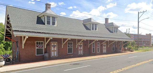
Depot?: (Satellite) The railroad was New York, New Haven & Hartford (NYNH&H)
Montgomery Mill: (3D Satellite)
John Weeks posted ten photos with the comment:
Today was an active recovery day, so I did a short hike on the state trail that runs along the Windsor Locks Canal along the Connecticut River north of Hartford. The trail is on the towpath between the canal and the river. The trail is about 6 miles long. I did a 5K out & back at the north end, which has a small state park as the trailhead.The Connecticut River is relatively wide but very shallow. Cargo was carried on flat bottom boats, but a series of rapids just above Hartford prevented boat traffic from the north. To get around these rapids, a 5 mile long canal was built on the west side of the river in 1827-1829. This canal had two uncommon features. First, it had a complex water valve on the north end to precisely control water flow in the canal. This allowed the canal to provide water power for industrial use. Second, the walls of the canal were reinforced to hold up to water turbulence from steam boats. This allowed fright to be moved by steamboat as well as boats towed by mules.The railroad arrived in the 1840’s causing boat traffic to dwindle to the point where it was unprofitable to run the canal for boats. But the water power business was very profitable even into the 1900’s despite the arrival of steam engines and electric motors.Today, the canal is still used for water power. The towpath that was used by the mules to tow boats through the canal has been converted into a paved bike path.More commentary in the photo captions.
 |
| 1 Looking downstream along the Windsor Locks Canal, which is more accurately called the Enfield Canal since it bypasses the Enfield Falls rapids. |
 |
| 2 The lock chamber at the north end of the canal. It could handle boats up to 90 feet long and 20 feet wide. |
 |
| 4 Looking south on the trail along the towpath. The river is on the left and the canal on the right. |
 |
| 5 Looking north along the towpath trail. The river is on the right and the canal on the left |
 |
| 7 Lift mechanism to tip the drawbridge open. |
 |
| 8 The trail heading north under the highway 190 bridge and towards town. |
As I followed the canal downstream on a satellite map, I was surprised that I didn't find any more locks. When I saw the Montgomery Mill Apartments, I was reminded that John said the canal was also used for water power. Thus, as they went downstream, they kept increasing the height of the embankment between the canal and the river until it reached a 32' head. I wonder if they had a double lock flight at the south end of the canal to handle the 32' lift back in the 1820s.
Bonus
While looking for a view of the Montgomery Mill that was not obstructed by trees, I think I found a depot.
 |
| Street View, Aug 2022 |
Some of these look like fairly old mill buildings.
 |
| Street View |
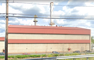
But it doesn't make sense for manufacturing to use water power in the 21st Century. It does make sense for a power plant to use water since it is carbon free. But the power plant has a smokestack. And hydropower plants don't need a smokestack.
 |
| Street View |


No comments:
Post a Comment