(
Satellite)
.jpg) |
Ken Schmidt posted via Dennis DeBruler
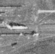
[The Stewart Avenue Tower is a little right of the center of this photo.] |
I include this 1929 topo map because...
 |
| 1929 Blue Island Quad @ 24,000 |
...I was surprised by how many streets, including Stewart Avenue, didn't actually exist in 1939.
I was even more surprised that I could not see the tower north of the mainline. (I included some boxcars to show that a building should be casting a shadow.) So I'm confused.
 |
At photo resolution
|
Of course, it doesn't show up on a contemporary image.


.jpg)


No comments:
Post a Comment