 |
| Grand Crossing |
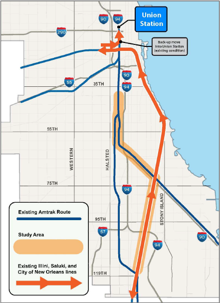
Because CN bought and upgraded the Elgin, Joliet, and Eastern (EJ&E), it plans to quit running its freight trains downtown to interchange with the other railroads. And all of the industry along the Chicago River has been replaced by high-rise office buildings, condos, and hotels. Since Amtrak could not afford $100,000 for a bridge to keep the Southwest Chief on the Sante Fe route, I'm sure it can't afford to buy the St. Charles Air Line. The proposed solution for this problem is CREATE project P4.
P4 will connect the CN/IC tracks to the NS/Pennsy tracks. This will reduce travel times by 19 minutes and take advantage of a train corridor that already supports 14 Amtrak trains and 46 NS freight trains each day to eastern destinations. According to the project description, it will also free up the land used by the Air Line and the northern portion of the CN/IC "to serve future public needs." But the CN/IC part can't be true because that is used for commuter service not only to Chicago suburbs, but to South Bend. But it does mean the Air Line would be obsolete. Unfortunately, that means another one of Chicago's impressive draw bridges will become a bridge to nowhere.
Note that the proposed connector between CN and NS is at the crossing that precipitated the "railroad crossing war."
The new connector is just part of the project. Another part of the project is improving the NS mainline capacity between this crossing and Pershing Road. According to the status map, this project is in the first of three phases and 30% done. Unfortunately, that status map has become a bit of a joke because I know that P1 completed a few months ago. It's not like they punch out these multi-gazillion projects fast enough that they can't afford the staff to update the map when a project is completed. A Grand Crossing page indicates that Phase I is more advanced than 30%. I saw 2014 results for noise and vibration studies. The P1 project needed to be done before this one is done to remove railroad crossing delays caused by Metra commuters on the old Rock Island line. (The railroad wars demonstrated that bad things happen if two trains go through a crossing at the same time!)
 |
| Grand Crossing |
 |
| Grand Crossing |
 |
| Grand Crossing |
 |
| Steven J. Brown posted
NOW AND THEN!
Amtrak City of New Orleans #58 at 18th Street inbound to Chicago Union Station on July 14, 2019 and May 7, 1992 - Twenty-seven years apart!
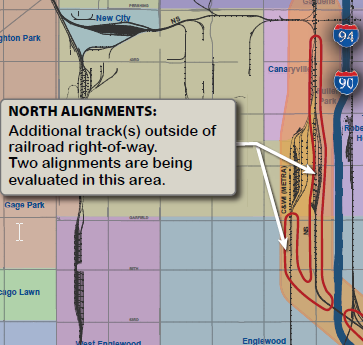
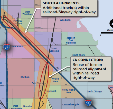
[In addition to the St. Charles Air Line route where Amtrak shoves backwards on BNSF/CB&Q tracks, Amtrak sometimes uses the CN/IC Freeport Branch to shove backward on the Amtrak+Metra+NS/Pennsy tracks.]Steven J. Brown It can go either way but generally I'm told it goes this way inbound and over the St Charles AL outbound now. Todd Pearson Sam Bergus there are multiple different ways we can come in and depart with the consists for the old IC. Either straight out to 21st and around the BN wye to the air line. Back out to the air line. Back out past 21 and use the NS connection at 21st to get on the Freeport , back out to 21st and over the GM&O tracks to Cermak and then out the Freeport to Chicago. Same thing with coming in, but it will always be a back up move into the station. Jon Roma I rode train 390 from Champaign to Chicago on Sunday 7/21 [2019], and we took the ex-IC Iowa Division route to 21st Street interlocking, where we proceeded south on the former Pennsy Ft. Wayne main line until we were given a signal to back north into the station. On my return trip southbound on train 393 on Wednesday 7/24, we backed out of Union Station and around the Canal St. curve on the former CB&Q to the Union Avenue interlocking plant, at which time we were lined to go south (compass east) on the St. Charles Air Line toward the IC main. The plan to reroute these trains has been talked about since 1972 when they moved the trains out of IC's Central Station. Yes, it's in the CREATE plan, but I ain't holding my breath. Even though the backup move adds 15 to 20 minutes delay to these trains, and even though I ride these trains regularly, it's hard to justify the expense of eliminating the backup move. The most commonly talked-about reroute plan is to rebuild the former Nickel Plate main line between 83rd Street and 71st Street, and establish a connection between the CN and NS Chicago Line. There's bridges in the right place to complete this route, but it has turned into a forest in the 50 or so years since it was last used, and is likely to require a complete rebuild. Furthermore, even though Englewood has been eliminated as a bottleneck due to the Metra line having been relocated to a flyover, the NS Chicago Line is saturated, and the delays between the 71st Street junction and 21st Street might nullify any speed improvement gained by eliminating the backup move for the trains on the former IC. |
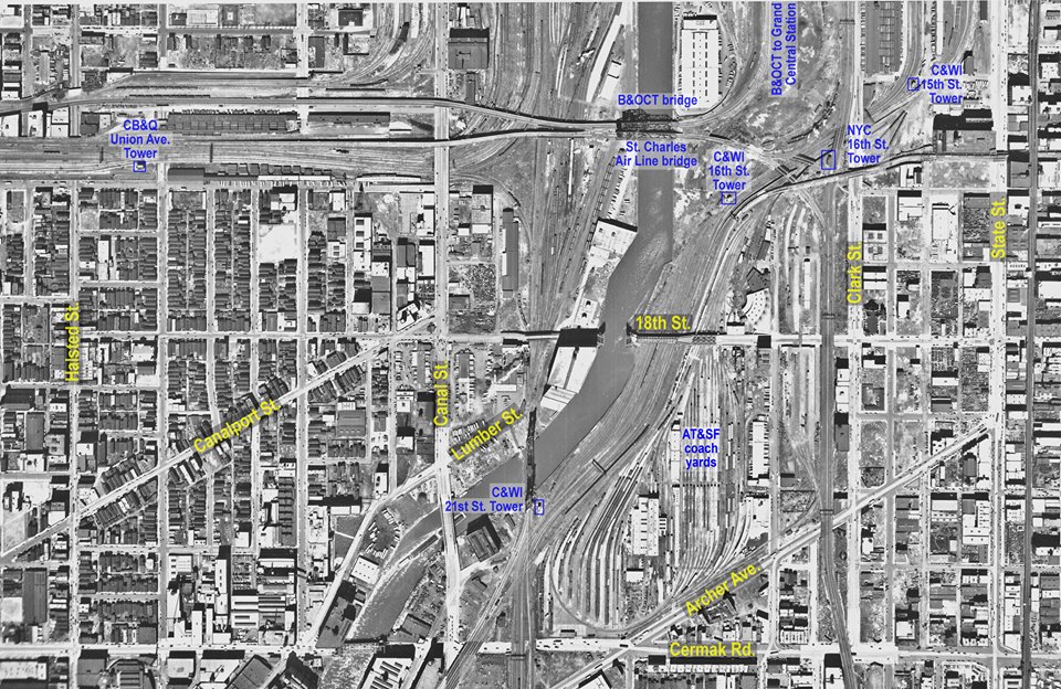 |
| Jon Roma commented on Steven's post Here is an annotated aerial map by the Chicago Aerial Survey Co. dating to the Forties showing most of the area involved in the Amtrak trains' backup moves. I made my annotations several years ago for another FB group on another subject, so this isn't tailor-made for this discussion, but it does show the key points involved. Above all, it shows how much this area has changed in 75 years! |
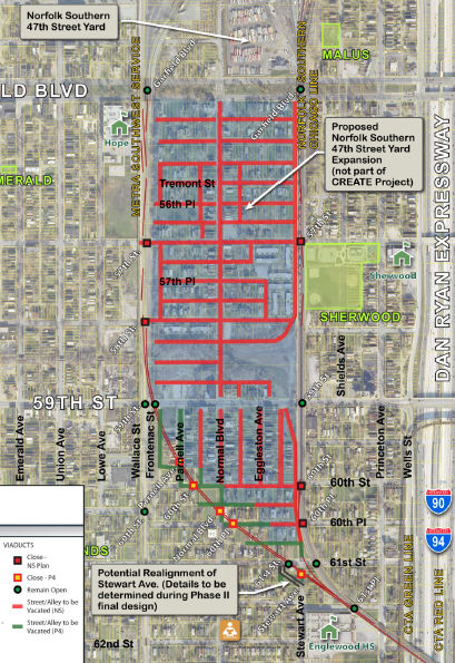
I live 432 w 60th Pl. Will the R/R project affect my family
ReplyDelete