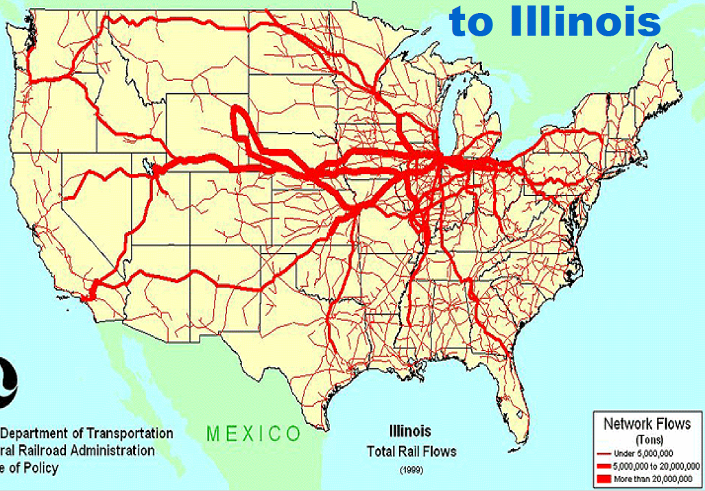
Especially as the Powder River Basin coal flows decrease, the waterways carry more than the rails. And the railroads have successfully forced a lot of freight traffic onto our highways.
 |
| bts.gov |
I came across a link that is worthy of its own posting: intermodal traffic density map. (Update: I see Ports of Indiana has broken that link! Bummer! Fortunately, I wrote enough about the map that we get a feel for what it looked like.)
The thick line from Southern California to Chicago would be over the BNSF/SantaFe route. Looking at the system maps of NS and CSX, it appears the transcontinental traffic is handed off to NS. This is probably because of their competitive advantage of the Streator, IL cut-off. This traffic flow would explain the BNSF/NS merger noise I have been seeing on the web. It will be interesting to see how thin this line becomes once the Panama Canal enlargement project is completed.
The flow from Salt Lake to Chicago shows how important the Chicago and NorthWestern route is for the Union Pacific. The former Burlington Northern route between Seattle and Chicago is also an important corridor. The major surprise is that most of the San Francisco Bay traffic goes via Southern California rather than use the former Southern Pacific route to the east.
And these would be the flows back in 1859. This map reminded me that the Monon (New Albany & Salem) originally focused on connecting two bodies of water --- Lake Michigan and Ohio River. That was because 1859 was still back in the canal era. Of course, railroads soon made canals obsolete and people quit thinking in terms of bodies of water. Thus, they built today's route between Monon, IN, and Chicago. It is also interesting seeing the earlier railroad names. I knew about C&NW's Galena & Chicago, but I did not know that the C&NW route to the west was named Chicago, Fulton & Iowa. It is also interesting seeing which dotted lines (proposed) got built and which didn't.
 |
| Chuck Mountain posted New and Reliable Rail Road Map 1859 |
 |
| System Map with Corridors Tab |
Container standards and clearances. The standard international length is 20' and 40', and the standard domestic length is 53'. The height of a double-stack is 20' 3". The standard width is 8'. Ted Gregory commented on a posting:
When I was working on my Exec Masters in Intermodal Transp. Mgmt, I read a few yrs back BNSF plans to keep running trailers cuz it helps the small truckers get into intermodal easier and quicker, since they don't need a huge capital outlay to buy new containers. BNSF is brilliant. I know of at least one Class I RR that won't allow trailers. Why would u turn away business??
CSX, NS, UP, BNSF, FEC (havent seen KCS and CN in awhile, but they WERE doing same) all run their intermodal trains in blocks like you describe. Reasons are many: rail equipment available, unloaders available. CSX runs single stacks cuz of tunnel and bridge clearances. CP runs only double stacked 8'-6"s thru Detroit Windsor tunnel. CN can run full, highcube doubles thru Sarnia Tunnel 9'-6". 9'-6" is railroad standard.CSX, NS, UP, BNSF, FEC (havent seen KCS and CN in awhile, but they WERE doing same) all run their intermodal trains in blocks like you describe. Reasons are many: rail equipment available, unloaders available. CSX runs single stacks cuz of tunnel and bridge clearances. CP runs only double stacked 8'-6"s thru Detroit Windsor tunnel. CN can run full, highcube doubles thru Sarnia Tunnel 9'-6". 9'-6" is railroad standard.
I wonder how this is impacting the flow of containers across the country.
 |
| safe_image for Congestion in Southern California Spreads to Other West Coast Ports |
The numbers for the scale are 250, 125 and 62.5 million tons per year. The big blob in the middle would have been coal from the Powder River Basin. These 2016 flows would look different in 2020, even before the COVID-19 disease hit the country.
 |
| WashingtonPost, 2016 |
 |
| FRA posted Did you know the U.S. has one the world’s longest freight railway systems with an estimated 140,000 route miles? Lance Myers: Where can I find a higher rez or PDF version of this map? Federal Railroad Administration Hi Lance Myers Try this link https://railroads.dot.gov/rail.../freight-rail-overview BRHS shared Dennis DeBruler: The blue lines point at the Powder River Basin coal mines. The Blackhawk Railway Historical Society: Dennis DeBruler Still a big thing, in spite of the war on coal, and mostly routed Kansas City, presumably on to points south and southeast. |
 |
| 05_OpsIT_Allen_Chuck.pdf, probably from the CREATE site |
 |
| California Air Resources Board, Freight Locomotives, p. 27 (I-1) from FRA 2015 (source) |
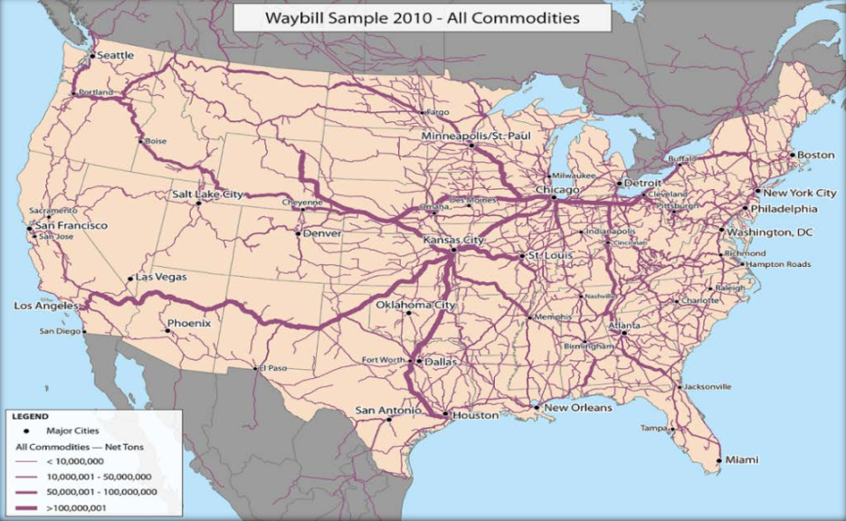
This image shows the route from Denver to Houston is rather busy.
 |
| safe_image for Where Trains Go, Big Things Follow |
 |
| Map via Trains via Facebook |
Michael Maitland posted three images with the comment: "Kept this copy of the 1973 USRA Preliminary plan. Interesting to see what lines were being used and compare to what is now. The Maybrook line is gone, the RDG/LV lines are about to get the traffic off the PC low grade and Trenton cut-off......"
Edward Bommer: The USRA ran the nation's railroads from Dec. 28, 1917, to March 1, 1920. The main reason behind that drastic move was that railroads were not cooperating to provide the most efficient routes or interchanges for WW I movements of materiel and personnel, but preferring to retain as much war effort traffic for themselves as possible. This situation caused serious delays. It also highlighted the poor condition of outdated motive power and rolling stock on a number of railroads. for that, the USRA developed standardized designs for replacement locomotives and cars with an eye toward reducing the costs of their production. In the past, locomotives and rolling stock were most often custom designed and built for individual railroads. I am not sure where a 1973 USRA plan would come from. Perhaps the AAR instead? The nation's railroads did their best as WW II developed, to avoid a repeat of the USRA during WW I. They maintained a focus on overall efficiency, even between competing lines.
 |
| 1 |
 |
| 2 |
 |
| 3 |
 |
| Michael added this in response to a request for details about Toledo. |
John Sniffen posted two images with the comment: "This map of streamliners then in operation ran in the July 1948 issue of Trains magazine along with a short article."
[According to some comments, several streamliners started after this date such as the Texas Eagle and California Zypher.]
 |
| 1 Alan Buck: They forgot the Chicago to Florida South Wind. PRR to Louisville, L&N to Montgomery, ACL and FEC to Miami. [I was particularly interested in how you could get from Chicago to Tampa Bay.] |
 |
| 2 |
Bonus:
.jpg) |
| grains.org |
The Craftsman blog posted three images with the comment:
These incredible maps published in 1930 by the Atlas of Historical Geography of the US show how long it look to travel to places from New York City thru the years.
It seems unfathomable that in 1800 a trip from NYC to Chicago would take 6 weeks compared to a 2.5 hr flight today!
I’m also amazed how much longer it took to get to the Atlanta/Nashville area due to the Appalachian mountains and lack of train tracks in 1830. History is so cool!
Are Øverseth Blomfeldt: Bigger versions of the maps, with sources on where they’re from: https://railroads.unl.edu/documents/view_document.php...
 |
| 1 |
 |
| 2 |
 |
| 3 |
 |
| Eric Sorensen posted This map of semi truck traffic looks like veins across the country. The bigger the width, the more flow. I am proud to support local funding from the Infrastructure Act, as well as supporting skilled labor programs so we can be proud of what we make in America. |
 |
| Trains at Night posted Multi-year project to produce a map of all rail lines in the US, displaying the relative frequency of trains. It started when I wanted to explore photographing some places further from home and wondered how long I'd have to wait for a train to roll through some interesting spot at night. 𝗝.𝗕. 𝗥𝗮𝗶𝗹 𝗣𝗵𝗼𝘁𝗼𝗴 shared |
 |
| Wondering Maps posted The U.S. Passenger Rail Network 1962 vs. 2005 Kabyoshree Neog posted with the same comment. |
 |
| Thomas Chilton posted [I didn't bother to read this. As the comments indicate, Amtrak barely has enough superliners to run today's routes. And there is no viable replacement in the works.] What an expanded Amtrak long distance map could realistically look like Hi everyone, as I’m sure some of you know the FRA a couple years ago released a map of what 15 new long distance services could look like. In many ways there was a lot to like about the map, especially since it tried to serve the entire country. However there were a couple of problematic aspects about the map. First off it could be argued that some of the routes were simply too long, such as the New York to Dallas-Fort Worth, which arguably should have been two separate routes. But secondly some of the routes arguably had too many issues to be viable, especially the route from the Twin Cities to Denver, which not only had a circuitous route through South Dakota, which was problematic enough, but the trackage for much of the route has extremely low speeds that would require huge sums of money to upgrade. This isn’t to say that such a route should never come to existence, but realistically, at least for now, such a route isn’t viable. However I feel that all 10 of these routes I’m suggesting are viable, and I feel these are the top 10 routes Amtrak should consider expanding their long distance network. While these aren’t the only long distance routes Amtrak should consider adding (for instance a route between El Paso and Billings via Denver could be really useful) I do feel these are the top 10 long distance routes Amtrak could consider adding. Some of the routes would feature historic names such as the Broadway Limited, while others would be new names such as the Prairie Zephyr. Finally I will include the possible timings of the trains as well as the useful purposes such routes would serve. Broadway Limited: The revived Broadway Limited linking New York and Chicago would follow the same routing as the former Broadway Limited did between New York and Pittsburgh but would be rerouted in Ohio and Indiana to serve Columbus and Fort Wayne. The westbound train could leave New York in the evening and arrive in Columbus at around dawn while eastbound train could leave Chicago in the afternoon, arrive in Columbus in the evening hours and arrive in New York the next morning. Train would provide service to Columbus, currently one of the largest metropolitan areas without any intercity rail service. Tennessean: The revived Tennessean would follow the same routing as the former Tennessean from New York to Chattanooga but would be rerouted past Chattanooga to go to Atlanta instead of Memphis. The southbound train could leave New York in the evening and be in Southwest Virginia at around dawn while northbound train could leave Atlanta in the afternoon and arrive in New York the next morning. Route would provide service to Southwest Virginia and Eastern Tennessee with the route specially serving the University of Tennessee. South Flyer: Train would be named after the South Wind and Dixie Flyer, both which traversed a portion of the route. The southbound train could leave Chicago in the morning, arrive in Atlanta in the evening, and be in Miami the next day while northbound train could leave Miami in the evening, arrive in Atlanta the next morning and arrive in Chicago in the evening. The train would provide a direct route between Chicago and Florida and provide service to several notable metropolitan areas in between those two cities such as Nashville and Atlanta. Gulf Wind: Train would follow the former Gulf Wind route from New Orleans to Jacksonville but be extended to Miami. The westbound train could leave Miami in the evening, traverse the Florida Panhandle at dawn and arrive in New Orleans the next evening while the eastbound train could leave New Orleans in the morning, traverse the Florida Panhandle at dusk, and arrive in Miami the next morning. The train would provide service to Florida Panhandle residents and provide a direct route between New Orleans and Florida. Magnolia: Train would link Atlanta and Dallas-Fort Worth and the westbound train could leave Atlanta in the evening and arrive in Dallas-Fort Worth the next day, while the eastbound train could leave Dallas-Fort Worth in the morning and arrive in Atlanta the next day. The train would provide a train alternative for those living along the I-20 corridor. Prairie Zephyr: Train would link New Orleans and Denver via Dallas-Fort Worth. The southbound train could leave Denver in the afternoon, arrive in Dallas-Fort Worth in the next morning, and New Orleans the next evening, while northbound train could leave New Orleans in the morning, arrive in Dallas-Fort Worth in the evening, and arrive in Denver the next day. The train would provide a convenient way for people in Texas to ski in Colorado as well as partake in other attractions in Colorado without flying. Lone Star: Train would link Chicago and Houston and largely follow the former Lone Star route but link Dallas and College Station instead of Temple. The westbound train could leave Chicago in the morning, arrive in Wichita around dawn, and arrive in Houston in the evening, while the eastbound train could leave Houston in the morning and arrive in Chicago afternoon the next day. The train would provide connections to major cities located in the Great Plains region of the U.S. North Coast Hiawatha: Train would link Chicago and Seattle and the westbound train could leave Chicago in the afternoon, traverse Montana the next day and arrive in Seattle the following day, while the eastbound train could leave Seattle in the afternoon, arrive in Montana in the morning, and arrive in Chicago in the evening the following day. The train would provide service to some of the largest cities in Montana. Desert Wind: Train would link Denver and Los Angeles and the westbound train could leave Denver in the morning arrive in Salt Lake City in the evening and arrive in Las Vegas and Los Angeles the next day while the eastbound train could leave Los Angeles in the afternoon, arrive in Las Vegas in the evening, and arrive in Denver the next day. The train would provide service to Las Vegas, as well as a one seat ride between Denver and Los Angeles Pioneer: Train would link Denver and Seattle via Grand Junction, Salt Lake City, Boise and Portland. The westbound train could leave Denver in the morning, arrive in Salt Lake City in the evening, and arrive in Seattle the following evening while the eastbound train could leave Seattle in the morning, arrive in Salt Lake City the following morning and arrive in Denver the following evening. The train would provide service to Boise, as well as a one seat ride between Denver and the Pacific Northwest. So that’s my list of possible long distance routes. While there are plenty of more Amtrak long distance routes I would like to see added some day as well, I feel this could provide a great initial groundwork for expanding the Amtrak long distance system, as (along with the Northeast Corridor and state supported routes) all 50 of the largest metropolitan statistical areas in the U.S. would be served. |
No comments:
Post a Comment