(
Satellite, 52+ photos)
 |
Jack Hines posted
4000 working at Indian Lake spillway, Russell's Point, Oh.
I ran there 40 ton grove there for four months Reese is the operator on the 4000 does a great job of it solid dude for sure |
It appears the spillway designers tried to ensure that only a small stream of water would go over the spillway because a long dam feeds water under a rather short bridge. With only a small stream over the dam, I would not think it would be
a drowning machine. I wonder why it is being replaced with a V-shaped dam design. It looks like it needs to be replaced because of
spalling on the dam's surface. And it does appear that
the flow can get rather heavy even with its long length. So if you are going to build a new dam anyhow, it might as well be of a modern design. They are also
installing erosion mats on the downstream side.
When I saw how big Indian Lake is, more than a couple of miles wide, I wondered if it was built for the Miami and Erie Canal. The following map confirms that Indian Lake was a summit lake for the canal. That is, it is a lake built near the summit of the canal to store water for the canal to supply water during dry seasons. There should have been a gate structure to let water out when the water level was below the spillway to feed the canal. They must have removed the gate structure since the canal feeder function is now obsolete.
 |
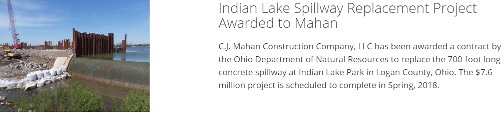
cjmahan
|
 |
cjmahan
[Unfortunately, the video link is broken. But you can play the video in the little window. It is timelapsed and caught several overflow events. I took a screenshot during one of them.] |
 |
| Indian Lake Aerials by Kevin Campbell posted |
Indian Lake Aerials by Kevin Campbell
posted five photos with the comment: "Spillway Spillin’ (02.25.26)."
 |
| 1 |
 |
| 2 |
 |
| 3 |
 |
| 4 |
 |
| 5 |


No comments:
Post a Comment