 |
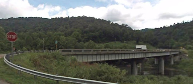
| Street View, Aug 2022 |
So why am I noting yet another railroad overpass? Originally, because Ron's comment on this post was informative.
Ron Flanary posted three photos with the comment:
The creation of Norfolk Southern brought a melding of railroad operating philosophies, particularly with respect to the movement of heavy coal trains. Southern relied heavily on its older Locotrol mid-train remotes while the N&W was a true believer in manned pushers. As management leaders were swapped around between the former systems, some interesting hybrid ideas emerged. This was one.On June 13, 1986, the eastbound loaded Catawba unit coal train (with a mix of steel air dumps and aluminum Southern Silverside gons) is shown climbing the grade across US 23 at Speers Ferry, Va. with two SD60s on the point, two more mid-trains remotes, and two SD40-2s pushing behind the caboose (manned units).
Bret Stringer: Was the box car with the mid train DPUs for radio equipment?
Ron Flanary: Bret Stringer Yes. That's a radio receiver car. It's tied to the mid-train units by MU cables, like any locomotive. The cars were mostly ballasted with concrete since the electronics took up very little space. In this system, any locomotive with MU could be used as a remote mid train unit.
This system dated to about 1964 or 65. It worked too.
Stephen Warner: Accidently ballasted US 23 from this bridge on day in the early 70's unloading a ballast train from Copper through Speers Ferry. Going onto the bridge, we shoved our pick handles into the open doors (could not roll the doors up once there was ballast in them), and some merrily found its way down onto the pavement. I didn't send VDOT a bill for the rock that we donated to them. Fortunately, no cars passing under us at the time. In '70 - 71 VDOT was widening US23, and they were blasting the rock face next to our track. We always had a Foremen there to OK the blast. One day I was called there and found that the blast had humped the track. That was an aw shucks, sorry. Had to pull several rail lengths either side to even out the hump, but after the job was over, we had to relocate the main track and we got today's better roadbed. That long straight section saved a cornfield meet around 73 there (dark, TT TO territory then). The local was coming up over this bridge and a WB Yuma Turn was coming down the hill (light engines, radio car, and hack). They almost kissed on that straight, but anywhere else it would have been bad. Teeny Huff was Condr. on the local and when they stopped at Gate City to report it he was limping - he had jumped. I remember that place well.
Brian Richardson: Interestingly enough, I have even been on two or three of these. After they ended on this stretch of track NS ran a radio train to north out of Knoxville to Jellico Tn copper glo mines as late as early 2000.
Evan Miller: Interesting seeing that mix of cars!
Chris Calton: Evan Miller I never recall seeing Big Reds and Silversides together either.
Randall Hampton shared
Collin McLaughlin II: I had to qualify on the Radio Train units , but never had to run one .
I heard from the guys on the east side of the Pokey they worked pretty well most of the time , but not all of the time .
I’m sure they would have worked great on a territory where the terrain was void of mountains and tunnels unlike the Pocahontas Division .
And on the East Palestine derailment , I’ve heard they did have a hotbox reading , just don’t know how soon before the derailment and what actions were taken .
But then I learned more while looking for Speers Ferry, VA. First of all, Google Maps doesn't know about it, but Mapcarta and USGS does find it.
 |
| 1 |
 |
| 2 |
 |
| 3 |
But then I learned more while looking for Speers Ferry, VA. First of all, Google Maps doesn't know about it, but Mapcarta and USGS does find it.
 |
| USGS |
Secondly, I've seen the US route numbers of 23, 58 and 421 for this highway.
Third, this is the NS route that is next to the CSX Copper Creek Viaduct.
Fourth, this is the NS route that goes through the Natural Tunnel.
Fifth, this is where Southern left the Clinch River Valley and headed East.
Sixth, I can't find nearby towns on Google Maps, but there are a lot of churches. I've noticed this in other parts of the Appalachian Mountains.
This road was originally the Crooked Road and Daniel Boone lived here a couple of years to command the forts in the area. The original economic driver was putting logs into rafts and floating them down to Chattanooga. "Joshua Speers established a ferry across the Clinch River in 1833." Of course, coal later became an economic driver in this region. The rich musical heritage of southwest Virginia continues to thrive in this area. "Old time mountain music, bluegrass, and gospel can be enjoyed all year long and several museums are devoted to showcasing the area's rich musical heritage." [hmdb]
At the former ferry crossing, we now have a generic bridge.
 |
| Street View, Jul 2009 |
I learned from weather that you can see the Copper Creek Viaduct from the bridge.
 |
| Street View, Oct 2021 |
No comments:
Post a Comment