1890-1980 swing: (
Bridge Hunter;
John A. Weeks III;
Satellite, removed. It was just upstream of the existing bridge)
1920 fixed: (
Bridge Hunter;
John A. Weeks III,
Satellite, 1063 photos) Long Meadow Bridge
By the Twin Cities airport and and Mall of America, the Minnesota River has a big flood plain that is full of lakes. So the Cedar Avenue bridge consists of a swing bridge over a navigable channel, a fixed truss over a back channel and a lot of fill.
 |
| 1947 Photo by MnDOT via BridgeHunter-1890 |
 |
| Jun 22, 1953 Image by Star Tribune via BridgeHunter-swing |
The 1890 crossing of the backchannel was a wooden trestle. In 1920, the trestle was replaced by a 5-span truss bridge. [Weeks-swing]
 |
Al Schirmacher posted
Old Cedar Avenue Bridge Bloomington MN |
 |
| 1951 St Paul Quad @ 62,500 |
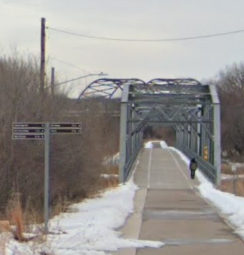
Reading the comments in BridgeHunter-1920 indicates that restoration of this bridge was a struggle. They had to replace the abutments, piers, much of the bottom chord and the deck. Weeks-1920 provides a history of the bridge: After the 1978 bridge was built, this bridge was given to the City of Bloomington by the state in 1981 for automobile access to the nature area. But it was closed to cars in 1993. But it continued as a bike and pedestrian bridge to complement the bicycle bridge that was also opened in 1978. But it was completely closed in 2002. Here are three photos that John has that show it was having a hard time holding itself up. Fortunately, the sides and top chord of the truss were in good shape.
The restoration was completed in 2016. [BridgeHunter-1920 comments]
 |
Weeks-1920
|
 |
Weeks-1920
|
 |
| Weeks-1920 |
According to a comment in BridgeHunter-1920, the river floods about every spring. John recorded some of that action. That is why the bottom chord members are so corroded. Unfortunately, they did not raise the bridge when they restored it even though they had to build new abutments and piers.
 |
Weeks-1920, Spring 2010
John mentioned that the water was several feet over the bridge deck in the 2001 flood. |
 |
| Weeks-1920, Fall 2010 |
After restoration:
 |
| Weeks-1978-road |
It is easy to focus on the tied-arches and miss that this is a long concrete-girder bridge over the wetlands. In fact, John calls it the longest bridge in Minnesota that is entirely within the state.
This is the post that motivated this research.
Two of the photos
posted by John Weeks.
 |
a
The newly rebuilt Old Cedar Avenue Bridge, looking south towards Dakota County. The trail was in great condition here, but it is currently glare ice between the trailhead and the main channel of the Minnesota River. |
 |
b
The main river channel spans of the Cedar Avenue Bridge as seen from the Bloomington side of the Minnesota River. The trails in the river bottoms are fully groomed and are in fantastic condition at the moment. |
The bicycle bridge is cantilevered off the east side of the northbound main span and is 55' above the water. The ramps tie it into the Fort Snelling State Park Trail on the south side and the Kelly Trail on the north side. The Kelly Trail is the one that uses the Long Meadow Lake (1920) Bridge.
 |
Street View, Jul 2021
|


No comments:
Post a Comment