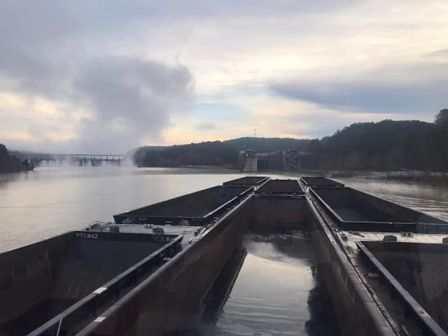
I labeled this wwTennTom because it shares the Tombegbee River part of the Tennessee-Tombigbee Waterway.
 |
HAER ALA,63-KELMA.V,1--4JOHN HOLLIS BANKHEAD LOCK & DAM IN TUSCALOOSA COUNTY, BIG INDIAN CREEK PUBLIC USE AREA IN FOREGROUND. |
"The original 1915 dam (the only one of the original 17) remains, though not easily accessible to the general public. The current dam is 1,400 feet wide, 77 feet high with a lift of 69 feet." [HAER-data]
The structural height is 111', and the hydraulic height is 103'. The spillway width is 1023' and it can pass 666,000 cfs. [The height and flow rate numbers seem too high.] It has a high hazard potential. [I hope that "high" rating was before the rebuild that started in the 1960s. Wikipedia implies the dam was replaced in addition to building the new lock.] It specifies 2 locks with a size of 285' x 52'. [BankHeadLake] But judging from the satellite image, the 1915 lock next to the dam would be the 285' x 52' lock. The new lock that was under construction between 1963 and 1980 looks like a more standard 600' x 110'. "The 1963 turbine was replaced in 1997, but stopped working in 2015. In February 2019 Alabama Power invested $17 million to install a new American Hydro turbine, along with constructing a new control room and replacing headgates, stop-logs, wicket gates and other infrastructure." [bamwiki] AlabamaNewsCenter has four file photos of the spillway. A couple of those photos show that it uses sluice gates. The article describes the $17m modernization job, but I still can't find a MW figure for any of the turbines.
 |
| Photo from picryl, cropped Alabama Power Co. built the powerhouse in 1963. The new lock was started in 1966, opened in 1975 and was completed in 1980. (bhamwiki provides a date of 1963 instead of 1966.) HAER ALA,63-KELMA.V,1--3 JOHN HOLLIS BANKHEAD LOCK & DAM IN TUSCALOOSA COUNTY. - John Hollis Bankhead Lock & Dam, On Warrior River below Port Birmingham, Kellerman, Tuscaloosa County, AL |
The following two photos were in the record for the Holt Dam instead of this dam.
 |
| HAER ALA,63-HOLT,3- |
 |
| HAER ALA,63-HOLT,3- |
 |
| Jay Robinson posted Bankhead Dam seen from 2 thousand feet back in August. |
 |
| Gracie Johnson commented on Jay's post, cropped Love the post and enjoy seeing it like this. |
 |
| Craig Dodson posted Lock 17 the uppermost dam on the black warrior Don Traut: How much traffic up that far these days? Craig Dodson: Don Traut not much. Shoal creek mine closed last year. From here down does have some traffic. |
| Don Traut: Craig Dodson declining coal traffic is going to be hard to replace on many of our rivers. |
 |
| BlackWarriorRiver, Photo by Nelson Brooke, Flight by SouthWings.org "A series of fourteen locks and dams were built on the river in the late 1800s. In the 1930s, work began to replace those dams with a more modern series of four locks and dams. The river is heavily used by barges for the transport of commercial commodities such as coal, coke, steel, wood, and chemicals. These dams have created a number of lake-like reservoirs stealing the river’s free-flowing beauty." |
G Warren Simmons III posted two photos with the comment: "M/V Alice Parker making Bankhead Lock on the Black Warrior River."
Jim Colby
Great photos Warren! You may want to join my group and post this. I know that our group members would enjoy seeing your perspective.
 |
| 1 |
 |
| 2 |
 |
| Maurice Mettee posted Upstream view of the cofferdam at Lock and Dam 17. The lock chamber and fish ladder construction areas are on the right. The spillway construction area is on the left. 1911. Salmon don’t naturally occur in Alabama. Early newspaper articles confirm Gulf sturgeon spawned in the Black Warrior, Alabama, Coosa, Tallapooas, Cahaba, and lower Tombigbee Rivers. Upstream spawning habitats were cut off after larger, higher dams were built. |
 |
| Maurice Mettee posted Upstream view of early lock chamber construction at Lock and Dam 17, 1912. |
 |
| Maurice Mettee posted Upstream view of spillway construction at Lock and Dam 17, 1913. |
 |
| Maurice Mettee posted Looking upstream at the massive dam construction area at Lock and Dam 17, Enlarge and examine this photo to get the maximum visual effect.1913. Lloyd Scott Hardin shared |

No comments:
Post a Comment