Update: except for some photos, this map makes these notes obsolete. It was developed by a HGIS project.
#3 & #4 were wiped out by the construction of 406 except for a corner of #3 [9:51].
#6: (Satellite)
#11: (Satellite)
#12: (Satellite)
The canal and Locks 14-16 have been replaced by a culvert.
#14 (Satellite, filled in, it was halfway between the edge of the Sobeys Glendale building and the road.)
#15: (Satellite, mostly filled)
Locks #16-#21 are called Neptune's Staircase and they climb the face of the Niagara Escarpment.
#16; (Satellite, they allowed nature to claim this lock.)
#18: (Satellite)
#19: (Satellite)
#21: (Satellite)
Thorold filled in the canal and the locks in their city.
#22: (Satellite)
#24: (Satellite, just south of Albert Street)
#25: (Satellite, mostly filled in. The top of the walls still show.)
Welland River Aqueduct: (Satellite, it was just south of today's siphon)
#26: (Satellite, The western lock is Second Canal, and the eastern lock is Third Canal.)
Today's Welland Canal is the fourth one and it has eight locks. There were 27 locks on the Second Welland Canal (1845-1886). I've documented the locks of the fourth canal in detail. But I'm just going to save information about locks on the second canal as I come across it. This map of the locks makes this research a lot less challenging than the research I did for my notes on the third canal.
Hopefully, historic markers will be added in the parks that preserve the locks. [StCatharines]
#1
 |
| Street View |
#5
Karen Limardi posted seven photos with the comment: "The Westchester Bridge in St Catharines is built directly over Lock 5 of the Old Second Welland Canal."
Karen Limardi shared with the comment: "Some Sunday history The old Second Welland canal in St Catharines. Much of the old canal was buried to build Hwy 406...but some old Locks are still exposed and in remarkable condition. The First canal was old wooden locks which deteriorated quickly...the second canal followed much of the first canal but the locks were stone...magnificent masonry and some have the Lock numbers in the wall itself. A great experience wandering through Canal Valley and Mountain Locks park."
 |
| 1 |
 |
| 2 |
 |
| 3 |
 |
| 4 |
 |
| 5 |
 |
| 6 |
 |
| 7 |
 |
| Jason Miller commented on Karen's post |
#7
 |
| Alison Peloquin posted |
 |
| Alison Peloquin posted |
I'm surprised how well the limestone walls have survived. The ones in the I&M Canal have not fared so well.
 |
| 17:46 video @ 34:30 |
#8

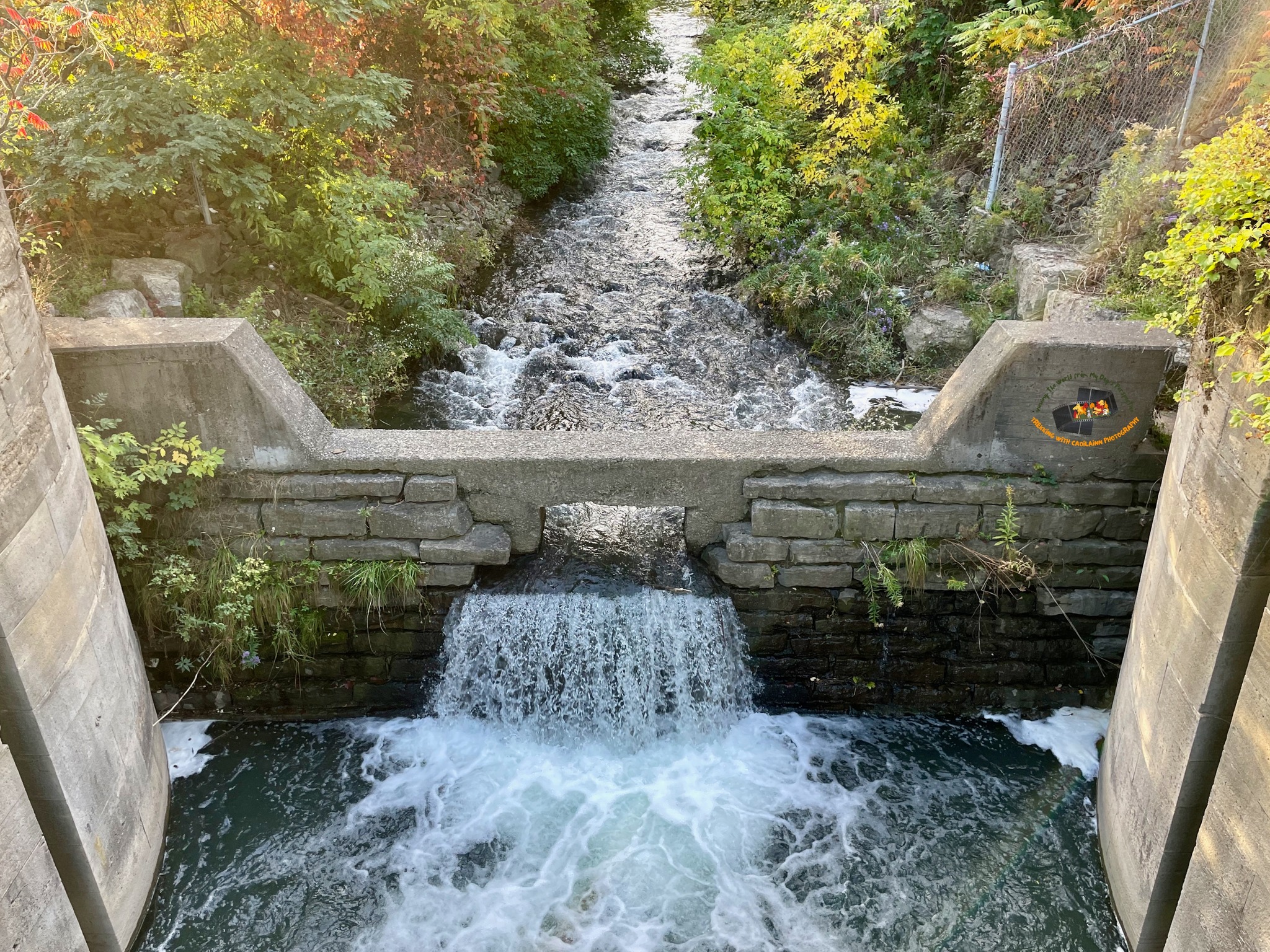


The water that entered a culvert at Lock #17 reemerges here.
 |
| BrockMap |
#16-#21
Locks 16-21 were known as Neptune's Staircase. I presume that it climbs up the face of the Niagara Escarpment. This is reinforced by the fact that the Twin Flight Locks are just east of here.
 |
| Satellite |
This map shows how the locks formed evenly spaced "stairs." (The Yellow Line is the First Welland Canal.)
%20-%20Explore%20the%20gems%20of%20our%20local%20.png) |
| BrockMaps |
OldWellandCanals confirms that Neptune's Staircase climbs along the side of the escarpment.
#17
The end of a wall has eroded away so we can see a cross section. It consists of a thin finish wall and a thick embankment wall.

The water of the canal channel enters a culvert here and reemerges in Lock #13.
 |
| 37:46 video @ 14:18 |
#20
Julie Waller Fletcher posted three photos with the comment: "Locks of love."
 |
| 1 |
 |
| 2 |
 |
| 3 |
 |
| Dennis DeBruler commented on Julie's post This appears to be Lock #20 in Neptune Stairs, https://maps.app.goo.gl/ryehABtd4JRb3Cy89. |
#23
 |
| Robert Gauthier posted Downtown Thorold showing the Welland Canal in front of the old Maple Leaf flour mill. Time of this photo is unknown. A 1914 map indicates that it may be the steeple of a Methodist church at centre left. At the beginning of operation (1845) the mill was the largest of its kind in Canada, capable of producing 300 barrels of flower per day. Dennis DeBruler: To the right of the powerhouse, I think we see a gate of Lock #23. |
Welland River Aqueduct in Welland, ON
The video explained that the Welland River went under the canal a little further south than the original fourth canal crosses. Here is a 1921 aerial photo to show that location.
 |
| BrockAerial, H21-9 @ 6000, rotated |
 |
| BrockMap |
This aqueduct was replaced with a siphon.
 |
| St. Catharines Museum & Welland Canals Centre posted This photo was taken #onthisday [Jan 31] in 1927 during construction of the Welland Ship Canal. It shows work on the syphon culvert, which enables the Welland River to pass under the canal. 2006.130.6 |
No comments:
Post a Comment