Downstream Dam: (New Brighton): (Satellite)
Upstream Dam
The abandoned bridge piers in the foreground were for a road bridge.
 |
| Street View, Jul 2024 |
It is interesting catching different river levels.
 |
| Street View, Sep 2019 |
This photo shows the dam in the background. The above views were taken from the road bridge in this photo.
 |
| HAER PA,4-NBRIG,1--1 via Dennis DeBruler |
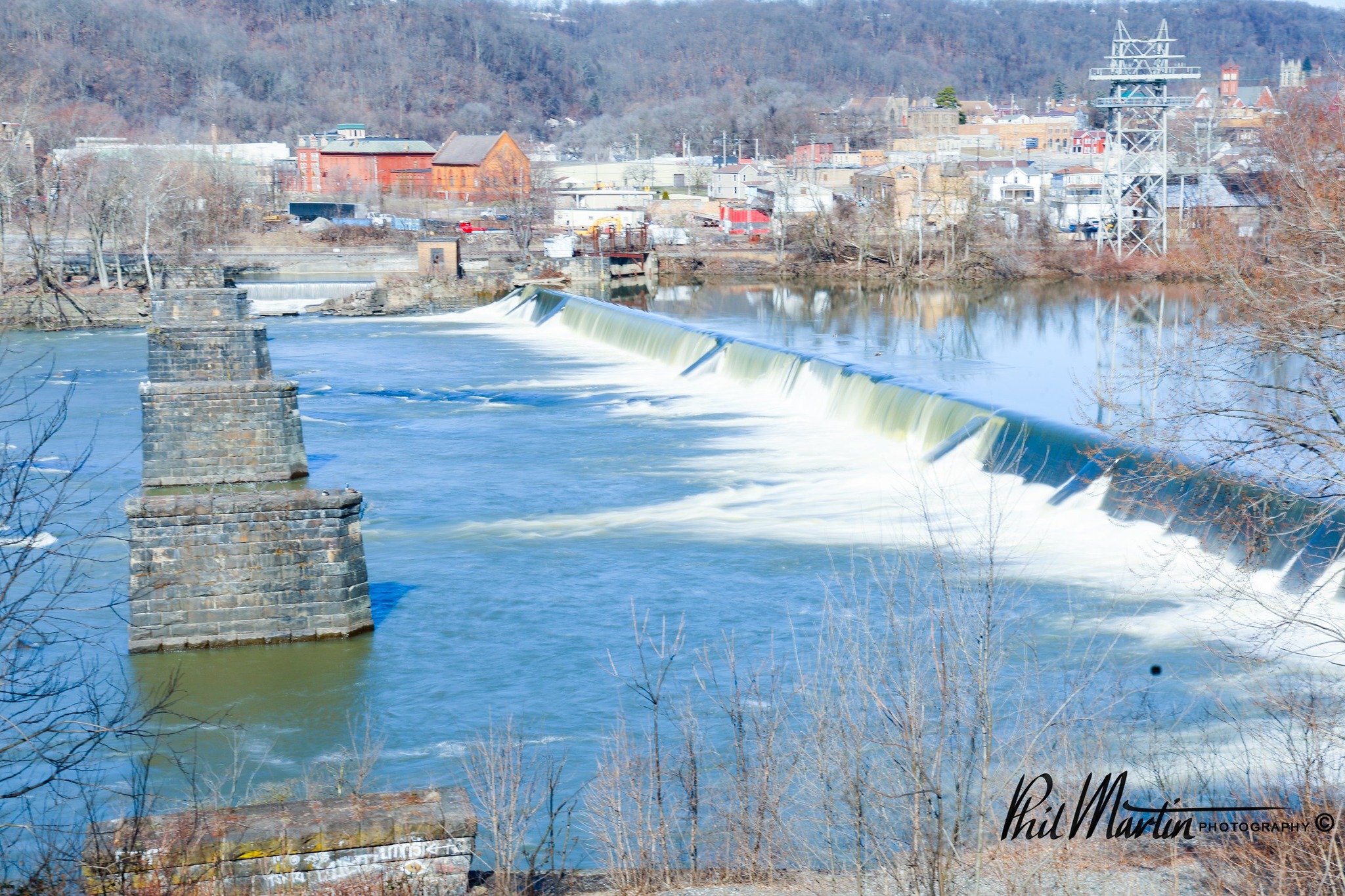 |
| Phil Martin Photography posted Overlooking the Beaver Falls Dam on the Beaver River in Beaver Falls Pennsylvania. |
This looks like this dam, but this dam is more like 4th Street Dam than 10th Street Dam.
 |
| Little Beaver Historical Society posted Break in the 10th Street Dam Beaver Falls & New Brighton, between 1904-1918. |
I didn't notice the powerhouse until I noticed the headrace and followed it down the bank of the river past the descent of the rapids.
 |
| Satellite |
The powerhouse is on the left in this view.
 |
| Street View, Jun 2023 |
Downstream (New Brighton) Dam
 |
| Roscoe Pics4yinz, Feb 2023 |
It has a powerhouse at the left descending bank behind a tree.
 |
| Scott Scarlett, Jun 2022 |
Evidently, the powerhouse is not abandoned because it appears that they are doing maintenance work on it.
 |
| Street View, Jul 2024 |
 |
| jaep |
Pin-Connected Truss Bridge
 |
| HAER PA,4-FALS,1--2 (CT) OBLIQUE VIEW, LOOKING DUE NORTH FROM FALLSTON INTO NEW BRIGHTON - Fallston Bridge, Spanning Beaver River at Front Street, Fallston, Beaver County, PA |
It was built in 1884. [HAER_data]
It must be in really bad shape because they are not even allowing pedestrians on it.
 |
| Street View, Sep 2022 |
Downstream from this bridge are several marinas because we are close to the mouth of the Beaver River at the Ohio River.
 |
| D, Aug 2022 |
These photos show the importance of all of the flood control dams that were built in Pennsylvania.
 |
| Postcard via BridgeHunter |
 |
| HistoricBridges |
Mystery Bridge
Was this the predecessor of the truss bridge?
 |
| 𝗥𝗲𝗺𝗲𝗺𝗯𝗲𝗿 𝗪𝗵𝗲𝗻: 𝗣𝗲𝗻𝗻𝘀𝘆𝗹𝘃𝗮𝗻𝗶𝗮 and Ohio posted [The description is wrong.] Robin Russo: No, it's written on the photo. "Old Bridge, Beaver River, Beaver Falls, PA. |
No comments:
Post a Comment